
Matabeleland South is a province in southwestern Zimbabwe. With a population of 683,893 as of the 2012 Zimbabwean census, it is the country's least populous province. After Matabeleland North, it is Zimbabwe's second-least densely populated province. Matabeleland South was established in 1974, when the original Matabeleland Province was divided into two provinces, the other being Matabeleland North. The province is divided into six districts. Gwanda is the capital, and Beitbridge is the province's largest town. The name "Matabeleland" is derived from Ndebele, the province's largest ethnic group.

Matabeleland is a region located in southwestern Zimbabwe that is divided into three provinces: Matabeleland North, Bulawayo, and Matabeleland South. These provinces are in the west and south-west of Zimbabwe, between the Limpopo and Zambezi rivers and are further separated from Midlands by the Shangani River in central Zimbabwe. The region is named after its inhabitants, the Ndebele people who were called "Amatabele"(people with long spears – Mzilikazi 's group of people who were escaping the Mfecani wars). Other ethnic groups who inhabit parts of Matabeleland include the Tonga, Bakalanga, Venda, Nambya, Khoisan, Xhosa, Sotho, Tswana, and Tsonga. The population of Matabeleland is just over 20% of the Zimbabwe's total.
George Mitchell served as Prime Minister of Southern Rhodesia from July to September 1933.

Beitbridge is a border town in the province of Matabeleland South, Zimbabwe. The name also refers to the border post and bridge spanning the Limpopo River, which forms the political border between South Africa and Zimbabwe. The border on the South African side of the river is also named Beitbridge.

Gwanda is a town in Zimbabwe. It is the capital of the province of Matabeleland South, one of the ten administrative provinces in the country. It is also the district capital of Gwanda District, one of the seven administrative districts in the province.
Esigodini, originally known as Essexvale, is a town in the Matabeleland South Province of Zimbabwe. It is the administrative centre for Umzingwane District, one of the seven administrative districts in Matabeleland South. It was originally an estate of Frederick Selous.
Colleen Bawn is a town in Zimbabwe.
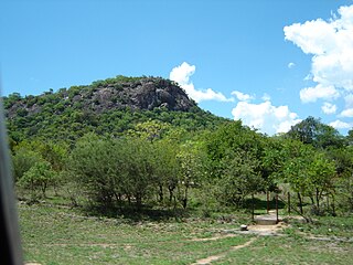
Plumtree is a town in Zimbabwe. Alongside marula trees, wild plum trees grow abundantly in area. The town was once called Getjenge by baKalanga. Another name which is mainly used is Titji, meaning station and referring to the railway station which was operating in the area around 1897.

Filabusi is a town in the Matabeleland South Province of Zimbabwe. The town is the district capital of Insiza District and a service centre for the surrounding mining and farming areas.
Brunapeg is a settlement in the Matabeleland South Province of Zimbabwe. It is one of the urban centres in Mangwe District, one of the seven administrative districts in the province.
Mbalabala, originally known as Balla Balla, is a village on the main Beitbridge-Bulawayo road in Matabeleland, Zimbabwe. Situated approximately 41 miles (66 km) south-east of the city of Bulawayo. The name is derived from the Ndebele name for the greater kudu. It was originally rendered Balla Balla by Europeans, which was altered to its present name in 1982 by the Zimbabwean government in order to coincide closer with the local orthography.
JZ Moyo High School, formerly Majoda School, is a co-educational government high school. It is located in the former Majoda Farm, approximately 12 km north of West Nicholson on the road to Filabusi and Mavako, in Matabeleland South province, Zimbabwe. JZ Moyo High is part of the ZIMFEP group of schools.
The A6 is a highway in Zimbabwe running from the Beitbridge border with South Africa, through Gwanda, to Bulawayo. It is part of the R9 Route, which links Beitbridge with Victoria Falls.

The Bubye River, also known as Bubi River, is a tributary of the Limpopo River in Beitbridge District and Gwanda District, Zimbabwe. It rises about 40 kilometres (25 mi) to the northeast of West Nicholson in Matabeleland South, from where it flows southeast before joining the Limpopo about 25 kilometres (16 mi) west of the border with Mozambique. Its course forms part of the border between Mberengwa and Mwenezi districts.

Hwange District is an administrative district in northwestern Zimbabwe, in southern Africa.

Matabeleland South Volleyball Association (MSVA) is the governing body of volleyball, beach volleyball and other forms of volleyball in Matabeleland South, province of Zimbabwe. It represents the interests of the provincial club volleyball.
Lazarus Nkala, known in political circles by the nickname UMavava, was a Rhodesian trade union leader, activist, and revolutionary. Born in Filabusi in Matabeleland, he attended mission and government schools and trained as a builder. He worked in Bulawayo, and became a union leader and African nationalist activist. In the 1950s and 60s, he served in leadership roles in the Southern Rhodesia African National Congress, National Democratic Party, and Zimbabwe African People's Union. He was detained in 1964 and, with the exception of a three-week period the following year, was held in continuous detention for the next ten years. Upon his release in 1974, he was named Organising Secretary of the ANC, and attended the Victoria Falls Conference as part of Joshua Nkomo's delegation. He died shortly after in an automobile accident driving from Salisbury to Bulawayo.
The Colleen Bawn Solar Power Station is a 32 MW (43,000 hp) solar power plant under development in Zimbabwe. The project is owned by Pretoria Portland Cement Limited, who own a cement factory in Colleen Bawn and plan to consume 16 megawatts of the electricity generated and sell the rest to the Zimbabwe national grid.

