Dumri block is a CD block that forms an administrative division in the Chainpur subdivisionS of Gumla district, in the Indian state of Jharkhand.
Jagadanandapur is a census town in the Nakashipara CD block in the Krishnanagar Sadar subdivision of the Nadia district in the Indian state of West Bengal,and the town is part of Bethuadahari 1 G.P.
Plumtree is a town in Zimbabwe. Marula trees, wild plum trees grow abundantly in the area. The town was once called Getjenge by baKalanga. Another name by which it is often caled, is Titji, meaning station and referring to the railway station which was operating in the area around 1897.

Marsabit County is a county in Kenya. Covering a surface area of 66,923.1 square kilometres. Marsabit is the second largest county by size in Kenya after Turkana county which has an area of 71,597.8 km2. Its capital is Marsabit and its largest town Moyale. According to the 2019 census, the county has a population of 459,785. It is bordered to the North by Ethiopia, to the West by Turkana County to the South by Samburu County and Isiolo County, and to the East by Wajir County.

Garissa County is an administrative county in Kenya. Its capital and largest urban area is Garissa. The county had a population of 841,353 at the 2019 Census, and a land area of about 44,753 km2 (17,279 sq mi).
Brunapeg is a settlement in the Matabeleland South Province of Zimbabwe. It is one of the urban centres in Mangwe District, one of the seven administrative districts in the province.

Tanga District, offcially the, Tanga City Council is one of eleven administrative districts of Tanga Region in Tanzania. The District covers an area of 596.5 km2 (230.3 sq mi). Tanga district is bordered to the north by Mkinga District, to the east by the Indian Ocean, to the south and west by Muheza District. The district seat (capital) is the city of Tanga. The district is the administrative and economic center of Tanga Region. According to the 2012 census, the district has a total population of 273,332.

Kurseong subdivision is a subdivision of the Darjeeling district in the state of West Bengal, India.
Siliguri subdivision is a subdivision of the Darjeeling district in the state of West Bengal, India.

Dinhata I is a community development block that forms an administrative division in the Dinhata subdivision of the Cooch Behar district in the Indian state of West Bengal.

Dinhata II is a community development block that forms an administrative division in the Dinhata subdivision of the Cooch Behar district in the Indian state of West Bengal.

Mekhliganj is a community development block that forms an administrative division in the Mekhliganj subdivision of the Cooch Behar district in the Indian state of West Bengal.

Bulilimamangwe District is a district in Zimbabwe.
Rameswarpur is a census town within the jurisdiction of the Maheshtala police station in the Thakurpukur Maheshtala CD block in the Alipore Sadar subdivision of the South 24 Parganas district in the Indian state of West Bengal.
Seke District is a district of the Province Mashonaland East in Zimbabwe.
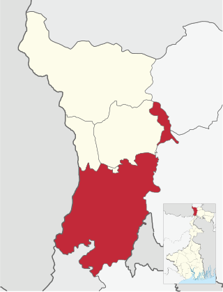
Bulilima District is a district of the Province Matabeleland South in Zimbabwe.
Matobo, originally Matopos, is a district of the Province Matabeleland South in Zimbabwe.
Bulu is a village found in the Mangwe District of Zimbabwe. The village is separated from Ngwizi by the main road coming from Plumtree. The closest hospital to Bulu is Brunaburg and the closest police station is Mphoengs.
Harinadibhastsala is a census town in the Santipur CD block in the Ranaghat subdivision of the Nadia district in the state of West Bengal, India.
Purba Narayanpur is a census town in the Habra I CD block in the Barasat Sadar subdivision of the North 24 Parganas district in the state of West Bengal, India.
