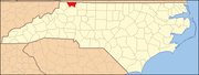
Alleghany County is a county located in the U.S. state of North Carolina. As of the 2020 census, the population was 10,888. Its county seat is Sparta.

North Carolina's 5th congressional district covers the central western portion of North Carolina from the Appalachian Mountains to the western suburbs of the Piedmont Triad. The district borders Tennessee and Virginia, with the bulk of its territory in the mountains; it stretches just far enough to the east to grab its share of Forsyth County, home to most of its population.
Boomer is a farming community located in Wilkes County, North Carolina. Legally it is a township, a non-governmental county subdivision. The population was 1,266 at the 2020 Census.
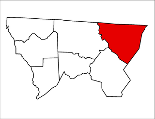
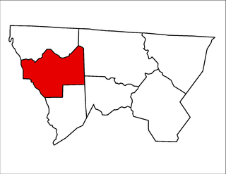
Gap Civil Township is one of seven townships in Alleghany County, North Carolina, United States. The township had a population of 4,474 according to the 2010 census.

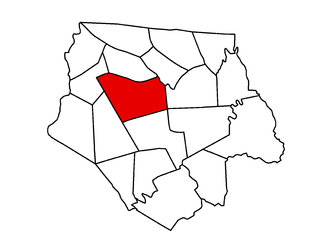
Cherry Lane Township is one of seven townships in Alleghany County, North Carolina, United States. The township had a population of 1,528 according to the 2010 census.
Cherry Lane is an unincorporated community located in the Cherry Lane Township of Alleghany County, North Carolina, United States. The community was settled circa 1838 and was named for the cherry tree-bordered lane that led to the home of local resident Frank Bryan. The community is located along U.S. Highway 21, near its junction with the Blue Ridge Parkway in southeastern Alleghany County.
Cranberry Township is one of seven townships in Alleghany County, North Carolina, United States. The township had a population of 375, according to the 2010 census. Before 1880, it was included in Prathers Creek Township.
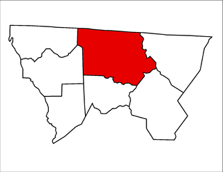
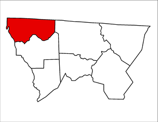
Glade Creek Township is one of seven townships in Alleghany County, North Carolina, United States. The township had a population of 1,991 according to the 2010 census.
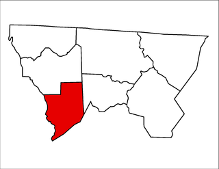
Prathers Creek Township is one of seven townships in Alleghany County, North Carolina, United States. The township had a population of 869 according to the 2010 census. Before 1880, it included Cranberry Township.
Piney Creek Township is one of seven townships in Alleghany County, North Carolina, United States. The township had a population of 858 according to the 2010 census.

Roaring Gap is an unincorporated community in the Cherry Lane Township of Alleghany County, North Carolina, United States, situated near the border with Wilkes County. Home to three private golf communities, Roaring Gap is a popular summer colony.
Piney Creek is an unincorporated community located in Piney Creek Township, Alleghany County, North Carolina, United States.
Glade Valley is an unincorporated community located in Alleghany County, North Carolina, United States along U.S. Highway 21 between Cherry Lane and Sparta.

Jefferson Township is one of nineteen townships in Ashe County, North Carolina, United States. The township had a population of 4,718 as of the 2010 census and is the largest township in Ashe County by population.

Grassy Creek Township is one of nineteen townships in Ashe County, North Carolina, United States. The township had a population of 455 as of the 2010 census.
Clifton Township is one of nineteen townships in Ashe County, North Carolina, United States. The township had a population of 1,911 as of the 2010 census.

Elk Township is one of nineteen townships in Ashe County, North Carolina, United States. The township had a population of 613 as of the 2010 census.

Helton Township is one of nineteen townships in Ashe County, North Carolina, United States. The township had a population of 718 as of the 2010 census.
Scottville is an unincorporated community in both Ashe and Alleghany counties, North Carolina, United States, on U.S. Route 221. It lies at an elevation of 2,854 feet. The ZIP Code for Scottville is 28672.