Related Research Articles

Alleghany County is a county located in the U.S. state of North Carolina. As of the 2020 census, the population was 10,888. Its county seat is Sparta.
Boomer is a farming community located in Wilkes County, North Carolina. Legally it is a township, a non-governmental county subdivision. The population was 1,266 at the 2020 Census.
Fairview Crossroads is an unincorporated community in Surry County, North Carolina, United States. Historically, the community was known earliest as Alberty.
Level Cross is an unincorporated community located in the Rockford Township of Surry County, North Carolina, United States.
Woodville in an unincorporated community located in the Westfield Township of northeast Surry County, North Carolina, United States, near Big Creek. The main thoroughfare through the community is North Carolina Highway 89.
Union Hill is an unincorporated community located in the Bryan Township of western Surry County, North Carolina, United States. It is located between Little Mountain and the south fork of the Mitchell River.
Pine Ridge is an unincorporated community in the Stewarts Creek Township of northern Surry County, North Carolina, United States, located near the city of Mount Airy on North Carolina Highway 89. The community is located between the Little Fisher River and Stewarts Creek and has an altitude of 1,347 feet. Area attractions include Pine Ridge Classic Golf Course. Noted 19th-century humorist Hardin E. Taliaferro was born near Pine Ridge in 1811.
Ladonia is an unincorporated community located in the Franklin Township of northwest Surry County, North Carolina, United States. The community generally lies on the Fisher River and is centered on the intersection of Blevins Store Road and Ladonia Church Road. Area landmarks include Ladonia Baptist Church, M & M Signs and Awnings, and the nearby Raven Knob Scout Reservation.
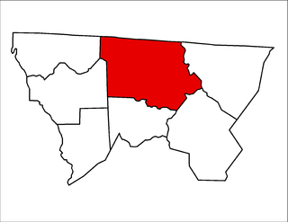
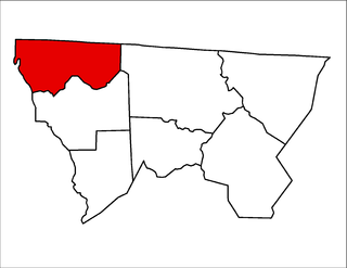
Gap Civil Township is one of seven townships in Alleghany County, North Carolina, United States. The township had a population of 4,474 according to the 2010 census.

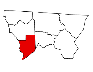
Cherry Lane Township is one of seven townships in Alleghany County, North Carolina, United States. The township had a population of 1,528 according to the 2010 census.
Cranberry Township is one of seven townships in Alleghany County, North Carolina, United States. The township had a population of 375, according to the 2010 census. Before 1880, it was included in Prathers Creek Township.
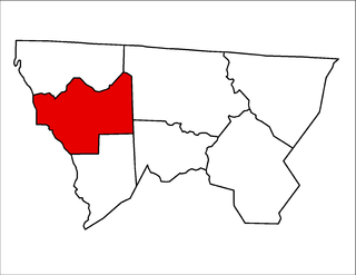
Prathers Creek Township is one of seven townships in Alleghany County, North Carolina, United States. The township had a population of 869 according to the 2010 census. Before 1880, it included Cranberry Township.
Piney Creek Township is one of seven townships in Alleghany County, North Carolina, United States. The township had a population of 858 according to the 2010 census.

Whitehead Township is one of seven townships in Alleghany County, North Carolina, United States. The township had a population of 1,060 according to the 2010 census.

Roaring Gap is an unincorporated community in the Cherry Lane Township of Alleghany County, North Carolina, United States, situated near the border with Wilkes County. Home to three private golf communities, Roaring Gap is a popular summer colony.
Piney Creek is an unincorporated community located in Piney Creek Township, Alleghany County, North Carolina, United States.
Glade Valley is an unincorporated community located in Alleghany County, North Carolina, United States along U.S. Highway 21 between Cherry Lane and Sparta.

Grassy Creek Township is one of nineteen townships in Ashe County, North Carolina, United States. The township had a population of 455 as of the 2010 census.
Sturgills is an unincorporated community in the Helton Township of Ashe County, North Carolina, United States, near the border with the state of Virginia.
Scottville is an unincorporated community in both Ashe and Alleghany counties, North Carolina, United States, on U.S. Route 221. It lies at an elevation of 2,854 feet. The ZIP Code for Scottville is 28672.