Willetton, Western Australia

Last updated

Willetton
Perth,  Western Australia
Willetton Collins - The Vale on Collins.jpg
"The Vale", a business premises on Collins Road, Willetton
Willetton, Western Australia
Coordinates 32°03′09″S115°53′16″E / 32.0524594°S 115.8878267°E / -32.0524594; 115.8878267 (Willetton)
Population19,262 (SAL 2021) [1]
Established1970s
Postcode(s) 6155
Area8.6 km2 (3.3 sq mi)
Location12 km (7 mi) from Perth City
LGA(s) City of Canning
State electorate(s) Riverton
Federal division(s) Tangney
Suburbs around Willetton:
Rossmoyne Riverton Ferndale
Bull Creek Willetton Parkwood
Leeming Leeming Canning Vale

Willetton is a large southern suburb of Perth, Western Australia. Its local government area is the City of Canning.

Contents

History

Willetton's name derives from Henry Willett of Willett & Co, who was granted Canning Location 21 (roughly the location of modern Lynwood and Parkwood) and settled in the area in June 1832. In November 1964, the Shire of Canning proposed the names "Burtsdale" and "Willetton" for Willetton and Lynwood/Parkwood respectively, the name Burtsdale honouring Septimus Burt, who purchased the land in 1882. In August 1965, developers at Lynwood requested the name "Clovercrest Estate", but finally agreed to "Lynwood". The name Willetton was shifted westwards and gazetted in December 1965 within its present boundaries. [2]

The original subdivision was opened in the early 1970s under the developer's name "Burrendah Heights". This name survives as Burrendah Boulevard and Burrendah Primary School. The section to the east of Vahland Avenue and north of Collins Road was developed in the 1980s under the unofficial name "Rostrata", from which Rostrata Primary School gets its name. Most housing and infrastructure was completed in the 1990s.

Geography

Looking west over the lake in Prendwick Park Lake in Prendwick Park, Willetton, 27 January 2022, Portrait.jpg
Looking west over the lake in Prendwick Park

Willetton is located about 12 kilometres (7.5 miles) south of the Perth central business district. It is built on a section of flat sandy coastal plain that was originally covered with open Banksia woodland and stands of paperbark trees marking the edges of shallow seasonal swamps.

Willetton is bounded by Karel Avenue to the west, Leach Highway and High Road to the north, Willeri Drive to the east and South Street and Roe Highway to the south. Vahland Avenue runs north-south through the suburb. [3]

At the 2001 Australian census, Willetton had a mostly average-income population of 17,571 people living in 6,300 dwellings, nearly all of which are detached houses on single lots. The Australian Bureau of Statistics reported that almost 20% of the suburb's population were of East, Southeast or South Asian origin. Retail trade (1,515), property and business services (1,118), manufacturing (944), education (911), and health and community services (904) were the key occupations of Willetton's residents.

Facilities

Willetton contains the Southlands Boulevarde shopping centre, with two levels and businesses including two supermarkets, Hoyts cinemas and a food court. Opposite the shopping centre across Burrendah Boulevard is the Willetton Sports and Community Centre. A light industrial area exists in the north of the suburb near Leach Highway and High Road, containing a Bunnings, pool shops and various trades. Three small neighbourhood shopping centres offer local services in the corners of the suburb.

Adjacent to Willetton on High Road, the Riverton Leisureplex, a large facility with sporting, fitness and recreation facilities opened on 9 November 2001, [4] is operated by the City of Canning, and includes the council's largest library. The Willetton Library is located near Southlands Boulevarde.

Willetton contains the Castlereagh, Burrendah, Willetton, Rostrata and Orana Catholic primary schools, as well as Woodthorpe School and Willetton Senior High School, the largest public high school in Western Australia, with 2,710 students as of 23 December 2023.

Transport

Willetton is situated between two major east-west routes  Leach Highway (west to the Bull Creek railway station, Kwinana Freeway to Perth's central business district and Fremantle; east to Cannington and Perth Airport) and South Street (west to Murdoch railway station, Murdoch University and Fremantle; east to Canning Vale and Armadale). Roe Highway is on the southeastern fringe of the suburb, while Karel Avenue (to Jandakot Airport), Vahland Avenue and Willeri Drive are major north-south routes.

Willetton contains the Southlands bus station, where the CircleRoute takes passengers to Murdoch railway station, Murdoch University and Curtin University, while other bus routes go to Cannington. All services are operated by the Public Transport Authority.

Bus

Bus routes serving South Street:

Politics

Polling place at Rostrata Primary School for the 2022 Australian federal election Australian Federal Election 2022, Polling Place Rostrata Primary School, Landscape.jpg
Polling place at Rostrata Primary School for the 2022 Australian federal election

Historically it has been fairly safe for the Liberal Party at both Federal and state elections, although three of the suburb's four booths delivered majorities to the Labor Party at state level in 2001 and 2005. In 2008 it returned a Liberal member to parliament by a very slim majority. By the 2017 state election, despite the Liberal Party winning only 13 of 59 seats, the Liberal Party won all four booths in Willetton. In the 2022 Australian federal election, Labor won First Preference in all six booths in Willetton and Two Candidate Preferred in five of the six booths, in line with an overall nationwide shift to Labor. [22]

The suburb is located within the federal Division of Tangney, the state seat of Riverton and the Beeliar ward of the City of Canning.

Related Research Articles

<span class="mw-page-title-main">Bull Creek, Western Australia</span> Suburb of Perth, Western Australia

Bull Creek is a suburb of Perth, Western Australia, located within the local government area of City of Melville. The suburb lies to the south of a creek of the same name, which flows into the Canning River.

<span class="mw-page-title-main">Ferndale, Western Australia</span> Suburb of Perth, Western Australia

Ferndale is a southeastern suburb of Perth, Western Australia. Its local government area is the City of Canning. It is approximately 15 kilometres (9 mi) from Perth's central business district.

<span class="mw-page-title-main">Como, Western Australia</span> Suburb of Perth, Western Australia

Como is a suburb of Perth, Western Australia. Its local government area is the City of South Perth. The suburb has a population of 12,423. Canning Highway divides the suburb.

<span class="mw-page-title-main">Leeming, Western Australia</span> Suburb of Perth, Western Australia

Leeming is a southern suburb of Perth, Western Australia. It is divided between the three local government areas of the City of Melville, the City of Cockburn (south) and the City of Canning (north-east). It is located approximately 17 kilometres (11 mi) south of the Perth central business district and 13 kilometres (8.1 mi) east of Fremantle.

<span class="mw-page-title-main">Booragoon, Western Australia</span> Suburb of Perth, Western Australia

Booragoon is a southern suburb of Perth, Western Australia, located within the City of Melville.

<span class="mw-page-title-main">Riverton, Western Australia</span> Suburb of Perth, Western Australia

Riverton is a southeastern suburb of Perth, the capital city of Western Australia. Its local government area is the City of Canning.

<span class="mw-page-title-main">Parkwood, Western Australia</span> Suburb of Perth, Western Australia

Parkwood is a southeastern suburb of Perth, the capital city of Western Australia. Its local government area is the City of Canning.

<span class="mw-page-title-main">Forrestdale, Western Australia</span> Suburb of Perth, Western Australia

Forrestdale is a suburb of Perth, Western Australia, located within the City of Armadale. It is named after John Forrest, the first premier of Western Australia.

Bateman is a suburb of Perth, Western Australia, located within the City of Melville.

<span class="mw-page-title-main">Brentwood, Western Australia</span> Suburb of Perth, Western Australia

Brentwood is a suburb of Perth, Western Australia, located within the City of Melville and approximately 10 kilometres (6.2 mi) from Perth city centre. The nearest airport is Perth Airport and the nearest railway station is Bull Creek.

<span class="mw-page-title-main">Murdoch, Western Australia</span> Suburb of Perth, Western Australia, Western Australia

Murdoch is a suburb of Perth, Western Australia, located within the City of Melville. Murdoch University, St John of God Hospital Murdoch and Fiona Stanley Hospital are located in Murdoch. The suburb is named after Sir Walter Murdoch.

<span class="mw-page-title-main">Winthrop, Western Australia</span> Suburb of Perth, Western Australia

Winthrop is a southern suburb of Perth, Western Australia, located within the City of Melville.

<span class="mw-page-title-main">Canning Vale, Western Australia</span> Suburb of Perth, Western Australia

Canning Vale is a southern suburb of Perth, 22 km (13.7 mi) from the central business district. Its local government areas are the City of Canning and the City of Gosnells.

<span class="mw-page-title-main">Bentley, Western Australia</span> Suburb of Perth, Western Australia

Bentley is a southern suburb of Perth, the capital city of Western Australia, 8 kilometres (5.0 mi) southeast of Perth's central business district. Its local government areas are the City of Canning and the Town of Victoria Park. Bentley is home to the main campus of Curtin University and Technology Park.

<span class="mw-page-title-main">Cannington, Western Australia</span> Suburb of Perth, Western Australia

Cannington is a southern suburb of Perth, Western Australia. Its local government area is the City of Canning.

Lynwood is a small southeastern suburb of Perth, the capital city of Western Australia. Its local government area is the City of Canning.

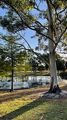
Rossmoyne is a suburb of Perth, Western Australia, within the City of Canning. Rossmoyne is located 14 kilometres (8.7 mi) south of central Perth, and is bounded by Leach Highway to the south, the Bull Creek to the west, the Canning River to the north, and Shelley to the east.

Shelley is a suburb of Perth, Western Australia, located within the City of Canning.

<span class="mw-page-title-main">Wilson, Western Australia</span> Suburb of Perth, Western Australia

Wilson is a suburb of Perth, Western Australia, located within the City of Canning on the north bank of the Canning River. It is a fairly old suburb with parks and close proximity to prominent shopping centres in South Perth. It is favoured by Curtin University students, the reason being its convenient access to the university. Bus numbers 72 and 75 travel through this suburb. The suburb contains Castledare, Kent Street Weir, Canning River and Lo Quay River Cafe. Wilson is located quite closely to various park, some of those being Cetenary Park, Thomas Moore Park, and Alderley Park.

<span class="mw-page-title-main">Fremantle (suburb)</span> Suburb of Perth, Western Australia

Fremantle is a Western Australian suburb located in Perth at the mouth of the Swan River, and is situated 18 kilometres (11 mi) from the Perth central business district. One of the original settlements of the Swan River Colony established in 1829 is within the area known today as this suburb.

References

  1. Australian Bureau of Statistics (28 June 2022). "Willetton (suburb and locality)". Australian Census 2021 QuickStats. Retrieved 28 June 2022.  OOjs UI icon edit-ltr-progressive.svg
  2. "History of metropolitan suburb names – W". Western Australian Land Information Authority. Archived from the original on 16 March 2022. Retrieved 17 January 2007.
  3. 2006 StreetSmart directory, Department of Lands and Surveys, Perth.
  4. Riverton Leisureplex - City Of Canning
  5. "Route 75". Bus Timetable 15 (PDF). Transperth. 25 August 2023 [effective from 20 November 2023].
  6. "Route 179". Bus Timetable 13 (PDF). Transperth. 24 August 2023 [effective from 20 November 2023].
  7. "Route 506". Bus Timetable 2 (PDF). Transperth. 24 August 2023 [effective from 20 November 2023].
  8. "Route 507". Bus Timetable 2 (PDF). Transperth. 24 August 2023 [effective from 20 November 2023].
  9. "Route 508". Bus Timetable 13 (PDF). Transperth. 24 August 2023 [effective from 20 November 2023].
  10. "Route 509". Bus Timetable 13 (PDF). Transperth. 24 August 2023 [effective from 20 November 2023].
  11. "Route 516". Bus Timetable 117 (PDF). Transperth. 25 August 2022 [effective from 20 November 2023].
  12. "Route 998". CircleRoute Timetable 200 (PDF). Transperth. 29 August 2023 [effective from 20 November 2023].
  13. "Route 999". CircleRoute Timetable 200 (PDF). Transperth. 29 August 2023 [effective from 20 November 2023].
  14. "Route 204". Bus Timetable 1 (PDF). Transperth. 24 August 2023 [effective from 20 November 2023].
  15. "Route 205". Bus Timetable 1 (PDF). Transperth. 24 August 2023 [effective from 20 November 2023].
  16. "Route 206". Bus Timetable 18 (PDF). Transperth. 28 August 2022 [effective from 20 November 2022].
  17. "Route 207". Bus Timetable 18 (PDF). Transperth. 28 August 2022 [effective from 20 November 2022].
  18. "Route 208". Bus Timetable 18 (PDF). Transperth. 28 August 2022 [effective from 20 November 2022].
  19. "Route 517". Bus Timetable 4 (PDF). Transperth. 11 January 2024 [effective from 28 January 2024].
  20. "Route 518". Bus Timetable 17 (PDF). Transperth. 11 January 2024 [effective from 28 January 2024].
  21. "Route 519". Bus Timetable 17 (PDF). Transperth. 11 January 2024 [effective from 28 January 2024].
  22. "Tangney, WA". Australian Electoral Commission Tally Room, Electoral Commissioner. 20 June 2022. Retrieved 25 June 2022.