Saint Mary, officially the Parish of Saint Mary, is a parish of Antigua and Barbuda on the island of Antigua. Saint Mary borders Saint John to the north, and Saint Paul to the east. Saint Mary is dominated by the Shekerley Mountains, and its northern border is largely defined by the mountains, and by Cooks Creek. The largest city in the parish is Bolans, home to the Jolly Harbour neighbourhood, and the parish church is located in Old Road. Saint Mary was created with the other five original parishes on 11 January 1692. It had a population of 7,341 in 2011, and 8,141 in 2018.

Saint Paul, officially the Parish of Saint Paul, is a parish of Antigua and Barbuda on the island of Antigua. Saint Paul borders Saint Peter and Saint John to the north, Saint Mary to the west, and Saint Philip to the east. Saint Paul is dominated by farmland in the north, with various creeks and Potworks Dam marking its northern border, and low-lying hills to the south, defining its western border with Saint Mary. The largest city fully within the parish is Liberta, the fourth largest city in the country. The parish capital, and the location of the parish church, is Falmouth. The main economic and tourism hub of the parish is English Harbour. Saint Paul was created with the other five original parishes on 11 January 1692. It had a population of 9,004 in 2018.

Saint Peter, officially the Parish of Saint Peter, is a parish of Antigua and Barbuda on the island of Antigua. Saint Peter borders Saint Paul to the south, Saint Philip to the east, and Saint George and Saint John to the west. Saint Peter is dominated by farmland, savanna, and undeveloped fields, and its borders are not well-defined. The largest city fully within the parish is Parham, which is also the capital. However, the portion of the city of All Saints in Saint Peter is significantly larger than Parham. Saint Peter was created with the other five original parishes on 11 January 1692. It had a population of 5,325 in 2011.

Antigua, also known as Waladli or Wadadli by the native population, is an island in the Lesser Antilles. It is one of the Leeward Islands in the Caribbean region and the most populous island of the country of Antigua and Barbuda. Antigua and Barbuda became an independent state within the Commonwealth of Nations on 1 November 1981.

All Saints is the second largest town in Antigua and Barbuda, with a population of 3,412. It is located in the middle of Antigua, at 17°3′N61°47′W. Just 5 miles NW of here is the capital, St. John's. It had a population of 3,900 in 2001.
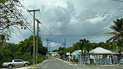
Seatons is a village in Saint Philip Parish, located on eastern Antigua island in Antigua and Barbuda.
Parham Town is a coastal town and port located in and capital of Saint Peter Parish on the island of Antigua, in Antigua and Barbuda. It had a population of 1,491 in 2001.

Cedar Grove is a settlement in the far north of the island of Antigua. It is located to the east of the island's northernmost headlands, Boon Point. It is 6 kilometres (3.7 mi) northeast of the capital, St. John's.

Liberta is a town located in Saint Paul Parish, on the island of Antigua in Antigua and Barbuda. It had a population of 2,560 in 2001.
Freetown, officially known as FreeTown, is a town in Antigua. It is located in the southeast of the island, on a peninsula between Willoughby Bay to the south and Nonsuch Bay to the north.

Falmouth is a coastal port town located in Saint Paul Parish on the island of Antigua, in Antigua and Barbuda. The town is located in the south of the island, at the end of Falmouth Harbour. A road links Falmouth with the nearby larger town of Liberta inland to the north. In 2018, a proposal was made for squatters who had lived on their land for ten years or more to buy their plots for $1 per foot².
Piggotts, also known as St Mark's Village, is a small township in Saint George Parish on Antigua island in Antigua and Barbuda. It had a population of 1,478 in 2001.
Potters Village is a township located on Antigua in Antigua and Barbuda. It is located in the north of the island, to the east of the capital, St. John's and southwest of Piggotts.
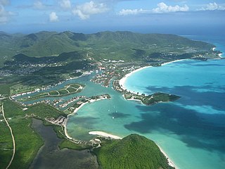
Jolly Harbour is a township on Antigua island, in Antigua and Barbuda.
Bethesda is a township in Saint Paul Parish on the island of Antigua, in Antigua and Barbuda.
Sea View Farm is a township located in Saint George Parish on the island of Antigua, in Antigua and Barbuda.

Afro-Antiguans and Afro-Barbudans are Antiguans and Barbudans of entirely or predominantly African ancestry.

Five Islands Village is a village located on the northwest coast of Antigua, within Saint John Parish in Antigua and Barbuda.
The 2017–18 Antigua and Barbuda Premier Division was the 47th season of the Antigua and Barbuda top-flight football league. The season began on 12 November 2017 and ended on 18 March 2018.

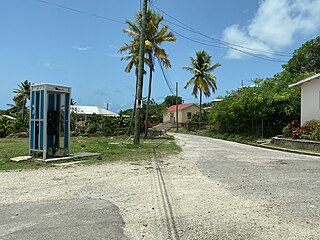
Long Bay is a coastal settlement in Saint Philip, Antigua and Barbuda.