John Hughes, Antigua and Barbuda

Last updated
John Hughes
Village
John Hughes field in 2023 (1).jpg
John Hughes in June 2023
Antigua and Barbuda location map.svg
Red pog.svg
John Hughes
Location in Antigua and Barbuda
Coordinates: 17°02′56″N61°48′29″W / 17.04889°N 61.80806°W / 17.04889; -61.80806
Country Antigua and Barbuda
Island Antigua
Civil parish Saint Mary Parish
Government
  TypeVillage Council [1] (possibly dissolved) [2]
Population
 (2011)
  Total455
Time zone UTC-4 (AST)

John Hughes is a village in Saint Mary Parish, Antigua and Barbuda.

Contents

John Hughes welcome sign in June 2023 John Hughes welcome sign.jpg
John Hughes welcome sign in June 2023

Demographics

John Hughes has two enumeration districts.

Census data [3]

Q49 ReligionCounts%
Adventist9621.16%
Anglican6113.49%
Baptist214.65%
Church of God81.86%
Evangelical61.40%
Jehovah Witness20.47%
Methodist10923.95%
Moravian173.72%
Nazarene61.40%
None/no religion296.28%
Pentecostal204.42%
Rastafarian132.79%
Roman Catholic388.37%
Weslyan Holiness143.02%
Other102.09%
Don't know/Not stated40.93%
Total454100.00%
NotApp :1
Q48 EthnicCounts%
African descendent43094.43%
Caucasian/White132.78%
Mixed (Black/White)30.70%
Mixed (Other)61.39%
Hispanic10.23%
Other20.46%
Total455100.00%
Q58. Country of birthCounts%
Antigua and Barbuda37482.13%
Other Caribbean countries10.23%
Canada30.70%
Other Asian countries20.46%
Other European countries20.46%
Dominica71.62%
Dominican Republic10.23%
Guyana163.48%
Jamaica132.78%
St. Kitts and Nevis10.23%
St. Lucia10.23%
St. Vincent and the Grenadines20.46%
Trinidad and Tobago10.23%
United Kingdom102.09%
USA163.48%
USVI United States Virgin Islands20.46%
Not Stated30.70%
Total455100.00%
Q71 Country of Citizenship 1Counts%
Antigua and Barbuda39586.77%
Other Caribbean countries10.23%
Canada10.23%
Other Asian and Middle Eastern countries10.23%
Dominica61.39%
Guyana153.25%
Jamaica122.55%
Monsterrat10.23%
St. Vincent and the Grenadines20.46%
United Kingdom71.62%
USA112.32%
Other countries10.23%
Not Stated20.46%
Total455100.00%
Q71 Country of Citizenship 2 (Country of Second Citizenship)Counts%
Other Caribbean countries312.00%
Canada28.00%
Other Asian and Middle Eastern countries14.00%
Dominica28.00%
Dominican Republic14.00%
Guyana28.00%
Jamaica14.00%
St. Lucia14.00%
Trinidad and Tobago14.00%
United Kingdom416.00%
USA728.00%
Total26100.00%
NotApp :429

Related Research Articles

Telecommunications in Antigua and Barbuda are via media in the telecommunications industry.

<span class="mw-page-title-main">Saint Mary, Antigua and Barbuda</span> Parish in Antigua and Barbuda

Saint Mary, officially the Parish of Saint Mary, is a parish of Antigua and Barbuda on the island of Antigua. Saint Mary borders Saint John to the north, and Saint Paul to the east. Saint Mary is dominated by the Shekerley Mountains, and its northern border is largely defined by the mountains, and by Cooks Creek. The largest city in the parish is Bolans, home to the Jolly Harbour neighbourhood, and the parish church is located in Old Road. Saint Mary was created with the other five original parishes on 11 January 1692. It had a population of 7,341 in 2011, and 8,141 in 2018.

<span class="mw-page-title-main">All Saints, Antigua and Barbuda</span> Village in Antigua, Antigua and Barbuda

All Saints is the second largest settlement in Antigua and Barbuda, with a population of 3,412. It is located in the middle of Antigua, at 17°3′N61°47′W. Just 5 miles NW of here is the capital, St. John's. It had a population of 3,900 in 2001.

<span class="mw-page-title-main">Willikies</span> Town in Antigua, Antigua and Barbuda

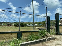
Willikies is a small settlement in Saint Philip Parish, located in the eastern part of Antigua island in Antigua and Barbuda.

Freetown, officially known as FreeTown, is a town in Antigua. It is located in the southeast of the island, on a peninsula between Willoughby Bay to the south and Nonsuch Bay to the north.

<span class="mw-page-title-main">Swetes</span> Town in Antigua, Antigua and Barbuda

Swetes is located in Saint Paul Parish on the island of Antigua, in Antigua and Barbuda.

Piggotts, also known as St Mark's Village, is a small township in Saint George Parish on Antigua island in Antigua and Barbuda. It had a population of 1,478 in 2001.

Potters Village is a township located on Antigua in Antigua and Barbuda. It is located in the north of the island, to the east of the capital, St. John's and southwest of Piggotts.

<span class="mw-page-title-main">Afro-Antiguans and Barbudans</span>

Afro-Antiguans and Afro-Barbudans are Antiguans and Barbudans of entirely or predominantly African ancestry.

<span class="mw-page-title-main">Five Islands, Antigua and Barbuda</span> Village in Antigua, Antigua and Barbuda

Five Islands Village is a village located on the northwest coast of Antigua, within Saint John Parish in Antigua and Barbuda.

Demographic features of the population of Saint John's include population density, internet access, crime rate, and other aspects of the population.

<span class="mw-page-title-main">Buckleys</span> Village in Antigua, Antigua and Barbuda

Buckleys is a village in Saint John Parish, Antigua and Barbuda.

Nut Grove is a village in Saint John Parish, Antigua and Barbuda.

Tomlinsons is a village in Saint John Parish, Antigua and Barbuda.

Branns Hamlet is a village in Saint John Parish, Antigua and Barbuda.

Emmanuel is a village in Saint John Parish, Antigua and Barbuda.

Crosbies is a village in Saint John Parish, Antigua and Barbuda.

Radio Range is a settlement in Saint John Parish, Antigua and Barbuda.

<span class="mw-page-title-main">Indian Antiguans and Barbudans</span>

Indian Antiguans and Indian Barbudans are Antiguans and Barbudans of entirely or predominantly Indian descent.

References

  1. http://laws.gov.ag/wp-content/uploads/2018/08/cap-466.pdf [ bare URL PDF ]
  2. "The political Neanderthal". 12 March 2020.
  3. "Antigua and Barbuda::Statistics Division/Redatam Webserver | Statistical Process and Dissemination Tool". redatam.org. Retrieved 2021-12-18.