Yeptons

Last updated
Yepton's
Village
Yepton's ED in Antigua.png
Yepton's in Antigua
Antigua and Barbuda location map.svg
Red pog.svg
Yepton's
Coordinates: 17°07′31″N61°52′31″W / 17.125278°N 61.875278°W / 17.125278; -61.875278
Country Antigua and Barbuda
Island Antigua
Civil parish Saint John Parish
Government
  TypeVillage Council [1] (possibly dissolved) [2]
Area
  Total4.83 km2 (1.86 sq mi)
Population
 (2011)
  Total314
  Density65/km2 (170/sq mi)
Time zone UTC-4 (AST)

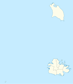
Yepton's (also known as Yepton or Yeptons) is a settlement in Saint John Parish, Antigua and Barbuda.

Contents

Etymology

Yepton's Estates name is thought to have come from the Sussex, England, town of Yapton, which lies close to the city of Arundel. Yapton-born Sir George Thomas acquired ownership of the plantation around 1800. [3]

History

Yepton's Estate [3]

George Thomas, the Leeward Islands' governor from 1753 to 1766, was granted the Thomas Baronetcy of Yapton in the County of Sussex in 1790. After the seventh Baronet, a well-known chess player, passed away in 1972, the title was abolished. The same was granted to Thomas Edwards and his heirs in fee simple of the plantation therein mentioned for the sum of 22,000 pounds to be paid as follows in 1802, according to an indenture between Sir George Thomas and his son. When George White-Thomas inherited Yapton from his grandfather, Sir George Thomas (d. 1821), he adopted the name Thomas, and Yapton now serves as his memorial cemetery.

Messrs. Hyndman, who owned Yapton in 1829, also owned a number of other estates on Antigua, including Bendalls (#37), 503 acres, Towerhill, 361 acres, Belevedere, 343 acres, Yapton Farm, 888 acres, Mathew's or Constitution Hill (#132), 158 acres, Elmes, and Sawcolt's, all of which were owned by Warrick P. Hyndman in 1852.

Yepton's received a legacy payment of £1,681. 4s. 1p. for freeing 113 slaves when slavery was outlawed by the British Parliament in 1833. Boyd Alexander, Claude Neilson, and William Maxwell Alexander received the honor. Robert Hyndman was unsuccessful, and the Honorable William Fraser was involved.

Alex Coltart, owner of Harney & Coltart, a company that minted farthing coins—a quarter of a penny in British currency—for the collecting of salt from the surrounding salt ponds, was the apparent owner of Yepton's in the 1850s (although he is officially documented as gaining possession in 1878). The only supply of salt today is in Barbuda, where it is harvested during the dry months and kept in sizable barrels for local consumption. As was previously mentioned, various ponds in Antigua once produced salt that was harvested in baskets.

The Yepton's pond behind Deep Bay was a valuable supply of salt in the mid-1800s and well into the early 1900s. It was a coarse-grained kind that was perfect for creating ice cream or salting fresh dishes. A short passage at the northern end of the pond was used to bring sea water, and it was kept from draining during the hot, dry months so that the sun's rays could evaporate the sea water, leaving behind a layer of salt crystals. Village ladies from Five Islands and neighboring villages would gather the salt at the conclusion of the drying season. For each basket of salt they delivered, Harney & Coltart paid them with farthings. These tiny coins are occasionally discovered and brought to the Antigua & Barbuda Museum.

Demographics

Yepton's has one enumeration district, ED 36100 (Yepton's).

Yepton's had a Living Conditions Index of 18.2 in August 2007, among the highest in the country. [4]

Historically, Yepton's has had a population of 114 in 2001, and 122 in 1991. [5] [6]

Census data (2011)

Ethnic Data for Yepton's [7]
Q48 EthnicCounts%
African descendent17856.69%
Caucasian/White41.41%
East Indian/India10.35%
Mixed (Black/White)82.46%
Mixed (Other)278.45%
Hispanic20.70%
Other10.35%
Don't know/Not stated9329.58%
Total314100.00%
Religion Data for Yepton's [8]
Q49 ReligionCounts%
Adventist175.43%
Anglican185.80%
Baptist20.72%
Church of God10.36%
Evangelical31.09%
Methodist82.54%
Moravian5417.75%
None/no religion72.17%
Pentecostal3210.51%
Roman Catholic185.80%
Weslyan Holiness82.54%
Other196.16%
Don't know/Not stated11939.13%
Total305100.00%
NotApp :9
Internet Use Data for Yepton's [9]
Q55 Internet UseCounts%
Yes9630.63%
No21367.96%
Don't know/Not stated41.41%
Total314100.00%
Insurance Data for Yepton's [10]
Q53 InsuranceCounts%
Yes8928.52%
No22170.42%
Don't know/Not stated31.06%
Total314100.00%
Country of birth data for Yepton's [11]
Q58. Country of birthCounts%
Africa20.70%
Other Latin or North American countries20.70%
Antigua and Barbuda15248.59%
Canada20.70%
Other European countries10.35%
Dominica92.82%
Guyana144.58%
Jamaica72.11%
Monsterrat10.35%
St. Lucia10.35%
St. Vincent and the Grenadines31.06%
Trinidad and Tobago10.35%
United Kingdom31.06%
USA61.76%
Not Stated10834.51%
Total314100.00%
Country of Citizenship data for Yepton's [12]
Q71 Country of Citizenship 1Counts%
Antigua and Barbuda16652.82%
Other Caribbean countries61.76%
Canada10.35%
Dominica31.06%
Guyana123.87%
Jamaica61.76%
Monsterrat10.35%
St. Vincent and the Grenadines20.70%
United Kingdom20.70%
USA31.06%
Other countries31.06%
Not Stated10834.51%
Total314100.00%
Country of second citizenship data for Yepton's [13]
Q71 Country of Citizenship 2 (Country of Second Citizenship)Counts%
Canada620.00%
Dominica416.00%
Guyana312.00%
Jamaica14.00%
St. Lucia28.00%
St. Vincent and the Grenadines14.00%
Trinidad and Tobago14.00%
United Kingdom14.00%
USA620.00%
Other countries28.00%
Total28100.00%
NotApp :286
Business earning data for Yepton's [14]
Q91 Business EarningCounts%
Under $1,000 EC per month225.00%
1,000 to $1,999 EC per month225.00%
2,000 to $2,999 EC per month112.50%
3,000 to $4,999 EC per month225.00%
$5,000 EC and over per month112.50%
Total9100.00%
NotApp :298
Missing :7
Employment status data for Yepton's [15]
Employment statusCounts%
Employed9237.90%
Unemployed62.28%
Inactive14258.90%
Not stated20.91%
Total242100.00%
NotApp :72

Tourist attractions

Related Research Articles

<span class="mw-page-title-main">Antigua and Barbuda</span> Country in the Lesser Antilles of the West Indies

Antigua and Barbuda is a sovereign island country in the Caribbean. It lies at the conjuncture of the Caribbean Sea and the Atlantic Ocean in the Leeward Islands part of the Lesser Antilles.

<span class="mw-page-title-main">St. John's, Antigua and Barbuda</span> Capital of Antigua and Barbuda

<span class="mw-page-title-main">Barbuda</span> Island in Antigua and Barbuda

Barbuda is an island located in the eastern Caribbean forming part of the twin-island state of Antigua and Barbuda as an autonomous entity. Barbuda is located approximately 30 miles (48 km) north of Antigua. The sole settlements on the island are Codrington and its surrounding localities. Barbuda is a flat island with the western portion being dominated by Codrington Lagoon, and the eastern portion being dominated by the low-lying Barbuda Highlands, with salty ponds and scrubland spread throughout the island. The climate is classified as tropical marine.

<span class="mw-page-title-main">Saint George, Antigua and Barbuda</span> Parish in Antigua and Barbuda

Saint George, officially the Parish of Saint George, is a parish of Antigua and Barbuda on the island of Antigua. Saint George borders Saint Peter to the southeast, and Saint John to the west and south. Saint George is mostly farmland and savanna in the south, dense forest in the Blackman's Peninsula area, marshland in the Fitches Creek area, and dense forest in the northwest. It is the smallest parish in Antigua and Barbuda, and the parish capital is Fitches Creek. The largest city in the parish is Piggotts. Saint George is the newest parish, splitting from the parish of Saint Peter in 1725. It had a population of 7,976 in 2011.

<span class="mw-page-title-main">Saint Philip, Antigua and Barbuda</span> Parish in Antigua and Barbuda

Saint Philip, officially the Parish of Saint Philip, is a civil parish of Antigua and Barbuda, on the easternmost portion of Antigua island. Its capital is the village of St. Philip's. Saint Philip borders Saint Peter and Saint Paul. Saint Philip faces the Atlantic Ocean. Saint Philip is surrounded by various islands and islets. It had a population of 3,347 in 2011, which makes it the least populous parish of Antigua and Barbuda.

<span class="mw-page-title-main">Saint Mary, Antigua and Barbuda</span> Parish in Antigua and Barbuda

Saint Mary, officially the Parish of Saint Mary, is a parish of Antigua and Barbuda on the island of Antigua. Saint Mary borders Saint John to the north, and Saint Paul to the east. Saint Mary is dominated by the Shekerley Mountains, and its northern border is largely defined by the mountains, and by Cooks Creek. The largest city in the parish is Bolans, home to the Jolly Harbour neighbourhood, and the parish church is located in Old Road. Saint Mary was created with the other five original parishes on 11 January 1692. It had a population of 7,341 in 2011, and 8,141 in 2018.

<span class="mw-page-title-main">Saint Paul, Antigua and Barbuda</span> Parish in Antigua and Barbuda

Saint Paul, officially the Parish of Saint Paul, is a parish of Antigua and Barbuda on the island of Antigua. Saint Paul borders Saint Peter and Saint John to the north, Saint Mary to the west, and Saint Philip to the east. Saint Paul is dominated by farmland in the north, with various creeks and Potworks Dam marking its northern border, and low-lying hills to the south, defining its western border with Saint Mary. The largest city fully within the parish is Liberta, the fourth largest city in the country. The parish capital, and the location of the parish church, is Falmouth. The main economic and tourism hub of the parish is English Harbour. Saint Paul was created with the other five original parishes on 11 January 1692. It had a population of 9,004 in 2018.

<span class="mw-page-title-main">Saint Peter, Antigua and Barbuda</span> Parish in Antigua and Barbuda

Saint Peter, officially the Parish of Saint Peter, is a parish of Antigua and Barbuda on the island of Antigua. Saint Peter borders Saint Paul to the south, Saint Philip to the east, and Saint George and Saint John to the west. Saint Peter is dominated by farmland, savanna, and undeveloped fields, and its borders are not well-defined. The largest city fully within the parish is Parham, which is also the capital. However, the portion of the city of All Saints in Saint Peter is significantly larger than Parham. Saint Peter was created with the other five original parishes on 11 January 1692. It had a population of 5,325 in 2011.

<span class="mw-page-title-main">Saint John, Antigua and Barbuda</span> Parish in Antigua, Antigua and Barbuda

Saint John, officially the Parish of Saint John, is a civil parish of Antigua and Barbuda, on the northwestern portion of Antigua island. Its capital is the city of St. John's. Saint John borders Saint Mary, Saint Peter, Saint George, and Saint Paul. Saint John faces the Caribbean Sea. Saint John is surrounded by some of Antigua's most premier beaches. Saint John had a population of 56,736 in a 2018 estimate, making it home to the majority of the population in Antigua and Barbuda.

<span class="mw-page-title-main">Antigua</span> Island in Antigua and Barbuda

Antigua, also known as Waladli or Wadadli by the native population, is an island in the Lesser Antilles. It is one of the Leeward Islands in the Caribbean region and the most populous island of the country of Antigua and Barbuda. Antigua and Barbuda became an independent state within the Commonwealth of Nations on 1 November 1981.

<span class="mw-page-title-main">Codrington, Barbuda</span> Village in Barbuda, Antigua and Barbuda

Codrington is the only major settlement on the island of Barbuda, which is part of the country of Antigua and Barbuda. Codrington coincides with the Major Division of Codrington, one of the two major divisions on Barbuda. Situated on the Codrington Lagoon, Codrington is the nation's northernmost settlement. The population of Codrington was 796 in 2011.

<span class="mw-page-title-main">Monarchy of Antigua and Barbuda</span> Constitutional monarchy as a system of government in Antigua and Barbuda

The monarchy of Antigua and Barbuda is a system of government in which a hereditary monarch is the sovereign and head of state of Antigua and Barbuda. The current Antiguan and Barbudan monarch and head of state, since 8 September 2022, is King Charles III. As sovereign, he is the personal embodiment of the Crown of Antigua and Barbuda. Although the person of the sovereign is equally shared with 14 other independent countries within the Commonwealth of Nations, each country's monarchy is separate and legally distinct. As a result, the current monarch is officially titled King of Antigua and Barbuda and, in this capacity, he and other members of the Royal Family undertake public and private functions domestically and abroad as representatives of Antigua and Barbuda. However, the King is the only member of the Royal Family with any constitutional role.

Freetown, officially known as FreeTown, is a town in Antigua. It is located in the southeast of the island, on a peninsula between Willoughby Bay to the south and Nonsuch Bay to the north.

<span class="mw-page-title-main">Bethesda, Antigua and Barbuda</span> Village in Antigua, Antigua and Barbuda

Bethesda is a township in Saint Paul Parish on the island of Antigua, in Antigua and Barbuda.

Freemans is a town located in Saint Peter Parish on the island of Antigua, in Antigua and Barbuda.

McKinnon's Pond is a lake just north of St. John's, Antigua and Barbuda, the capital of its country. Runaway Beach is just west of it, and it is fed by a small stream leading from St. John's.

The Barbuda Land Acts establishes that the citizens of Barbuda communally own the land. The act specifies that residents must provide consent for major development projects on the island. The Government of Antigua and Barbuda passed the act on January 17, 2008.

Diamonds, also known as The Diamond is a rural hamlet in Saint Peter, Antigua and Barbuda.

Mercers Creek Division is a division of Saint Peter, Antigua and Barbuda. It also coincides with the borders of enumeration district 51303, part of Vernons.

<span class="mw-page-title-main">St. George (Antigua and Barbuda parliament)</span>

St. George is a constituency in Saint John and Saint George, Antigua and Barbuda. It is composed of the villages of New Winthorpes, Barnes Hill, Powells, Potters, Piggotts, Osbourn, Jonas, and Scotts Hill.

References

  1. "LAWS OF ANTIGUA AND BARBUDA - Chapter 466 - THE VILLAGE COUNCILS ACT" (PDF). Retrieved 2023-09-01.
  2. "The political Neanderthal". 12 March 2020.
  3. 1 2 "Yepton's – Antigua Sugar Mills" . Retrieved 2023-02-17.
  4. "Living Conditions in Antigua and Barbuda: Poverty in a Services Economy in Transition" (PDF). statistics.gov.ag. August 2007. Retrieved 25 March 2023.
  5. "Population and Housing Census" (PDF). statistics.gov.ag. 1991. Retrieved 25 March 2023.
  6. "Census of Population and Housing" (PDF). statistics.gov.ag. 2001. Retrieved 25 March 2023.
  7. "Ethnic" (PDF). 2023-02-22. Archived from the original (PDF) on 2023-02-22. Retrieved 2023-02-22.
  8. "Religion" (PDF). 2023-02-22. Archived from the original (PDF) on 2023-02-22. Retrieved 2023-02-22.
  9. "Internet Use" (PDF). 2023-02-22. Archived from the original (PDF) on 2023-02-22. Retrieved 2023-02-22.
  10. "Insurance" (PDF). 2023-02-22. Archived from the original (PDF) on 2023-02-22. Retrieved 2023-02-22.
  11. "Country of birth" (PDF). 2023-02-22. Archived from the original (PDF) on 2023-02-22. Retrieved 2023-02-22.
  12. "Country of Citizenship" (PDF). 2023-02-22. Archived from the original (PDF) on 2023-02-22. Retrieved 2023-02-22.
  13. "Country of second citizenship" (PDF). 2023-02-22. Archived from the original (PDF) on 2023-02-22. Retrieved 2023-02-22.
  14. "Business earning" (PDF). 2023-02-22. Archived from the original (PDF) on 2023-02-22. Retrieved 2023-02-22.
  15. "Employment status" (PDF). Archived from the original (PDF) on 2023-02-22. Retrieved 2023-02-22.
  16. "Yepton beach, Antigua, Antigua and Barbuda - Ultimate guide (February 2023)". www.beach-on-map.com. Retrieved 2023-02-22.