Pares, Antigua and Barbuda

Last updated

Pares
Village
Pares East 1st neighbourhood.jpg
Pares East #1 neighbourhood in 2023
Antigua and Barbuda location map.svg
Red pog.svg
Pares
Coordinates: 17°05′N61°45′W / 17.083°N 61.750°W / 17.083; -61.750
Country Antigua and Barbuda
Island Antigua
Civil parish Saint Peter
Major division Pares
Established1750
Founded byJohn Pare
Government
  MP Asot Michael
Area
  Total0.56 km2 (0.22 sq mi)
Population
 (2011)
  Total575
  Density1,026.8/km2 (2,659/sq mi)
Time zone UTC-4 (AST)

Pares is a small village in central Antigua. it is located to the north of Potworks Dam and south of the town of Parham on the road between Freemans and Willikies.

Contents

History

Sugar

John Pare owned 153 acres and died in 1757. Rachel Warner, the wife of Ashton Warner (d. 1789) held 153 acres in 1803 and was the daughter of John Pare. The slave registration listed 13 children, 89 women, and 63 men in 1787. Samuel Otto-Baijer, member of council and chief baron of Court of Exchequer, was born in Pares on May 1, 1782, and died in Philadelphia on December 20, 1835, at the age of 54. Pares estate was established by John Pare in 1750. [1]

Neighbourhoods

Pares has three enumeration districts, Pares East #1 (51101), Pares East #2 (51102), and Pares West (51200).

Pares (West)

Pares West has an area of 0.2 square kilometres. [2] There are 200 individuals total in Pares West. [3] [4] [5] 72.82% of the population of Pares West is African descendant, 11.79% is other mixed, 8.72% is mixed Black/White, 4.10% of the population is Indian, 1.54% of the population didn't know or didn't state their ethnicity, and 1.03% of the population is Hispanic. [3] 73.33% of the population of Pares West was born in Antigua and Barbuda, 12.82% was born in Guyana, 4.62% was born in Jamaica, and 4.10% of the population was born in the United States. The rest of the population were born in various other countries in the Americas, or in the United Kingdom. [4] The largest religious denomination in Pares West was Pentecostalism, making up 33.85% of the population. [5] The next largest religious denomination in Pares West was Anglicanism, with Anglicans making up 29.74% of the population. The third largest religious denomination in Pares West were Adventists, making up 19.49% of the population. The remainder of the population was other Christian denominations, with an additional 1.03% of the population being Rastafarian, and 0.51% of the population being irreligious. [5]

Pares (East)

In combination of Pares East #1 and Pares East #2, Pares East has a total population of 375 people. [6] [7] 90.16% of the population of Pares East is African descendant, 4.92% are other mixed, 2.46% are Indian, 1.09% are Hispanic, 0.82% of the population didn't know or didn't state their ethnicity, and 0.55% of the population were Syrian/Lebanese. [6] 77.60% of the population of Pares East was born in Antigua and Barbuda, 7.92% were born in Guyana, 2.46% in the United States, and the rest in various other Caribbean countries. [7] The largest religious denomination in Pares East are Adventists, making up 23.55% of the population. The next largest religious group in Pares East are Anglicans, making up 21.05% of the population. Trailing closely behind, the third largest religious group in Pares East are Pentecostalists, making up 20.22% of the population. The rest of the population are various other Christian denominations, with 3.32% of the population being irreligious and 1.66% of the population being Rastafarian. [8]

Pares (East) #1

Pares East #1 has an area of 0.089 square kilometres. [2] Pares East #1 is the most central area of Pares, [2] and is also the smallest enumeration district/neighbourhood of Pares. Pares East #1 has a population of 195 people. [9] 91.05% of the population of Pares East #1 is African descendant, 4.21% are other mixed, 2.11% are Indian, 1.58% are Hispanic, and 1.05% of the population didn't know or didn't state their ethnicity. [9] 76.32% of the population of Pares East #1 was born in Antigua and Barbuda, 10.00% of the population were born in Guyana, 4.74% in the Dominican Republic, and the rest of the population were born in various other countries in the Americas. [10] 28.57% of the population of Pares East #1 are Anglican, 26.46% of the population are Adventist, 20.11% of the population are Pentecostal, and the rest of the population are various other Christian denominations, with 3.17% of the population being Rastafarian and no people reporting themselves as irreligious. 7.94% of the population didn't know or didn't state their religious affiliation. [11]

Pares (East) #2

Pares East #2 has an area of 0.26 square kilometres. [2] Pares East #2 is the easternmost area of Pares, and is also the largest enumeration district/neighbourhood in Pares. [2] Pares East #2 has a population of 180 people. [12] 89.20% of the population of Pares East #2 is African descendant, 5.68% of the population is other Mixed, 2.84% of the population is Indian, 1.14% of the population is Syrian/Lebanese, 0.57% of the population is Hispanic, and 0.57% of the population didn't know or didn't state their ethnicity. [12] 78.98% of the population of Pares East #2 was born in Antigua and Barbuda, 5.68% of the population was born in Guyana, 2.84% of the population was born in the United States (excluding the U.S. Virgin Islands), and the rest of the population of Pares East #2 was born in various other Caribbean countries and territories. [13] 20.35% of the population of Pares East #2 is Adventist, 20.35% of the population is Pentecostalist, 12.79% of the population is Anglican, 12.79% of the population is Evangelical, 6.98% of the population is irreligious, and 7.56% of the population didn't know or didn't state their religion. [14]

Demographics

Population census
YearPop.±% p.a.
1856 139    
1991 459+0.89%
2001 620+3.05%
2011 575−0.75%
Source: 1856 Census, 2001 Census, 1991 Census

Ethnicity

Out of the 575 people living in Pares, 84.14% of the population is African descendant. The remainder of the population of Pares is 7.31% other mixed, 3.03% mixed Black/White, 3.03% Indian, 1.07% Hispanic, 1.07% of the population didn't know or didn't state their ethnicity, and 0.36% of the population is Syrian/Lebanese. [15]

Immigration

76.11% of the population of Pares was born in Antigua and Barbuda, 0.71% of the population were born in "Other Latin or North American countries", 1.25% of the population were born in "Other Caribbean countries", 1.25% of the population were born in Dominica, 1.96% of the population were born in the Dominican Republic, 9.63% in Guyana, 3.03% in Jamaica, 0.18% in Montserrat, 0.18% in Saint Vincent and the Grenadines, 0.18% in the United Kingdom, 3.03% in the United States, 0.89% in the United States Virgin Islands, and 1.60% did not state their country of birth. [16]

Emigration

95.02% of households in Pares have had 0 people migrate abroad, 3.98% of households had 1 person migrate abroad, and 1.00% of households had 2 or more persons migrate abroad. [17] Out of the 51 persons living in Pares who had migrated abroad from Antigua and Barbuda and later returned to Antigua and Barbuda, 56.00% of these persons had migrated back due to regarding Antigua and Barbuda as "home", 22.00% due to family, 10.00% for no reason, 6.00% for other reasons such as involuntary reasons, to start a business, or for education, 4.00% for employment or work, and 2.00% for retirement. [18] 11.71% of the population of Pares have lived overseas at some point. [19] 280 people living in Pares have never moved. [20]

Young people

28.16% of the population, or 162 people, are young people, who are defined as people aged 0-17 years old. [21] 6.42% of the population are aged 0-4 years old, 6.24% 5-9 years old, 9.98% 10-14 years old, and 8.56% are aged 15-19 years old. [22]

Elderly

11.41% of the population, or 66 people, are older people, who are defined as people aged 60 or older. [21] 3.74% of the population are aged 60-64, 2.67% are aged 65-69, 1.25% of the population are aged 70-74, 1.07% of the population are aged 75-79, and 2.67% of the population are aged 80 and over. [22]

Unmet basic needs

10.70% of the population had an unmet basic need for housing, 0.89% of the population had an unmet basic need for water, 0.53% for sanitation, 0.36% for fuel, 0.18% for refuse collection, 1.60% for information, 13.90% of the population had one or more unmet basic needs, and 0.36% had two or more unmet basic needs. [23]

Religion

Pares is home to the Pares Pentecostal Church and the Pares SDA Church, both located in Pares East.

Religion statistics

22.12% of the population is Adventist, 24.10% of the population is Anglican, 0.54% of the population is Baptist, 1.26% of the population is Church of God, 3.96% of the population is Evangelical, 1.62% of the population is Jehovah's Witness, 4.50% of the population is Methodist, 2.34% of the population is irreligious, 25.00% of the population is Pentecostalist, 1.44% of the population is Rastafarian, 5.94% of the population didn't know or didn't state their religion, and the remainder of the population is composed mostly of other Christian denominations. [24]

Economy

Employment and income

26.10% of workers in Pares are paid employees for the government, 5.15% are paid employees for statutory bodies, 50.74% are paid private employees, 4.78% are paid private home employees, 0.74% are self-employed with paid employees, 9.19% are self-employed without paid employees, 1.10% are other types of workers, and 2.21% didn't know or didn't state their worker status. [25] Out of the 23 people asked about their accounts, 27.27% have a complete set of written accounts, 13.64% answered only through informal records, 22.73% had simplified written accounts, and 36.36% kept no records. [26] Out of the 445 people asked, 62.67% are employed, 7.14% are unemployed, 29.26% are inactive, and 0.92% did not state their employment status. [27]

3.69% of people participate in subsistence farming. [28]

444 people receive money from overseas, 97.46% of those people receive less than EC$100, 1.15% receive 100 to 499 EC$, 0.23% receive 500 to 999 EC$, 0.46% receive 1,000 to 1,999 EC$, 0.23% receive 2,000 to 4,999 EC$, and 0.46% receive 5,000 to 99,999 EC$. [29]

Business ownership

Out of the 17 business owners in Pares, 23.53% of businesses make under 1,000 $EC per month, 11.76% make 1,000 to 1,999 $EC per month, 29.41% make 2,000 to 2,999 $EC per month, and 35.29% make 3,000 to 4,999 $EC per month. [30]

Housing and land tenure

There are 219 households in Pares. [31] 12.33% of homes are owned with mortgage, 49.32% of homes are owned outright, 2.28% of homes are rent free, 20.09% of homes are rented private, 3.20% of homes have another type of ownership, and 12.79% didn't know or didn't state. [31] 91.78% of dwellings are a separate house, 0.46% are part of a private house, 5.02% are flats, apartments, or condos, 1.83% are double houses or duplexes, and 0.91% didn't know or didn't state. [32] 57.53% of households have their land owned or freeheld. [33]

34.70% of households had concrete as the main material of their outer walls, 1.37% used concrete/blocks, 40.18% used wood, 12.33% used wood and brick, 9.59% used wood and concrete, 0.91% used wood and galvanized, and 0.91% used other materials. [34] 0.91% of households had concrete roofs, 94.06% of households had sheet metal roofs, 4.11% of households had asphalt shingles, and 0.91% used wood shingles. [35]

91.32% of households had their main kitchen inside, 4.11% outside, and 4.57% didn't know or didn't state. [36] 95.89% of households used cooking gas/LPG as the main source of fuel, 1.37% used electricity, 1.37% used wood/charcoal or kerosene, and 1.37% used none. [37]

As of 2011, 29.68% of households owned a desktop computer, [38] and 33.33% of households owned a laptop. [39] In 2011, 46.58% of households did not have access to the internet, 35.16% did have access to the internet, and 18.26% didn't know or didn't declare. [40]

96.35% of households did not own an air conditioner, and 3.65%, only eight households, did own an air conditioner. [41] Out of these eight households, 87.50% owned one air conditioner, and 12.50%, one household, owned two air conditioners. [42]

Water

56.62% of people stated their main source of water as public water piped into dwelling. [43] For drinking water, 57.53% of people used cistern/tank as their main source of drinking water, 27.85% used bottled water, 9.59% didn't know or didn't state, 4.11% used other sources, and 0.91% used public water piped into dwelling. [44]

Education

Education statistics

Students at Pares Primary School US Navy 090511-F-7923S-128 ST JOHN'S, Antigua (May 11, 2009) Hospital Corpsman 3rd Class Andrew Johnson, emergency room leading petty officer aboard the Military Sealift Command hospital ship USNS Comfort (T-AH 20).jpg
Students at Pares Primary School

42.60% of residents had no educational examination, 5.17% had a school leaving certificate, 2.14% had a high school certificate, 4.28% had a Cambridge School/CXC, 17.65% had a GCE 'O' level/CXC General, 2.85% had a GCE 'A' Levels, CAPE, 6.42% had a college certificate, 2.67% had an associate degree, 2.85% had a bachelor's degree, 0.53% had a post graduate diploma, 0.53% had a professional certificate, 0.71% had a master's or doctoral degree, 2.50% had an other degree, and 9.09% didn't know or didn't state their examination. [45]

Educational facilities

Pares Primary School

Pares Primary School is located in Zone 2, and in the 2017-2018 school year, had 122 pupils. [46]

Pares Secondary School

Pares Secondary School has an enrollment of 353 pupils from various villages in Saint Peter's parish during the 2017-2018 school year. [47] The school has a cricket team, [48] and an alumni association with a chapter in the Cayman Islands. [49]

Government

Pares has no local government such as a village/town/city council and is part of and mostly consists of the "B" division of the Saint Peter parliamentary constituency as of 2023. [50]

There are five laws mentioning Pares Village.

Electoral history

Pares Village is a part of the "B" polling district of the Saint Peter constituency, with the overwhelming majority of "B" polling district residents living in Pares and a few others living in surrounding localities and hamlets.

2018 general election in Pares

In 2018, Asot Michael who was the Labour Party candidate won the "B" polling district. [51]

2023 general election in Pares

Party [52] TotalPercentage
Asot Michael (IND)34260.85%
ABLP13724.38%
UPP7914.06%
DNA20.36%
Rejected20.36%
Total votes562
Registered voters674

Out of the 674 registered voters, 562 votes were cast, leading to a 83.38% turnout. [52]

Police

Pares is patrolled by the Willikies Police Station Service District, led by Assistant Superintendent Canute Mitchel and part of the B Division of the Royal Police Force of Antigua and Barbuda. [53]

Related Research Articles

<span class="mw-page-title-main">Barbuda</span> Island in Antigua and Barbuda

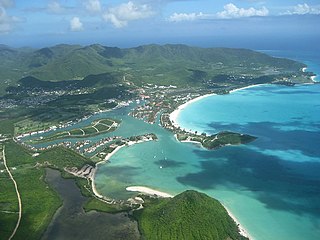
Barbuda is an island located in the eastern Caribbean forming part of the twin-island state of Antigua and Barbuda as an autonomous entity. Barbuda is located approximately 30 miles (48 km) north of Antigua. The sole settlements on the island are Codrington and its surrounding localities. Barbuda is a flat island with the western portion being dominated by Codrington Lagoon, and the eastern portion being dominated by the low-lying Barbuda Highlands, with salty ponds and scrubland spread throughout the island. The climate is classified as tropical marine.

<span class="mw-page-title-main">Saint Philip, Antigua and Barbuda</span> Parish in Antigua and Barbuda

Saint Philip, officially the Parish of Saint Philip, is a civil parish of Antigua and Barbuda, on the easternmost portion of Antigua island. Its capital is the village of St. Philip's. Saint Philip borders Saint Peter and Saint Paul. Saint Philip faces the Atlantic Ocean. Saint Philip is surrounded by various islands and islets. It had a population of 3,347 in 2011, which makes it the least populous parish of Antigua and Barbuda.

<span class="mw-page-title-main">Saint Mary, Antigua and Barbuda</span> Parish in Antigua and Barbuda

Saint Mary, officially the Parish of Saint Mary, is a parish of Antigua and Barbuda on the island of Antigua. Saint Mary borders Saint John to the north, and Saint Paul to the east. Saint Mary is dominated by the Shekerley Mountains, and its northern border is largely defined by the mountains, and by Cooks Creek. The largest city in the parish is Bolans, home to the Jolly Harbour neighbourhood, and the parish church is located in Old Road. Saint Mary was created with the other five original parishes on 11 January 1692. It had a population of 7,341 in 2011, and 8,141 in 2018.

<span class="mw-page-title-main">Saint Paul, Antigua and Barbuda</span> Parish in Antigua and Barbuda

Saint Paul, officially the Parish of Saint Paul, is a parish of Antigua and Barbuda on the island of Antigua. Saint Paul borders Saint Peter and Saint John to the north, Saint Mary to the west, and Saint Philip to the east. Saint Paul is dominated by farmland in the north, with various creeks and Potworks Dam marking its northern border, and low-lying hills to the south, defining its western border with Saint Mary. The largest city fully within the parish is Liberta, the fourth largest city in the country. The parish capital, and the location of the parish church, is Falmouth. The main economic and tourism hub of the parish is English Harbour. Saint Paul was created with the other five original parishes on 11 January 1692. It had a population of 9,004 in 2018.

<span class="mw-page-title-main">Saint Peter, Antigua and Barbuda</span> Parish in Antigua and Barbuda

Saint Peter, officially the Parish of Saint Peter, is a parish of Antigua and Barbuda on the island of Antigua. Saint Peter borders Saint Paul to the south, Saint Philip to the east, and Saint George and Saint John to the west. Saint Peter is dominated by farmland, savanna, and undeveloped fields, and its borders are not well-defined. The largest city fully within the parish is Parham, which is also the capital. However, the portion of the city of All Saints in Saint Peter is significantly larger than Parham. Saint Peter was created with the other five original parishes on 11 January 1692. It had a population of 5,325 in 2011.

<span class="mw-page-title-main">Codrington, Barbuda</span> Village in Barbuda, Antigua and Barbuda

Codrington is the only village on the island of Barbuda, which is part of the country of Antigua and Barbuda. Codrington coincides with the Codrington major division, one of the two major divisions on Barbuda. Situated on the Codrington Lagoon, Codrington is the country's northernmost settlement. The population of Codrington was 796 in 2011.

<span class="mw-page-title-main">All Saints, Antigua and Barbuda</span> Village in Antigua, Antigua and Barbuda

All Saints is the second largest settlement in Antigua and Barbuda, with a population of 3,412. It is located in the middle of Antigua, at 17°3′N61°47′W. Just 5 miles NW of here is the capital, St. John's. It had a population of 3,900 in 2001.

<span class="mw-page-title-main">Parham, Antigua and Barbuda</span> Town in Antigua, Antigua and Barbuda

Parham, officially known as the Town of Parham, is the capital of Saint Peter, the largest city in Saint Peter, and the fourteenth largest city in Antigua and Barbuda. Parham had a population of 1,307 in 2011, distributed over 1.99 square kilometres. Parham is similar in population to Potters Village, the thirteenth largest city in Antigua and Barbuda, and Bendals, the fifteenth largest city. Parham is situated on the shore of Parham Harbour, one of the most important harbors in the country enclosed by the Parham Peninsula and Long Island. Parham comprises four main neighbourhoods: Lovers Lane, Parham Market, Byam Wharf, and the School neighborhood. If the Saint Peter portion of All Saints, home to 1,954 people extending across three parishes, is considered a separate city, Parham would be considered the second largest city of Saint Peter. The major division of Parham, the town's metropolitan area, stretching over the eastern portion of the parish, had a 2011 population of 3,499 people.

Freetown, officially known as FreeTown, is a town in Antigua. It is located in the southeast of the island, on a peninsula between Willoughby Bay to the south and Nonsuch Bay to the north.

<span class="mw-page-title-main">Old Road, Antigua and Barbuda</span> Town in Antigua, Antigua and Barbuda

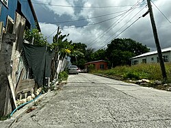
Old Road, officially known as the Town of Old Road, is a town located on a roadstead in the parish of Saint Mary, Antigua and Barbuda. It is overlooked by Boggy Peak, which lies to its northwest. Old Road was founded in the 1700s, and in the 1850s was still a tiny settlement of 96, smaller than its neighbour to the west, Urlings. Old Road has since grown to a population of 1,251 in 2011, and is now the tenth largest settlement in the country. Old Road is smaller than Willikies, but is larger than Montclear, Skyline, and Potters Village. Old Road is separated from the rest of Antigua by the Shekerley Mountains. The village is located on Andy Roberts Drive which to the east, merges onto Fig Tree Drive leading to John Hughes, and to the west, continues through Urlings, Crabs Hill, and Johnsons Point before merging onto Valley Road in Ffryes village.

<span class="mw-page-title-main">Urlings</span> Village in Antigua, Antigua and Barbuda

Urlings is a village in Saint Mary, and the twenty-sixth largest settlement in Antigua and Barbuda. Urlings is located in the southwest of Antigua and has a history dating to before 1856. Urlings started as a small coastal village with a little over 100 people in the 1800s to now being one of the country's more medium sized towns. Urlings is separated from the rest of Antigua by the Shekerley Mountains. Urlings is located between the communities of Johnsons Point and Old Road. Urlings has a seafood festival, a community association, a primary school, a playing field, a fisheries complex, and a cricket club that plays in the Village Parish League.

<span class="mw-page-title-main">Barbuda-North</span> Village and enumeration district in Barbuda, Antigua and Barbuda

Barbuda North is a village and enumeration district on the island of Barbuda.

Montpelier is a small village in Saint Philip Parish, Antigua and Barbuda.

Downtown, officially City Center Downtown, is an enumeration district in the Major Division of Upper Fort Road, St. John's, Antigua and Barbuda.

Twenty Hill is a historic site and sparsely populated unincorporated area in southern Parham.

<span class="mw-page-title-main">Housing in Barbuda</span>

On the island of Barbuda, which is part of the nation of Antigua and Barbuda, the housing industry is a major economic sector. The majority of households, or 68.38% of all households, are owner-occupied homes.

<span class="mw-page-title-main">Long Bay, Antigua and Barbuda</span> Coastal settlement in Saint Philip, Antigua

Long Bay is a coastal settlement in Saint Philip, Antigua and Barbuda.

<span class="mw-page-title-main">Youth in Barbuda</span>

In terms of the demography of the island, youth in Barbuda can be categorized together as one age group. It was projected that 33.92% of the Barbudan population was aged 0–17 years in 2011..

Health in Saint George refers to the overall health of the population of the parish of Saint George, Antigua and Barbuda.

References

  1. "Pares – Antigua Sugar Mills" . Retrieved 31 July 2023.
  2. 1 2 3 4 5 "Enumeration District Boundaries for the 2021 Census". nri.environment.gov.ag. Retrieved 31 July 2023.
  3. 1 2 "Wayback Machine" (PDF). Archived from the original (PDF) on 31 July 2023. Retrieved 31 July 2023.
  4. 1 2 "Wayback Machine" (PDF). Archived from the original (PDF) on 31 July 2023. Retrieved 31 July 2023.
  5. 1 2 3 "Wayback Machine" (PDF). Archived from the original (PDF) on 31 July 2023. Retrieved 31 July 2023.
  6. 1 2 "Wayback Machine" (PDF). Archived from the original (PDF) on 31 July 2023. Retrieved 31 July 2023.
  7. 1 2 "Wayback Machine" (PDF). Archived from the original (PDF) on 31 July 2023. Retrieved 31 July 2023.
  8. "Wayback Machine" (PDF). Archived from the original (PDF) on 31 July 2023. Retrieved 31 July 2023.
  9. 1 2 "Wayback Machine" (PDF). Archived from the original (PDF) on 31 July 2023. Retrieved 31 July 2023.
  10. "Wayback Machine" (PDF). Archived from the original (PDF) on 31 July 2023. Retrieved 31 July 2023.
  11. "Wayback Machine" (PDF). Archived from the original (PDF) on 31 July 2023. Retrieved 31 July 2023.
  12. 1 2 "Wayback Machine" (PDF). Archived from the original (PDF) on 31 July 2023. Retrieved 31 July 2023.
  13. "Wayback Machine" (PDF). Archived from the original (PDF) on 31 July 2023. Retrieved 31 July 2023.
  14. "Wayback Machine" (PDF). Archived from the original (PDF) on 31 July 2023. Retrieved 31 July 2023.
  15. "Wayback Machine" (PDF). Archived from the original (PDF) on 31 July 2023. Retrieved 31 July 2023.
  16. "Wayback Machine" (PDF). Archived from the original (PDF) on 31 July 2023. Retrieved 31 July 2023.
  17. "Wayback Machine" (PDF). Archived from the original (PDF) on 31 July 2023. Retrieved 31 July 2023.
  18. "Wayback Machine" (PDF). Archived from the original (PDF) on 31 July 2023. Retrieved 31 July 2023.
  19. "Wayback Machine" (PDF). Archived from the original (PDF) on 31 July 2023. Retrieved 31 July 2023.
  20. "Wayback Machine" (PDF). Archived from the original (PDF) on 31 July 2023. Retrieved 31 July 2023.
  21. 1 2 "Wayback Machine" (PDF). Archived from the original (PDF) on 31 July 2023. Retrieved 31 July 2023.
  22. 1 2 "Wayback Machine" (PDF). Archived from the original (PDF) on 31 July 2023. Retrieved 31 July 2023.
  23. "Wayback Machine" (PDF). Archived from the original (PDF) on 31 July 2023. Retrieved 31 July 2023.
  24. "Wayback Machine" (PDF). Archived from the original (PDF) on 31 July 2023. Retrieved 31 July 2023.
  25. "Wayback Machine" (PDF). Archived from the original (PDF) on 31 July 2023. Retrieved 31 July 2023.
  26. "Wayback Machine" (PDF). Archived from the original (PDF) on 31 July 2023. Retrieved 31 July 2023.
  27. "Wayback Machine" (PDF). Archived from the original (PDF) on 31 July 2023. Retrieved 31 July 2023.
  28. https://web.archive.org/web/20230731192106/https://redatam.org/binatg/RpWebUtilities.exe/reporte.pdf?LFN=RpBases%5CTempo%5C63988%5C~tmp_639881001.pdf
  29. "Wayback Machine" (PDF). Archived from the original (PDF) on 31 July 2023. Retrieved 31 July 2023.
  30. "Wayback Machine" (PDF). Archived from the original (PDF) on 31 July 2023. Retrieved 31 July 2023.
  31. 1 2 https://web.archive.org/web/20230731202605/https://redatam.org/binatg/RpWebUtilities.exe/reporte.pdf?LFN=RpBases%5CTempo%5C63988%5C~tmp_6398861.pdf
  32. https://web.archive.org/web/20230731203430/https://redatam.org/binatg/RpWebUtilities.exe/reporte.pdf?LFN=RpBases%5CTempo%5C63988%5C~tmp_6398831.pdf
  33. "Wayback Machine" (PDF). Archived from the original (PDF) on 31 July 2023. Retrieved 31 July 2023.
  34. "Wayback Machine" (PDF). Archived from the original (PDF) on 31 July 2023. Retrieved 31 July 2023.
  35. "Wayback Machine" (PDF). Archived from the original (PDF) on 31 July 2023. Retrieved 31 July 2023.
  36. "Wayback Machine" (PDF). Archived from the original (PDF) on 31 July 2023. Retrieved 31 July 2023.
  37. "Wayback Machine" (PDF). Archived from the original (PDF) on 31 July 2023. Retrieved 31 July 2023.
  38. "Wayback Machine" (PDF). Archived from the original (PDF) on 31 July 2023. Retrieved 31 July 2023.
  39. "Wayback Machine" (PDF). Archived from the original (PDF) on 31 July 2023. Retrieved 31 July 2023.
  40. https://web.archive.org/web/20230731210748/https://redatam.org/binatg/RpWebUtilities.exe/reporte.pdf?LFN=RpBases%5CTempo%5C63988%5C~tmp_639881081.pdf
  41. https://web.archive.org/web/20230731211153/https://redatam.org/binatg/RpWebUtilities.exe/reporte.pdf?LFN=RpBases%5CTempo%5C63988%5C~tmp_639881021.pdf
  42. "Wayback Machine" (PDF). Archived from the original (PDF) on 31 July 2023. Retrieved 31 July 2023.
  43. "Wayback Machine" (PDF). Archived from the original (PDF) on 31 July 2023. Retrieved 31 July 2023.
  44. "Wayback Machine" (PDF). Archived from the original (PDF) on 31 July 2023. Retrieved 31 July 2023.
  45. "Wayback Machine" (PDF). Archived from the original (PDF) on 31 July 2023. Retrieved 31 July 2023.
  46. https://statistics.gov.ag/subjects/education-training-learning/govt-primary-school-enrollment-2009-2018/
  47. https://statistics.gov.ag/subjects/education-training-learning/govt-secondary-school-enrollment-2009-2018/
  48. "Pares Secondary School". Cricket268. 8 April 2022. Retrieved 31 July 2023.
  49. "Home". Pss Alumni Association Ga Ci Chapter. Retrieved 31 July 2023.
  50. "2023 General Election Polling Districts and Polling Stations". www.abec.gov.ag. Retrieved 31 July 2023.
  51. "General Elections 2018". www.abec.gov.ag. Retrieved 1 August 2023.
  52. 1 2 "2023 General Elections Results St. Peter". www.abec.gov.ag. Retrieved 1 August 2023.
  53. https://mpsl.gov.ag/departments/police/division/b-division/