Willows, California

Last updated

Willows, California
City of Willows
Willows Post Office.jpg
The historic Willows post office
Glenn County California Incorporated and Unincorporated areas Willows Highlighted.svg
Location within Glenn County
Relief map of California.png
Red pog.svg
Willows
Location within California
Usa edcp relief location map.png
Red pog.svg
Willows
Location within the United States
Coordinates: 39°31′28″N122°11′37″W / 39.52444°N 122.19361°W / 39.52444; -122.19361
Country United States
State California
County Glenn
Incorporated January 16, 1886 [1]
Area
[2]
   City 2.85 sq mi (7.38 km2)
  Land2.84 sq mi (7.34 km2)
  Water0.01 sq mi (0.03 km2)  0.92%
Elevation
[3]
138 ft (42 m)
Population
 (2010)
   City 6,166
  Estimate 
(2019) [4]
6,072
  Density2,141.04/sq mi (826.75/km2)
   Metro
74,337,899
Time zone UTC-8 (Pacific (PST))
  Summer (DST) UTC-7 (PDT)
ZIP code
95988
Area code 530
FIPS code 06-85684
GNIS feature IDs 1660184, 2412272
Website cityofwillows.org

Willows is a city and the county seat of Glenn County, California, located in the Sacramento Valley region of Northern California. The city is home to regional government offices, including the California Highway Patrol, the California Department of Motor Vehicles, the United States Bureau of Reclamation and the main offices of the Mendocino National Forest, which comprises about one million acres (404,686 ha) of Federal land located mostly in mountainous terrain west of Willows. The population was 6,293 at the 2020 census. [5]

Contents

History

The historic Willows Masonic Lodge. Willows Masonic Building, March 2022-3368 (cropped).jpg
The historic Willows Masonic Lodge.

The Willow post office opened in 1862; the name was changed to Willows in 1916. [6] The current post office building, which was built in 1918, is listed on the National Register of Historic Places. [7] The Willows Auxiliary Field (1942–1945) was used for training World War II pilots. [8] [9] [10] [11]

Geography

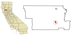
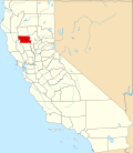
According to the United States Census Bureau, the city has a total area of 2.9 square miles (7.5 km2), of which, 2.8 square miles (7.3 km2) of it is land and 0.03 square miles (0.078 km2) of it (0.92%) is water.

Climate

Willows has a Hot-summer Mediterranean climate (Csa) according to the Köppen climate classification system.

Climate data for Willows, California, 1991–2020 normals, extremes 1906–present
MonthJanFebMarAprMayJunJulAugSepOctNovDecYear
Record high °F (°C)83
(28)
83
(28)
88
(31)
101
(38)
109
(43)
113
(45)
117
(47)
115
(46)
115
(46)
105
(41)
92
(33)
81
(27)
117
(47)
Mean maximum °F (°C)70.5
(21.4)
73.8
(23.2)
80.2
(26.8)
89.0
(31.7)
96.4
(35.8)
104.0
(40.0)
105.1
(40.6)
102.9
(39.4)
102.3
(39.1)
94.1
(34.5)
80.5
(26.9)
68.8
(20.4)
107.6
(42.0)
Mean daily maximum °F (°C)58.4
(14.7)
62.8
(17.1)
67.9
(19.9)
74.7
(23.7)
82.5
(28.1)
90.2
(32.3)
94.8
(34.9)
93.6
(34.2)
91.0
(32.8)
81.6
(27.6)
67.3
(19.6)
58.4
(14.7)
76.9
(25.0)
Daily mean °F (°C)49.2
(9.6)
52.3
(11.3)
56.0
(13.3)
61.0
(16.1)
68.2
(20.1)
75.1
(23.9)
78.8
(26.0)
77.5
(25.3)
74.7
(23.7)
67.1
(19.5)
55.6
(13.1)
48.7
(9.3)
63.7
(17.6)
Mean daily minimum °F (°C)40.0
(4.4)
41.9
(5.5)
44.1
(6.7)
47.3
(8.5)
54.0
(12.2)
60.1
(15.6)
62.9
(17.2)
61.3
(16.3)
58.4
(14.7)
52.6
(11.4)
43.9
(6.6)
39.0
(3.9)
50.5
(10.3)
Mean minimum °F (°C)28.2
(−2.1)
30.4
(−0.9)
32.0
(0.0)
33.8
(1.0)
41.0
(5.0)
47.4
(8.6)
52.6
(11.4)
51.5
(10.8)
46.6
(8.1)
40.7
(4.8)
31.5
(−0.3)
26.6
(−3.0)
24.8
(−4.0)
Record low °F (°C)15
(−9)
21
(−6)
21
(−6)
22
(−6)
29
(−2)
38
(3)
43
(6)
42
(6)
37
(3)
30
(−1)
22
(−6)
11
(−12)
11
(−12)
Average precipitation inches (mm)4.40
(112)
4.19
(106)
2.77
(70)
1.53
(39)
1.20
(30)
0.46
(12)
0.03
(0.76)
0.07
(1.8)
0.22
(5.6)
1.08
(27)
2.35
(60)
3.58
(91)
21.88
(555.16)
Average precipitation days (≥ 0.01 in)9.28.38.54.33.71.60.10.31.03.14.25.950.2
Source 1: NOAA [12]
Source 2: National Weather Service [13]

Demographics

Historical population
CensusPop.Note
1880 728
1890 1,17661.5%
1900 893−24.1%
1910 1,13927.5%
1920 2,19092.3%
1930 2,024−7.6%
1940 2,2159.4%
1950 3,01936.3%
1960 4,13937.1%
1970 4,085−1.3%
1980 4,77716.9%
1990 5,98825.4%
2000 6,2203.9%
2010 6,166−0.9%
2019 (est.)6,072 [4] −1.5%
U.S. Decennial Census [14]

2010

Downtown Willows. Willows Hardware Store, March 2022-3372.jpg
Downtown Willows.

At the 2010 census Willows had a population of 6,166. The population density was 2,146.2 inhabitants per square mile (828.7/km2). The racial makeup of Willows was 4,304 (69.8%) White, 78 (1.3%) African American, 138 (2.2%) Native American, 312 (5.1%) Asian, 11 (0.2%) Pacific Islander, 1,099 (17.8%) from other races, and 224 (3.6%) from two or more races. Hispanic or Latino of any race were 2,020 persons (32.8%). [15]

The census reported that 5,976 people (96.9% of the population) lived in households, 20 (0.3%) lived in non-institutionalized group quarters, and 170 (2.8%) were institutionalized.

There were 2,173 households, 839 (38.6%) had children under the age of 18 living in them, 1,037 (47.7%) were opposite-sex married couples living together, 327 (15.0%) had a female householder with no husband present, 133 (6.1%) had a male householder with no wife present. There were 225 (10.4%) unmarried opposite-sex partnerships, and 7 (0.3%) same-sex married couples or partnerships. 538 households (24.8%) were one person and 228 (10.5%) had someone living alone who was 65 or older. The average household size was 2.75. There were 1,497 families (68.9% of households); the average family size was 3.28.

The age distribution was 1,783 people (28.9%) under the age of 18, 614 people (10.0%) aged 18 to 24, 1,542 people (25.0%) aged 25 to 44, 1,445 people (23.4%) aged 45 to 64, and 782 people (12.7%) who were 65 or older. The median age was 32.6 years. For every 100 females, there were 97.4 males. For every 100 females age 18 and over, there were 94.5 males.

There were 2,399 housing units at an average density of 835.0 per square mile (322.4/km2),of which 2,173 were occupied, 1,148 (52.8%) by the owners and 1,025 (47.2%) by renters. The homeowner vacancy rate was 2.3%; the rental vacancy rate was 8.8%. 3,137 people (50.9% of the population) lived in owner-occupied housing units and 2,839 people (46.0%) lived in rental housing units.

2000

At the 2000 census there were 6,220 people in 2,134 households, including 1,513 families, in the city. The population density was 2,168.5 inhabitants per square mile (837.3/km2). There were 2,368 housing units at an average density of 825.6 per square mile (318.8/km2). The racial makeup of the city was 69.3% White, 0.9% Black or African American, 2.3% Native American, 10.3% Asian, 0.2% Pacific Islander, 12.3% from other races, and 4.8% from two or more races. 23.3% of the population were Hispanic or Latino of any race. [16] Of the 2,134 households 38.5% had children under the age of 18 living with them, 52.1% were married couples living together, 14.2% had a female householder with no husband present, and 29.1% were non-families. 24.7% of households were one person and 11.0% were one person aged 65 or older. The average household size was 2.83 and the average family size was 3.40.

The age distribution was 32.7% under the age of 18, 9.6% from 18 to 24, 26.4% from 25 to 44, 19.0% from 45 to 64, and 12.4% 65 or older. The median age was 31 years. For every 100 females, there were 98.1 males. For every 100 females age 18 and over, there were 92.4 males.

The median income for a household in the city was $27,466, and the median family income was $35,856. Males had a median income of $30,297 versus $22,159 for females. The per capita income for the city was $12,523. About 17.7% of families and 24.6% of the population were below the poverty line, including 39.6% of those under age 18 and 9.4% of those age 65 or over.

Politics

The historic Willows Post Office. Willows Main Post Office, March 2022-3373.jpg
The historic Willows Post Office.

In the state legislature, Willows is in the 4th Senate District , represented by Democrat Marie Alvarado-Gil, [17] and in the 3rd Assembly District , represented by Republican James Gallagher. [18]

Federally, Willows is in California's 3rd congressional district , represented by Republican Kevin Kiley. [19]

Notable people

Related Research Articles

<span class="mw-page-title-main">Glenn County, California</span> County in California, United States

Glenn County is a county located in the U.S. state of California. As of the 2020 census, the population was 28,917. The county seat is Willows. It is located in the Sacramento Valley, in the northern part of the California Central Valley. The Grindstone Rancheria, reservation of the Grindstone Indian Rancheria of Wintun-Wailaki Indians, is located in Glenn County.

<span class="mw-page-title-main">Willow Valley, Arizona</span> Census-designated place in Arizona, United States

Willow Valley is an unincorporated community and census-designated place (CDP) in Mohave County, Arizona, United States. The population was 1,059 as of the 2020 census.

<span class="mw-page-title-main">Durham, California</span> Census-designated place in California, United States

Durham is a census-designated place (CDP) in Butte County, California, United States. The population was 5,518 at the 2010 census.

<span class="mw-page-title-main">Hamilton City, California</span> Census-designated place in California, United States

Hamilton City is a census-designated place (CDP) in Glenn County, California, United States. The population was 1,759 at the 2010 census, down from 1,903 at the 2000 census. Hamilton City is located 9.5 miles (15 km) east of Orland, and 10 miles west of Chico at an elevation of 151 feet. The community is inside area code 530. The default prefix used for wired telephones in the Hamilton City area is 826. The postal ZIP Code is 95951.

<span class="mw-page-title-main">Orland, California</span> City in California, United States

Orland is a city in Glenn County, California. The population as of the 2020 census was 8,298. The population was 7,291 at the 2010 census, up from 6,281 at the 2000 census, making Orland the most populous and fastest growing city in Glenn County. Orland is located 16 miles (26 km) north of Willows, at an elevation of 259 feet. Interstate 5, (north–south) passes west of the downtown area while State Route 32 (east–west) passes through downtown.

<span class="mw-page-title-main">Willow Creek, California</span> Census-designated place in California, United States

Willow Creek is a census-designated place (CDP) in Humboldt County, California, United States. The population was 1,710 at the 2010 census, down from 1,743 at the 2000 census. Residents of this small mountain town are commonly referred to as "Willow Creekers". The town is located around 30 miles (48 km) from county seat and harbor city Eureka, with the two places differing vastly in climate.

<span class="mw-page-title-main">Rosamond, California</span> Unincorporated community in Kern County, California

Rosamond is an unincorporated community in Kern County, California, US, near the Los Angeles county line. Rosamond is part of Greater Los Angeles and is located in the Mojave Desert just north of Lancaster and Palmdale, two of the largest cities in Antelope Valley. As of the 2010 Census, Rosamond's population was 18,150. For statistical purposes, the United States Census Bureau has defined Rosamond as a census-designated place (CDP).

<span class="mw-page-title-main">Desert View Highlands, California</span> Census designated place in California, United States

Desert View Highlands is a census-designated place (CDP) in Los Angeles County, California, United States. The population was 2,360 at the 2010 census, up from 2,337 at the 2000 census. It is surrounded by the City of Palmdale.

<span class="mw-page-title-main">Sand City, California</span> City in California, United States

Sand City is a city in Monterey County, California, United States, located on the shores of Monterey Bay, and surrounded on most sides by the larger city of Seaside. Sand City is located 2 miles (3 km) northeast of Monterey, at an elevation of 72 feet. The population was 325 at the 2020 census. The city is predominantly a business community, and has a number of larger retail stores. The West End area of Sand City, once an industrial area, hosts a growing artists' colony. Every August, the artists of Sand City and neighboring areas hold a street fair called the "West End Celebration".

<span class="mw-page-title-main">El Cerrito, Riverside County, California</span> Census-designated place in Riverside County, California, United States

El Cerrito is a census-designated place (CDP) in Riverside County, California, United States. It is an unincorporated area mostly surrounded by the city of Corona. The population was 5,100 at the 2010 census, up from 4,590 at the 2000 census.

<span class="mw-page-title-main">Glenns Ferry, Idaho</span> City in Idaho, United States

Glenns Ferry is a city in Elmore County, Idaho, United States. The population was 1,293 at the 2020 census. The city is adjacent to Interstate 84 and the Snake River.

<span class="mw-page-title-main">Salix, Iowa</span> City in Iowa, United States

Salix is a city in Woodbury County, Iowa, United States. It is part of the Sioux City, IA–NE–SD Metropolitan Statistical Area. The population was 295 at the time of the 2020 census.

<span class="mw-page-title-main">Lakeland Village, California</span> Census-designated place in California, United States

Lakeland Village is a census-designated place (CDP) in Riverside County, California, United States. The population was 11,541 at the 2010 census, more than double the 5,626 reported at the 2000 census.

<span class="mw-page-title-main">Denham, Minnesota</span> City in Minnesota, United States

Denham is a city in Pine County, Minnesota, United States. The population was 37 at the 2020 census.

<span class="mw-page-title-main">Willow River, Minnesota</span> City in Minnesota, United States

Willow River is a city in Pine County, Minnesota, United States, at the confluence of the Kettle and Willow Rivers. The population was 415 at the 2010 census.

<span class="mw-page-title-main">Willow Springs, Missouri</span> City in Missouri, United States

Willow Springs is a city in Howell County, Missouri, in the Ozark Mountains of the United States. The population was 2,164 at the 2020 census.

<span class="mw-page-title-main">Olivette, Missouri</span> City in Missouri, United States

Olivette is an inner-ring suburb of St. Louis, located in St. Louis County, Missouri, United States. The population was 8,504 at the 2020 census.

<span class="mw-page-title-main">Willow City, North Dakota</span> City in North Dakota, United States

Willow City is a city in Bottineau County, North Dakota, United States. The population was 149 at the 2020 census.

<span class="mw-page-title-main">Willow Lake, South Dakota</span> City in South Dakota, United States

Willow Lake is a city in Clark County, South Dakota, United States. The population was 255 at the 2020 census.

<span class="mw-page-title-main">Follansbee, West Virginia</span> City in West Virginia, United States

Follansbee is a city in Brooke County, West Virginia, United States, located along the Ohio River. The population was 2,853 at the 2020 census, a decrease from 2,986 at the 2010 census. It is part of the Weirton–Steubenville metropolitan area. The city was named after the Follansbee brothers, the proprietors of a local steel mill.

References

  1. "California Cities by Incorporation Date" (Word). California Association of Local Agency Formation Commissions . Retrieved April 7, 2013.
  2. "2019 U.S. Gazetteer Files". United States Census Bureau. Retrieved July 1, 2020.
  3. "Willows". Geographic Names Information System . United States Geological Survey, United States Department of the Interior.
  4. 1 2 "Population and Housing Unit Estimates". United States Census Bureau. May 24, 2020. Retrieved May 27, 2020.
  5. "Search Results". The United States Census Bureau. Retrieved August 11, 2022.
  6. Durham, David L. (1998). California's Geographic Names: A Gazetteer of Historic and Modern Names of the State. Clovis, Calif.: Word Dancer Press. p. 336. ISBN   1-884995-14-4.
  7. "National Register Information System". National Register of Historic Places . National Park Service. July 9, 2010.
  8. militarymuseum.org Willows Auxiliary Field
  9. Willows-Glenn County Airport
  10. Willows-Glenn County Airport
  11. airnav.com, Willows-Glenn County Airport
  12. "U.S. Climate Normals Quick Access – Station: Willows 6 W, CA". National Oceanic and Atmospheric Administration. Retrieved May 23, 2023.
  13. "NOAA Online Weather Data – NWS Sacramento". National Weather Service. Retrieved May 23, 2023.
  14. "Census of Population and Housing". Census.gov. Retrieved June 4, 2015.
  15. "2010 Census Interactive Population Search: CA - Willows city". U.S. Census Bureau. Archived from the original on July 15, 2014. Retrieved July 12, 2014.
  16. "U.S. Census website". United States Census Bureau . Retrieved January 31, 2008.
  17. "Senators". State of California. Retrieved April 7, 2013.
  18. "Members Assembly". State of California. Retrieved April 7, 2013.
  19. "California's 3rd Congressional District - Representatives & District Map". Civic Impulse, LLC. Retrieved March 1, 2013.
  20. Reichler, Joseph L., ed. (1979) [1969]. The Baseball Encyclopedia (4th ed.). New York: Macmillan Publishing. ISBN   978-0-02-578970-8.