Yan Yean Road

Last updated

Yan Yean Road

Australia Victoria metropolitan Melbourne location map.svg
Red pog.svg
North end
Red pog.svg
South end
Coordinates
General information
TypeRoad
Length12.6 km (7.8 mi) [1]
Route number(s) Australian state route 57.svg Metro Route 57 (1989–present)
(Doreen–Diamond Creek)
Major junctions
North endRidge Road
Yan Yean, Victoria
 
  • Arthurs Creek Road
  • Australian state route 57.svg Bridge Inn Road
  • Ironbark Road
  • Australian state route 58.svg Kurrak Road

Australian state route 46.svgAustralian state route 57.svg Diamond Creek Road

South endAqueduct Road
Diamond Creek, Melbourne
Location(s)
Major suburbs Doreen, Plenty, Diamond Creek

Yan Yean Road is a major road in the outer north-eastern suburbs of Melbourne, Victoria, Australia. Yan Yean Road begins at the intersection with Diamond Creek Road and Aqueduct Road in Diamond Creek, extending northward through the suburbs of Plenty, Yarrambat and Doreen before terminating in Yan Yean near the Yan Yean Reservoir. The road, previously a rural road until development in the 2000s, is now an important arterial link between the traditional north-eastern suburbs of Melbourne and new estates in Doreen and Mernda.

Contents

Route

Yan Yean Road begins at the intersection with Diamond Creek Road and Aqueduct Road in Diamond Creek, heading northbound as a 4 lane, divided road with a speed limit of 70km/h. It travels through the semi rural communities of Plenty and Yarrambat. North of the Kurrak Road intersection in Yarrambat, the road narrows to a 2 lane, single carriageway continuing north towards the developing suburb of Doreen. At the Bridge Inn Road intersection, the road continues north with the newer estates on the western side of the road. This section of the road is classed as a local road as opposed to an arterial road and has a speed limit of 80km/h. [2] The road ends at the intersection with Arthurs Creek Road in Yan Yean.

History

The road was assigned Metropolitan Route 57 in 1989, which continues at the southern point along Diamond Creek Road and continues westward at Bridge Inn Road.

The passing of the Road Management Act 2004 [3] granted the responsibility of overall management and development of Victoria's major arterial roads to VicRoads: in 2004, VicRoads re-declared the road as Yan Yean Road (Arterial #5724), beginning at Kurrak Road at Yarrambat and ending at Diamond Creek Road in Diamond Creek, [4] the section of Yan Yean Road between Arthurs Creek and Kurrak Roads through Doreen remains undeclared.

The road prior to 2019 was a 2 lane single carriageway road along its entire length, which with commuters from the developing suburbs of Doreen and Mernda relying on this road to travel to the Melbourne CBD and inner suburbs, the road was carrying traffic far beyond its design limit. The Yan Yean Road Upgrade Stage 1 duplicated and reworked the road between Diamond Creek Road and Kurrak Road, providing an additional lane in each direction as well as upgrading a number of intersections along the route with traffic lights and removing a dangerous set of corners near the Heard Avenue intersection. This upgrade was completed in 2019. [5]

Major works

Whilst the Yan Yean Road Upgrade Stage 1 improved a significant portion of the road, the road now experiences additional bottlenecks around the Kurrak Road, Ironbark Road and Bridge Inn Road intersections with cars often queuing for kilometres. The Yan Yean Road Upgrade Stage 2 will duplicate the road to Bridge Inn Road, as well as upgrade a number of intersections along the route. The upgrade is currently undergoing an EES (Environment Effects Statement) review, and is currently anticipated to begin construction no earlier than 2022. [5]

Major intersections

LGALocation [1] [4] km [1] miDestinationsNotes
WhittleseaNillumbik boundary Yan YeanDoreen boundary0.00.0Ridge Road  Yan Yean Northern terminus of road, continues north as Ridge Road
Arthurs Creek Road  Arthurs Creek
Doreen 3.82.4Australian state route 57.svg Bridge Inn Road (Metro Route 57 west)  Mernda, Wollert
Doctors Gully Road (east)  Nutfield
Metro Route 57 continues west along Bridge Inn Road
Nillumbik YarrambatPlenty boundary9.35.8Australian state route 58.svg Kurrak Road (Metro Route 58)  South Morang, Epping
PlentyDiamond Creek boundary12.67.8Australian state route 46.svgAustralian state route 57.svg Diamond Creek Road (Metro Route 46 west, east/Metro Route 57 east)  Ivanhoe, Greensborough, Wattle Glen Metro Route 57 continues east along Diamond Creek Road
Aqueduct Road  St Helena Southern terminus of road, continues south as Aqueduct Road
  •        Route transition

Related Research Articles

<span class="mw-page-title-main">Princes Highway</span> Highway in Australia

Princes Highway is a major road in Australia, extending from Sydney via Melbourne to Adelaide through the states of New South Wales, Victoria and South Australia. It has a length of 1,941 kilometres (1,206 mi) or 1,898 kilometres (1,179 mi) via the former alignments of the highway, although these routes are slower and connections to the bypassed sections of the original route are poor in many cases.

<span class="mw-page-title-main">Doreen, Victoria</span> Suburb of City of Whittlesea, Victoria, Australia

Doreen is a rapidly growing suburb in Melbourne, Victoria, Australia, 29 km (18 mi) north-east of Melbourne's Central Business District, located within the City of Whittlesea and Shire of Nillumbik local government areas. Doreen recorded a population of 27,122 at the 2021 census.

<span class="mw-page-title-main">Plenty, Victoria</span> Suburb of Melbourne, Victoria, Australia

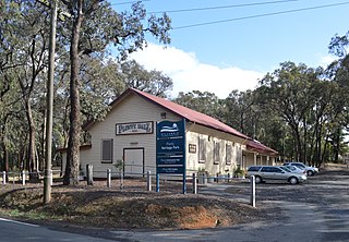
Plenty is a suburb in Melbourne, Victoria, Australia, 21 km (13 mi) north-east of Melbourne's Central Business District, located within the Shire of Nillumbik local government area. Plenty recorded a population of 2,575 at the 2021 census.

<span class="mw-page-title-main">Yarrambat, Victoria</span> Town in Victoria, Australia

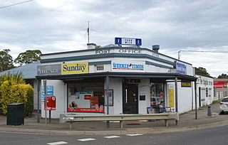
Yarrambat is a town in Victoria, Australia, 24 km north-east of Melbourne's Central Business District, located within the Shire of Nillumbik local government area. Yarrambat recorded a population of 1,602 at the 2021 census.

Melton Highway links Melbourne's outer north-western suburbs of Melton and Taylors Lakes, connecting the Western Freeway and Calder Freeway to provide a more-direct route between Ballarat and Melbourne and Essendon airports; it has a Victorian route designation of C754.

<span class="mw-page-title-main">Monash Freeway</span> Freeway in Victoria, Australia

The Monash Freeway is a major urban freeway in Victoria, Australia, linking Melbourne's CBD to its south-eastern suburbs and beyond to the Gippsland region. It carries up to 180,000 vehicles per day and is one of Australia's busiest freeways. The entire stretch of the Monash Freeway bears the designation M1.

South Gippsland Freeway is a short freeway linking Dandenong in Melbourne's south–east to other south–eastern destinations, including the Mornington Peninsula and the Gippsland region. The freeway bears the designation M420.

<span class="mw-page-title-main">Princes Freeway</span> Freeway in Victoria, Australia

Princes Freeway is a 159-kilometre (99 mi) Australian freeway, divided into two sections, both located in Victoria, Australia. The freeway links Melbourne to Geelong in the west, and to Morwell in the east. It continues beyond these extremities as the Princes Highway towards Adelaide to the west and Sydney to the northeast. The freeway bears the designation M1.

Flemington Road is a major thoroughfare in the inner suburbs of North Melbourne and Parkville in Melbourne, Victoria, Australia. It runs for 2 km in a northwest–southeast direction, from the southern end of Mount Alexander Road, Flemington, to Haymarket roundabout and the northern end of Elizabeth Street, and provides a main connection between the northern arm of the CityLink tollway and Melbourne's CBD.

Westall Road is a major north to south thoroughfare west of Springvale, Victoria, Australia.

<span class="mw-page-title-main">Greensborough Highway</span>

Greensborough Highway is a highway in the north-eastern suburbs of Melbourne, Australia, and is an important route for north-east Melbourne. This name is not widely known to most drivers, as the entire allocation is still best known as by the names of its constituent parts: Lower Heidelberg Road, Rosanna Road, Lower Plenty Road, Greensborough Road and Greensborough Bypass. This article will deal with the entire length of the corridor for sake of completion, as well to avoid confusion between declarations.

<span class="mw-page-title-main">Mernda</span> Suburb of Melbourne, Victoria, Australia

Mernda is a suburb of Melbourne, Victoria, Australia, 26 km north-east of Melbourne's central business district, located within the City of Whittlesea local government area. Mernda recorded a population of 23,369 at the 2021 census.

Thompson Road is a major urban arterial road in the south-eastern suburbs of Melbourne, Victoria, Australia.

Western Port Highway is a highway in Victoria, Australia, linking the south-eastern fringe of suburban Melbourne to the western coast of Western Port, after which the highway is named, at the Port of Hastings nearly 30 km to the south. It runs from the end of South Gippsland Freeway at Lynbrook, firstly as a dual carriageway and later as an undivided road, to Frankston-Flinders Road at Hastings.

Warrigal Road is a major inner urban road in southeastern Melbourne, Australia. On weekdays, it is heavily trafficked as it runs through many major suburbs along its route, traversing some of Melbourne's eastern and south-eastern suburbs. These suburbs include Chadstone, Oakleigh, and Cheltenham. The Chadstone Shopping Centre can be accessed directly from Warrigal Road at its eastern entrance.

<span class="mw-page-title-main">Canterbury Road, Melbourne</span> Road in Melbourne, Australia

Canterbury Road is a major arterial road through eastern Melbourne, linking the inner eastern suburbs to the outer eastern fringe at the western foot of the Dandenong Ranges.

Plenty Road is a major urban arterial road in the north-eastern suburbs of Melbourne, Victoria, Australia. Plenty Road begins at the intersection of High Street and Dundas Street in Preston, travelling through the north eastern suburbs of Reservoir, Bundoora, Mill Park, South Morang and Mernda and terminating in the township of Whittlesea, just outside the urban area of Melbourne.

<span class="mw-page-title-main">Doncaster–Eltham Road</span>

Doncaster–Eltham Road is a major arterial road in the north-eastern suburbs of Melbourne, Victoria, Australia. This name is not widely known to most drivers, as the entire allocation is still best known as by the names of its constituent parts: Fitzsimons Lane and Williamsons Road. This article will deal with the entire length of the corridor for sake of completion, as well to avoid confusion between declarations.

Craigieburn Road is an arterial road located in the northern suburbs of Melbourne.

Donnybrook Road is an arterial road through the northern fringes of Melbourne, Australia, linking the outer northern suburb of Mickleham to the outer northern fringe at Yan Yean, travelling through the suburbs of Donnybrook and Woodstock.

References

  1. 1 2 3 Google (21 December 2021). "Yan Yean Road" (Map). Google Maps . Google. Retrieved 21 December 2021.
  2. "VicRoads Map of Declared Roads".
  3. State Government of Victoria. "Road Management Act 2004" (PDF). Government of Victoria. Archived (PDF) from the original on 18 October 2021. Retrieved 19 October 2021.
  4. 1 2 VicRoads. "VicRoads – Register of Public Roads (Part A) 2015" (PDF). Government of Victoria. p. 683. Archived from the original on 1 May 2020. Retrieved 19 October 2021.
  5. 1 2 "Yan Yean Road Upgrade".