
The Dandenong Ranges are a set of low mountain ranges in Victoria, Australia, approximately 35 km (22 mi) east of the state capital Melbourne. A minor branch of the Great Dividing Range, the Dandenongs consist mostly of rolling hills, rising to 633 m (2,077 ft) at Mount Dandenong, as well as steeply weathered valleys and gullies covered in thick temperate rainforest, predominantly of tall mountain ash trees and dense ferny undergrowth. The namesaked Dandenong Creek and most of its left-bank tributaries originate from headwaters in these mountain ranges. Two of Melbourne's most important storage reservoirs, the Cardinia and Silvan Reservoir, are also located within the Dandenongs.

Princes Highway is a major road in Australia, extending from Sydney via Melbourne to Adelaide through the states of New South Wales, Victoria and South Australia. It has a length of 1,941 kilometres (1,206 mi) or 1,898 kilometres (1,179 mi) via the former alignments of the highway, although these routes are slower and connections to the bypassed sections of the original route are poor in many cases.
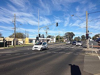
Ferntree Gully is a suburb in Melbourne, Victoria, Australia, at the foothills of the Dandenong Ranges, 27 km east of Melbourne's Central Business District, located within the City of Knox local government area. Ferntree Gully recorded a population of 27,398 at the 2021 census.

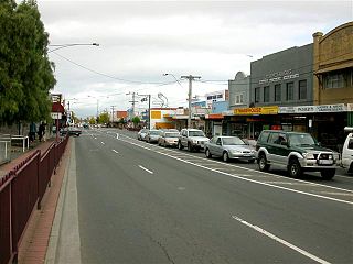
Belgrave is a town and outer suburb in Melbourne, Victoria, Australia, located 36 km east of Melbourne's central business district, within the Shire of Yarra Ranges local government area. Belgrave recorded a population of 3,894 at the 2021 census.

Upwey is a suburb of Melbourne, Victoria, Australia, 33 kilometres (21 mi) east from Melbourne's central business district, located within the City of Knox and the Shire of Yarra Ranges local government areas. Upwey recorded a population of 6,818 at the 2021 census.

Tecoma railway station is a commuter railway station on the Belgrave line, serving the eastern Melbourne suburb of Tecoma in Victoria, Australia. Tecoma is a ground level unstaffed station, featuring one side platform. It opened on 1 December 1924, with the current station provided in 1962.

Belgrave railway station is a commuter railway station and the terminus of the Belgrave line, serving the eastern Melbourne suburb of Belgrave in Victoria, Australia. Belgrave is a ground level premium station, featuring an island platform with two faces. It opened on 18 December 1900, with the current terminus station provided in 1962.
South Gippsland Highway is a partially divided highway connecting the south-eastern suburbs of Melbourne through the South Gippsland region of in Victoria, Australia to the town of Sale. The highway serves as a gateway from Melbourne to many attractions including Wilsons Promontory and Phillip Island as well as being an important road for farmers in Gippsland.

The Monash Freeway is a major urban freeway in Victoria, Australia, linking Melbourne's CBD to its south-eastern suburbs and beyond to the Gippsland region. It carries up to 180,000 vehicles per day and is one of Australia's busiest freeways. The entire stretch of the Monash Freeway bears the designation M1.
South Gippsland Freeway is a short freeway linking Dandenong in Melbourne's south–east to other south–eastern destinations, including the Mornington Peninsula and the Gippsland region. The freeway bears the designation M420.
Maroondah Highway is a major east–west thoroughfare in the eastern suburbs of Melbourne, and a highway connecting the north-eastern fringes of Melbourne to Mansfield, at the lower alpine region of Victoria, Australia.

The Dandenong Valley Highway is an urban highway stretching almost 40 kilometres from Bayswater in Melbourne's eastern suburbs to Frankston in the south. This name covers many consecutive streets and is not widely known to most drivers, as the entire allocation is still best known as by the names of its constituent parts: Stud Road, Foster Street, Dandenong-Frankston Road, Dandenong Road West and Fletcher Road. This article will deal with the entire length of the corridor for sake of completion, as well to avoid confusion between declarations.
Glenferrie Road is a major north–south thoroughfare in Melbourne, Australia. It runs from Kew to Caulfield North, and includes major shopping districts at both Hawthorn and Malvern. There are a number of rail transport options on Glenferrie Road and also some landmarks.

Mountain Highway is an 18 km west–east highway located in the eastern suburbs of Melbourne, linking the outer fringes of the city to the Dandenong Ranges.
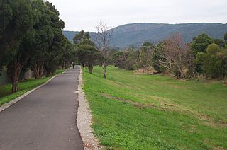
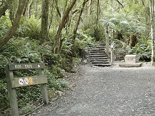
The Ferny Creek Trail is a shared use path for cyclists and pedestrians, which follows Ferny and Corhanwarrabul Creeks through the suburbs of Knoxfield and Ferntree Gully in Melbourne, Victoria, Australia.
Western Port Highway is a highway in Victoria, Australia, linking the south-eastern fringe of suburban Melbourne to the port of Hastings nearly 30km to the south on the western coast of Western Port, after which the highway is named.
Warrigal Road is a major inner urban road in southeastern Melbourne, Australia. On weekdays, it is heavily trafficked as it runs through many major suburbs along its route, traversing some of Melbourne's eastern and south-eastern suburbs. These suburbs include Chadstone, Oakleigh, and Cheltenham. The Chadstone Shopping Centre can be accessed directly from Warrigal Road at its eastern entrance.

State Highway, is a major arterial road in the southeastern suburbs of Melbourne, Australia. These names are not widely known to most drivers, as the entire allocation is still best known as by the names of its constituent parts: Lower Dandenong Road, Cheltenham Road, and Foster Street. This article will deal with the entire length of the corridor for sake of completion.
Canterbury Road is a major arterial road through eastern Melbourne, linking the inner eastern suburbs to the outer eastern fringe at the western foot of the Dandenong Ranges.
Doncaster–Mordialloc Road is a major arterial road through the eastern and south-eastern suburbs of Melbourne. This name is not widely known to most drivers, as the entire allocation is still best known as by the names of its constituent parts: Victoria Street, Wetherby Road, Middleborough Road, Stephensons Road, Clayton Road and Boundary Road. This article will deal with the entire length of the corridor for sake of completion.


