York and Doncaster branch

Last updated

York and Doncaster branch
The Roadbridge over Trans Pennine Trail on former York-Selby railway line - geograph.org.uk - 295086.jpg
The roadbridge over the Trans-Pennine Trail at Escrick
Overview
Other name(s)York and Doncaster branch line
East Coast Main Line (old route)
StatusPartially closed
Owner Network Rail
Locale Yorkshire
Termini York (historical)
Selby (current)
Doncaster
Stations11/12 [note 1]
Service
Type Heavy rail
High speed rail
Operator(s)
History
Opened2 January 1871 (1871-01-02)
Technical
Line length33.5 mi (53.9 km)
Track length27 mi (43 km)
Number of tracks2
Track gauge 1,435 mm (4 ft 8+12 in) standard gauge
Electrification 25 kV overhead (partial)

The York and Doncaster branch was a railway line that opened in 1871 connecting Doncaster with York via Selby in Yorkshire, England. This line later became part of the East Coast Main Line (ECML) and was the route that express trains took between London King's Cross, the north of England and Scotland. It was opened by the North Eastern Railway (NER) between York and Shaftholme Junction, some 4.5 miles (7.2 km) north of Doncaster railway station. Between its opening in 1871 and the grouping in 1923, the line was used by both the NER, and the Great Northern Railway (GNR). All of the intermediate local stations that had opened with the line in 1871 closed down in the 1950s and 1960s leaving just Selby open between the town of Doncaster and the city of York.

Contents

In the 1970s, a plan for extracting the coal from underneath the northern section of the line between Selby and York, led to British Rail building an avoiding line, the Selby Diversion, which fully opened to traffic in October 1983. [note 2] The southern section of the line between Doncaster and Selby is still open to enable trains from Doncaster to access the East Riding of Yorkshire and Lincolnshire. [note 3]

The trackbed of the line between Selby and York is now used partly by the A19 (as a bypass at Riccall), whilst the rest of the route forms part of the Trans-Pennine Trail and National Cycle Route 65.

History

At least two routes were available from the region of South Yorkshire [note 4] northwards into York by the time that the York to Doncaster Branch was opened in January 1871. George Hudson had already promoted his venture, the York and North Midland Railway, whilst the Lancashire and Yorkshire Railway (L&Y) had their line which went through Knottingley. [1] The L&Y were against the NER building what would be a shorter line (by 10.5 miles (16.9 km)), [2] between Doncaster and York as it would take traffic away from their line. Nevertheless, the plan was approved in March 1864, and despite some financial problems, the line opened to traffic in January 1871. [3]

The Great Northern Railway achieved running powers over the line from the NER which allowed a mutually beneficial service for both companies. The GNR would run the long distance trains and the NER would operate the local services. [2] As the new line connected with Shaftholme Junction, the section south from there to Doncaster was controlled by the GNR, so the NER needed their permission to run into Doncaster. [4]

The works included an entirely new section of railway south from Chaloners Whin Junction, south of York, to Barlby Junction on the eastern side of Selby. The route then used the Hull and Selby line across the River Ouse on Selby Swing Bridge and into Selby railway station. The second part of the route was another new build going due south from Selby to Shaftholme Junction north of Doncaster. The whole route between York and Doncaster consisted of 2 miles (3.2 km) from York to Chaloners Whin Junction (already in existence), 12.5 miles (20.1 km) of new railway to Barlby Junction at Selby, 14.5 miles (23.3 km) from Selby to Shaftholme Junction, and then the last 4.5 miles (7.2 km) section to Doncaster on the existing GNR metals. [5] The cost of the new railway was £239,500 in 1871. [3]

There were no major engineering obstacles on the line apart from a swing bridge over the River Ouse at Naburn, just to the north of Naburn station. [6] Built to a design by Thomas Elliott Harrison, it was constructed of wrought iron which had two sections spanning 176 feet (54 m). [7] Only one of the spans was able to swing, this being the one that had a control tower on top of it. [8] In the first few years of operation, the bridge would be swung open to allow the passage of river traffic, and would only be moved into alignment with the railway when a train was due to pass. [9] During the National Railway strike of 1911, the bridge and its signal box were overrun with striking railwaymen. The military were sent in to retake the bridge. [10] The span was fixed in place by British Rail in 1956 as river traffic lessened in favour of ports downstream. [11]

Another bridge spanned the River Ouse at Selby, just east of the station. This was originally a bascule bridge, [12] that was replaced in 1891 with a swing bridge. [13] The 1871 line also brought a new build station and Selby became an important junction on the routes between London and Edinburgh, and also on the Transpennine route to and from Hull. [14] The station at Selby had four through tracks, with the middle tracks having no platforms. The westbound and eastbound tracks were gauntletted over the bridge and were reformed from two lines over the bridge, to four on either side. [15] The gauntletting was removed in 1960, 23 years before the old ECML branch through Riccall was closed because of the Selby Diversion. [16]

In 1989, the route northwards via the Selby Diversion was electrified, [17] whilst the former line to Selby northwards from Temple Hirst Junction remains un-electrified. [18]

Stations

The York to Doncaster line served the following stations;

NameCoordinatesNotes
York 53°57′30″N1°05′35″W / 53.9583°N 1.0930°W / 53.9583; -1.0930 The original formation had trains that used the old York railway station. In 1877, a through station at York was built. [19]
Naburn 53°54′32″N1°05′09″W / 53.9089°N 1.0859°W / 53.9089; -1.0859 New build station opened by the NER 2 January 1871. [20] Closed in June 1953. [21]
Escrick 53°52′11″N1°02′48″W / 53.8697°N 1.0467°W / 53.8697; -1.0467 New build station opened by the NER 2 January 1871. [22] Closed in June 1953. [23]
Riccall 53°49′53″N1°03′11″W / 53.8314°N 1.0531°W / 53.8314; -1.0531 New build station opened by the NER 2 January 1871. [24] Closed in September 1958. [21]
Selby 53°46′59″N1°03′48″W / 53.7830°N 1.0634°W / 53.7830; -1.0634 First station on the west bank of the River Ouse opened in 1834, replaced by a new station with tracks across the Ouse in 1840. [12] The opening of the new York and Doncaster Branch line led to a new station being built to a design by Thomas Prosser in January 1871.
Temple Hirst 53°43′04″N1°05′21″W / 53.7179°N 1.0893°W / 53.7179; -1.0893 New build station opened by the NER in 1871. [25] Closed to passengers in June 1961, [26] goods traffic ceased in 1964. [27]
Heck 53°40′58″N1°05′58″W / 53.6828°N 1.0994°W / 53.6828; -1.0994 New build station opened by the NER in 1871. [28] Closed in September 1958. [26]
Balne 53°39′51″N1°06′20″W / 53.6641°N 1.1056°W / 53.6641; -1.1056 New build station opened by the NER in 1871. [29] Closed in September 1958. [26]
Moss 53°37′19″N1°06′47″W / 53.6220°N 1.1131°W / 53.6220; -1.1131 New build station opened by the NER in 1871. [30] Closed in June 1953. [26]
Joan Croft Halt 53°35′16″N1°07′18″W / 53.5878°N 1.1218°W / 53.5878; -1.1218 Non-public station in use by crossing keepers and their families. Quick states the halt was in use between 1920 and 1955, but that it only appeared in the Working Timetable (WTT) in 1939, 1940 and lastly in June 1955. [31]
Arksey 53°33′05″N1°07′59″W / 53.5515°N 1.1331°W / 53.5515; -1.1331 Opened by the Great Northern Railway 6 June 1848; closed to passenger traffic 5 August 1952. [32]
Doncaster 53°31′21″N1°08′22″W / 53.5225°N 1.1395°W / 53.5225; -1.1395 Opened between 1850 and 1852. [33]

Aside from the express trains that used the route, the timetable from 1910 shows that the section north of Selby had eight stopping services per day, [34] this had dropped by the 1930s, with three trains per day calling at all stations. [35] In 1946, the Bradshaws timetable shows some six local trains per day each way, though only one stopped at all of the stations on the line. [36]

Accidents

Partial closure

Naburn railway bridge near York Naburn railway bridge near York.jpg
Naburn railway bridge near York

In the 1970s, British Coal set about developing a working coalfield (the Selby Coalfield) to the north of Selby. To avoid subsidence on this section of line, a 14.5-mile (23.3 km) diversion (the Selby Diversion) was opened between Temple Hirst Junction, just south of Temple Hirst railway station and Colton Junction, some 6 miles (9.7 km) south of York railway station. [42] Both junctions were new to the railway and the whole cost of the project was £60 million, which was paid for entirely by British Coal. [43] This was seen as a good compromise as the estimated value of the coal underneath the railway was thought to have been worth over £1,000 million. [44]

At its furthest point away from the original formation, the Selby Diversion was still only 5 miles (8 km) west of Riccall. [45]

The stretch of trackbed between the sites of Riccall railway station and Barlby Junction is now the site of at the widened A19 road. [46] The section between Riccall and York now forms part of the Trans-Pennine Trail, and the National Route 65 which Sustrans purchased for the price of £1. [47] The route has a scale model of the solar system, with each planet staggered along the path at the correct proportional distances from each other. The swing bridge at Naburn also has a sculpture of a man fishing on the top of it; he is known as The Fisher of Dreams, [48] [49] and is constructed of galvanised steel. [50]

The section of line between York and Riccall, was featured on the TV series Walks Around Britain in 2017, complete with a CGI film of how the railway would have looked in the days of steam. [51]

Notes

  1. See the stations section; Joan Croft Halt was not officially a public station.
  2. The northern section of the line between York and Hambleton Junction opened earlier in 1983 to allow for York to Hull trains to traverse the section.
  3. There is another line between Doncaster and the East Riding of Yorkshire which goes via Goole (the Hull and Doncaster Branch). Hull Trains services use the former York and Doncaster line via Selby
  4. At that time, the area was in the West Riding of Yorkshire.

Related Research Articles

East Coast Main Line railway link between London and Edinburgh and London and Leeds

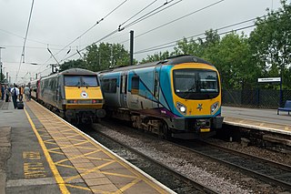
The East Coast Main Line (ECML) is a 393-mile long (632 km) electrified railway between London and Edinburgh via Peterborough, Doncaster, York, Darlington, Durham and Newcastle. The line is a key transport artery on the eastern side of Great Britain running broadly parallel to the A1 road.

Hull and Barnsley Railway British pre-grouping railway company

The Hull Barnsley & West Riding Junction Railway and Dock Company (HB&WRJR&DCo.) was opened on 20 July 1885. It had a total projected length of 66 miles but never reached Barnsley, stopping a few miles short at Stairfoot. The name was changed to The Hull and Barnsley Railway (H&BR) in 1905. Its Alexandra Dock in Hull opened 16 July 1885.

North Eastern Railway (United Kingdom) British railway company, active 1854–1922

The North Eastern Railway (NER) was an English railway company. It was incorporated in 1854 by the combination of several existing railway companies. Later, it was amalgamated with other railways to form the London and North Eastern Railway at the Grouping in 1923. Its main line survives to the present day as part of the East Coast Main Line between London and Edinburgh.

Selby railway station Railway station in North Yorkshire, England

Selby railway station is a Grade II listed station which serves the town of Selby in North Yorkshire, England. The original terminus station was opened in 1834 for the Leeds and Selby Railway. The Hull and Selby Railway extended the line in 1840, and a new station was built, with the old station becoming a goods shed. The station was rebuilt in 1873 and 1891, the 1891 rebuilding being required due to the replacement of the swing bridge over the Ouse at the same time.

Hull–Scarborough line

The Hull–Scarborough line, also known as the Yorkshire Coast Line, is a minor railway line in northern England used primarily for passenger traffic. It runs northwards from Hull Paragon via Beverley and Driffield to Bridlington, joining the York–Scarborough line at a junction near Seamer before terminating at Scarborough railway station.

The Askern branch line is a railway line which runs in North, South and West Yorkshire in England. The stretch of track runs from Shaftholme Junction north of Doncaster, via Askern, Norton and Womersley to Knottingley, where it joins the Pontefract Line.

Malton and Driffield Junction Railway Disused railway in Yorkshire, England

The Malton and Driffield Junction Railway, later known as the Malton and Driffield branch was a railway line in Yorkshire that ran between the towns of Malton, North Yorkshire and Driffield in the East Riding of Yorkshire.

The Leeds and Selby Railway was an early British railway company and first mainline railway within Yorkshire. It was opened in 1834.

Hull and Selby Railway

The Hull and Selby Railway is a railway line between Kingston upon Hull and Selby in the United Kingdom which was authorised by an act of 1836 and opened in 1840. As built the line connected with the Leeds and Selby Railway at Selby, with a Hull terminus adjacent to the Humber Dock.

York and North Midland Railway

The York and North Midland Railway (Y&NMR) was an English railway company that opened in 1839 connecting York with the Leeds and Selby Railway, and in 1840 extended this line to meet the North Midland Railway at Normanton near Leeds. Its first chairman was the railway financier George Hudson, who had been called the railway king.

Riccall railway station Disused railway station in North Yorkshire, England

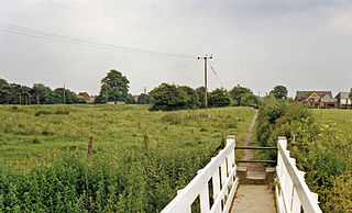
Riccall railway station was a railway station which served the village of Riccall, north of Selby, on the East Coast Main Line. It was opened in 1871, closed to passengers in 1958 and then closed to goods services in 1964; the station building is now a private dwelling. In 1983 the Selby Diversion was opened which led to the closure of the railway line through Riccall; the former trackbed is now the route of the A19 around the village.

Selby–Goole line

The Selby–Goole line was a standard gauge branch line connecting Selby and Goole, built in 1910 by the North Eastern Railway. The line closed in the 1960s as part of the Beeching cuts.

Selby Diversion

The Selby Diversion is a mainline railway in the United Kingdom, built as a new part of the East Coast Main Line (ECML) to avoid an area of potential subsidence over the newly discovered Selby Coalfield.

Cawood, Wistow and Selby Light Railway

The Cawood, Wistow and Selby Light Railway (CW&SLR) was a short light railway in a rural part of Yorkshire, England. The company was sometimes referred to as the Cawood, Wistow and Selby Railway.

The Hull and Doncaster Branch is a secondary main railway line in England, connecting Kingston upon Hull to South Yorkshire and beyond via a branch from the Selby Line near Gilberdyke to a connection to the Barnsley to Barnetby Line at a junction near Thorne 8 miles northeast of Doncaster.

Thirsk and Malton line

The Thirsk and Malton line was a railway line that ran from a triangular junction on what is now the East Coast Main Line and served eight villages between Thirsk and Malton in North Yorkshire, England. The line was built after a protracted process due to inefficiencies and financial problems suffered by the then York and North Midland Railway.

Gilling and Pickering line

The Gilling and Pickering line (G&P) was a railway line that ran from Gilling to Pickering in North Yorkshire, England.

Castleford–Garforth line

The Castleford–Garforth line was a single-track railway line in West Yorkshire, England, connecting Castleford with Garforth east of Leeds. the route was developed to allow coal to be transported from the area, though a passenger service was operated between 1878 and 1951. Initially promoted by Leeds, Castleford and Pontefract Junction Railway, it was taken over by the North Eastern Railway before the line was completed.

Cawood was the northern terminus of the short Cawood, Wistow and Selby Light Railway (CW&SLR), in rural North Yorkshire, England. The line was connected to the North Eastern Railway (NER) at its southern end.

Railways in Northallerton About the railways in Northallerton, North Yorkshire, England

The network of railways in Northallerton, North Yorkshire, England, was constructed by three companies whose lines through the town were built between 1841 and 1852. They were all amalgamated into the North Eastern Railway (NER) which in turn was subsumed into the London and North Eastern Railway in 1923 and British Rail in 1948. British Rail closed two lines, the Wensleydale line in 1954 and a section of the Leeds Northern Railway to Harrogate in 1969. The Wensleydale line was retained as a freight branch and resurrected as a heritage railway in 2003 but the line to Harrogate closed completely. Despite closures and rationalisation, the station still is at a major junction on the East Coast Main Line.

References

  1. Hoole 1985, p. 47.
  2. 1 2 Hoole 1983, p. 20.
  3. 1 2 Batty 1991, p. 41.
  4. Joy 1984, p. 213.
  5. Allen, Cecil J (1964). The North Eastern Railway. London: Ian Allan. p. 137. OCLC   1068170488.
  6. Taylor, J P G (2015). Riccall : a village history. Wetherby: Oblong Creative. p. 150. ISBN   978-0-9575992-6-0.
  7. Tomlinson 1914, p. 644.
  8. Welbourn, Nigel (2018). Lost Lines Railway Treasures. Manchester: Crecy. p. 39. ISBN   9780860936916.
  9. "History of Naburn Swing Bridge - Railway to Greenway". railwaytogreenway.org. Retrieved 5 September 2019.
  10. Lewis, Stephen (15 April 2019). "The 1911 rail strike that almost caused a disaster at Scarborough Bridge" . infoweb.newsbank.com. Retrieved 5 September 2019.
  11. Appleby 1993, p. 75.
  12. 1 2 Body 1989, p. 152.
  13. "A booklet to mark the 175th anniversary of the opening of the Hull to Selby railway" (PDF). scs.statementcms.co.uk. July 2015. p. 8. Retrieved 9 August 2019.
  14. Historic England. "Selby Railway Station building on Up Platform, Canopies on Both PLatforms Footbridge and Benches  (Grade II) (1365687)". National Heritage List for England . Retrieved 5 September 2019.
  15. Brailsford, Martyn, ed. (2016). Railway track diagrams. Book 2, Eastern (4 ed.). Frome: Trackmaps. 38A. ISBN   978-0-9549866-8-1.
  16. Chapman 2002, p. 33.
  17. "ECML: Electrification as it used to be". railengineer.co.uk. 27 November 2017. Retrieved 5 September 2019.
  18. Brailsford, Martyn, ed. (2016). Railway track diagrams. Book 2, Eastern (4 ed.). Frome: Trackmaps. 18A. ISBN   978-0-9549866-8-1.
  19. "England's oldest railway stations as they used to look". The Telegraph. 26 March 2019. Retrieved 24 June 2019.
  20. Quick 2009, p. 284.
  21. 1 2 Burgess, Neil (2011). The lost railways of Yorkshire's East Riding. Catrine: Stenlake. p. 43. ISBN   9781840335521.
  22. Quick 2009, p. 166.
  23. Ellis, Norman (1995). North Yorkshire railway stations. Ochiltree: Stenlake. p. 53. ISBN   1-872074-63-4.
  24. Quick 2009, p. 330.
  25. Hoole 1985, p. 192.
  26. 1 2 3 4 Burgess, Neil (2014). The lost railways of Yorkshire's West Riding. The central section : Bradford, Halifax, Huddersfield, Leeds, Wakefield. Catrine: Stenlake. p. 83. ISBN   9781840336573.
  27. Body 1989, p. 169.
  28. Hoole 1985, p. 169.
  29. Hoole 1985, p. 152.
  30. Hoole 1985, p. 177.
  31. Quick 2009, p. 227.
  32. Young, Alan (2015). Lost stations of Yorkshire; the West Riding. Kettering: Silver Link. p. 28. ISBN   978-1-85794-438-9.
  33. Body, Geoffrey (1986). Railways of the Eastern Region. Vol. 1, Southern operating area. London: Guild. p. 55. ISBN   0850597129.
  34. Suggitt 2007, p. 119.
  35. Body 1989, p. 154.
  36. 1946 June Bradshaw's Railway Timetable - British Isles at the Internet Archive
  37. "The Escrick Railway Station Fatality". The York Herald (9,979). Col F. 22 May 1883. p. 3. OCLC   877360086.
  38. "Fatalities to Signalmen". The York Herald (14,125). Col F. 12 September 1896. p. 13. OCLC   877360086.
  39. Gray 2013, pp. 79–80.
  40. Gray 2013, p. 88.
  41. "Rail deaths driver blames 'fate'". BBC News. 28 February 2011. Retrieved 1 June 2019.
  42. Brailsford, Martyn, ed. (2016). Railway track diagrams. Book 2, Eastern (4 ed.). Frome: Trackmaps. 18–19. ISBN   978-0-9549866-8-1.
  43. Suggitt 2007, p. 118.
  44. Hoole 1983, p. 22.
  45. Taylor, J P G (2015). Riccall : a village history. Wetherby: Oblong Creative. p. 197. ISBN   978-0-9575992-6-0.
  46. Appleby 1993, p. 74.
  47. "York to Selby". sustrans.org.uk. Retrieved 3 September 2019.
  48. Suggitt 2007, p. 120.
  49. "Sculpture dream comes true". York Press. 2 August 2001. Retrieved 3 September 2019.
  50. "Cycle guide: York to Selby". The Guardian. 3 March 2007. Retrieved 5 September 2019.
  51. Laycock, Mike (5 December 2016). "Film-maker recreates age of steam on closed York-Selby rail line" . infoweb.newsbank.com. Retrieved 5 September 2019.

Sources