
Caernarfon is a royal town, community and port in Gwynedd, Wales. It has a population of 9,852. It lies along the A487 road, on the eastern shore of the Menai Strait, opposite the island of Anglesey. The city of Bangor is 8.6 miles (13.8 km) to the north-east, while Snowdonia (Eryri) fringes Caernarfon to the east and south-east.

Afon Rheidol is a river in Ceredigion, Wales, 19 miles (31 km) in length. The source is Plynlimon. Receiving an average annual rainfall of 40 inches (1.02 m), Plynlimon is also the source of both the Wye and the Severn.
Afon Ogwen is a river in north-west Wales draining from some of the greatest peaks in Snowdonia before discharging to the sea on the eastern side of Bangor, Gwynedd.

The River Dwyryd, is a river in Gwynedd, Wales which flows principally westwards; draining to the sea into Tremadog Bay, south of Porthmadog.

Segontium is a Roman fort on the outskirts of Caernarfon in Gwynedd, North Wales. The fort, which survived until the end of the Roman occupation of Britain, was garrisoned by Roman auxiliaries from present-day Belgium and Germany. It was the most important military base and administrative centre in this part of Britain.

The Llanberis Pass in Snowdonia carries the main road (A4086) from the south-east to Llanberis, over Pen-y-Pass, between the mountain ranges of the Glyderau and the Snowdon massif. At the bottom of the pass is the small village of Nant Peris.

Llyn Padarn is a glacially formed lake in Snowdonia, Gwynedd, north Wales, and is an example of a moraine dammed lake. The lake is approximately 2 miles (3.2 km) long and at its deepest point is 94 feet (29 m) deep, and is one of the largest natural lakes in Wales. At its south-eastern end it is linked to the neighbouring Llyn Peris. The busy village of Llanberis lies on the southern banks of the lake.
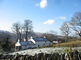
Dinorwig, sometimes spelled Dinorwic, is a village located high above Llyn Padarn, near Llanberis, in Wales. The name is shared with the fort of Dinas Dinorwig, also within the community of Llanddeiniolen, on a foothill 6 kilometres (3.7 mi) from Dinorwig village and 3 kilometres (1.9 mi) from the Menai Strait and also with Port Dinorwic, the anglicised name of Y Felinheli.
River Adda is a small watercourse which flows, through the city of Bangor North Wales before discharging into the Menai Strait at Hirael Bay, opposite Porth Penrhyn. The name is said to be of 19th-century origin, deriving from a field Cae Mab Adda close to its source. Its earlier name was Tarannon.

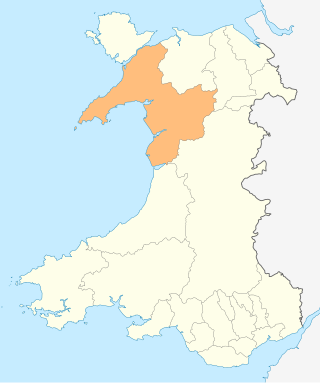
Arfon was a mediaeval Welsh cantref in north-west Wales. It was the core of the kingdom of Gwynedd. Later it was included in the new county of Caernarfonshire, together with Llŷn and Arllechwedd under the terms of the Statute of Rhuddlan in 1284. The island of Anglesey faced it across the Menai Strait; to the east was the cantref of Arllechwedd, to the south the cantref of Eifionydd, and to the west was the cantref of Llŷn.
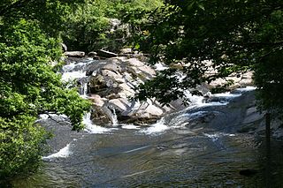
The River Rhythallt is a river in Gwynedd, North Wales whose source is Llyn Padarn. It flows in a northwesterly direction past the village of Brynrefail, Gwynedd and changes its name to Afon Seiont downstream of Pont Rhythallt in Llanrug. The Afon Seiont eventually reaches the sea at Caernarfon. The river has a broad flood plain which occasionally threatens homes in the village of Cwm-y-glo.
The Carnarvon and Llanberis Railway, built under the Caernarvon and Llanberis Railway Act 1864, was an eight-mile branch line from the Carnarvonshire Railway running from Caernarfon to Llanberis, via Pont Rhythallt, Cwm-y-Glo, and Padarn Halt.
The Bangor and Carnarvon Railway was a railway company promoted to build a branch railway connecting Caernarfon with the main line at Bangor, in north-west Wales. It opened in 1852 as far as Port Dinorwic and was extended to Caernarfon later in the same year.

Dwygyfylchi is a village in Conwy County Borough, Wales. It is part of the community of Penmaenmawr which has a population of 4,353. The electoral ward of Capelulo which includes Dwygyfylchi had a population of 1,485 in 2011. It forms part of the historic county of Caernarfonshire.

The Afon Cegin is a small river draining parts of North Wales and discharging to the Menai Strait at Porth Penrhyn. Its name means Kitchen River in English.
Afon Dyffryn Gwyn is a river in Gwynedd, north-west Wales. Its source is on Trum Gelli above Cwm Maethlon. It flows in a south-westerly direction through Cwm Maethlon and reaches the sea near Penllyn farm, south of Tywyn. It was formerly sometimes known as Caethle Brook.

Afon Braint is a small tidal river on Anglesey, North Wales. There is a series of stepping stones near the village of Dwyran, and a Grade II bridge near Penmynydd. Until recently, there was an electoral ward named after the river.
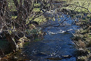
The Afon Gwyrfai is a short river in Gwynedd, Wales. For half of its length it flows through Snowdonia National Park. Exiting Llyn y Gader it flows north through the small village of Rhyd-ddu to enter the southeastern end of Llyn Cwellyn. Downstream of the lake it flows northwest past Betws Garmon, leaving the national park and continues to the southern edge of Waunfawr. It then turns slightly west to flow on to Bontnewydd beyond which it turns slightly south to enter Foryd Bay. The tidal channel within the bay flows north into the western end of the Menai Strait. Principal tributary streams include the Afon Treweunydd which contributes water from the reservoir of Llyn Ffynnon-y-gwas and from the lakes of Llyn Glas, Llyn Coch and Llyn Nadroedd in Cwm Clogwyn immediately west of the summit of Snowdon. The tidal channel of the Gwyrfai within Foryd Bay also accepts the flow of the left bank tributaries, the Afon Foryd, Afon Rhyd and Afon Carrog. The river is shadowed by the line of the Welsh Highland Railway for much of its length, and by which it is crossed four times.

