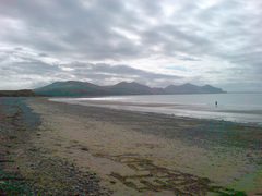
Dinas Emrys is a rocky and wooded hillock near Beddgelert in Gwynedd, north-west Wales. Rising some 76 m (250 ft) above the floor of the Glaslyn river valley, it overlooks the southern end of Llyn Dinas in Snowdonia.

A hillfort is a type of fortified refuge or defended settlement located to exploit a rise in elevation for defensive advantage. They are typically European and of the Bronze Age or Iron Age. Some were used in the post-Roman period. The fortification usually follows the contours of a hill and consists of one or more lines of earthworks or stone ramparts, with stockades or defensive walls, and external ditches. If enemies were approaching, the civilians would spot them from a distance.

Aberdaron is a community, electoral ward and former fishing village at the western tip of the Llŷn Peninsula in the Welsh county of Gwynedd. It lies 14+3⁄4 miles (23.7 km) west of Pwllheli and 33+1⁄2 miles (53.9 km) south west of Caernarfon, and has a population of 965. The community includes Bardsey Island, the coastal area around Porthor, and the villages of Anelog, Llanfaelrhys, Penycaerau, Rhoshirwaun, Rhydlios, Uwchmynydd and Y Rhiw. It covers an area of just under 50 square kilometres.

Aberffraw is a village and community on the south west coast of the Isle of Anglesey in Wales. The village is 9 miles from the island's capital, Llangefni, and is located is on the west bank of the Afon Ffraw. The community includes Soar and Dothan. Located near the A4080 and the nearest rail station is Bodorgan.

Pilsdon Pen is a 277-metre (909 ft) hill in Dorset in South West England, situated at the north end of the Marshwood Vale, approximately 4.5 miles (7.2 km) west of Beaminster. It is Dorset's second highest point and has panoramic views extending for many miles. It was bequeathed to the National Trust by the Pinney family in 1982. For many years it was thought to be Dorset's highest hill, until modern survey revealed that nearby Lewesdon Hill was 2 metres higher.

The Nantlle Valley is an area in Gwynedd, North Wales, characterised by its numerous small settlements.

Pen Dinas is a large hill in Penparcau, on the coast of Ceredigion, Wales, upon which an extensive Iron Age, Celtic hillfort is situated. The site can easily be reached on foot from Aberystwyth town centre and is accessible via a series of well marked trails. Boasting a commanding position at the confluence of the River Ystwyth and Afon Rheidol, it has been described as "the pre-eminent hillfort on the Cardigan Bay coast".

Prehistoric Wales in terms of human settlements covers the period from about 230,000 years ago, the date attributed to the earliest human remains found in what is now Wales, to the year AD 48 when the Roman army began a military campaign against one of the Welsh tribes. Traditionally, historians have believed that successive waves of immigrants brought different cultures into the area, largely replacing the previous inhabitants, with the last wave of immigrants being the Celts. However, studies of population genetics now suggest that this may not be true, and that immigration was on a smaller scale.

Burrough Hill is an Iron Age hillfort in Burrough on the Hill, 7 miles (11 km) south of Melton Mowbray in the English county of Leicestershire. Situated on a promontory about 210 metres (690 ft) above sea level, the site commands views over the surrounding countryside for miles around. There has been human activity in the area since at least the Mesolithic, and the hillfort was founded in the early Iron Age. In the medieval period, after the hillfort was abandoned, the hill was used as farmland. This ended in the 17th century when the parish the hill was in was enclosed. Traces of ridge and furrow show where the medieval fields were ploughed. Since the 1930s the site has been the subject of archaeological investigations and renewed excavations under the auspices of the University of Leicester began in 2010. Part of Burrough Hill Country Park and open to the public, the hillfort is protected as a Scheduled Ancient Monument.
Mellor hill fort is a prehistoric site in North West England, that dates from the British Iron Age—about 800 BC to 100 AD. Situated on a hill in Mellor, Greater Manchester, on the western edge of the Peak District, the hill fort overlooks the Cheshire Plain. Although the settlement was founded during the Iron Age, evidence exists of activity on the site as far back as 8,000 BC; during the Bronze Age the hill may have been an area where funerary practices were performed. Artefacts such as a Bronze Age amber necklace indicate the site was high status and that its residents took part in long-distance trade. The settlement was occupied into the Roman period. After the site was abandoned, probably in the 4th century, it was forgotten until its rediscovery in the 1990s.
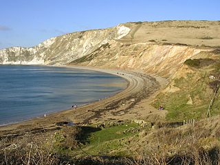
Flower’s Barrow is an Iron Age hillfort, built over 2500 years ago, above Worbarrow Bay in Dorset on the south coast of England.
The Dinas Powys hillfort is an Iron Age hillfort near Dinas Powys, Glamorgan, Wales. It is just one of several thousand hillforts to have been constructed around Great Britain during the British Iron Age, for reasons that are still debatable. The main fort at Dinas Powys was constructed on the northernmost point of the hill in either the third or 2nd century BCE, with two further constructs, known as the Southern Banks, being built further down on the southern end of the hill in the following 1st century BCE. It appears that occupation at the site ceased during the period of Roman Britain, but was re-inhabited by an Early Mediaeval settlement in the 5th century CE, who constructed further additions to the fort. The site was subsequently excavated by a team of archaeologists led by Leslie Alcock from 1954 through to 1958.
Hillforts in Britain refers to the various hillforts within the island of Great Britain. Although the earliest such constructs fitting this description come from the Neolithic British Isles, with a few also dating to later Bronze Age Britain, British hillforts were primarily constructed during the British Iron Age. Some of these were apparently abandoned in the southern areas that were a part of Roman Britain, although at the same time, those areas of northern Britain that remained free from Roman occupation saw an increase in their construction. Some hillforts were reused in the Early Middle Ages, and in some rarer cases, into the Later Medieval period as well. By the early modern period, these had essentially all been abandoned, with many being excavated by archaeologists in the nineteenth century onward.

Cornish promontory forts, commonly known in Cornwall as cliff castles, are coastal equivalents of the hill forts and Cornish "rounds" found on Cornish hilltops and slopes. Similar coastal forts are found on the north–west European seaboard, in Normandy, Brittany and around the coastlines of the British Isles, especially in Wales, Scotland and Ireland. Many are known in southwest England, particularly in Cornwall and its neighbouring county, Devon. Two have been identified immediately west of Cornwall, in the Isles of Scilly.

Gwynedd is a large rural county in North Wales. The northern half includes the high mountains of Snowdonia and the mixed farmland and hills of the Llŷn peninsula, which between them make up much of the former county of Caernarfonshire. The southern part of Gwynedd is the softer coastal and upland landscapes of the former county of Merionethshire. Gwynedd, the second-largest county in Wales, has a total of 497 scheduled monuments. That is too many to have on a single list article, so for convenience the list is divided into three. The 365 prehistoric sites are in two lists, covering 171 sites in former Merionethshire, and 194 sites in former Caernarvonshire. The 132 sites dating from Roman to modern times are included in a single list covering the whole of the county. Gwynedd is a unitary authority comprising most of the two historic counties. In 1974 it also merged with Anglesey, and the merged county was also called Gwynedd. Since 1996 Anglesey has been a separate county again.

Parciau hill fort is a hill fort on the Welsh island of Anglesey. It stands on the summit of Bryn Ddiôl, whose name means "trackless hill".

Danish Camp is an Iron Age fortified settlement in Shoeburyness in Essex. It is a Scheduled Monument under the Ancient Monuments and Archaeological Areas Act 1979, list number 1017206. The site is in the Gunners Park and Shoebury Ranges nature reserve, which is managed by the Essex Wildlife Trust.

Castell Caer Seion is an Iron Age hillfort situated at the top of Conwy Mountain, in Conwy County, North Wales. It is unusual for the fact that the main fort contains a smaller, more heavily defended fort, complete with its own distinct defences and entrance, with no obvious means of access between the two. The construction date of the original fort is still unknown, but recent excavations have revealed evidence of occupation as early as the 6th century BC, whilst the smaller fort can be dated with reasonable certainty to around the 4th century BC. Whilst the forts were constructed in different periods, archaeologists have uncovered evidence of concurrent occupation, seemingly up until around the 2nd century BC. The larger fort contained around 50 roundhouses during its lifetime, whereas examinations of the smaller fort have turned up no more than six. The site was traditionally associated with Maelgwyn Gwynedd, but there is no evidence pointing to a 6th-century occupation. The fort and wider area beyond its boundaries have been said to retain significant archaeological potential, and are protected by law as a scheduled ancient monument.
The archaeology of Wales is the study of human occupation within the country of Wales which has been occupied by modern humans since 225,000 BCE, with continuous occupation from 9,000 BCE. Analysis of the sites, artefacts and other archaeological data within Wales details its complex social landscape and evolution from Prehistoric times to the Industrial period. This study is undertaken by academic institutions, consultancies, charities as well as government organisations.