Beas is a riverfront city in the Amritsar district of the Indian state of Punjab. It is located, just 43 km from Amritsar city, the district headquarters. Beas lies on the banks of the Beas River. Beas town is mostly located in revenue boundary of Budha Theh with parts in villages Dholo Nangal and Wazir Bhullar.Beas falls in Amritsar district situated in Punjab state, with a population 55295. The male and female populations are 28921 and 26374 respectively. The size of the area is about 68.75 square kilometer. Beas railway station is the best and cleanest railway station in the india 2018. Radha Swami Beas hospital is the best Charitable Hospital in the punjab . Beas railway station is located on the boundaries of beas. And Budha Theh is a census town in Baba Bakala tehsil of Amritsar district.
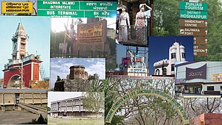
Hoshiarpur is a city and a municipal corporation in Hoshiarpur district in the Doaba region of the Indian state of Punjab. It was founded, according to tradition, during the early part of the fourteenth century. In 1809, it was occupied by the forces of Maharaja Karanvir Singh and was united into the greater state of Punjab in 1849.
Hoshiarpur district is a district of Punjab state in northern India. Hoshiarpur, one of the oldest districts of Punjab, is located in the North-east part of the Punjab state and shares common boundaries with Gurdaspur district in the north-west, Jalandhar district and Kapurthala district in south-west, Kangra district and Una district of Himachal Pradesh in the north-east. Hoshiarpur district comprises 4 sub-divisions, 10 community development blocks, 9 urban local bodies and 1417 villages. The district has an area of 3365 km2. and a population of 1,586,625 persons as per census 2011.

Kapurthala district is a district of Punjab state in northern India. The city of Kapurthala is the district headquarters.

Jalandhar district is a district in Doaba region of the state of Punjab, India. The district headquarters is the city of Jalandhar.
Jalandhar Cantonment is a cantonment town in Jalandhar District in the Indian state of Punjab. The Cantonment is located between latitude 30° 18' and longitude 75° 37' on the southwest and at a distance of 2 km from Cantonment Railway Station and 5 km from City Railway Station. It is situated beside Grand Trunk Road at a distance of 89 km from Amritsar and 371 km from Delhi. It covers an area of 5.87 square miles (15.2 km2). It is on Amritsar-Delhi Broad Gauge Main Line. A Class-I airfield at Adampur is situated at a distance of 19 km. The airfield is linked with Jalandhar Cantonment by rail and road. It has a Recruiting Office responsible for enlisting the soldiers for Army, Navy and Air Force. The first Recruiting Officer who held this post until 1952 was Col. Dilbagh Singh Minhas of Jallandhar Doab.
Alawalpur is a town and a municipal council in Jalandhar district in the state of Punjab, India. Alawalpur is named after Alawal Khan, a Pathan who ruled the area during the time of Maharajah Ranjit Singh. Sardar Himmat Singh Jallewalia, a Bains Jat Sardar, a general in Ranjit Singh's army, later conquered Alawalpur. His descendants still live in a fort located at the center of the city.
Balachaur is a town in Balachaur Tehsil in the Shaheed Bhagat Singh Nagar District of Punjab, India.
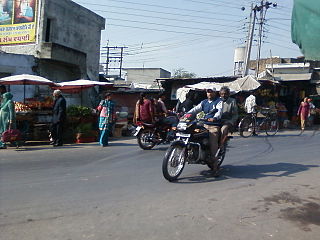
Dasuya (Dasua) is a town and a municipal council in Hoshiarpur district in the state of Punjab, India. It is one of the major subdivisions with 398 villages under its jurisdiction. This town has a great historical and mythological importance.
Garhdiwala is a town and a municipal council in Hoshiarpur district in the state of Punjab, India.

Mukerian is a city and municipal corporation of Hoshiarpur district in Punjab, India. Mukerian is located on National Highway 44 and state highway 15 about 450 kilometres (280 mi) north of New Delhi.It is a Sub-district headquarters situated on Jalandhar-jammu railway line and is connected by road with Jalandhar, Hoshiarpur, Talwara, Gurdaspur and Pathankot. National Highway-44 also passes through here.
Banga is a town and Municipal council in the Shaheed Bhagat Singh Nagar district of Punjab, India. Banga is also one of the sub-division (tehsil) headquarters of the district. Banga located on Phagwara-Rupnagar section of National Highway 344A. It is currently estimated to have a population of about 23,000 and is classified as a class 2 Municipality. The town also incorporates the former village of Jindowal apart from Banga town.

Kartarpur is a town, near the city of Jalandhar in Jalandhar district in the Indian state of Punjab and is located in the Doaba region of the state. It was founded by the fifth Guru of the Sikhs, Guru Arjan.
Punjab is home to 2.3% of India's population; with a density of 551 persons per km2. According to the provisional results of the 2011 national census, Punjab has a population of 27,743,338, making it the 16th most populated state in India. Of which male and female are 14,639,465 and 13,103,873 respectively. 32% of Punjab's population consists of Dalits. In the state, the rate of population growth is 13.9% (2011), lower than national average. Out of total population, 37.5% people live in urban regions. The total figure of population living in urban areas is 10,399,146 of which 5,545,989 are males and while remaining 4,853,157 are females. The urban population in the last 10 years has increased by 37.5%. According to the 2011 Census of India, Punjab, India has a population of around 27.7 million.
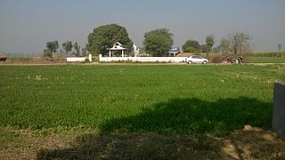
Odhra also spelled as Odrah is a village in the Dasuya (Dasua) subdivision of the Hoshiarpur district in Punjab, India. Other names for Odhra are Ond, Odhran and Odrysian.

Islam is a minority religion in Punjab, India followed by 535,489 people constituting about 1.93 percent of the state population out of 27.7 million population as of 2011 census report.

Adampur Airport, is a domestic airport and an Indian Air Force base serving the cities of Jalandhar and Hoshiarpur in Punjab, India. It is located 6.7 km (4.2 mi) from Adampur town in Jalandhar district, 28 km (17 mi) from Jalandhar and 27 km (17 mi) from Hoshiarpur. It just beside NH-3. As it lies just between the cities of Jalandhar and Hoshiarpur, it serves both the cities. The airport was required by the Doaba region of Punjab for facilitating commercial operations, as the other two main airports of the state at Amritsar and Chandigarh are 100 and 145 km distant, respectively.
Adampur is a Punjab Legislative Assembly constituency in Jalandhar district, Punjab state, India.
Bhojowal is a census town in the Jalandhar district of Punjab State, India. It is situated 10 kilometres (6.2 mi) from Jalandhar, 21 kilometres (13 mi) from Phagwara, 39 kilometres (24 mi) from the district headquarters Hoshiarpur, and 148 kilometres (92 mi) from the state capital Chandigarh. The village is governed by a sarpanch, who is an elected representative of the village as per the Panchayati Raj system in India.

Duhre is a village in Jalandhar district of Punjab State, India. It is located 24 kilometres (15 mi) from district headquarter Jalandhar and 166 kilometres (103 mi) from state capital Chandigarh. The village is administrated by a sarpanch who is an elected representative of village as per Panchayati raj (India).
