Culver Depot, also called Culver Terminal or Culver Plaza, was a railroad and streetcar terminal in Coney Island, Brooklyn, New York City, United States, located on the northern side of Surf Avenue near West 5th Street. It was just north of the boardwalk, near the former Luna Park amusement complex, and across from the current New York Aquarium. Originally built by the Prospect Park and Coney Island Railroad for the Culver surface line, it later became a major terminal for the Brooklyn Rapid Transit Company (BRT).
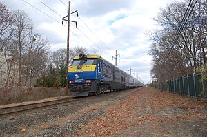
The Babylon station is a station on the Long Island Rail Road in the village of Babylon, New York at Railroad Avenue west of Deer Park Avenue. It is on the Montauk Branch and is the eastern terminus of the Babylon Branch service. To the west is the junction with the Central Branch, which heads northwest to join the Main Line at Bethpage Interlocking southeast of the Bethpage station. Babylon station is elevated with two island platforms and is wheelchair accessible through elevator access. The electrified portion of the Montauk Branch ends east of the station.
The Suffolk Traction Company is a former streetcar system in Suffolk County, New York. It operated primarily between Patchogue and Holtsville, but also included a route that served Blue Point, Bayport, and Sayville. It was opened in 1909 and ceased operations in 1919.

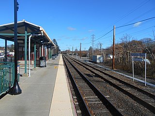
Patchogue is a station of the Montauk Branch of the Long Island Rail Road in Patchogue, New York. It is on Division Street between West Avenue and South Ocean Avenue. The station is the eastern terminus for some trains on the branch.

Sayville is a station on the Montauk Branch of the Long Island Rail Road in the village of Sayville, New York, on Depot Street between Greeley Avenue and Railroad Avenue. Ferries to Fire Island board from a port south of the station.

Central Islip is a station on the Main Line of the Long Island Rail Road. It is at the southwest corner of Suffolk County Road 100 and Lowell Avenue in Central Islip, New York. Short-term parking is also available on Suffolk CR 100 across from the intersections between Pineville and Hawthorne Avenues.

Islip is a station on the Montauk Branch of the Long Island Rail Road, off NY 111 and Nassau Avenue, north of Suffolk CR 50, and south of Moffitt Boulevard in Islip, New York.
Hampton Bays is a railroad station along the Montauk Branch of the Long Island Rail Road. It is on Good Ground Road between Springville Road and Suffolk CR 32 in Hampton Bays, New York.

Fresh Pond was a small middle class neighborhood in the New York City borough of Queens, separated from Juniper Valley by the Lutheran and Mount Olivet cemeteries. In present day, it is now considered part of the surrounding neighborhoods of Maspeth, Middle Village, Glendale, and Ridgewood and is no longer referred to by the name "Fresh Pond." The area was originally named for two freshwater ponds that, in the early 1900s, were filled in. Other ponds were lower, and brackish due to Newtown Creek being estuarine.

The Richmond Hill station is a closed station on the Montauk Branch of the Long Island Rail Road in the Richmond Hill neighborhood of Queens in New York City. The station is located at Myrtle Avenue and cuts diagonally from the intersection of Jamaica Avenue and Lefferts Boulevard through to Hillside Avenue. The station has two tracks and an island platform. Richmond Hill was the only station on the Lower Montauk Branch that was elevated with a high-level platform for passengers to wait for trains; the others were at ground level, with low-level platforms.

Center Moriches was a station stop along the Montauk Branch of the Long Island Rail Road. It was located on Railroad Avenue and Hamilton Street in Center Moriches, New York.
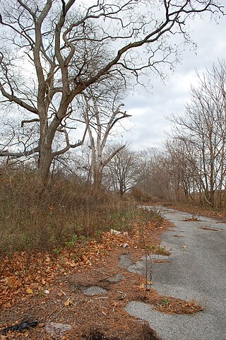
Blue Point was a station stop along the Montauk Branch of the Long Island Rail Road It was located on Martha Avenue on the south side of the tracks in Blue Point, New York, and was the westernmost station along the Montauk Branch in the Town of Brookhaven. Access to the station was through a driveway that emptied onto Blue Point Avenue. The station was originally opened on February 1, 1870, by the South Side Railroad of Long Island and closed on June 1, 1882. The second depot opened around June, 1900, evidently in conjunction with the bridge over Blue Point Avenue. The newer station also had a connection to the South Shore Traction Company trolleys, which were later replaced by Suffolk Traction Company trolleys. Blue Point station closed on September 6, 1980. It was located between Bayport and Patchogue stations, the former of which also closed on the same day. It was located between Bayport and Patchogue stations. The former station site, across from the Blue Point Wine & Liquor store, remains, to this day, gated off, and covered partially in trees, leaves, and weeds. Somewhat recently, the former site has been used by LIRR workers as a storage yard for road vehicles and equipment, being cleaned up in the process.

Mastic was a station stop along the Montauk Branch of the Long Island Rail Road. It was located on the corner of Mastic Road and Mastic Boulevard at the Mastic Road grade crossing, near the Fire Department and Mastic Seafoods.
The Huntington Railroad was established on July 19, 1890 with a trolley line between Huntington Village and Halesite on Long Island, New York. It was eventually extended to Huntington Railroad Station, then along what is today mostly NY 110 through Melville, Farmingdale, and as far south as the docks of Amityville. Huntington Railroad had only one line throughout its history, although the length varied through the years.

Water Mill is a former Long Island Rail Road station on the Montauk Branch of the Long Island Rail Road. It was located at the end of a dead-end street off Montauk Highway in Water Mill, New York.
The Manhattan and Queens Traction Company, also known as the Manhattan and Queens Transit Company, was a streetcar company operating in Manhattan and Queens County, New York between 1913 and 1937.