Climate of Turkey

Last updated
Koppen climate types of Turkey Koppen-Geiger Map TUR present.svg
Köppen climate types of Turkey

Turkey's climate is varied and generally temperate, with the regions bordering the Mediterranean and Black Sea heavily affected by the coasts, and the interior being drier and more continental.

Contents

Coastal areas in the southern half of the country, including Antalya, İzmir, Adana, feature a very typical Mediterranean climate, with hot, dry summers and mild, rainy winters. Coastal areas in the north are cooler and are either humid temperate or sub-Mediterranean, with cool, frequently rainy and occasionally snowy winters, and warm summers.

The lower plateaus of the interior are generally continental, and feature hot, dry summers, and cold, snowy winters. Winter precipitation varies widely, leading to humid precipitation regimes near areas like Bitlis, while rain-shadowed areas are semi-arid. On higher elevations, plateaus that nevertheless allow permanent settlement, like Kars and Ardahan, are high-continental and sometimes subalpine, with frigid, snowy winters, and mild, rainy summers.

Dry summers in the south and west, along with moderate aridity in the interior makes the country vulnerable to climate change.

Regions

Mediterranean climates

"True" Mediterranean climate

Pine forest, near ancient ruins. Turkey 2006 (132767769).jpeg
Pine forest, near ancient ruins.

A "true", or rather eu-Mediterranean (Köppen: Csa , Trewartha: Cs ) climate exists on sea level from the coasts of Antakya to around Muğla, and north to around Manisa, which is generally considered to be its northern limit. [1] Average temperatures range between 17–20 °C (63–68 °F); winters have means around 7–10 °C (45–50 °F), while summers have mean temperatures between 26–29 °C (79–84 °F). Precipitation amounts to around 600–1,200 millimetres (24–47 in), all of it rain. Summers get almost no rain, while winters receive plentiful, and sometimes copious amounts of it. Winter precipitation depends on local topography, with enclosed bays of convergent air,[ citation needed ] such as Antalya, getting almost twice the amount of rain as storm-protected areas such as Mersin.

Mountains around the region still show the Mediterranean rainfall pattern, but have mild summers and below-freezing temperatures during winter, creating a zone which may be termed oro-Mediterranean. [1]

Climate data for Antalya (1991–2020, extremes 1930–2020)
MonthJanFebMarAprMayJunJulAugSepOctNovDecYear
Mean daily maximum °C (°F)15.0
(59.0)
15.9
(60.6)
18.4
(65.1)
21.8
(71.2)
26.4
(79.5)
31.6
(88.9)
34.9
(94.8)
34.9
(94.8)
31.7
(89.1)
27.3
(81.1)
21.6
(70.9)
16.7
(62.1)
24.7
(76.5)
Daily mean °C (°F)9.8
(49.6)
10.8
(51.4)
13.1
(55.6)
16.4
(61.5)
20.9
(69.6)
25.7
(78.3)
28.9
(84.0)
29.0
(84.2)
25.6
(78.1)
20.9
(69.6)
15.3
(59.5)
11.4
(52.5)
19.0
(66.2)
Mean daily minimum °C (°F)5.9
(42.6)
6.5
(43.7)
8.3
(46.9)
11.3
(52.3)
15.7
(60.3)
20.1
(68.2)
23.4
(74.1)
23.7
(74.7)
20.1
(68.2)
15.9
(60.6)
10.7
(51.3)
7.5
(45.5)
14.1
(57.4)
Average precipitation mm (inches)210.6
(8.29)
112.7
(4.44)
94.5
(3.72)
63.1
(2.48)
37.0
(1.46)
10.1
(0.40)
4.0
(0.16)
5.0
(0.20)
22.0
(0.87)
76.6
(3.02)
152.2
(5.99)
262.2
(10.32)
1,050
(41.34)
Average precipitation days11.509.607.606.434.972.130.670.601.934.877.0710.0067.4
Mean monthly sunshine hours 151.9161.0201.5231.0291.4330.0344.1325.5273.0232.5177.0145.72,864.6
Source: Turkish State Meteorological Service [2]

Pre-Mediterranean climate

Drought-tolerant secondary (new-growth) pine woodland, Gaziantep. Gaziantep overview.jpg
Drought-tolerant secondary (new-growth) pine woodland, Gaziantep.

A pre-Mediterranean climate (Turkish : Akdeniz sâhil ardı iklimi, [3] Köppen: Csa , Trewartha: Cs / Do / Dc ) exists in relatively continental areas influenced by the Mediterranean climatic system, notably around the inner Aegean and Southeastern Anatolia. Average temperatures range between 14–18 °C (57–64 °F) with winter means around 1–6 °C (34–43 °F), and summers as hot as (or hotter than) the Mediterranean. Rainfall follows the general pattern of the Mediterranean region, but sunshine is sometimes noticeably lower, and precipitation amounts are lower than the Mediterranean region, between 400–800 millimetres (16–31 in). Snow can also fall in this area, unlike the coastal Mediterranean region.

Climate data for Diyarbakır (1991–2020, extremes 1929–2020)
MonthJanFebMarAprMayJunJulAugSepOctNovDecYear
Mean daily maximum °C (°F)7.3
(45.1)
9.6
(49.3)
15.0
(59.0)
20.5
(68.9)
26.8
(80.2)
34.4
(93.9)
38.9
(102.0)
38.7
(101.7)
33.4
(92.1)
25.7
(78.3)
16.3
(61.3)
9.2
(48.6)
23.0
(73.4)
Daily mean °C (°F)2.1
(35.8)
3.8
(38.8)
8.7
(47.7)
13.5
(56.3)
18.9
(66.0)
26.3
(79.3)
31.0
(87.8)
30.5
(86.9)
25.0
(77.0)
17.8
(64.0)
9.3
(48.7)
3.8
(38.8)
15.9
(60.6)
Mean daily minimum °C (°F)−2.0
(28.4)
−1.1
(30.0)
2.6
(36.7)
6.6
(43.9)
10.9
(51.6)
16.8
(62.2)
21.7
(71.1)
21.2
(70.2)
15.9
(60.6)
10.4
(50.7)
3.8
(38.8)
−0.5
(31.1)
8.9
(48.0)
Average precipitation mm (inches)63.6
(2.50)
66.8
(2.63)
67.5
(2.66)
63.1
(2.48)
50.0
(1.97)
10.8
(0.43)
1.0
(0.04)
0.4
(0.02)
8.4
(0.33)
37.3
(1.47)
54.3
(2.14)
75.2
(2.96)
498.4
(19.62)
Average precipitation days11.7711.1012.8012.4311.403.800.830.602.137.008.2011.8393.9
Mean monthly sunshine hours 124.0135.6173.6210.0282.1348.0362.7341.0279.0220.1165.0114.72,755.8
Source: Turkish State Meteorological Service [4]

Transitional zone

Marmara dry-summer temperate climate

Sub-Mediterranean, deciduous vegetation, near Izmit. Izmit manzarasi.jpg
Sub-Mediterranean, deciduous vegetation, near İzmit.

The climate around the Marmara Sea (Turkish : Marmara geçiş iklimi, lit. 'Marmara transitional climate', [5] Köppen: Csa / Csb / Cfa / Cfb , Trewartha: Cs /Cf/ Do ) is complex, transitional and often microclimatic. It wraps around the sea, covering Bursa, Bilecik, southern İzmit and İstanbul, as well as Tekirdağ. Often of a meso- or supra-Mediterranean quality at sea-level; its vegetation at sea level is similar to the lower mountains of the "true" Mediterranean region, with heat-tolerant broadleaf oaks and occasional mesophilous trees, such as beech. [1] Therefore, it is generally considered mild-temperate and not subtropical in Turkish sources and furthermore, Bohn, in a survey of European vegetation and climate, calls the climate sub-continental sub-Mediterranean. [5] [6]

Its average temperatures range around 12–15 °C (54–59 °F) at sea level. Its summers are generally cool for the Mediterranean, but warm for oceanic climates, with means around 20–25 °C (68–77 °F), varying on a microclimatic level. Winter means range between 2–6 °C (36–43 °F), with a noticeable decrease further inland. Precipitation amounts to 600–1,100 millimetres (24–43 in). Winters are very cloudy, with the amount of rainy days far surpassing much of Europe; while snow falls occasionally, often with sea-effect. Summers are moderately dry, but feature occasional thunderstorms, sometimes severe; along with the Black Sea climatic region further east, areas around the Marmara Sea have their peak thunderstorm activity in early and late summer. [7]

Mountains here often quickly transition into subalpine climates, most notably Uludağ.

Climate data for Istanbul (normals 1991–2020)
MonthJanFebMarAprMayJunJulAugSepOctNovDecYear
Mean daily maximum °C (°F)8.8
(47.8)
9.4
(48.9)
12.0
(53.6)
16.1
(61.0)
21.0
(69.8)
25.7
(78.3)
28.0
(82.4)
28.2
(82.8)
24.6
(76.3)
19.9
(67.8)
15.0
(59.0)
10.7
(51.3)
18.3
(64.9)
Daily mean °C (°F)5.9
(42.6)
6.1
(43.0)
8.0
(46.4)
11.5
(52.7)
16.3
(61.3)
21.1
(70.0)
23.7
(74.7)
24.2
(75.6)
20.5
(68.9)
16.2
(61.2)
11.7
(53.1)
7.9
(46.2)
14.4
(58.0)
Mean daily minimum °C (°F)3.6
(38.5)
3.5
(38.3)
4.9
(40.8)
8.1
(46.6)
12.8
(55.0)
17.4
(63.3)
20.3
(68.5)
21.2
(70.2)
17.4
(63.3)
13.6
(56.5)
9.2
(48.6)
5.5
(41.9)
11.0
(51.8)
Average precipitation mm (inches)96.1
(3.78)
87.7
(3.45)
69.8
(2.75)
45.1
(1.78)
37.1
(1.46)
44.7
(1.76)
36.3
(1.43)
43.5
(1.71)
81.3
(3.20)
98.3
(3.87)
100.5
(3.96)
124.8
(4.91)
865.2
(34.06)
Average precipitation days (≥ 0.1 mm)16.915.213.210.07.47.04.75.18.112.313.917.5131.3
Mean monthly sunshine hours 68.289.6142.6180.0248.0297.6319.3288.3234.0158.193.062.02,180.7
Source: [8] [9] [10]

Thracian sub-humid climate

Shrubs and low-growing trees, Kirklareli. Cukurpinar, 39100 Cukurpinar-Kirklareli Merkez-Kirklareli, Turkey - panoramio (2).jpg
Shrubs and low-growing trees, Kırklareli.

Inland regions northwest of the Marmara Sea have a transitional, sub-humid climate (Köppen: Csa / Cfa , Trewartha: Cs /Cf/ Do ), with average temperatures matching those of the Marmara Sea, albeit with colder, snowier winters and hotter summers. The vegetation here is pre-steppic, mostly oak savanna. [1]

This area does have similarities to the pre-Mediterranean climate further south, but its lower sunshine, light winter precipitation and milder, wetter summers distinguish the two. The area's thunderstorm season peaks in May and early June, resulting in a slightly earlier season than that of the Marmara Sea. [7]

Climate data for Kırklareli (1991–2020, extremes 1959–2020)
MonthJanFebMarAprMayJunJulAugSepOctNovDecYear
Mean daily maximum °C (°F)7.2
(45.0)
9.2
(48.6)
12.8
(55.0)
18.4
(65.1)
24.0
(75.2)
28.7
(83.7)
31.3
(88.3)
31.5
(88.7)
26.6
(79.9)
20.1
(68.2)
14.0
(57.2)
8.7
(47.7)
19.4
(66.9)
Daily mean °C (°F)3.3
(37.9)
4.5
(40.1)
7.5
(45.5)
12.4
(54.3)
17.6
(63.7)
22.1
(71.8)
24.6
(76.3)
24.6
(76.3)
19.9
(67.8)
14.6
(58.3)
9.5
(49.1)
5.0
(41.0)
13.8
(56.8)
Mean daily minimum °C (°F)0.3
(32.5)
1.0
(33.8)
3.4
(38.1)
7.3
(45.1)
12.0
(53.6)
16.1
(61.0)
18.4
(65.1)
18.6
(65.5)
14.5
(58.1)
10.3
(50.5)
6.0
(42.8)
2.1
(35.8)
9.2
(48.6)
Average precipitation mm (inches)61.9
(2.44)
48.3
(1.90)
48.8
(1.92)
39.1
(1.54)
53.6
(2.11)
56.2
(2.21)
34.2
(1.35)
19.1
(0.75)
39.9
(1.57)
60.6
(2.39)
62.4
(2.46)
61.7
(2.43)
585.8
(23.06)
Average precipitation days9.938.7310.2010.5010.439.075.673.675.708.679.0711.13102.8
Mean monthly sunshine hours 71.381.9130.2165.0226.3234.0266.6266.6189.0136.490.065.11,922.4
Source: Turkish State Meteorological Service [11]

Humid maritime climates

Western Pontic climate

Quercus petraea and Fagus sylvatica forest, north of Istanbul. Belgrad Forest (4).jpg
Quercus petraea and Fagus sylvatica forest, north of Istanbul.

A mild, humid temperate climate (Köppen: Cfa / Cfb , Trewartha: Cf/ Do ) exists from the northern coast of Istanbul to İnebolu, at sea level around the coast of the Black Sea. Its vegetation is deciduous broadleaf, and resembles the supra-Mediterranean zone at sea level, although it is part of a different floristic zone, specifically the Euxinic one. [1]

Its average temperatures range around 12–14 °C (54–57 °F) at sea level, with summer means around 20–23 °C (68–73 °F) and winter means around 4–6 °C (39–43 °F). Rainfall is well-distributed and quite frequent, generally around 900–1,500 millimetres (35–59 in) with a spring drying pattern, instead of a summer-dry one. Winter snowfall is about the same amount as the Marmara region, but winter means are raised by Foehn winds.

Climate data for Zonguldak (1991–2020, extremes 1939–2020)
MonthJanFebMarAprMayJunJulAugSepOctNovDecYear
Mean daily maximum °C (°F)9.2
(48.6)
9.7
(49.5)
11.7
(53.1)
15.2
(59.4)
19.3
(66.7)
23.6
(74.5)
25.8
(78.4)
26.2
(79.2)
23.2
(73.8)
19.2
(66.6)
15.2
(59.4)
11.5
(52.7)
17.5
(63.5)
Daily mean °C (°F)6.3
(43.3)
6.4
(43.5)
8.1
(46.6)
11.5
(52.7)
15.7
(60.3)
19.9
(67.8)
22.4
(72.3)
22.7
(72.9)
19.5
(67.1)
15.7
(60.3)
11.7
(53.1)
8.3
(46.9)
14.0
(57.2)
Mean daily minimum °C (°F)3.8
(38.8)
3.6
(38.5)
5.2
(41.4)
8.3
(46.9)
12.6
(54.7)
16.5
(61.7)
18.8
(65.8)
19.2
(66.6)
16.1
(61.0)
12.8
(55.0)
8.9
(48.0)
5.7
(42.3)
11.0
(51.8)
Average precipitation mm (inches)127.7
(5.03)
93.9
(3.70)
96.4
(3.80)
57.1
(2.25)
59.5
(2.34)
83.0
(3.27)
69.7
(2.74)
81.6
(3.21)
125.9
(4.96)
147.5
(5.81)
134.5
(5.30)
161.8
(6.37)
1,238.6
(48.76)
Average precipitation days18.1315.9315.6012.7311.379.337.177.0310.1712.8013.6018.30152.2
Mean monthly sunshine hours 62.073.5108.5153.0195.3243.0275.9257.3189.0130.290.065.11,842.8
Source: Turkish State Meteorological Service [12]

Central Pontic climate

Temperate and meso-Mediterranean vegetation together, near Samsun. Yesilova.jpg
Temperate and meso-Mediterranean vegetation together, near Samsun.

In sheltered locations around Sinop and Samsun, the climate (Köppen: Cfa , Trewartha: Cf) is noticeably drier and warmer than the Western Pontic zone, but somewhat cooler, and much drier than the Eastern Pontic zone. Meso-Mediterranean vegetation resurfaces here, and coexists with broadleaf forest. [1] Average temperatures range around 13–15 °C (55–59 °F), with summer means around 22–25 °C (72–77 °F) and winter means around 6–8 °C (43–46 °F). Rainfall follows the general distribution of the region, but the area is less humid than expected in all seasons.

Climate data for Sinop (1991–2020, extremes 1936–2020)
MonthJanFebMarAprMayJunJulAugSepOctNovDecYear
Mean daily maximum °C (°F)9.7
(49.5)
9.8
(49.6)
11.3
(52.3)
14.5
(58.1)
19.0
(66.2)
24.0
(75.2)
26.8
(80.2)
27.6
(81.7)
24.1
(75.4)
19.9
(67.8)
15.6
(60.1)
12.0
(53.6)
17.9
(64.2)
Daily mean °C (°F)7.1
(44.8)
6.8
(44.2)
8.1
(46.6)
11.0
(51.8)
15.5
(59.9)
20.5
(68.9)
23.6
(74.5)
24.3
(75.7)
20.8
(69.4)
16.9
(62.4)
12.6
(54.7)
9.2
(48.6)
14.7
(58.5)
Mean daily minimum °C (°F)4.9
(40.8)
4.4
(39.9)
5.6
(42.1)
8.4
(47.1)
12.7
(54.9)
17.6
(63.7)
20.6
(69.1)
21.4
(70.5)
18.1
(64.6)
14.4
(57.9)
10.0
(50.0)
6.9
(44.4)
12.1
(53.8)
Average precipitation mm (inches)73.4
(2.89)
54.4
(2.14)
60.1
(2.37)
37.3
(1.47)
34.5
(1.36)
39.1
(1.54)
35.5
(1.40)
37.2
(1.46)
74.6
(2.94)
94.4
(3.72)
82.9
(3.26)
104.4
(4.11)
727.8
(28.65)
Average precipitation days15.8013.0013.7711.3710.178.475.836.3010.1012.7312.1716.13135.8
Mean monthly sunshine hours 62.076.3117.8159.0186.0234.0269.7248.0183.0124.087.058.91,805.7
Source: Turkish State Meteorological Service [13]

Eastern Pontic climate

Temperate cloud forest, near Giresun. State road D865 (Turkey) 10.jpg
Temperate cloud forest, near Giresun.

As the Black Sea coast assumes a southwest-northeast direction once again, rainfall increases, and forms the near-subtropical, extremely humid climate (Köppen: Cfa , Trewartha: Cf) prevalent in the eastern Black Sea region. Featuring temperate rainforests, its temperatures are very slightly warmer than the transitional zone further west, but rainfall in this region is nearly constant in frequency, varying only by intensity. Rainfall amounts are also quite copious at 1,500–2,500 millimetres (59–98 in), with a spring drying pattern. Some parts of the region get below 1,200 hours of sunshine, values far below Western Europe and more comparable to subpolar regions. [14]

Mountains in this region have a perhumid, alpine climate with verdant meadows (Turkish : yayla) alternating with krummholz and boreal forests. [15]

Climate data for Rize (1991–2020, extremes 1928–2020)
MonthJanFebMarAprMayJunJulAugSepOctNovDecYear
Mean daily maximum °C (°F)11.0
(51.8)
11.1
(52.0)
12.9
(55.2)
15.9
(60.6)
20.2
(68.4)
24.9
(76.8)
27.4
(81.3)
28.1
(82.6)
25.4
(77.7)
21.4
(70.5)
16.7
(62.1)
13.0
(55.4)
19.0
(66.2)
Daily mean °C (°F)6.9
(44.4)
6.8
(44.2)
8.7
(47.7)
11.8
(53.2)
16.6
(61.9)
21.2
(70.2)
23.8
(74.8)
24.5
(76.1)
21.2
(70.2)
17.2
(63.0)
12.1
(53.8)
8.7
(47.7)
15.0
(59.0)
Mean daily minimum °C (°F)3.9
(39.0)
3.7
(38.7)
5.4
(41.7)
8.5
(47.3)
13.2
(55.8)
17.5
(63.5)
20.5
(68.9)
21.2
(70.2)
17.7
(63.9)
13.9
(57.0)
8.8
(47.8)
5.6
(42.1)
11.7
(53.1)
Average precipitation mm (inches)223.1
(8.78)
170.5
(6.71)
154.0
(6.06)
90.5
(3.56)
96.6
(3.80)
148.4
(5.84)
163.4
(6.43)
192.5
(7.58)
265.1
(10.44)
307.3
(12.10)
246.0
(9.69)
252.1
(9.93)
2,309.5
(90.93)
Average precipitation days15.5314.4316.8315.6315.7315.9714.3715.1015.2715.7313.6015.27183.5
Mean monthly sunshine hours 62.084.8114.7144.0179.8195.0176.7161.2156.0127.187.058.91,547.2
Source: Turkish State Meteorological Service [16]

Continental climates

Pre-Pontic sub-humid continental climate

The old town of Kastamonu. Kastamonu edge of town 1305.jpg
The old town of Kastamonu.

Between the humid Pontic climate and semi-arid conditions further inland, a sub-humid to humid continental climate (Turkish : Karadeniz sâhil ardı iklimi, lit. 'Pre-Pontic climate', [3] Köppen: Dfb , Trewartha: Dc ) exists, most notably near Kastamonu. Average temperatures range around 8–11 °C (46–52 °F), with means of 18–21 °C (64–70 °F) during the hottest month and winter means just below the freezing mark. Rainfall is around 500 millimetres (20 in), with a spring storm season.

Climate data for Kastamonu (1991–2020, extremes 1930–2020)
MonthJanFebMarAprMayJunJulAugSepOctNovDecYear
Mean daily maximum °C (°F)3.6
(38.5)
6.9
(44.4)
11.5
(52.7)
17.0
(62.6)
21.7
(71.1)
25.3
(77.5)
28.8
(83.8)
29.1
(84.4)
24.6
(76.3)
18.7
(65.7)
11.2
(52.2)
4.8
(40.6)
16.9
(62.4)
Daily mean °C (°F)−0.6
(30.9)
1.1
(34.0)
4.8
(40.6)
9.5
(49.1)
14.2
(57.6)
17.7
(63.9)
20.5
(68.9)
20.5
(68.9)
16.2
(61.2)
11.2
(52.2)
4.9
(40.8)
0.7
(33.3)
10.1
(50.2)
Mean daily minimum °C (°F)−3.8
(25.2)
−3.1
(26.4)
−0.4
(31.3)
3.4
(38.1)
7.7
(45.9)
11.0
(51.8)
13.0
(55.4)
13.1
(55.6)
9.5
(49.1)
5.9
(42.6)
0.5
(32.9)
−2.4
(27.7)
4.5
(40.1)
Average precipitation mm (inches)29.4
(1.16)
28.1
(1.11)
38.5
(1.52)
50.5
(1.99)
77.9
(3.07)
89.6
(3.53)
36.0
(1.42)
38.2
(1.50)
38.7
(1.52)
34.8
(1.37)
27.5
(1.08)
36.1
(1.42)
525.3
(20.68)
Average precipitation days11.2010.3011.8713.1315.2312.706.906.537.379.878.9711.37125.4
Mean monthly sunshine hours 62.096.1127.1162.0198.4222.0272.8266.6192.0148.8105.055.81,908.6
Source: Turkish State Meteorological Service [17]

Northeastern high-continental climate

Riparian environment around Kars. Kars along river 3423.jpg
Riparian environment around Kars.

In the far-northeast of the country, often in elevations above 1,500 metres (4,900 ft), the summerly drying trend is no longer observed, and a unique, high-continental climate (Köppen: Dfb / Dfc , Trewartha: Dc / Ec ) forms near Kars and Ardahan. Here, average temperatures are generally just above the freezing mark, while summers average around 15 °C (59 °F). Winters are the most severe in the country, with lows routinely below −18 °C (0 °F). Rainfall is generally around 500–700 millimetres (20–28 in) with an early-summer wet season.

Climate data for Ardahan (1991–2020, extremes 1958–2020)
MonthJanFebMarAprMayJunJulAugSepOctNovDecYear
Mean daily maximum °C (°F)−4.4
(24.1)
−2.7
(27.1)
3.6
(38.5)
11.1
(52.0)
16.4
(61.5)
20.8
(69.4)
24.3
(75.7)
25.2
(77.4)
21.2
(70.2)
15.2
(59.4)
6.7
(44.1)
−1.5
(29.3)
11.3
(52.3)
Daily mean °C (°F)−10.3
(13.5)
−9.1
(15.6)
−2.3
(27.9)
4.7
(40.5)
9.6
(49.3)
13.3
(55.9)
16.4
(61.5)
16.7
(62.1)
12.5
(54.5)
7.2
(45.0)
−0.1
(31.8)
−7.3
(18.9)
4.3
(39.7)
Mean daily minimum °C (°F)−15.5
(4.1)
−14.6
(5.7)
−7.5
(18.5)
−0.8
(30.6)
3.6
(38.5)
6.5
(43.7)
9.4
(48.9)
9.3
(48.7)
4.9
(40.8)
0.7
(33.3)
−5.4
(22.3)
−12.1
(10.2)
−1.8
(28.8)
Average precipitation mm (inches)24.0
(0.94)
21.7
(0.85)
37.0
(1.46)
54.2
(2.13)
85.2
(3.35)
101.7
(4.00)
77.2
(3.04)
64.8
(2.55)
38.9
(1.53)
41.1
(1.62)
29.9
(1.18)
24.7
(0.97)
600.4
(23.64)
Average precipitation days7.807.9710.3314.2317.9715.5012.9712.009.4710.877.938.03135.1
Mean monthly sunshine hours 80.6104.5155.0153.0195.3234.0257.3251.1213.0164.3111.077.51,996.6
Source: Turkish State Meteorological Service [18]

Orographic rain-belt continental climate

Bitlis during winter. Bedlis.jpg
Bitlis during winter.

On the foothills of the Anti-Taurus and Zagros Mountains, south of the Armenian highlands and, in general, near the continental foothills of the southern Alpide belt in Turkey, an orographically-induced rainbelt forms a Mediterranean-influenced continental climate (Köppen: Dsa / Dsb , Trewartha: Dc ), high in precipitation. Temperatures average around 8–12 °C (46–54 °F) with winter means around −3 °C (27 °F) and summer temperatures averaging between 21–25 °C (70–77 °F). Precipitation is heaviest in early-spring, with totals above 800 millimetres (31 in). Winters are very snowy. Despite this high precipitation, summer aridity keep the vegetation of the area pre-steppic. [19]

Climate data for Bitlis (1991–2020, extremes 1959–2020)
MonthJanFebMarAprMayJunJulAugSepOctNovDecYear
Mean daily maximum °C (°F)−0.9
(30.4)
0.9
(33.6)
5.0
(41.0)
11.7
(53.1)
17.5
(63.5)
24.0
(75.2)
28.9
(84.0)
29.3
(84.7)
24.8
(76.6)
16.5
(61.7)
7.9
(46.2)
2.0
(35.6)
14.0
(57.2)
Daily mean °C (°F)−4.7
(23.5)
−3.4
(25.9)
0.9
(33.6)
6.8
(44.2)
12.3
(54.1)
18.1
(64.6)
22.6
(72.7)
22.8
(73.0)
18.3
(64.9)
11.2
(52.2)
4.1
(39.4)
−1.6
(29.1)
9.0
(48.2)
Mean daily minimum °C (°F)−8.5
(16.7)
−7.5
(18.5)
−2.8
(27.0)
2.5
(36.5)
7.2
(45.0)
11.4
(52.5)
15.6
(60.1)
15.9
(60.6)
11.6
(52.9)
6.3
(43.3)
0.4
(32.7)
−5.0
(23.0)
3.9
(39.0)
Average precipitation mm (inches)161.0
(6.34)
114.3
(4.50)
170.0
(6.69)
136.6
(5.38)
105.7
(4.16)
14.6
(0.57)
11.1
(0.44)
6.1
(0.24)
27.9
(1.10)
89.0
(3.50)
86.8
(3.42)
123.5
(4.86)
1,046.6
(41.20)
Average precipitation days13.5511.5513.7313.0914.005.092.451.092.558.829.3612.45107.7
Mean monthly sunshine hours 74.496.1158.1177.0229.4279.0303.8300.7276.0167.487.062.02,210.9
Source: Turkish State Meteorological Service [20] [21]

Semi-arid continental climate

Igdir, in which a pocket of semi-arid climate exists outside of the climate's typical range. Bei Igdir (40402131381).jpg
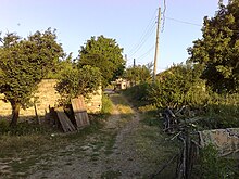
Iğdır, in which a pocket of semi-arid climate exists outside of the climate's typical range.

In drier areas of Central and Eastern Anatolia, a semi-arid, occasionally sub-humid climate (Köppen: BSk / Dsa , Trewartha: BS / Dc ) takes hold, due to extensive rain-shadow ing from all sides. Here, summer means range around 22–25 °C (72–77 °F), while winter means are around freezing, averaging out to around 10–13 °C (50–55 °F). Precipitation is scarce at around 300–400 millimetres (12–16 in), and heaviest in late-spring.

Climate data for Konya (1991–2020, extremes 1929–2020)
MonthJanFebMarAprMayJunJulAugSepOctNovDecYear
Mean daily maximum °C (°F)4.6
(40.3)
6.9
(44.4)
12.5
(54.5)
17.6
(63.7)
22.8
(73.0)
27.4
(81.3)
31.0
(87.8)
30.9
(87.6)
26.7
(80.1)
20.4
(68.7)
12.7
(54.9)
6.3
(43.3)
18.3
(64.9)
Daily mean °C (°F)−0.3
(31.5)
1.3
(34.3)
6.0
(42.8)
10.9
(51.6)
15.9
(60.6)
20.5
(68.9)
24.1
(75.4)
24.0
(75.2)
19.4
(66.9)
13.4
(56.1)
6.2
(43.2)
1.5
(34.7)
11.9
(53.4)
Mean daily minimum °C (°F)−3.9
(25.0)
−3.3
(26.1)
0.2
(32.4)
4.4
(39.9)
9.0
(48.2)
13.6
(56.5)
17.1
(62.8)
17.2
(63.0)
12.3
(54.1)
7.0
(44.6)
0.8
(33.4)
−2.2
(28.0)
6.0
(42.8)
Average precipitation mm (inches)35.9
(1.41)
23.1
(0.91)
27.4
(1.08)
34.2
(1.35)
38.2
(1.50)
27.8
(1.09)
6.5
(0.26)
6.5
(0.26)
15.9
(0.63)
29.7
(1.17)
34.5
(1.36)
45.6
(1.80)
325.3
(12.81)
Average precipitation days10.538.979.8010.8312.478.103.002.634.407.277.1310.1095.2
Mean monthly sunshine hours 105.4138.4195.3216.0269.7309.0344.1334.8291.0235.6159.0102.32,700.6
Source: Turkish State Meteorological Service [22]


Climate change

Lake Marmara has completely dried out; lawsuits ongoing in 2023 allege that there is not enough rainfall for upstream irrigation dams. Lake Marmara.webp
Lake Marmara has completely dried out; lawsuits ongoing in 2023 allege that there is not enough rainfall for upstream irrigation dams.

Droughts and heatwaves are the main hazards due to the climate of Turkey getting hotter. [25] [26] The temperature has risen by more than 1.5 °C (2.7 °F), [27] [23] and there is more extreme weather. [28]

Current greenhouse gas emissions are over 1% of the global total, [29] and energy policy includes subsidizing both fossil gas [30] and coal. [31] Annual per person emissions since the late-2010s have varied around six and a half  tonnes, [32] which is about the global average. [33] However historical emissions are less than 1% of the global total. [34]

The Environment Ministry co-ordinates adaptation to climate change, which has been planned for water resources by river basin, and for agriculture. Climate change was recently added to school education. [35]

See also

References and notes

  1. 1 2 3 4 5 6 Biltekin, Demet. "Vegetation and Climate of North Anatolian and North Aegean Region Since 7 Ma According to Pollen Analysis". HAL.
  2. "Resmi İstatistikler: İllerimize Ait Mevism Normalleri (1991–2020)" (in Turkish). Turkish State Meteorological Service. Retrieved 1 May 2021.
  3. 1 2 Mızrak, Gürbüz. Türkiye İklim Bölgeleri ve Haritası.
  4. "Resmi İstatistikler: İllerimize Ait Mevism Normalleri (1991–2020)" (in Turkish). Turkish State Meteorological Service. Retrieved 28 June 2021.
  5. 1 2 Sensoy, Ferhat; Demircan, Mesut; Ulupınar, Yusuf; Balta, İzzet. "Türkiye İklimi" (PDF). Turkish State Meteorological Service: 5. Retrieved 15 July 2023.
  6. "G30: West Euxinian sessile oak-Balkan oak forests (Quercus frainetto, Quercus iberica, partly with Quercus hartwissiana) with Mespilus germanica, Sesleria alba | Sites | Recent | IPR database". iprdatabase.eu. Retrieved 2023-07-15.
  7. 1 2 Taszarek, Mateusz; Allen, John; Púčik, Tomáš; Groenemeijer, Pieter; Czernecki, Bartosz; Kolendowicz, Leszek; Lagouvardos, Kostas; Kotroni, Vasiliki; Schulz, Wolfgang (2019-03-15). "A Climatology of Thunderstorms across Europe from a Synthesis of Multiple Data Sources". Journal of Climate. 32 (6): 1813–1837. doi: 10.1175/JCLI-D-18-0372.1 . ISSN   0894-8755.
  8. "Resmi İstatistikler". mgm.gov.tr. Meteoroloji Genel Müdürlüğü. Archived from the original on 23 December 2020. Retrieved 13 December 2020.
  9. "Rivista Ligure di Meteorologia 44 - La neve sulle coste del Mediterraneo". www.nimbus.it. Retrieved 3 June 2021.
  10. "World Meteorological Organization Climate Normals for 1991-2020". National Oceanic and Atmospheric Administration. Retrieved January 16, 2024.
  11. "Resmi İstatistikler: İllerimize Ait Mevism Normalleri (1991–2020)" (in Turkish). Turkish State Meteorological Service. Retrieved 11 April 2021.
  12. "Resmi İstatistikler: İllerimize Ait Mevism Normalleri (1991–2020)" (in Turkish). Turkish State Meteorological Service. Retrieved 24 April 2021.
  13. "Resmi İstatistikler: İllerimize Ait Mevism Normalleri (1991–2020)" (in Turkish). Turkish State Meteorological Service. Retrieved 24 April 2021.
  14. "Giresun". MGM.
  15. "C45: West Low Caucasian krummholz and open woodlands (Betula litwinowii, Fagus sylvatica subsp. orientalis, Acer trautvetteri) with Quercus pontica, Betula medwediewii, scrub (Rhododendron caucasicum) with Rhododendron ungernii, tall-herb communities (Ligusticum alatum, Milium schmidtianum) with Heracleum cyclocarpum, Heracleum mantegazzianum and grasslands (Agrostis planifolia, Geranium platypetalum) with Euphorbia oblongifolia, Astragalus bachmarensis | Sites | Recent | IPR database". iprdatabase.eu. Retrieved 2023-07-15.
  16. "Resmi İstatistikler: İllerimize Ait Mevism Normalleri (1991–2020)" (in Turkish). Turkish State Meteorological Service. Retrieved 7 August 2021.
  17. "Resmi İstatistikler: İllerimize Ait Mevism Normalleri (1991–2020)" (in Turkish). Turkish State Meteorological Service. Retrieved 24 April 2021.
  18. "Resmi İstatistikler: İllerimize Ait Mevism Normalleri (1991–2020)" (in Turkish). Turkish State Meteorological Service. Retrieved 11 April 2021.
  19. Atalay, Ibrahim (1986). "Vegetation formations of Turkey". Travaux de l'Institut de Géographie de Reims. 65 (1): 17–30. doi:10.3406/tigr.1986.1183.
  20. "Resmi İstatistikler: İllerimize Ait Mevism Normalleri (1991–2020)" (in Turkish). Turkish State Meteorological Service. Retrieved 2 May 2021.
  21. "Resmi İstatistikler: İllerimize Ait Genel İstatistik Verileri" (in Turkish). Turkish State Meteorological Service. Retrieved 2 May 2021.
  22. "Resmi İstatistikler: İllerimize Ait Mevism Normalleri (1991–2020)" (in Turkish). Turkish State Meteorological Service. Retrieved 6 July 2021.
  23. 1 2 Tridimas, Beatrice (2023-09-25). "Turkey's fishermen fight to save wetlands as water scarcity bites". Reuters . Retrieved 2023-11-27.
  24. Gunacti, Mert Can; Gul, Gulay Onusluel; Cetinkaya, Cem P.; Gul, Ali; Barbaros, Filiz (2023-05-01). "Evaluating Impact of Land Use and Land Cover Change Under Climate Change on the Lake Marmara System". Water Resources Management. 37 (6): 2643–2656. Bibcode:2023WatRM..37.2643G. doi:10.1007/s11269-022-03317-8. ISSN   1573-1650. S2CID   252081287.
  25. Turkes, Murat; Turp, M. Tufan; An, Nazan; Ozturk, Tugba; Kurnaz, M. Levent (2020), Harmancioglu, Nilgun B.; Altinbilek, Dogan (eds.), "Impacts of Climate Change on Precipitation Climatology and Variability in Turkey", Water Resources of Turkey, World Water Resources, Cham: Springer International Publishing, vol. 2, pp. 467–491, doi:10.1007/978-3-030-11729-0_14, ISBN   978-3-030-11729-0, S2CID   198403431 , retrieved 2023-11-30
  26. Erlat, Ecmel; Türkeş, Murat; Aydin-Kandemir, Fulya (2021-07-01). "Observed changes and trends in heatwave characteristics in Turkey since 1950". Theoretical and Applied Climatology. 145 (1): 137–157. Bibcode:2021ThApC.145..137E. doi:10.1007/s00704-021-03620-1. ISSN   1434-4483. S2CID   233313907.
  27. Aksu, Hakan (2021). "Nonstationary analysis of the extreme temperatures in Turkey". Dynamics of Atmospheres and Oceans. 95: 101238. Bibcode:2021DyAtO..9501238A. doi:10.1016/j.dynatmoce.2021.101238.
  28. "'Climate change leading to extreme weather events in Türkiye'". Hürriyet Daily News . 2023-03-21. Retrieved 2023-11-27.
  29. "Each Country's Share of CO2 Emissions". Union of Concerned Scientists. Retrieved 16 September 2018.
  30. Ergur, Semih (2023-05-12). "Turkey Spent Over $200,000,000 in Fossil Fuel Subsidies in 2022". Climate Scorecard. Retrieved 2023-11-30.
  31. "Fossil Fuel Support - TUR". stats.oecd.org. Retrieved 2023-11-30.
  32. "Greenhouse Gas Emissions Statistics, 1990-2021". Turkish Statistical Institute . 2023-03-29.
  33. "Per capita greenhouse gas emissions". Our World in Data. Retrieved 2023-11-30.
  34. "T.C.CUMHURBAŞKANLIĞI : "2053 yılı itibarıyla net sıfır emisyon hedefini gerçekleştirmeyi öngörüyoruz"". www.tccb.gov.tr. Retrieved 2023-12-01.
  35. "Climate Law On Its Way In Türkiye - Climate Change - European Union". www.mondaq.com. Retrieved 2023-11-14.

Related Research Articles

<span class="mw-page-title-main">Zonguldak</span> Municipality in Turkey

Zonguldak is a city in the Black Sea region of Turkey. It is the seat of Zonguldak Province and Zonguldak District. Its population is 101,749 (2022). It was established in 1849 as a port town for the nearby coal mines in Ereğli and the coal trade remains its main economic activity. According to the 2009 census, Zonguldak has a population of 108,792. The current mayor is Ömer Selim Alan, representing the AKP.

<span class="mw-page-title-main">Karabük</span> Municipality in Turkey

Karabük is a city in the Black Sea region of Turkey. It is the seat of Karabük Province and Karabük District. Its population is 125,403 (2022). The town lies at an elevation of 301 m (988 ft).

<span class="mw-page-title-main">Nevşehir Province</span> Province of Turkey

Nevşehir Province is a province in central Turkey with its capital in Nevşehir. Its area is 5,485 km2, and its population is 310,011 (2022). Its adjacent provinces are Kırşehir to the northwest, Aksaray to the southwest, Niğde to the south, Kayseri to the southeast, and Yozgat to the northeast. Nevşehir includes the area called Cappadocia - a tourist attraction in Turkey. The town of Göreme is also located in Nevşehir.

<span class="mw-page-title-main">Çankırı</span> Municipality in Turkey

Çankırı, historically known as Gangra, is a city in Turkey, about 140 km (87 mi) northeast of Ankara. It is situated about 800 m (2500 ft) above sea level. It is the seat of Çankırı Province and of Çankırı District. Its population is 90,564 (2021).

<span class="mw-page-title-main">Rize</span> Municipality in Turkey

Rize is a coastal city in the eastern part of the Black Sea Region of Turkey. It is the seat of Rize Province and Rize District. Its population is 119,828 (2021). Rize is a typical Turkish provincial capital with little in the way of nightlife or entertainment. Since the border with Georgia was opened in the early 1990s, the Black Sea coast road has been widened and the town is much wealthier than it used to be. Current Turkish President Recep Tayyip Erdoğan's family has its roots in Rize and the local university is named after him. The city is linked by road with Trabzon, Hopa (55 miles [88 km] east on the Georgian border, and Erzurum. Rize–Artvin Airport started operating in 2022.

<span class="mw-page-title-main">Adapazarı</span> District and municipality in Sakarya, Turkey

Adapazarı is a municipality and the capital district of Sakarya Province, Turkey. Its area is 324 km2, and its population is 281,489 (2022). It covers the central and northern part of the agglomeration of Adapazarı and the adjacent countryside.

<span class="mw-page-title-main">Giresun</span> Municipality in Turkey

Giresun, formerly Cerasus, is a city in the Black Sea Region of northeastern Turkey, about 175 km (109 mi) west of the city of Trabzon. It is the seat of Giresun Province and Giresun District. It has a population of 125,682 (2022).

<span class="mw-page-title-main">Uşak</span> Municipality in Turkey

Uşak is a city in the interior part of the Aegean Region of Turkey. It is the seat of Uşak Province and Uşak District. Its population is 236,366 (2022).

<span class="mw-page-title-main">Hakkâri (city)</span> Municipality in Hakkâri, Turkey

Hakkâri, formerly known as Julamerk, is a city and the seat of Hakkâri District in the Hakkâri Province of Turkey. The city is populated by Kurds and had a population of 58,470 in 2023.

<span class="mw-page-title-main">Adıyaman</span> Municipality in Turkey

Adıyaman is a city in southeastern Turkey. It is the administrative centre of Adıyaman Province and Adıyaman District. Its population is 267,131 (2021). The inhabitants of the city are mostly Kurdish.

<span class="mw-page-title-main">Ağrı</span> Municipality in Turkey

Ağrı is a city in eastern Turkey, near the border with Iran. It is the seat of Ağrı Province and Ağrı District. Its population is 120,390 (2021). Formerly known as Karaköse from the early Turkish republican period until 1946, and before that as Karakilise, the city is now named after Ağrı, the Turkish name of Mount Ararat.

<span class="mw-page-title-main">Düzce</span> Municipality in Turkey

Düzce is a city in northwestern Turkey, the capital city of Düzce Province, the eighty-first province in the country. It is the seat of Düzce District. Its population is 194,097.

<span class="mw-page-title-main">Kırıkkale</span> Municipality in Turkey

Kırıkkale is a city in the Central Anatolia region of Turkey. It is the seat of Kırıkkale Province and Kırıkkale District. Its population is 186,960 (2022). It is located 80 km east of Ankara which is the capital city of Turkey. The name of the city means broken castle.

<span class="mw-page-title-main">Şırnak</span> Municipality in Turkey

Şırnak is a city in Şırnak District and the capital of Şırnak Province in Turkey. The Ibrahim Khalil border crossing with Iraq is one of the main links of Turkey to Kurdistan Region in Iraq.

<span class="mw-page-title-main">Bartın</span> City in northern Turkey

Bartın is a city in northern Turkey, near the Black Sea. It is the seat of Bartın Province and Bartın District. Its population is 81,692 (2021).

<span class="mw-page-title-main">Bilecik</span> City in Bilecik province in western Turkey

Bilecik is a city in northwestern Anatolia, Turkey. It is the seat of Bilecik Province and Bilecik District. Its population is 74,457 (2021). The mayor is Melek Mızrak Subaşı (CHP).

<span class="mw-page-title-main">Osmaniye</span> Municipality in Turkey

Osmaniye is a city on the eastern edge of the Çukurova plain in southern Turkey. It is the seat of Osmaniye Province and Osmaniye District. Its population is 252,186 (2022).

<span class="mw-page-title-main">Yalova</span> Municipality in Turkey

Yalova is a market-gardening town located in northwestern Turkey on the eastern coast of the Sea of Marmara. It is the seat of Yalova Province and Yalova District. Its population is 133,109 (2022). A largely modern town, it is best known for the spa resort at nearby Termal, a popular summer retreat for residents of Istanbul.

<span class="mw-page-title-main">Humid subtropical climate</span> Transitional climatic zone

A humid subtropical climate is a temperate climate type characterized by hot and humid summers, and cool to mild winters. These climates normally lie on the southeast side of all continents, generally between latitudes 25° and 40° and are located poleward from adjacent tropical climates, and equatorward from either humid continental or oceanic climates. It is also known as warm temperate climate in some climate classifications.

<span class="mw-page-title-main">Climate of Istanbul</span> Typical weather in Turkeys largest city

The climate of Istanbul, classified variously as Mediterranean, oceanic, or a transitional climate between the two, is temperate; with cool, frequently rainy, somewhat snowy winters, and warm to hot, moderately dry summers. Strongly influenced by the Sea of Marmara to the south and the Black Sea to the north, it is thoroughly maritime; precipitation is moderately high, fog is frequent, and seasonal lag is noticeable both in winter and in summer. The city is sheltered from both extreme heat and frigid temperatures, with temperatures rarely reaching 33 °C (91 °F) or dipping below −6 °C (21 °F), and is quite windy year-round.