Coldstream

Last updated

Coldstream
River Tweed at Coldstream.jpg
Coldstream Bridge over the River Tweed (August 2004)
Scottish Borders UK location map.svg
Red pog.svg
Coldstream
Location within the Scottish Borders
Population1,990 (mid-2020 est.) [1]
OS grid reference NT841398
  Edinburgh 42 miles (68 km) NW
  London 299 miles (481 km) SSE
Civil parish
  • Coldstream
Council area
Lieutenancy area
Country Scotland
Sovereign state United Kingdom
Post town COLDSTREAM
Postcode district TD12
Dialling code 01890
Police Scotland
Fire Scottish
Ambulance Scottish
UK Parliament
Scottish Parliament
Website Coldstream Community Trust
List of places
UK
Scotland
55°39′N2°15′W / 55.65°N 2.25°W / 55.65; -2.25

Coldstream (Scottish Gaelic : An Sruthan Fuar) is a town and civil parish in the Scottish Borders area of Scotland. [2] A former burgh, Coldstream was where the Coldstream Guards, a regiment in the British Army, originated.

Contents

Description

Coldstream lies on the north bank of the River Tweed in Berwickshire, while Northumberland in England lies to the south bank, with Cornhill-on-Tweed the nearest village. At the 2001 census, the town had a population of 1,813, which was estimated to have risen to 2,050 by 2006. [3] [4] The parish, in 2001, had a population of 6,186. [5]

History

Coldstream Town Hall Coldstream, 73 High Street, Town Hall (cropped).jpg
Coldstream Town Hall

Coldstream is the location where Edward I of England invaded Scotland in 1296. In February 1316 during the Wars of Scottish Independence, Sir James Douglas defeated a numerically superior force of Gascon soldiery led by Edmond de Caillou at the Skaithmuir to the north of the town. In 1650 General George Monck founded the Coldstream Guards regiment (a part of the Guards Division, Foot Guards regiments of the British Army). It is one of two regiments of the Household Division that can trace its lineage to the New Model Army. Monck led the regiment to London, helping to enable the Restoration of King Charles II. [6]

In the 18th and 19th centuries, Coldstream was a popular centre for runaway marriages, much like Gretna Green, as it lay on a major road (now the A697). A monument to Charles Marjoribanks (1794–1833), MP for Berwickshire, whose ancestral home was in nearby Lees, stands at the east end of the town, near the Coldstream Bridge. Alec Douglas-Home (1903–95), who served as Prime Minister of the United Kingdom from October 1963 to October 1964, is buried in the churchyard of the ruined Lennel parish church, just outside the village. [7]

Notable buildings in the town include the marriage house, where weddings were conducted, [8] The Hirsel, which is the family seat of the Earls of Home, [9] and Coldstream Town Hall, which is used as a library and registration office. [10]

Each year, during the first week of August, Coldstream hosts a traditional "Civic Week" where it includes historical aspects of the town's history such as the Torchlight procession and horse-rides to the Battle of Flodden battlefield. [11]

Coldstream Priory

The Priory of St Mary was founded before 1166 by Gospatric III, Earl of Lothian. Never wealthy or powerful, the monastery nevertheless occurs frequently in the history of the border lands, being targeted several times by English forces. The monastery is the only one from the period where any charters survive thanks to the good sense of the prioress, having them copied. The house was used by both the English and Scots to gather information on each other, thanks to its location, the prioress treading a tightrope to ensure the survival of the monastery. It became a favourite of Margaret Tudor, wife of James IV, Margaret using it several times during the troubled times of the Regency.

After the Battle of Flodden, the prioress had all the bodies of the Scottish casualties (apart from James IV’s, which was taken to England) brought to the monastery for burial - an event commemorated annually even today, by a procession & service, involving cutting a sod of grass from the battle field and it being carried back to Coldstream; since the priory is completely lost today, the sod is symbolically ‘buried’ on the Tweed Green. The last prioress signed away her community and it ceased to exist as a legal entity in 1621, although no new novices had been permitted since the 1560 Reform Parliament. No reliable record of the number of nuns living in the house have survived. [12] Isabella Hoppringle (1460–1538) was the prioress of Coldstream from 1505 until her death. She was succeeded by her relative, Janet Pringle, the last ‘real’ prioress of the house. [13]

Bughtrig House

In February 2020, the Scottish Borders Council announced plans to build a museum at the family home of Vice-Admiral Bertram Home Ramsay, who masterminded Operation Dynamo, the evacuation of Dunkirk. "A former garden store will be converted at Bughtrig House in Coldstream to create the museum in his honour," BBC News reported. [14]

The Ba Green

The border between Scotland and England runs down the middle of the River Tweed, however between the villages of Wark and Cornhill the Scottish border comes south of the river to enclose a small riverside meadow of approximately 2 to 3 acres (or about a hectare). This piece of land is known as the Ba Green. It is said locally that every year the men of Coldstream would play the men of Wark (south of the river) at ba, and the winning side would claim the Ba Green for their country. As Coldstream grew to have a larger population than Wark, the men of Coldstream always defeated those of Wark at the game, and so the land became a permanent part of Scotland. [15] [16] [17]

Media

Local news and television programmes are provided by BBC Scotland and ITV Border. Television signal are received from the Selkirk TV transmitter. [18] BBC North East and Cumbria and ITV Tyne Tees can also be received from the Chatton TV transmitter. [19]

Local radio stations are BBC Radio Scotland on 93.5 FM, BBC Radio Newcastle can also be received on 96.0 FM and Greatest Hits Radio Scottish Borders and North Northumberland on 96.8 FM.

The Border Telegraph and Southern Reporter are the town's local newspapers. [20] [21]

See also

Related Research Articles

<span class="mw-page-title-main">Berwick-upon-Tweed</span> Town and civil parish in Northumberland, England

Berwick-upon-Tweed, sometimes known as Berwick-on-Tweed or simply Berwick, is a town and civil parish in Northumberland, England, 2+12 mi (4 km) south of the Anglo-Scottish border, and the northernmost town in England. The 2011 United Kingdom census recorded Berwick's population as 12,043.

<span class="mw-page-title-main">Branxton, Northumberland</span> Human settlement in England

Branxton is a village and civil parish in northern Northumberland, England. It lies about 3 miles (5 km) from the England-Scotland border and about 4 miles (6 km) from the Scottish border town of Coldstream, just off the A697 Newcastle-Edinburgh road. At the 2011 Census, the population of the parish was 123, increasing slightly from 121 at the 2001 Census.

<span class="mw-page-title-main">Berwickshire</span> Historic county in Scotland

Berwickshire is a historic county, registration county and lieutenancy area in south-eastern Scotland, on the English border. The county takes its name from Berwick-upon-Tweed, its original county town, which was part of Scotland at the time of the county's formation in the twelfth century, but became part of England in 1482 after several centuries of swapping back and forth between the two kingdoms. After the loss of Berwick, Duns and Greenlaw both served as county town at different periods.

<span class="mw-page-title-main">Eyemouth</span> Coastal town in Berwickshire Scotland

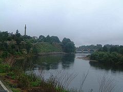
Eyemouth is a small town and civil parish in Berwickshire, in the Scottish Borders area of Scotland. It is two miles east of the main north–south A1 road and eight miles north of Berwick-upon-Tweed.

<span class="mw-page-title-main">Borough of Berwick-upon-Tweed</span> Former borough in England

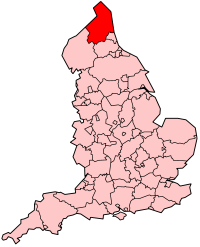
Berwick-upon-Tweed was a local government district and borough in Northumberland in the north-east of England, on the border with Scotland. The district had a resident population of 25,949 according to the 2001 census, which also notes that it is the most ethnically homogeneous in the country, with 99.6% of the population recording themselves in the 2001 census as White. It was also the least populated district in England with borough status, and the third-least densely populated local government district.

<span class="mw-page-title-main">History of Northumberland</span>

Northumberland, England's northernmost county, is a land where Roman occupiers once guarded a walled frontier, Anglian invaders fought with Celtic natives, and Norman lords built castles to suppress rebellion and defend a contested border with Scotland. The present-day county is a vestige of an independent kingdom that once stretched from Edinburgh to the Humber, hence its name, meaning literally 'north of the Humber'. Reflecting its tumultuous past, Northumberland has more castles than any other county in England, and the greatest number of recognised battle sites. Once an economically important region that supplied much of the coal that powered the industrial revolution, Northumberland is now a primarily rural county with a small and gradually shrinking population.

Cornhill-on-Tweed is a small village and civil parish in Northumberland, England about 1 mile (1.6 km) to the east of Coldstream, Scotland. The hamlets of West Learmouth and East Learmouth are located to the south and west of the village respectively.

This timeline summarises significant events in the history of Northumbria and Northumberland.

<span class="mw-page-title-main">Wark on Tweed</span> Human settlement in England

Wark or Wark on Tweed is a village in the English county of Northumberland. It lies about 15 mi (24 km) south west of Berwick-upon-Tweed.

The TD postcode area, also known as the Galashiels postcode area, is a group of fifteen postcode districts in south-east Scotland and the far north-east of England, within seventeen post towns. These cover most of the Scottish Borders council area and the northernmost part of Northumberland, plus a part of south-eastern East Lothian and a very small part of Cumberland.

<span class="mw-page-title-main">Anglo-Scottish border</span> 96-mile long border between England and Scotland

The Anglo-Scottish border is a border separating Scotland and England which runs for 96 miles (154 km) between Marshall Meadows Bay on the east coast and the Solway Firth in the west.

<span class="mw-page-title-main">Stichill</span> Human settlement in Scotland

Stichill is a village and civil parish in the historic county of Roxburghshire, a division of the Scottish Borders. Situated 2 miles (3.2 km) north of the Burgh of Kelso, Stichill lies north of the Eden Water and 5 miles (8.0 km) from the English Border at Coldstream.

<span class="mw-page-title-main">Birgham</span> Human settlement in Scotland

Birgham is a village in Berwickshire, parish of Eccles in the Scottish Borders area of Scotland, near Coldstream and the River Tweed, on the A698. Birgham is close to Ednam, Kelso, Lempitlaw, Leitholm and Sprouston as well as Carham and Wark on Tweed, Northumberland.

<span class="mw-page-title-main">Longhorsley</span> Human settlement in England

Longhorsley is a village in Northumberland, England about 7 miles (11 km) northwest of Morpeth, and about 14 miles (23 km) south of Alnwick. The A697 road passes through the village linking it with Morpeth, Wooler and Coldstream in Scotland. There are 8 "Streets" in Longhorsley: Whitegates, Church View, Drummonds Close, South Road, West Road, East Road and Reivers Gate, Wilding Place and .The village is bordered on the north by the River Coquet. The village formerly lay in three separate townships: Bigges Quarter, Freeholders Quarter and Riddells Quarter.

Coldstream railway station served the town of Coldstream in Berwickshire, Scotland although the station was across the River Tweed in Northumberland, England. The station was on both the Alnwick to Cornhill Branch which ran from Alnwick to Cornhill Junction on the Kelso line near Coldstream and the Kelso to Tweedmouth line.

<span class="mw-page-title-main">Kilham, Northumberland</span> Human settlement in England

Kilham is a hamlet and civil parish in the English county of Northumberland, located 8.0 miles (12.9 km) west of Wooler, 12.0 miles (19.3 km) east of Kelso, 17.0 miles (27.4 km) south west of Berwick-upon-Tweed and 38.9 miles (62.6 km) north west of Morpeth. It lies on the northern edge of the Northumberland National Park in Bowmont Valley Northumberland. The hamlet, which consists of a small group of agricultural dwellings, is overlooked by Kilham Hill and the northern limits of the Cheviot Hills. The parish had a population of 131 in 2001, and includes the hamlets of Howtel and Pawston, along with the former upland township of Coldsmouth and Thompson's Walls. falling to less than 100 at the 2011 Census. Details are now included in the parish of Branxton

A Dunnie is a small Brownie-like being in the folklore of the Anglo-Scottish borders, specifically Northumberland, the most famous being that of the Hazlerigg Dunnie of Hazlerigg in the parish of Chatton, Northumberland. The Dunnie has been known to take the form of a horse in order to trick a rider into mounting him before disappearing and leaving them in the muddiest part of the road. He also is said to disguise as plough-horses only to vanish when the ploughman takes him into the stalls.

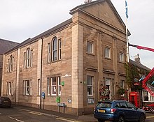
Isabella Hoppringle (1460–1538), was a Scottish prioress and spy. She was the prioress of Coldstream Priory in 1505—1538.

<span class="mw-page-title-main">Wark on Tweed Castle</span> Ruined C12 castle in Northumberland, England

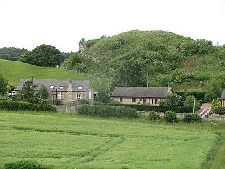
Wark on Tweed Castle, sometimes referred to as Carham Castle, is a ruined motte-and-bailey castle at the West end of Wark on Tweed in Northumberland. The ruins are a Grade II* listed building.

References

  1. "Mid-2020 Population Estimates for Settlements and Localities in Scotland". National Records of Scotland. 31 March 2022. Retrieved 31 March 2022.
  2. The Online Scots Dictionary [ permanent dead link ]
  3. "Comparative Population Profile: Coldstream Locality". Scotland's Census Results Online. 29 April 2001. Archived from the original on 3 April 2015. Retrieved 1 September 2008.
  4. "General Register Office for Scotland - Statistics - Publications and Data". Archived from the original on 16 September 2009. Retrieved 2012-04-21.
  5. "Census 2001: Usual Resident Population: Civil Parish: Coldstream". Scotland's Census Results Online. General Register Office for Scotland. Archived from the original on 16 January 2014. Retrieved 16 January 2014.
  6. Harris, Tim (2006). Restoration; Charles II and his kingdoms. Penguin. pp. 43–44.
  7. Thorpe, D R (1997). Alec Douglas-Home. London: Sinclair-Stevenson. pp. 463–464. ISBN   1856196631.
  8. Historic Environment Scotland. "The Marriage House, Coldstream Bridge (LB4074)" . Retrieved 3 October 2022.
  9. Historic Environment Scotland. "The Hirsel (LB4069)" . Retrieved 3 October 2022.
  10. Historic Environment Scotland. "Town Hall, 73 High Street, Coldstream (LB23072)" . Retrieved 3 October 2022.
  11. "Coldstream Civic Week". Scotland Starts Here. Retrieved 3 October 2022.
  12. Coldstream; Monastic Matrix
  13. "Isabella Hoppringle: Biography on Undiscovered Scotland". Undiscovered Scotland. Retrieved 29 March 2019.
  14. "Admiral Sir Bertram Ramsay: Dunkirk Mastermind Museum Approved". BBC News. 8 February 2020. Retrieved 9 February 2020.
  15. Crofton, Ian (2012). A dictionary of Scottish phrase and fable. Edinburgh: Birlinn. p. 25. ISBN   9781841589770.
  16. Moffat, Alistair (1 July 2011). The Reivers: The Story of the Border Reivers. Birlinn. ISBN   9780857901156.
  17. "(Showing Scottish border south of the Tweed) - Berwickshire Sheet XXIX.SW (includes: Coldstream) -". National Library of Scotland . Retrieved 30 June 2018.
  18. "Selkirk (The Scottish Borders, Scotland) Full Freeview transmitter". May 2004. Retrieved 26 December 2023.
  19. "Chatton (Northumberland, England) Full Freeview transmitter". May 2004. Retrieved 26 December 2023.
  20. "Border Telegraph". British Papers. 23 November 2013. Retrieved 26 December 2023.
  21. "Southern Reporter". British Papers. 21 January 2014. Retrieved 26 December 2023.