Hockessin is a census-designated place (CDP) in New Castle County, Delaware, United States. The population was 13,478 at the 2020 Census.
Birmingham Township is a township in Chester County, Pennsylvania. The population was 4,085 at the 2020 census.

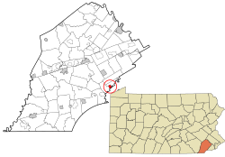
Easttown Township is a township in Chester County, Pennsylvania, United States. The population was 10,984 at the 2020 census. The township, which lies in the western half of Philadelphia's Main Line suburbs, comprises parts of three unincorporated areas: Devon, Berwyn and Paoli.

Boothwyn is a census-designated place (CDP) in Delaware County, Pennsylvania, United States. The population was 4,933 at the 2010 census, down from 5,206 at the 2000 census. The census estimation for population circa 2019 is 6,115.
Broomall is a census-designated place (CDP) in Marple Township, Delaware County, Pennsylvania, United States. The population was 10,789 at the 2010 census.
Lima is an unincorporated community and census-designated place (CDP) in Middletown Township, Delaware County, Pennsylvania, United States. The population was 2,735 at the 2010 census, down from 3,225 at the 2000 census.

Blackwells Mills is an unincorporated community and census-designated place (CDP) located in Franklin Township in Somerset County, in the U.S. state of New Jersey. As of the 2010 U.S. census, the CDP's population was 803.

Chadds Ford Township is an affluent township in Delaware County, Pennsylvania, United States. It is located about 25 miles (40 km) southwest of Philadelphia, the nation's sixth largest city as of 2020.

Chadds Ford is a census-designated place (CDP) in Delaware and Chester counties, Pennsylvania, United States, comprising the unincorporated communities of Chadds Ford and Chadds Ford Knoll. It was first listed as a CDP prior to the 2020 census.
Six Mile Run is an unincorporated community and census-designated place (CDP) located in Franklin Township, in Somerset County, New Jersey, United States. As of the 2010 United States Census, the CDP's population was 3,184.

Griggstown is an unincorporated community and census-designated place (CDP) located within Franklin Township, in Somerset County, New Jersey, United States. As of the 2010 United States Census, the CDP's population was 819. The area was first settled around 1733.

East Millstone is an unincorporated community and census-designated place (CDP) located in Franklin Township in Somerset County, New Jersey.

Georgetown is an unincorporated community and census-designated place (CDP) in Bart Township, Lancaster County, Pennsylvania, United States. As of the 2010 census, the population was 1,022. Georgetown has a post office for P.O. boxes that is called Bart and has the ZIP code of 17503. Otherwise, the CDP is divided into three ZIP code areas for more distant communities.
Bowmansville is an unincorporated community and census-designated place (CDP) in Brecknock Township, Lancaster County, Pennsylvania, United States. Bowmansville is home to a Pennsylvania Turnpike service plaza. The population was 2,077 as of the 2010 census.
Little Britain is an unincorporated community and census-designated place (CDP) in Little Britain Township, Lancaster County, Pennsylvania, United States. At the 2010 census, the population was 372.

Finesville is an unincorporated community and census-designated place (CDP) located within Pohatcong Township in Warren County, New Jersey, United States, that was defined as part of the 2010 United States Census. As of the 2010 Census, the CDP's population was 175.
Greenwich is an unincorporated community and census-designated place (CDP) in Cumberland County, in the U.S. state of New Jersey. It is in the western part of the county, in the southeast part of Greenwich Township, on the northwest side of the tidal Cohansey River, 4 miles (6 km) northeast of its mouth at Delaware Bay. The community is 7 miles (11 km) southwest of Bridgeton, the county seat.
Parsippany is a census-designated place (CDP) and the central community in the township of Parsippany-Troy Hills, Morris County, New Jersey, United States. It includes development around Lake Parsippany, as well as neighborhoods in the eastern part of the township, between Troy Hills to the south and Lake Hiawatha to the north. The southern end of Boonton Reservoir is also in the CDP.

Hamorton is an unincorporated community and census-designated place (CDP) in Chester County, Pennsylvania, United States. It was first listed as a CDP prior to the 2020 census.
Chestnut Hill is an unincorporated community and census-designated place (CDP) in Northampton County, Pennsylvania. It was first listed as a CDP prior to the 2020 census. Its population as of the 2020 census was 6,689. It is part of the Lehigh Valley metropolitan area, which had a population of 861,899 and was the 68th most populous metropolitan area in the U.S. as of 2020.