Hartsville, Tennessee

Last updated

Hartsville, Tennessee
Hartsville-Trousdale County
Hartsville, Tennessee 07272013.JPG
Downtown Hartsville
USA Tennessee relief location map.svg
Red pog.svg
Hartsville
Usa edcp relief location map.png
Red pog.svg
Hartsville
Coordinates: 36°23′30″N86°9′37″W / 36.39167°N 86.16028°W / 36.39167; -86.16028
Country Flag of the United States.svg  United States
State Flag of Tennessee.svg  Tennessee
County Trousdale
Settled1797
Founded1817
Incorporated1840 [1]
Founded byJames Hart, early settler [1]
Area
  Total3.6 sq mi (9.2 km2)
  Land3.6 sq mi (9.2 km2)
  Water0.0 sq mi (0.0 km2)
Elevation
472 ft (144 m)
Population
 (2020)
  Total11,615
  Density673.5/sq mi (260.1/km2)
Time zone UTC−06:00 (Central (CST))
  Summer (DST) UTC−05:00 (CDT)
ZIP code
37074
Area code 615
FIPS code 47-32720 [2]
GNIS feature ID1287064 [3]
Website www.trousdalecountytn.gov

Hartsville is a town in Trousdale County, Tennessee, United States. It is the county seat of Trousdale County, [4] with which it shares a consolidated city-county government. The population of Hartsville was 11,615 as of 2020. [5]

Contents

Hartsville now shares with Trousdale County a consolidated city-county government by virtue of a referendum which passed in Trousdale County in 2000. [6] Despite the city-county government, under Tennessee law, Hartsville is also considered to be a distinct municipality. [7] Trousdale County High School is located here, as well a Tennessee Colleges of Applied Technology campus operated by the Tennessee Board of Regents. Trousdale County is one of two counties in Tennessee to have legalized parimutuel betting on horse racing, but no group has ever stepped forward to build a racetrack. [8] Hartsville is located slightly north of the Cumberland River and is approximately fifty miles northeast of Nashville.

In 1977, the Tennessee Valley Authority began construction on the Hartsville Nuclear Plant, but cancelled the project in 1984 after spending nearly $2 billion. [9] The plant's unused cooling tower dominates the view south from State Route 25 between Smith County and Trousdale County. In 2016, Corrections Corporation of America (since renamed CoreCivic) opened the Trousdale Turner Correctional Center, a medium-security prison, in Hartsville. The prison became a hot spot for COVID-19 cases in the COVID-19 pandemic, giving the county the highest incidence rate in the U.S. in May 2020, with 1 in 7 residents known to be infected with coronavirus. [10]

History

Old Hartsville Depot Hartsville-depot-tn1.jpg
Old Hartsville Depot

The first Euro-American settlers arrived in what is now Hartsville in 1797, when the family of James Hart settled along the west bank of the West Fork of Goose Creek, and the family of Charles Donoho settled along the creek's east bank. Donoho erected a mill shortly thereafter, and the town was initially known as Donoho's Mill. James Hart established Hart's Ferry along the Cumberland River several miles to the south, and purchased the Donoho property in 1800. Hartsville was officially recognized as a town in 1817. Donoho's Mill, on the east bank of the creek, had become known as "Damascus," although it merged with Hartsville in 1840 when Hartsville officially incorporated. [1]

During the Civil War, Hartsville was site of the Battle of Hartsville, which took place in 1862.

Julie Hayden, a 17-year old teacher, was murdered by the White Man's League in 1874 in Hartsville.

Trousdale County is noted for having the 4th most TSSAA high school football championships, behind Alcoa, Maryville, and Brentwood Academy. Trousdale County High School won state championships in 1972, 1990, 1993, 1997, 1998, 2005, 2008, 2009, and 2013, and was runner-up in 1973, 1974, 1975, and 2018.

Education

Trousdale County is serviced by three public schools: Trousdale County High School, Trousdale County Elementary School, and Jim B. Satterfield Middle School. In October 2013, Trousdale County school district was awarded the State Collaborative on Reforming Education, or SCORE, Prize winner for the school district that has most dramatically improved student achievement. [11] Trousdale County "serves more than 1,200 students and has significantly narrowed the achievement gap in science between white students and African-American and Hispanic students. It also has shown notable growth on TVAAS in math and Biology I." [12]

Geography

Hartsville is located at 36°23′30″N86°9′37″W / 36.39167°N 86.16028°W / 36.39167; -86.16028 (36.391617, -86.160172). [13] The town's business district is situated along the West Fork of Goose Creek, which flows into Trousdale County from the hills to the north and empties into the Old Hickory Lake impoundment of the Cumberland River several miles to the south. A large hill rises immediately to the west of the business district and overlooks the entire eastern half of the county.

Hartsville lies at the junction of State Route 25, which connects the town with Carthage to the southeast and Sumner County to the west, and State Route 141, which connects Hartsville with Lebanon to the south and Macon County to the north.

According to the United States Census Bureau, the town has a total area of 3.6 square miles (9.3 km2) in 2000, all land.

Climate

Climate data for Hartsville, Tennessee, 1991–2020 normals, extremes 19982015
MonthJanFebMarAprMayJunJulAugSepOctNovDecYear
Record high °F (°C)77
(25)
77
(25)
85
(29)
89
(32)
93
(34)
98
(37)
101
(38)
105
(41)
100
(38)
92
(33)
83
(28)
78
(26)
105
(41)
Mean daily maximum °F (°C)47.8
(8.8)
51.7
(10.9)
60.4
(15.8)
70.5
(21.4)
78.2
(25.7)
84.9
(29.4)
88.2
(31.2)
88.2
(31.2)
82.8
(28.2)
72.1
(22.3)
60.3
(15.7)
50.2
(10.1)
69.6
(20.9)
Daily mean °F (°C)37.1
(2.8)
40.8
(4.9)
48.3
(9.1)
57.6
(14.2)
65.9
(18.8)
73.3
(22.9)
77.0
(25.0)
76.4
(24.7)
70.7
(21.5)
58.9
(14.9)
48.2
(9.0)
40.3
(4.6)
57.9
(14.4)
Mean daily minimum °F (°C)26.5
(−3.1)
29.8
(−1.2)
36.1
(2.3)
44.6
(7.0)
53.6
(12.0)
61.8
(16.6)
65.8
(18.8)
64.5
(18.1)
58.6
(14.8)
45.7
(7.6)
36.1
(2.3)
30.5
(−0.8)
46.1
(7.9)
Record low °F (°C)−6
(−21)
−7
(−22)
9
(−13)
21
(−6)
29
(−2)
43
(6)
48
(9)
48
(9)
35
(2)
26
(−3)
15
(−9)
7
(−14)
−7
(−22)
Average precipitation inches (mm)4.15
(105)
4.49
(114)
4.55
(116)
4.39
(112)
5.99
(152)
4.43
(113)
4.52
(115)
3.71
(94)
3.93
(100)
3.50
(89)
4.61
(117)
4.90
(124)
53.17
(1,351)
Source 1: NOAA (precipitation 19812010) [14] [15]
Source 2: XMACIS2 [16]

Demographics

Historical population
CensusPop.Note
1920 1,023
1930 1,015−0.8%
1940 1,0957.9%
1950 1,1303.2%
1960 1,71251.5%
1970 2,24331.0%
1980 2,67419.2%
1990 2,188−18.2%
2000 2,3959.5%
2010 7,870228.6%
2020 11,61547.6%
Sources: [17] [18]

As of the census [2] of 2000, there were 2,395 people, 938 households, and 601 families residing in the town. The population density was 673.5 inhabitants per square mile (260.0/km2). There were 1,043 housing units at an average density of 293.3 per square mile (113.2/km2). The racial makeup of the town was 75.70% White, 22.46% African American, 0.29% Native American, 0.21% Asian, 0.04% Pacific Islander, 0.84% from other races, and 0.46% from two or more races. Hispanic or Latino of any race were 1.46% of the population.

There were 938 households, out of which 29.1% had children under the age of 18 living with them, 42.2% were married couples living together, 18.9% had a female householder with no husband present, and 35.9% were non-families. 31.2% of all households were made up of individuals, and 13.8% had someone living alone who was 65 years of age or older. The average household size was 2.38 and the average family size was 2.96.

In the town, the population was spread out, with 23.3% under the age of 18, 8.9% from 18 to 24, 26.1% from 25 to 44, 22.5% from 45 to 64, and 19.1% who were 65 years of age or older. The median age was 39 years. For every 100 females, there were 87.4 males. For every 100 females age 18 and over, there were 81.2 males.

The median income for a household in the town was $26,797, and the median income for a family was $33,523. Males had a median income of $27,232 versus $21,429 for females. The per capita income for the town was $14,226. About 17.0% of families and 19.7% of the population were below the poverty line, including 21.0% of those under age 18 and 24.3% of those age 65 or over.

Notable people

Government

The legislative authority of the Hartsville/Trousdale County Government shall include all legislative authority vested in the former Town of Hartsville and in Trousdale County upon the date of the formation of the Hartsville/Trousdale County Government, as well as all legislative powers vested in metropolitan governments generally, in county governments generally under the Constitution of the State of Tennessee, under laws of general application of the State of Tennessee as the same shall be in effect at or after the date of formation of the Hartsville/Trousdale County Government, or under any private acts applicable to the Town of Hartsville or Trousdale County. The legislative authority of the Hartsville/Trousdale County Government except as otherwise specified in this charter, shall be vested in the Hartsville/Trousdale County Commission, sometimes hereinafter called "Commission."

The Commission is divided into 10 districts with 2 commissioners per district. The next election cycle for the commission is 2026. [20]

Current Trousdale County Commission [20]
DistrictCommissionerCommissioner
1stMark PresleyDavid Nollner
2ndShane BurtonLandon Gulley
3rdJerry FordGrant Cothron
4thLonnie TaylorTerry "Bubba" Gregory
5thLesley OvermanWill Dennis
6thAlan CarmanAmber Russell
7thJudy KerrChris Gregory
8thBrian CookSteve Whittaker
9thRichard B. JohnsonDavid Thomas
10thBeverly AtwoodTommy Belcher

Related Research Articles

<span class="mw-page-title-main">Wilson County, Tennessee</span> County in Tennessee, United States

Wilson County is a county in the U.S. state of Tennessee. It is in Middle Tennessee. As of the 2020 census, the population was 147,737. Its county seat is Lebanon. The largest city is Mt. Juliet. Wilson County is part of the Nashville-Davidson–Murfreesboro–Franklin, TN Metropolitan Statistical Area.

<span class="mw-page-title-main">Warren County, Tennessee</span> County in Tennessee, United States

Warren County is a county located on the Cumberland Plateau in Middle Tennessee, one of the three Grand Divisions of the U.S. state of Tennessee. As of the 2020 census, the population was 40,953. Its county seat is McMinnville. Warren County comprises the McMinnville, TN Micropolitan Statistical Area.

<span class="mw-page-title-main">Trousdale County, Tennessee</span> County in Tennessee, United States

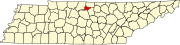
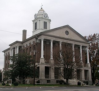
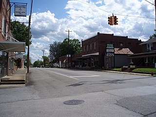
Trousdale County, also known as Hartsville/Trousdale County, is a county in the U.S. state of Tennessee. As of the 2020 census, the population was 11,615. Its county seat is Hartsville, with which it shares a uniquely formed consolidated city-county government. With an area of just 117 square miles (300 km2), it is Tennessee's smallest county.

<span class="mw-page-title-main">Sumner County, Tennessee</span> County in Tennessee, United States

Sumner County is a county located on the central northern border of Tennessee in the United States. As of the 2020 United States Census, the population was 196,281. Its county seat is Gallatin, and its most populous city is Hendersonville. The county is named after an American Revolutionary War hero, General Jethro Sumner.

<span class="mw-page-title-main">Smith County, Tennessee</span> County in Tennessee, United States

Smith County is a county in the U.S. state of Tennessee. As of the 2020 census, the population was 19,904. Smith County is located in the region of the state known as Middle Tennessee. Its county seat is Carthage. The county was organized in 1799 and is named for Daniel Smith, a Revolutionary War veteran who made the first map of Tennessee and served as a United States senator.

<span class="mw-page-title-main">Moore County, Tennessee</span> County in Tennessee, United States

Moore County is a county located in the south central part of the U.S. state of Tennessee. As of the 2020 census, the population was 6,461, making it the third-least populous county in Tennessee. It forms a consolidated city-county government with its county seat of Lynchburg. At 130 square miles (340 km2), it is the second-smallest county in Tennessee, behind only Trousdale. The county was created in 1871, during the Reconstruction era. Moore County is part of the Tullahoma-Manchester, TN Micropolitan Statistical Area.

<span class="mw-page-title-main">Madison County, Tennessee</span> County in Tennessee, United States

Madison County is a county located in the western part of the U.S. state of Tennessee. As of the 2020 census, the population was 98,823. Its county seat is Jackson. Madison County is included in the Jackson, TN Metropolitan Statistical Area.

<span class="mw-page-title-main">Macon County, Tennessee</span> County in Tennessee, United States

Macon County is a county located in the U.S. state of Tennessee As of the 2020 census, the population was 25,216. Its county seat is Lafayette. Macon County is part of the Nashville-Davidson–Murfreesboro–Franklin, TN Metropolitan Statistical Area.

<span class="mw-page-title-main">Bedford County, Tennessee</span> County in Tennessee, United States

Bedford County is a county located in the U.S. state of Tennessee. As of the 2020 census, the population was 50,237. Its county seat is Shelbyville. Bedford County comprises the Shelbyville, TN Micropolitan Statistical Area, which is also included in the Nashville-Davidson-Murfreesboro, TN Combined Statistical Area.

<span class="mw-page-title-main">Darlington County, South Carolina</span> County in South Carolina, United States

Darlington County is a county in the U.S. state of South Carolina. As of the 2020 census, its population was 62,905. Its county seat is Darlington. Hartsville is the largest community in the county. Darlington County is home to the Darlington Raceway, which hosts the annual NASCAR Southern 500. Darlington County is also home to Coker College in Hartsville. Darlington County was named by an act in March 1785.

<span class="mw-page-title-main">Hartsville, New York</span> Town in New York, United States

Hartsville is a town in Steuben County, New York, United States. The population was 561 at the 2020 census. The town is named after a prominent early settler, Reuben Hart.

<span class="mw-page-title-main">Camden, Tennessee</span> City in Tennessee, United States

Camden is a city in Benton County, Tennessee. The population was 3,674 at the 2020 census. It is the county seat of Benton County.

<span class="mw-page-title-main">Oak Hill, Tennessee</span> City in Tennessee, United States

Oak Hill is a city in Davidson County, Tennessee. The population was 4,529 at the 2010 census. The Tennessee Governor's Mansion is located in the city. Although the city is administered under the Metropolitan Government of Nashville and Davidson County, it retains its own municipal government.

<span class="mw-page-title-main">Charlotte, Tennessee</span> Town in Tennessee, United States

Charlotte is a town in Dickson County, Tennessee, United States. The population was 1,656 at the 2020 census. It is the county seat of Dickson County. This town is part of the Nashville metropolitan area.

<span class="mw-page-title-main">Jefferson City, Tennessee</span> City in Jefferson County, Tennessee, United States

Jefferson City is a city in Jefferson County, Tennessee, United States. It is part of the Morristown Metropolitan Statistical Area. As of the 2020 census the population was 8,419.

<span class="mw-page-title-main">Jasper, Tennessee</span> Town in Marion County, Tennessee

Jasper is a town in and the county seat of Marion County, Tennessee, United States. The population was 3,612 at the 2020 census. The town was formed in 1820 from lands acquired from Betsy Pack (1770–1851), daughter of Cherokee Chief John Lowery. Jasper is part of the Chattanooga, TN–GA Metropolitan Statistical Area.

<span class="mw-page-title-main">Chapel Hill, Tennessee</span> Town in Tennessee, United States

Chapel Hill is a town in northeastern Marshall County, Tennessee, United States. The town was named after Chapel Hill, North Carolina, by settlers from that area. The population was 1,717 as of the 2020 census.

<span class="mw-page-title-main">Athens, Tennessee</span> City in Tennessee, United States

Athens is the county seat of McMinn County, Tennessee, United States and the principal city of the Athens Micropolitan Statistical Area has a population of 53,569. The city is located almost equidistantly between the major cities of Knoxville and Chattanooga. The population was 14,084 at the 2020 census. The population of the zipcode area is at 23,726

<span class="mw-page-title-main">Graysville, Tennessee</span> Town in Tennessee, United States

Graysville is a town in Rhea County, Tennessee, United States. The population was 1,471 at the 2020 census and 1,502 at the 2010 census.

<span class="mw-page-title-main">Sweetwater, Tennessee</span> City in Tennessee, United States

Sweetwater is a city in Monroe and McMinn counties in the U.S. state of Tennessee, and the most populous city in Monroe County. As of the 2020 census, its population was 6,312. Sweetwater is the home of the Craighead Caverns which contains the Lost Sea, the United States' largest underground lake. In 2022, TravelMag named Sweetwater one of Tennessee’s Ten Most Charming Cities.

References

  1. 1 2 3 "Trousdale County History." Retrieved: February 11, 2008.
  2. 1 2 "U.S. Census website". United States Census Bureau . Retrieved January 31, 2008.
  3. "US Board on Geographic Names". United States Geological Survey. October 25, 2007. Retrieved January 31, 2008.
  4. "Find a County". National Association of Counties. Retrieved June 7, 2011.
  5. "Metro Govt Hartsville/Trousdale County". University of Tennessee Institute for Public Service.
  6. Suzanne M. Leland, Kurt M. Thurmaier, ed. (2004). Case Studies of City-county Consolidation: Reshaping the Local Government Landscape (illustrated ed.). M. E. Sharpe. p. 239. ISBN   9780765632883 . Retrieved December 17, 2013.
  7. "Tennessee" (PDF). Governments-Individual State Descriptions. U.S. Census Bureau. Retrieved December 17, 2013.
  8. Ridley Wills II, "Thoroughbred Horse Breeding and Racing." The Tennessee Encyclopedia of History and Culture , 2009. Retrieved: February 11, 2013.
  9. Jeffrey Durbin, "Trousdale County." The Tennessee Encyclopedia of History and Culture, 2009. Retrieved: February 11, 2013.
  10. See "Coronavirus in the U.S.: Latest Map and Case Count" The New York Times May 15, 2020.
  11. "Trousdale wins SCORE Prize". Hartsville Vidette. Retrieved November 19, 2013.
  12. "TROUSDALE COUNTY NAMED SCORE PRIZE WINNER". Trousdale County Schools website. Retrieved November 19, 2013.
  13. "US Gazetteer files: 2010, 2000, and 1990". United States Census Bureau. February 12, 2011. Retrieved April 23, 2011.
  14. "U.S. Climate Normals Quick Access – Station: Hartsville, TN (19912020)". National Oceanic and Atmospheric Administration. Retrieved May 10, 2023.
  15. "U.S. Climate Normals Quick Access – Station: Hartsville, TN (19812010)". National Oceanic and Atmospheric Administration. Retrieved May 10, 2023.
  16. "xmACIS2". National Oceanic and Atmospheric Administration. Retrieved May 10, 2023.
  17. "Census of Population and Housing: Decennial Censuses". United States Census Bureau . Retrieved March 4, 2012.
  18. "Incorporated Places and Minor Civil Divisions Datasets: Subcounty Resident Population Estimates: April 1, 2010 to July 1, 2012". Population Estimates. U.S. Census Bureau. Archived from the original on June 11, 2013. Retrieved December 11, 2013.
  19. "MARTIN, John - Biographical Information". bioguide.congress.gov. Retrieved September 17, 2019.
  20. 1 2 "Trousdale, TN". www.trousdalecountytn.gov. Retrieved September 25, 2022.