Internet GIS

Last updated
2007 map showing submarine fiberoptic telecommunication cables around the world. World map of submarine cables.png
2007 map showing submarine fiberoptic telecommunication cables around the world.

Internet GIS, or Internet geographic information system (GIS), is a term that refers to a broad set of technologies and applications that employ the Internet to access, analyze, visualize, and distribute spatial data. [1] [2] [3] [4] [5] Internet GIS is an outgrowth of traditional GIS, and represents a shift from conducting GIS on an individual computer to working with remotely distributed data and functions. [1] Two major issues in GIS are accessing and distributing spatial data and GIS outputs. [6] Internet GIS helps to solve that problem by allowing users to access vast databases impossible to store on a single desktop computer, and by allowing rapid dissemination of both maps and raw data to others. [7] [6] These methods include both file sharing and email. This has enabled the general public to participate in map creation and make use of GIS technology. [8] [9]

Contents

Internet GIS is a subset of Distributed GIS, but specifically uses the internet rather than generic computer networks. Internet GIS applications are often, but not exclusively, conducted through the World Wide Web (also known as the Web), giving rise to the sub-branch of Web GIS, often used interchangeably with Internet GIS. [10] [11] [12] [4] [5] While Web GIS has become nearly synonymous with Internet GIS to many in the industry, the two are as distinct as the internet is from the World Wide Web. [13] [14] [15] Likewise, Internet GIS is as distinct from distributed GIS as the Internet is from distributed computer networks in general. [1] [4] [5]

VPN connectivity overview, showing intranet site-to-site and remote-work configurations used together Virtual Private Network overview.svg
VPN connectivity overview, showing intranet site-to-site and remote-work configurations used together

Internet GIS includes services beyond those enabled by the Web. Use of any other internet-enabled services to facilitate GIS functions, even if used in conjuncture with the Web, represents the use of Internet GIS. [4] [5] One of the most common applications of a distributed GIS system, accessing remotely saved data, can be done through the internet without the need for the Web. [4] [5] This is often done in practice when data are sensitive, such as hospital patient data and research facilities proprietary data, where sending data through the Web may be a security risk. This can be done using a Virtual private network (VPN) to access a local network remotely. [16] The use of VPN for these purposes surged during the COVID-19 pandemic, when employers needed to allow employees using GIS access to sensitive spatial data from home. [17] [18] [19]

History

The history of Internet geographic information systems is linked to the history of the computer, the internet, and the quantitative revolution in geography. Geography tends to adapt technologies from other disciplines rather than innovating and inventing the technologies employed to conduct geographic studies. [20] The computer and internet are not an exception, and were rapidly investigated to purpose towards the needs of geographers. In 1959, Waldo Tobler published the first paper detailing the use of computers in map creation. [21] This was the beginning of computer cartography, or the use of computers to create maps. [22] [23] In 1960, the first true geographic information system capable of storing, analyzing, changing, and creating visualizations with spatial data was created by Roger Tomlinson on behalf of the Canadian Government to manage natural resources. [24] [25] These technologies represented a paradigm shift in cartography and geography, with desktop computer cartography facilitated through GIS rapidly replaced traditional ways of making maps. [20] The emergence of GIS and computer technology contributed to the quantitative revolution in geography and the emergence of the branch of technical geography. [26] [27]

As computer technology advanced the desktop machine became the default for producing maps, a process known as digital mapping, or computer cartography. These computers were networked together to share data and processing power and create redundant communications for defense applications. [12] This computer network evolved into the internet, and by the late 1980s, the internet was available in some people's homes. [12] Over time, the internet moved from a novelty to a major part of daily life. Using the internet, it was no longer necessary to store all data for a project locally, and communications were vastly improved. Following this trend, GIScientists began developing methods for combining the internet and GIS. This process accelerated in the 1990s, with the creation of the World Wide Web in 1990 and the first major web mapping program, Xerox PARC Map Viewer, capable of distributed map creation appearing in 1993. [12] [28] [9] This software was unique in that it facilitated dynamic user map generation, rather than static images. [28] These new Web-based programs helped users to employ GIS without having it locally installed on their machine, ultimately leading to Web GIS being the dominant way users interact with internet GIS. [10] [28]

T3 NSFNET Backbone, c. 1992 NSFNET-backbone-T3.png
T3 NSFNET Backbone, c. 1992

In 1995 The US federal government made the TIGER Mapping Service available to the public, facilitating desktop and Web GIS by hosting US boundary data. [10] This data availability, facilitated through the internet, silently revolutionized cartography by providing the world with authoritative boundary files, for free. In 1996, MapQuest became available to the public, facilitating navigation and trip planning. [10] Sometime during the 1990s, more maps were transmitted over the internet than physically printed. [12] This milestone was predicted in 1985 and represented a major shift in how we distribute spatial products to the masses. [29]

As of 2020, almost 75% of the population has a smartphone. [1] [30] These devices allow users to access the internet wherever they have service, and have revolutionized how we interact with the internet. One notable example is the rise of mobile apps, which have impacted both how GIS is done, and how data are collected. Some mobile apps like the Google Maps mobile app are web-based and allow users to get navigation instructions in real time. Others, like Esri's Survey123 allow users to collect data in the field with their smartphone. [31] As time progresses, internet-based applications that do not make use of HTML or Web Browsers have begun to become to grow in popularity. [32]

Web GIS

The World Wide Web is an information system that uses the internet to host, share, and distribute documents, images, and other data. [33] Web GIS involves using the World Wide Web to facilitate GIS tasks traditionally done on a desktop computer, as well as enabling the sharing of maps and spatial data. [7] Most, but not all, internet GIS is Web GIS, however all Web GIS is internet GIS. [10] [11] This is quite similar to how much of the activity on the internet is hosted on the World Wide Web, but not everything on the internet is the World Wide Web. The tasks Web GIS are used for are numerous but can be generally divided into the categories of Geospatial web services: web feature services, web processing services, and web mapping services. [3]

Criticism

By their definition, maps can never be perfect and are simplifications of reality. [34] Ethical cartographers try to keep these inaccuracies documented and to a minimum, while encouraging critical perspectives when using a map. Internet GIS has brought map-making tools to the general public, facilitating the rapidly disseminating these maps. [35] While this is potentially positive, it also means that people without cartographic training can easily make and disseminate misleading maps to a wide audience. [20] [36] [37] This was brought to public attention during the COVID-19 pandemic, when more than half of all United States state government COVID-19 dashboards had cartographic errors. [38] Further, malicious actors can quickly spread intentionally misleading spatial information while hiding the source. [34] As the internet is decentralized, traditional solutions to problems such as government regulation are difficult or impossible to implement. [39]

For many users, the World Wide Web is synonymous with the Internet, which is true for Internet GIS. Most functions done with Internet GIS are conducted through the use of Web GIS. This has caused the borders between the two terms to blur, and "Web GIS" to become genericized into meaning any GIS done over the internet to some users.

See also

Related Research Articles

<span class="mw-page-title-main">Geographic information system</span> System to capture, manage and present geographic data

A geographic information system (GIS) consists of integrated computer hardware and software that store, manage, analyze, edit, output, and visualize geographic data. Much of this often happens within a spatial database, however, this is not essential to meet the definition of a GIS. In a broader sense, one may consider such a system also to include human users and support staff, procedures and workflows, the body of knowledge of relevant concepts and methods, and institutional organizations.

<span class="mw-page-title-main">Esri</span> Geospatial software & SaaS company

Environmental Systems Research Institute, Inc., doing business as Esri, is an American multinational geographic information system (GIS) software company headquartered in Redlands, California. It is best known for its ArcGIS products. With a 40% market share, Esri is the world's leading supplier of GIS software, web GIS and geodatabase management applications.

<span class="mw-page-title-main">Waldo R. Tobler</span> American geographer

Waldo Rudolph Tobler was an American-Swiss geographer and cartographer. Tobler is regarded as one of the most influential geographers and cartographers of the late 20th century and early 21st century. He is most well known for coining what has come to be referred to as Tobler's first law of geography. He also coined what has come to be referred to as Tobler's second law of geography.

Animated mapping is the application of animation, either a computer or video, to add a temporal component to a map displaying change in some dimension. Most commonly the change is shown over time, generally at a greatly changed scale. An example would be the animation produced after the 2004 tsunami showing how the waves spread across the Indian Ocean.

<span class="mw-page-title-main">Choropleth map</span> Type of data visualization for geographic regions

A choropleth map is a type of statistical thematic map that uses pseudocolor, meaning color corresponding with an aggregate summary of a geographic characteristic within spatial enumeration units, such as population density or per-capita income.

A GIS software program is a computer program to support the use of a geographic information system, providing the ability to create, store, manage, query, analyze, and visualize geographic data, that is, data representing phenomena for which location is important. The GIS software industry encompasses a broad range of commercial and open-source products that provide some or all of these capabilities within various information technology architectures.

ArcSDE is a server-software sub-system that aims to enable the usage of Relational Database Management Systems for spatial data. The spatial data may then be used as part of a geodatabase.

<span class="mw-page-title-main">ArcGIS</span> Geographic information system maintained by Esri

ArcGIS is a family of client, server and online geographic information system (GIS) software developed and maintained by Esri.

<span class="mw-page-title-main">Thematic map</span> Type of map that visualizes data

A thematic map is a type of map that portrays the geographic pattern of a particular subject matter (theme) in a geographic area. This usually involves the use of map symbols to visualize selected properties of geographic features that are not naturally visible, such as temperature, language, or population. In this, they contrast with general reference maps, which focus on the location of a diverse set of physical features, such as rivers, roads, and buildings. Alternative names have been suggested for this class, such as special-subject or special-purpose maps, statistical maps, or distribution maps, but these have generally fallen out of common usage. Thematic mapping is closely allied with the field of Geovisualization.

ArcGIS Server is the core server geographic information system (GIS) software made by Esri. ArcGIS Server is used for creating and managing GIS Web services, applications, and data. ArcGIS Server is typically deployed on-premises within the organization’s service-oriented architecture (SOA) or off-premises in a cloud computing environment.

<span class="mw-page-title-main">Web mapping</span> Process of using the maps delivered by geographic information systems (GIS) in World Wide Web

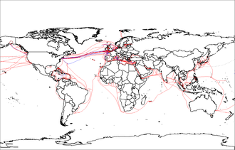
Web mapping or an online mapping is the process of using, creating, and distributing maps on the World Wide Web, usually through the use of Web geographic information systems. A web map or an online map is both served and consumed, thus, web mapping is more than just web cartography, it is a service where consumers may choose what the map will show.

A geoportal is a type of web portal used to find and access geographic information and associated geographic services via the Internet. Geoportals are important for effective use of geographic information systems (GIS) and a key element of a spatial data infrastructure (SDI).

Distributed GIS refers to GI Systems that do not have all of the system components in the same physical location. This could be the processing, the database, the rendering or the user interface. It represents a special case of distributed computing, with examples of distributed systems including Internet GIS, Web GIS, and Mobile GIS. Distribution of resources provides corporate and enterprise-based models for GIS. Distributed GIS permits a shared services model, including data fusion based on Open Geospatial Consortium (OGC) web services. Distributed GIS technology enables modern online mapping systems, Location-based services (LBS), web-based GIS and numerous map-enabled applications. Other applications include transportation, logistics, utilities, farm / agricultural information systems, real-time environmental information systems and the analysis of the movement of people. In terms of data, the concept has been extended to include volunteered geographical information. Distributed processing allows improvements to the performance of spatial analysis through the use of techniques such as parallel processing.

<span class="mw-page-title-main">Computer cartography</span> Compiling data to create a visual image

Computer cartography is the art, science, and technology of making and using maps with a computer. This technology represents a paradigm shift in how maps are produced, but is still fundamentally a subset of traditional cartography. The primary function of this technology is to produce maps, including creation of accurate representations of a particular area such as, detailing major road arteries and other points of interest for navigation, and in the creation of thematic maps. Computer cartography is one of the main functions of geographic information systems (GIS), however, GIS is not necessary to facilitate computer cartography and has functions beyond just making maps. The first peer-reviewed publications on using computers to help in the cartographic process predate the introduction of full GIS by several years.

Geographic information systems (GISs) and geographic information science (GIScience) combine computer-mapping capabilities with additional database management and data analysis tools. Commercial GIS systems are very powerful and have touched many applications and industries, including environmental science, urban planning, agricultural applications, and others.

Geographic information systems (GIS) play a constantly evolving role in geospatial intelligence (GEOINT) and United States national security. These technologies allow a user to efficiently manage, analyze, and produce geospatial data, to combine GEOINT with other forms of intelligence collection, and to perform highly developed analysis and visual production of geospatial data. Therefore, GIS produces up-to-date and more reliable GEOINT to reduce uncertainty for a decisionmaker. Since GIS programs are Web-enabled, a user can constantly work with a decision maker to solve their GEOINT and national security related problems from anywhere in the world. There are many types of GIS software used in GEOINT and national security, such as Google Earth, ERDAS IMAGINE, GeoNetwork opensource, and Esri ArcGIS.

Cynthia Ann Brewer is an American cartographer, author, and professor of geography at Pennsylvania State University. Brewer's specialty relates to visibility and color theory in cartography. In 2023, she was awarded the International Cartographic Society's highest honor, the Carl Mannerfelt Gold Medal, for her distinguished contribution to the field.

<span class="mw-page-title-main">Web GIS</span> Technologies employing the World Wide Web to manage spatial data

Web GIS, or Web Geographic Information Systems, are GIS that employ the World Wide Web to facilitate the storage, visualization, analysis, and distribution of spatial information over the Internet. The World Wide Web, or the Web, is an information system that uses the internet to host, share, and distribute documents, images, and other data. Web GIS involves using the World Wide Web to facilitate GIS tasks traditionally done on a desktop computer, as well as enabling the sharing of maps and spatial data. While Web GIS and Internet GIS are sometimes used interchangeably, they are different concepts. Web GIS is a subset of Internet GIS, which is itself a subset of distributed GIS, which itself is a subset of broader Geographic information system. The most common application of Web GIS is Web mapping, so much so that the two terms are often used interchangeably in much the same way as Digital mapping and GIS. However, Web GIS and web mapping are distinct concepts, with web mapping not necessarily requiring a Web GIS.

A Geodatabase is a proprietary GIS file format developed in the late 1990s by Esri to represent, store, and organize spatial datasets within a geographic information system. A geodatabase is both a logical data model and the physical implementation of that logical model in several proprietary file formats released during the 2000s. The geodatabase design is based on the spatial database model for storing spatial data in relational and object-relational databases. Given the dominance of Esri in the GIS industry, the term "geodatabase" is used by some as a generic trademark for any spatial database, regardless of platform or design.

George Frederick Jenks (1916–1996) was an American geographer known for his significant contributions to cartography and geographic information systems (GIS). With a career spanning over three decades, Jenks played a vital role in advancing map-making technologies, was instrumental in enhancing the visualization of spatial data, and played foundational roles in developing modern cartographic curricula. The Jenks natural breaks optimization, based on his work, is still widely used in the creation of thematic maps, such as choropleth maps.

References

  1. 1 2 3 4 Peng, Zhong-Ren; Tsou, Ming-Hsiang (2003). Internet GIS: Distributed Information Services for the Internet and Wireless Networks . Hoboken, NJ: John Wiley and Sons. ISBN   0-471-35923-8. OCLC   50447645.
  2. Moretz, David (2008). "Internet GIS" . In Shekhar, Shashi; Xiong, Hui (eds.). Encyclopedia of GIS. New York: Springer. pp.  591–596. doi:10.1007/978-0-387-35973-1_648. ISBN   978-0-387-35973-1. OCLC   233971247.
  3. 1 2 Zhang, Chuanrong; Zhao, Tian; Li, Weidong (2015). Geospatial Semantic Web. Cham: Springer. doi:10.1007/978-3-319-17801-1. ISBN   978-3-319-17800-4. OCLC   911032733. S2CID   63154455.
  4. 1 2 3 4 5 Ezekiel, Kuria; Kimani, Stephen; Mindila, Agnes (June 2019). "A Framework for Web GIS Development: A Review". International Journal of Computer Applications. 178 (16): 6–10. doi: 10.5120/ijca2019918863 . S2CID   196200139.
  5. 1 2 3 4 5 Rowland, Alexandra; Folmer, Erwin; Beek, Wouter (2020). "Towards Self-Service GIS—Combining the Best of the Semantic Web and Web GIS". ISPRS International Journal of Geo-Information. 9 (12): 753. doi: 10.3390/ijgi9120753 .
  6. 1 2 DeMers, Michael (2009). Fundamentals of Geographic Information Systems (4 ed.). Wiley.
  7. 1 2 Plewe, Brandon (1997). GIS Online: INFORMATION RETRIEVAL, MAPPING, AND THE INTERNET (1 ed.). OnWord Press. ISBN   1-56690-137-5.
  8. Hansen, Henning Sten (November 2005). "Citizen participation and Internet GIS—Some recent advances". Computers, Environment and Urban Systems. 29 (6): 617–629. doi:10.1016/j.compenvurbsys.2005.07.001 . Retrieved 6 January 2023.
  9. 1 2 Plew, Brandon (2007). "Web Cartography in the United States". Cartography and Geographic Information Science. 34 (2): 133–136. doi:10.1559/152304007781002235. S2CID   140717290 . Retrieved 6 January 2023.
  10. 1 2 3 4 5 Fu, Pinde; Sun, Jiulin (2011). Web GIS: Principles and Applications . Redlands, Calif.: ESRI Press. ISBN   978-1-58948-245-6. OCLC   587219650.
  11. 1 2 Fu, Pinde (2016). Getting to Know Web GIS (2 ed.). Redlands, Calif.: ESRI Press. ISBN   9781589484634. OCLC   928643136.
  12. 1 2 3 4 5 Peterson, Michael P. (2014). Mapping in the Cloud . New York: The Guiford Press. ISBN   978-1-4625-1041-2. OCLC   855580732.
  13. Mathiyalagan, V.; Grunwald, S.; Reddy, K.R.; Bloom, S.A. (April 2005). "A WebGIS and geodatabase for Florida's wetlands". Computers and Electronics in Agriculture. 47 (1): 69–75. doi:10.1016/j.compag.2004.08.003 . Retrieved 31 January 2023.
  14. Veenendaal, Bert; Brovelli, Maria Antonia; Li, Songnian (October 2017). "Review of Web Mapping: Eras, Trends and Directions". ISPRS International Journal of Geo-Information. 6 (10): 317. doi: 10.3390/ijgi6100317 . hdl: 11311/1045866 .
  15. Hojaty, Majid (21 February 2014). "What is the Difference Between Web GIS and Internet GIS?". GIS Lounge. Retrieved 30 August 2022.
  16. Maile, McCann; Rob, Watts. "What Is A VPN Used For? 9 VPN Uses In 2022". Forbes Advisor. Retrieved 24 December 2022.
  17. McCarthy, Niall. "VPN Usage Surges During COVID-19 Crisis [Infographic]". Forbes. Retrieved 24 December 2022.
  18. Skahill, Jeffrey (April 2020). "Tips for Leading a Remote Team during Covid-19". GIS Lounge. Retrieved 24 December 2022.
  19. "Five Reasons GIS Users Should Use a VPN". gisuser. 4 October 2021. Retrieved 24 December 2022.
  20. 1 2 3 Monmonier, Mark S. (1985). Technological Transition in Cartography . Madison: University of Wisconsin Press. ISBN   0299100707. OCLC   11399821.
  21. Tobler, Waldo (1959). "Automation and Cartography". Geographical Review. 49 (4): 526–534. doi:10.2307/212211. JSTOR   212211 . Retrieved 10 March 2022.
  22. Clark, Keith (1995). Analytic and Computer Cartography. Prentice Hall. ISBN   0133419002.
  23. Monmonier, Mark (1982). Computer-Assisted Cartography: Principles and Prospects 1st Edition (1 ed.). Pearson College Div. ISBN   9780131653085.
  24. "History of GIS | Early History and the Future of GIS - Esri". www.esri.com. Retrieved 2 May 2020.
  25. "Roger Tomlinson". UCGIS. 21 February 2014. Archived from the original on 17 December 2015. Retrieved 16 December 2015.
  26. Haidu, Ionel (2016). "What is Technical Geography – a letter from the editor". Geographia Technica. 11: 1–5. doi: 10.21163/GT_2016.111.01 .
  27. Ormeling, Ferjan (2009). Technical Geography Core concepts in the mapping sciences. p. 482. ISBN   978-1-84826-960-6.
  28. 1 2 3 Putz, Steve (November 1994). "Interactive information services using World-Wide Web hypertext". Computer Networks and ISDN Systems. 27 (2): 273–280. doi:10.1016/0169-7552(94)90141-4 . Retrieved 14 September 2022.
  29. Monmonier, Mark (1985). Technological Transition in Cartography (1 ed.). Univ of Wisconsin Pr. ISBN   978-0299100704.
  30. "Topic: Smartphones".
  31. ESRI. "ArcGIS Survey123" . Retrieved 27 May 2023.
  32. Anderson, Christopher M.; Wolff, Michael J. (September 9, 2010). "The web is dead. Long live the Internet" . Retrieved 27 May 2023.
  33. "What is the difference between the Web and the Internet?". W3C Help and FAQ. W3C. 2009. Retrieved 16 July 2015.
  34. 1 2 Monmonier, Mark (10 April 2018). How to lie with maps (3 ed.). University of Chicago Press. ISBN   978-0226435923.
  35. Monmonier, Mark (1 June 1990). "Ethics and Map Design: Six Strategies for Confronting the Traditional One-Map Solution". Cartographic Perspectives. 1 (10): 3–8. doi: 10.14714/CP10.1052 . Retrieved 15 September 2022.
  36. Adams, Aaron; Chen, Xiang; Li, Weidong; Zhang, Chuanrong (2020). "The disguised pandemic: the importance of data normalization in COVID-19 web mapping". Public Health. 183: 36–37. doi:10.1016/j.puhe.2020.04.034. PMC   7203028 . PMID   32416476.
  37. Zhong-Ren, Ren (November 2001). "Internet GIS for public participation". Environment and Planning B: Planning and Design. 8 (6): 889–905. doi:10.1068/b2750t. S2CID   15012889.
  38. Adams, Aaron M.; Chen, Xiang; Li, Weidong; Chuanrong, Zhang (27 July 2023). "Normalizing the pandemic: exploring thecartographic issues in state government COVID-19 dashboards". Journal of Maps. 19 (5): 1–9. doi: 10.1080/17445647.2023.2235385 .
  39. Peterson, Michael (2008). "Maps and the Internet:What a Mess It Is and How To Fix It". Cartographic Perspectives. 59 (59): 4–11. doi: 10.14714/CP59.244 . Retrieved 20 January 2024.