Related Research Articles
Bhotiya or Bhot is an Indian and Nepali exonym lumping together various ethnic groups speaking Tibetic languages, as well as some groups speaking other Tibeto-Burman languages living in the Transhimalayan region that divides India from Tibet. The word Bhotiya comes from the classical Tibetan name for Tibet, བོད, bod. The Bhotiya speak numerous languages including Ladakhi. The Indian recognition of such language is Bhoti / Bhotia having Tibetan scripts and it lies in the Parliament of India to become one of the official languages through Eighth Schedule of the Indian Constitution.

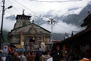
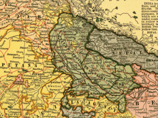
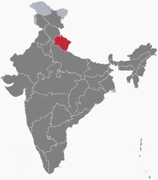
Uttarakhand, also known as Uttaranchal, is a state in northern India. It is often referred to as the "Devbhumi" due to its religious significance and numerous Hindu temples and pilgrimage centres found throughout the state. Uttarakhand is known for the natural environment of the Himalayas, the Bhabar and the Terai regions. It borders the Tibet Autonomous Region of China to the north; the Sudurpashchim Province of Nepal to the east; the Indian states of Uttar Pradesh to the south and Himachal Pradesh to the west and north-west. The state is divided into two divisions, Garhwal and Kumaon, with a total of 13 districts. The winter capital of Uttarakhand is Dehradun, the largest city of the state, which is a rail head. Gairsain, a town in Chamoli district, is the summer capital of Uttarakhand declared on 5 March 2020. The High Court of the state is located in Nainital, but is to be moved to Haldwani in future.

Garhwali is an Indo-Aryan language of the Central Pahari subgroup. It is primarily spoken by over 2.5 million Garhwali people in the Garhwal region of the northern Indian state of Uttarakhand in the Indian Himalayas.

Nainital district is a district in Kumaon division which is a part of Uttarakhand state in India. The headquarters is at Nainital.

Tehri Garhwal is a district in the hill state of Uttarakhand, India. Its administrative headquarters is at New Tehri. The district has a population of 618, 931, a 2.35% increase over the previous decade. It is surrounded by Rudraprayag District in the east, Dehradun District in the west, Uttarkashi District in the north, and Pauri Garhwal District in the south. Tehri Garhwal is a part of the Himalayas.

Uttarkashi District is a district of Garhwal division of the Uttarakhand state in northern India, and has its headquarters at Uttarkashi city. It has six Tehsils namely Barkot, Dunda, Bhatwadi, Chinyalisaur, Purola and Mori.
Garhwal District is a former district in Kumaon of British India of the United Provinces, and had an area of 5,629 sq mi (14,580 km2). It later became a part of the Indian state of Uttar Pradesh, today it is part of the Indian state Uttarakhand.
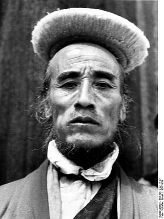
The Bhotiya, also called Rongpa, are located in the trans-Himalayan region of India. Rongpa communities are some of the oldest and native of the upper belt of the Himalayas, close to the border of Tibet in Garhwal. It was once believed that the Rongpa community had been wiped out.

Gauchar is a Hill Town sort of a valley town located in Karnaprayag tehsil within Chamoli district of Uttarakhand state in India. Gauchar is situated on the left bank of river Alaknanda and is en route to the celebrated holy destination of Badrinath. It is well known for being one of the cleanest place in country. It has previously topped Swachta sarvekshan best ganga town award. Situated at an altitude of 800 metres (2,620 ft) above the sea level, Gauchar is surrounded by seven mountains. Gauchar is well known for its historic trade fair and airstrip. Gauchar town known for its great work to curb loss of lives in 2013 flood disaster of Uttarakhand. This town is unique in terms of its geographical location and topography. Gauchar is located on one of the largest pieces of flatland in this mountainous region of Uttarakhand. Education institution in Gauchar includes a beautiful Kendriya Vidyalaya adjacent to the main playground.
Jaunsar-Bawar is a hilly region in Garhwal division of Uttarakhand, northern India. It is located in the north-west of Dehradun district, along the border with the state of Himachal Pradesh.

Harshil, the Himalayan paradise, is a village, tourist hill station and army area located on the banks of the Bhagirathi River, on the way to Gangotri, a Hindu pilgrimage site in Uttarkashi district of the Indian state of Uttarakhand.
Bhoksa, also known as Buksa/Bukhasiya, are indigenous peoples living mainly in the Indian states of Uttarakhand and Uttar Pradesh. They are mostly concentrated in Dehradun and Nainital districts in the foothills of the outer Himalayas. They are also found in the Bijnor district of Uttar Pradesh, where they are known as Khas. Both communities have been granted Scheduled Tribe status.
Uttarakhand is a state in North India. Its name, which means "northern land" or "section" or "northern part" in Sanskrit, is mentioned in early Hindu texts as the combined region of Kedarkhand and Manaskhand.

The Garhwali people are an Indian ethnolinguistic group native to the Garhwal, in the Indian state of Uttarakhand, who speak Garhwali, an Indo-Aryan language.
Bhotiyas are people of presumed Tibetan heritage that live along the Indo-Tibetan border in the upper reaches of the Great Himalayas, at elevations ranging from 6,500 feet (2,000 m) to 13,000 feet (4,000 m). In Uttarakhand, they inhabit seven river valleys, three in the Garhwal division and four in the Kumaon division. Their main traditional occupation used to be Indo-Tibetan trade, with limited amounts of agriculture and pastoralism. The customary Indo-Tibetan trade drastically stopped following the 1962 Sino-Indian war, and was resumed in the early 1990s under state-regulated mechanisms. These days, medicinal and aromatic plant collection is a major livelihood among this group, alongside by out-migration for education and jobs. Transhumance and pastoralism have drastically reduced in prevalence among this group too. They follow Hinduism and Buddhism and traditionally speak West Himalayish languages.

Jad (Dzad), also known as Bhotia and Tchhongsa, is a language spoken by a community of about 300 in the states of Uttarakhand and Himachal Pradesh, in India. It is spoken in several villages, and the three major villages are Jadhang, Nelang and Pulam Sumda in the Harsil sub-division of the Uttarkashi District. Jad is closely related to the Lahuli–Spiti language, which is another Tibetic language. Jad is spoken alongside Garhwali and Hindi. Code switching between Jad and Garhwali is very common. The language borrows some vocabulary from both Hindi and Garhwali. It is primarily a spoken language.

Nelang or Nilang is a river valley of the Himalayas, containing a small eponymous village, in the Uttarkashi District of the state of Uttarakhand, India. It is close to the disputed Sino-Indian Line of Actual Control (LAC), and hence is also claimed by China as part of Zanda County of Ngari Prefecture of Tibet.
Sang (Jadhang) is a small hilly village in Uttarkashi District, Uttarakhand, India, and claimed by Zanda County, Ngari Prefecture, Tibet, China. A tributary of the Jadh Ganga, itself an important tributary of the Bhagirathi River, flows through this place.
The following outline is provided as an overview of and topical guide to Uttarakhand:
References
- 1 2 "List of Scheduled Tribes". Census of India: Government of India. 7 March 2007. Archived from the original on 5 June 2010. Retrieved 27 November 2012.
- ↑ Mystery solved: Gartang Gully was made by 'Pahadi' Wilson for secretly venturing Tibet, First Post, June 2023.
| Government |
| ||||||||||||||||
|---|---|---|---|---|---|---|---|---|---|---|---|---|---|---|---|---|---|
| History |
| ||||||||||||||||
| Geography and Ecology |
| ||||||||||||||||
| Demographics |
| ||||||||||||||||
| Administrative divisions |
| ||||||||||||||||
| Politics | |||||||||||||||||
| Tourism |
| ||||||||||||||||
| Sports | |||||||||||||||||
| Other topics | |||||||||||||||||
| Districts |
| ||||||||||||||||
| Major cities | |||||||||||||||||
| | This article about an Indian ethnicity or social group is a stub. You can help Wikipedia by expanding it. |