Klamath Air Force Station

Last updated

Klamath Air Force Station
Air Defense Command.svg
Part of Air Defense Command (ADC)
Klamath Air Force Station 1977.jpg
Klamath Air Force Station 1977
USA California location map.svg
Red pog.svg
Klamath AFS
Location of Klamath AFS, California
Coordinates 41°33′33″N124°05′10″W / 41.55917°N 124.08611°W / 41.55917; -124.08611 (Klamath AFS P-33)
TypeAir Force Station
Site information
Controlled byFlag of the United States Air Force.svg  United States Air Force
Site history
Built1951
In use1950–1981
Garrison information
Garrison777th Aircraft Control and Warning Squadron

Klamath Air Force Station (ADC ID: P-33, NORAD ID: Z-33) is a closed United States Air Force General Surveillance Radar station. It is 3.4 miles (5.5 km) northwest of Klamath, California, and was closed in 1981.

Contents

History

Klamath Air Force Station was one of twenty-eight stations built as part of the second segment of the Air Defense Command permanent radar network. Prompted by the start of the Korean War, on 11 July 1950, the Secretary of the Air Force asked the Secretary of Defense for approval to quicken construction of the permanent network. Receiving the Defense Secretary's approval on 21 July, the Air Force directed the Corps of Engineers to begin construction [1] adjacent to the town of Requa, California, about 3 miles northwest of the town of Klamath and within sight of the mouth of the Klamath River.

The 777th Aircraft Control and Warning Squadron (AC&W Sq) was activated at the new station on 18 December 1950. The station initially was a "Lashup-Permanent" site (LP-33), operating an AN/TPS-1B radar. It joined the Permanent radar network, [2] and initially the station functioned as a Ground-Control Intercept (GCI) and warning station. As a GCI station, the squadron's role was to guide interceptor aircraft toward unidentified intruders picked up on the unit's radar scopes.

From April 1952, the 777th AC&W Sq operated AN/FPS-3 and AN/FPS-4 radars at the station. An AN/GPS-3 radar was added to it in 1956. The AN/FPS-3 and AN/FPS-4 were replaced by AN/FPS-20 and AN/FPS-6 radars by 1958. During the following year, the station added an AN/FPS-6A height-finder radar, which was later modified to an AN/FPS-90, while the AN/GPS-3 was removed. [3]

During 1960, Klamath AFS joined the Semi Automatic Ground Environment (SAGE) system, feeding data to DC-13 at Adair AFS, Oregon. After joining, the squadron was re-designated as the 777th Radar Squadron (SAGE) on 15 July 1960. [4] The radar squadron provided information 24/7 to the SAGE Direction Center where it was analyzed to determine range, direction altitude speed and whether or not aircraft were friendly or hostile.

By the end of 1961, the AN/FPS-20A long-range search radar had been upgraded and re-designated as an AN/FPS-66. An AN/FPS-26 frequency diversity height-finder radar was added during 1962. On 31 July 1963, the site was re-designated as NORAD ID Z-33. By 1966 there was an AN/FPS-27 long-range search radar in operation there, and the AN/FPS-66 was subsequently retired. [3]

In addition to the main facility, Klamath personnel operated one AN/FPS-14 Gap Filler site: [2]

Over the years, the equipment at the station was upgraded or modified to improve the efficiency and accuracy of the information gathered by the radars. In 1979, Klamath came under Tactical Air Command (TAC) jurisdiction with the inactivation of Aerospace Defense Command and the creation of ADTAC. [3] The 777th Radar Sq was inactivated on 30 September 1981, and the property was turned over to the National Park Service except for about 2 acres which were given to the Federal Aviation Administration, [3] who continued operations of the AN/FPS-66A search radar in the old AN/FPS-27 tower. FAA operations later ceased as well and the Klamath California radar site coverage volume was taken over by the FAA/USAF joint use site at Rainbow Ridge, CA (J-83A), operating an ARSR-4. [2]

After military use ceased, the site's residential housing area was used by the California Conservation Corps while the remainder of the site (other than the FAA property) became a maintenance facility for Redwood National Park. Following the opening of the park's North Operations Center near Crescent City, California in 2009, the NPS began work to remove nearly all remaining buildings and infrastructure, to return the site to a more natural state. As of 2012, all former Air Force, FAA and NPS facilities had been removed, with only some cellular telecommunications equipment remaining at the site.

See also

Related Research Articles

<span class="mw-page-title-main">Finley Air Force Station</span> Former US Air Force radar station

Finley Air Force Station is a closed United States Air Force General Surveillance Radar station. It is located 1.5 miles (2.4 km) west-northwest of Finley, North Dakota. It was closed in 1979 by the Air Force, and turned over to the Federal Aviation Administration (FAA).

<span class="mw-page-title-main">North Truro Air Force Station</span> Radar station in Massachusetts, US 1951–1994

North Truro Air Force Station (AFS) is a closed United States Air Force General Surveillance Radar station. It is located 2.2 mi (3.5 km) east of North Truro, Massachusetts.

Thomasville Air Force Station is a closed United States Air Force General Surveillance Radar station. It is located 1.9 miles (3.1 km) north-northwest of Thomasville, Alabama. It was closed in 1969.

<span class="mw-page-title-main">Cut Bank Air Force Station</span> US Air Force radar station

Cut Bank Air Force Station is a closed United States Air Force General Surveillance Radar station. It is located 30.4 miles (48.9 km) northwest of Cut Bank, Montana. It was closed in 1965.

North Charleston Air Force Station is a closed United States Air Force General Surveillance Radar station. It is located in the City of North Charleston, South Carolina. It was closed in 1980.

<span class="mw-page-title-main">Belleville Air Force Station</span> Closed United States Air Force General Surveillance Radar station

Belleville Air Force Station is a closed United States Air Force General Surveillance Radar station. It is located 2 miles (3.2 km) southeast of Belleville, Illinois. It was closed in 1968.

<span class="mw-page-title-main">Joelton Air Force Station</span> Former USAF radar station

Joelton Air Force Station is a closed United States Air Force General Surveillance Radar station. It is located 8.3 miles (13.4 km) west of Goodlettsville, Tennessee. It was closed in 1960.

<span class="mw-page-title-main">Kirksville Air Force Station</span> Former US Air Force radar station in Missouri

Kirksville Air Force Station is a closed United States Air Force General Surveillance Radar station. It is located 7.1 miles (11.4 km) north of Kirksville, Missouri. It was closed by the Air Force in 1968. Today the radar site is used by the Federal Aviation Administration (FAA) as a Joint Surveillance System (JSS) site.

<span class="mw-page-title-main">Eufaula Air Force Station</span>

Eufaula Air Force Station is a closed United States Air Force General Surveillance Radar station. It is located 6.4 miles (10.3 km) west of Eufaula, Alabama. It was closed in 1968.

<span class="mw-page-title-main">Rockville Air Force Station</span> Closed air force station in Indiana, United States

Rockville Air Force Station is a closed United States Air Force General Surveillance Radar station. It is located 1.7 miles (2.7 km) west-northwest of Rockville, Indiana. It was closed in 1966.

Omaha Air Force Station is a closed United States Air Force General Surveillance Radar station. It is located 7.5 miles (12.1 km) north of Omaha, Nebraska. It was closed in 1968.

<span class="mw-page-title-main">Baudette Air Force Station</span> Closed US Air Force radar station near Baudette, Minnesota

Baudette Air Force Station is a closed United States Air Force General Surveillance Radar station. It is located 3.1 miles (5.0 km) south-southwest of Baudette, Minnesota. It was closed in 1979.

<span class="mw-page-title-main">Havre Air Force Station</span> Surveillance radar station during the Cold War

Havre Air Force Station is a Formerly Used Defense Site that was used as a Cold War general surveillance radar station. In addition to radar facilities and a NORAD Control Center the site had support services: NCO club, bowling alley, hobby shops, library, movie theater, barber shop, exchange, commissary, grade school, and housing for officers and senior NCOs.

<span class="mw-page-title-main">Oklahoma City Air Force Station</span> Historical Air Force station

Oklahoma City Air Force Station is a closed Cold War United States Air Force air defense and communications-electronics headquarters and radar station. It was located 10 miles (16 km) east-southeast of Oklahoma City, Oklahoma, just to the southeast of Tinker Air Force Base. It ceased to be a separate Air Force installation on 1 October 1983, when it merged with Tinker.

<span class="mw-page-title-main">Mount Laguna Air Force Station</span> Radar station in California, US 1952–1981

Mount Laguna Air Force Station is a closed United States Air Force General Surveillance Radar station. It is located 24.3 miles (39.1 km) north-northeast of Tecate, California. It was closed in 1981 by the Air Force, and turned over to the Federal Aviation Administration (FAA).

<span class="mw-page-title-main">Ground Equipment Facility J-82</span> Radar station in Oregon, US 1957–1979

Keno Air Force Station is a closed United States Air Force General Surveillance Radar station. It is located 4.6 miles (7.4 km) south-southwest of Keno, Oregon. It was closed in 1979 by the Air Force, and turned over to the Federal Aviation Administration (FAA).

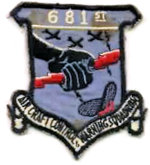
Othello Air Force Station is a closed United States Air Force General Surveillance Radar station. It is located 7.2 miles (11.6 km) south of Othello, Washington. It was the home station of the 637th Aircraft Control and Warning Squadron and the 637th Air Defense Group, closing in 1975.

<span class="mw-page-title-main">Blaine Air Force Station</span> Closed United States Air Force General Surveillance Radar station

Blaine Air Force Station is a closed United States Air Force General Surveillance Radar station. It is located 5.5 miles (8.9 km) south of Blaine, Washington. It was closed in 1979.

Makah Air Force Station is a closed United States Air Force General Surveillance Radar station. It is located 2.4 miles (3.9 km) south of Neah Bay, Washington. It was closed in 1988 by the Air Force, and turned over to the Federal Aviation Administration (FAA).

Naselle Air Force Station is a closed United States Air Force General Surveillance Radar station. It is located 3.9 miles (6.3 km) north of Naselle, Washington. It was decommissioned by the Air Force in 1966 and later used for commercial and recreational uses.

References

Citations

  1. Winkler, David F.; Webster, Julie L. (1997). Searching the skies: The legacy of the United States Cold War Defense Radar Program (PDF). Champaign, IL: US Army Construction Engineering Research Laboratories. p. 22. LCCN   97020912. Archived (PDF) from the original on 29 October 2013.
  2. 1 2 3 "Information for Klamath AFS (Crescent City), CA". Online Air Defense Radar Museum. Retrieved 23 October 2017.
  3. 1 2 3 4 Winkler & Webster, p. 102
  4. Cornett, Lloyd H.; Johnson, Mildred W. (1980). A Handbook of Aerospace Defense Organization, 1946–1980 (PDF). Peterson AFB, CO: Office of History, Aerospace Defense Center. p. 167. Archived from the original (PDF) on 13 February 2016. Retrieved 14 December 2011.

Bibliography

PD-icon.svg This article incorporates public domain material from the Air Force Historical Research Agency