Olathe Air Force Station

Last updated
Olathe Air Force Station
Air Defense Command.svg
Part of Air Defense Command (ADC)
USA Kansas location map.svg
Red pog.svg
Olathe AFS
Location of Olathe AFS, Kansas
Coordinates 38°50′06″N094°54′16″W / 38.83500°N 94.90444°W / 38.83500; -94.90444 (Olathe AFS P-72) Coordinates: 38°50′06″N094°54′16″W / 38.83500°N 94.90444°W / 38.83500; -94.90444 (Olathe AFS P-72)
TypeAir Force Station
CodeADC ID: P-72, NORAD ID: Z-72
Site information
Controlled byFlag of the United States Air Force.svg  United States Air Force
Site history
Built1951
In use1951–1968
Garrison information
Garrison738th Aircraft Control and Warning (later Radar) Squadron
Map all coordinates using: OpenStreetMap  
Download coordinates as: KML

Olathe Air Force Station is a former United States Air Force radar station that was located in Gardner, Kansas. It was located next to Naval Air Station Olathe, now the grounds of New Century AirCenter.

Contents

History

In 1950 the United States Air Force Air Defense Command selected Olathe NAS as a site for one of twenty-eight radar stations built as part of the second segment of the permanent ADC general radar surveillance network for the United States. Prompted by the start of the Korean War, on July 11, 1950, the Secretary of the Air Force asked the Secretary of Defense for approval to expedite construction of the second segment of the permanent network. Olathe was to provide defense radar coverage of the Kansas City area.

Receiving the Defense Secretary's approval on July 21, the Air Force directed the Army Corps of Engineers to proceed with construction of a radar station on the western part of the ground station, about a mile from the runway and ramp/hangars being used by the Navy. Additional housing units were also constructed at Olathe to accommodate the Air Force personnel. The Federalized Utah Air National Guard 130th Aircraft Control and Warning Squadron was assigned to the site on 1 June 1951 at the facilities of the 2472d Air Force Reserve Training Command, and initially the station functioned as a Ground control intercept (GCI) and warning station. As a GCI station, the squadron's role was to guide interceptor aircraft toward unidentified intruders picked up on the unit's radar scopes. It was relieved from active duty and returned to control of the State of Utah on 1 February 1953.

The Ground Air Transmitting Receiving (GATR) Site for communications was located at 38°50′27″N094°54′19″W / 38.84083°N 94.90528°W / 38.84083; -94.90528 (Ajo AS GATR) , approximately 0.4 miles north from the main site. Normally the GATR site was connected by a pair of buried telephone cables, with a backup connection of dual telephone cables overhead. The Coordinate Data Transmitting Set (CDTS) (AN/FST-2) at the main site converted each radar return into a digital word which was transmitted by the GATR via microwave to the Control Center.

The national guardsmen were replaced by the 738th Aircraft Control and Warning Squadron (AC&W) was activated at was designated by ADC as Olathe Air Force Station, being designated P-72. The squadron began operations in using AN/CPS-4 and AN/FPS-3 radars. The AN/CPS-4 soon was replaced by an AN/FPS-4 set that in turn was superseded by a pair of AN/FPS-6A sets in 1958. In 1958 this site also replaced the AN/FPS-3 set with an AN/FPS-20 search radar.

Olathe AFS used these radars in conjunction with the Nike missile Army Air-Defense Command Post (AADCP) KC-65DC (1959–1969). [1]

In 1958, the United States Army established an Air-Defense Command Post (AADCP) KC-65DC with the Air Force radar station at Olathe for Nike missile command-and-control functions as part of the Kansas City Defense Area. The site was equipped with the AN/GSG-5(V) BIRDIE solid-state computer system. The Army radars were fully integrated with the Air Force network, and both Army and Air Force personnel operated the radars.

In addition to the main facility, Olathe AFS operated the AN/FPS-14 Gap Filler site:

In late 1959 this station was also performing air-traffic-control duties for the Federal Aviation Administration (FAA). In the early 1960s the search radar was upgraded and redesignated as an AN/FPS-66. During late January 1961 Olathe AFS joined the Semi Automatic Ground Environment (SAGE) system, feeding data to DC-22 at Sioux City AFS, Iowa. After joining, the squadron was re-designated as the 793d Radar Squadron (SAGE) on 1 February 1962.

The radar squadron provided information 24/7 the SAGE Direction Center where it was analyzed to determine range, direction altitude speed and whether or not aircraft were friendly or hostile. On 31 July 1963, the site was redesignated as NORAD ID Z-72. Over the years, the equipment at the station was upgraded or modified to improve the efficiency and accuracy of the information gathered by the radars.

In September 1968 the Air Force inactivated the 738th Radar Squadron due to budget reductions and a general phase-down of Air Defense Command. The Army inactivated the Nike-Hercules AADCP in 1969 [2] [3] [4]

See also

Related Research Articles

Point Arena Air Force Station is a closed United States Air Force General Surveillance Radar station. It is located 3.7 miles (6.0 km) east of Point Arena, California. It was closed in 1998 by the Air Force, and turned over to the Federal Aviation Administration (FAA).

<span class="mw-page-title-main">Ground Equipment Facility J-33</span> Federal Aviation Administration (FAA) radar station

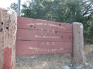
Ground Equipment Facility J-33 is a Federal Aviation Administration (FAA) radar station of the Joint Surveillance System's Western Air Defense Sector (WADS) with an Air Route Surveillance Radar (ARSR-4). The facility was previously a USAF general surveillance radar station during the Cold War.

<span class="mw-page-title-main">Finley Air Force Station</span> Former US Air Force radar station

Finley Air Force Station is a closed United States Air Force General Surveillance Radar station. It is located 1.5 miles (2.4 km) west-northwest of Finley, North Dakota. It was closed in 1979 by the Air Force, and turned over to the Federal Aviation Administration (FAA).

Dickinson Air Force Station is a closed United States Air Force General Surveillance Radar station. It is located 3.8 miles (6.1 km) northeast of Dickinson, North Dakota. It was closed in 1965.

Thomasville Air Force Station is a closed United States Air Force General Surveillance Radar station. It is located 1.9 miles (3.1 km) north-northwest of Thomasville, Alabama. It was closed in 1969.

<span class="mw-page-title-main">Tonopah Air Force Station</span> Closed United States Air Force General Surveillance Radar station

Tonopah Air Force Station is a closed United States Air Force General Surveillance Radar station. It is located 1.1 miles (1.8 km) south of Tonopah, Nevada. It was closed in 1970.

Claysburg Air Force Station is a closed United States Air Force General Surveillance Radar station. It is located 6 miles (9.7 km) west of Claysburg, Pennsylvania. It was closed in 1961 due to budget constraints. The unit was eventually moved to Gibbsboro Air Force Station (RP-63), New Jersey.

Bedford Air Force Station is a closed United States Air Force General Surveillance Radar station. It is located 12.7 miles (20.4 km) north of Bedford, Virginia. It was closed in 1975.

<span class="mw-page-title-main">Brookfield Air Force Station</span> Closed radar station in Ohio

Brookfield Air Force Station is a closed United States Air Force General Surveillance Radar station. It is located 1.1 miles (1.8 km) south-southeast of Brookfield, Ohio. It was closed in 1959.

Oakdale Air Force Station is a United States Air Force General Surveillance Radar station. It is located 1.3 miles (2.1 km) east of the Pittsburgh suburb of Oakdale, Pennsylvania. It was closed in 1969.

<span class="mw-page-title-main">Belleville Air Force Station</span> Closed United States Air Force General Surveillance Radar station

Belleville Air Force Station is a closed United States Air Force General Surveillance Radar station. It is located 2 miles (3.2 km) southeast of Belleville, Illinois. It was closed in 1968.

<span class="mw-page-title-main">Duncanville Air Force Station</span> Closed United States Air Force radar station

Duncanville Air Force Station is a closed United States Air Force General Surveillance Radar station. It is located on the east side of Duncanville, Texas. It was closed in 1964.

<span class="mw-page-title-main">Eufaula Air Force Station</span>

Eufaula Air Force Station is a closed United States Air Force General Surveillance Radar station. It is located 6.4 miles (10.3 km) west of Eufaula, Alabama. It was closed in 1968.

Omaha Air Force Station is a closed United States Air Force General Surveillance Radar station. It is located 7.5 miles (12.1 km) north of Omaha, Nebraska. It was closed in 1968.

<span class="mw-page-title-main">Finland Air Force Station</span> Closed US Air Force military installation

Finland Air Force Station is a closed United States Air Force General Surveillance Radar station. It is located 2.8 miles (4.5 km) north of Finland, Minnesota. It was closed in 1980.

<span class="mw-page-title-main">Ajo Air Force Station</span> Closed USAF surveillance radar site

Ajo Air Force Station is a closed United States Air Force General Surveillance Radar station. It is located 6.4 miles (10.3 km) northwest of Ajo, Arizona. It was closed in 1969 by the Air Force, and the radar site turned over to the Federal Aviation Administration (FAA).

Boron Air Force Station is a closed United States Air Force General Surveillance Radar station. It is located 6.8 miles (10.9 km) northeast of Boron, California. It was closed by the Air Force in 1975 and turned over to the Federal Aviation Administration (FAA). The radar site is still operated by the FAA as part of the Joint Surveillance System (JSS).

Santa Rosa Island Air Force Station is a closed United States Air Force General Surveillance Radar station. It is located 5.6 miles (9.0 km) south-southwest of Lompoc, California. It was closed in 1968 by the Air Force, and turned over to the Federal Aviation Administration (FAA).

<span class="mw-page-title-main">Blaine Air Force Station</span> Closed United States Air Force General Surveillance Radar station

Blaine Air Force Station is a closed United States Air Force General Surveillance Radar station. It is located 5.5 miles (8.9 km) south of Blaine, Washington. It was closed in 1979.

<span class="mw-page-title-main">Fort Lawton Air Force Station</span>

Fort Lawton Air Force Station is a closed United States Air Force General Surveillance Radar station. It is located on Fort Lawton in the Magnolia neighborhood of northwest Seattle, Washington. The Air Force inactivated its unit in 1963; while the site remained under Army control until 1974. Today the Federal Aviation Administration (FAA) operates the site as part of the Joint Surveillance System (JSS).

References

PD-icon.svg This article incorporates public domain material from the Air Force Historical Research Agency.

  1. Wikimapia: Nike Site KC-65DC
  2. PD-icon.svg This article incorporates public domain material from the Air Force Historical Research Agency.
  3. A Handbook of Aerospace Defense Organization 1946–1980, by Lloyd H. Cornett and Mildred W. Johnson, Office of History, Aerospace Defense Center, Peterson Air Force Base, Colorado
  4. Winkler, David F. (1997), Searching the skies: the legacy of the United States Cold War defense radar program. Prepared for United States Air Force Headquarters Air Combat Command.