Osceola Air Force Station

Last updated

Osceola Air Force Station
Air Defense Command.svg
Part of Air Defense Command (ADC)
Osceola Air Force Station - 22 May 2000.jpg
22 May 2000
USA Wisconsin location map.svg
Red pog.svg
Osceola AFS
Location of Osceola AFS, Wisconsin
Coordinates 45°15′05″N092°38′34″W / 45.25139°N 92.64278°W / 45.25139; -92.64278 (Osceola AFS P-35)
TypeAir Force Station
Site information
Controlled byFlag of the United States Air Force.svg  United States Air Force
Site history
Built1951
In use1951–1975
Garrison information
Garrison674th Aircraft Control and Warning Squadron
674th Radar Squadron emblem 674 Aircraft Control & Warning Sq emblem.png
674th Radar Squadron emblem

Osceola Air Force Station (ADC ID: P-35, NORAD ID: Z-35) is a closed United States Air Force General Surveillance Radar station. It is located 5.6 miles (9.0 km) south-southeast of Osceola, Wisconsin. It was closed in 1975.

Contents

History

In late 1950 Air Defense Command selected the East Farmington, Wisconsin site as one of twenty-eight radar stations built as part of the second segment of the permanent radar surveillance network. Prompted by the start of the Korean War, on July 11, 1950, the Secretary of the Air Force asked the Secretary of Defense for approval to expedite construction of the second segment of the permanent network. Receiving the Defense Secretary's approval on July 21, the Air Force directed the Corps of Engineers to proceed with construction.

Construction of the station began in 1950 and was opened in June 1951. The 674th Aircraft Control and Warning Squadron was assigned and began operating a pair of AN/CPS-6B radars from the site. 261 enlisted and 33 officers were assigned, and initially the station functioned as a Ground-Control Intercept (GCI) and warning station. As a GCI station, the squadron's role was to guide interceptor aircraft toward unidentified intruders picked up on the unit's radar scopes. East Farmington was re-designated as Osceola Air Force Station on 1 December 1953. The radars were retired at the end of the decade as an AN/FPS-7 search radar and two AN/FPS-6A height-finder radars were installed during 1959.

During 1959 Osceola AFS joined the Semi Automatic Ground Environment (SAGE) system, initially feeding data to DC-10 at Duluth AFS, Minnesota. After joining, the squadron was re-designated as the 674th Radar Squadron (SAGE) on 15 July 1959, its direction and control duties taken over by DC-10. The radar squadron provided information 24/7 to Duluth where it was analyzed to determine range, direction altitude speed and whether or not aircraft were friendly or hostile. On 31 July 1963, Osceola was re-designated as NORAD ID Z-35. In addition, the two height-finder radars were modified to AN/FPS-90 sets in 1963. One of the AN/FPS-90 was retired a few years later.

In addition to the main facility, Osceola operated the following AN/FPS-18 Gap Filler sites:

Over the years, the equipment at the station was upgraded or modified to improve the efficiency and accuracy of the information gathered by the radars.

In November 1974 the Air Force announced that Osceola would be closing due to what was called "redundancies with more strategically located radars". The 674th Radar Squadron (SAGE) was inactivated in March 1975 as part of a draw-down of ADC, and was closed on 30 April.

Today, Osceola Air Force Station is used as an Association Retreat Center. Most of the buildings are in use and well-maintained. The former radar towers are still standing.

Air Force units and assignments

Units

674th Radar Squadron
Activated on 8 October 1950
Redesignated 674th Radar Squadron (SAGE) on 15 July 1959
Redesignated 674th Radar Squadron on 1 February 1974
Inactivated 31 March 1975 [1]

Assignments

See also

Related Research Articles

Empire Air Force Station is a former United States Air Force Aerospace Defense Command (ADC) long range radar site located 0.7 miles (1.1 km) south-southeast of Empire, Michigan, in Empire Township. It was closed in 1978 by the Air Force, and turned over to the Federal Aviation Administration (FAA).

<span class="mw-page-title-main">Finley Air Force Station</span> Former US Air Force radar station

Finley Air Force Station is a closed United States Air Force General Surveillance Radar station. It is located 1.5 miles (2.4 km) west-northwest of Finley, North Dakota. It was closed in 1979 by the Air Force, and turned over to the Federal Aviation Administration (FAA).

Claysburg Air Force Station is a closed United States Air Force General Surveillance Radar station. It is located 6 miles (9.7 km) west of Claysburg, Pennsylvania. It was closed in 1961 due to budget constraints. The unit was eventually moved to Gibbsboro Air Force Station (RP-63), New Jersey.

<span class="mw-page-title-main">Antigo Air Force Station</span> Closed United States Air Force General Surveillance Radar station

Antigo Air Force Station is a closed United States Air Force General Surveillance Radar station. It is located 7.5 miles (12.1 km) south-southwest of Antigo, Wisconsin. It was closed in 1977 and is currently classified as a high risk toxic waste site involving groundwater, sediment, soil and surface water.

<span class="mw-page-title-main">Calumet Air Force Station</span> Abandoned Aircraft Control and Warning System located near Calumet, Michigan

Calumet Air Force Station is a closed United States Air Force General Surveillance Radar station. It is located 5.2 miles (8.4 km) east-northeast of Phoenix, Michigan. It was closed in 1988 by the Air Force, and turned over to the Federal Aviation Administration (FAA).

<span class="mw-page-title-main">Brunswick Air Force Station</span> Closed United States Air Force station in Brunswick, Maine

Brunswick Air Force Station is a closed United States Air Force General Surveillance Radar station. It is located 2.5 miles (4.0 km) east-southeast of Brunswick, Maine. It was closed in 1965.

<span class="mw-page-title-main">Caswell Air Force Station</span> Former Air Force radar station

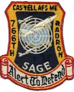
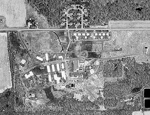
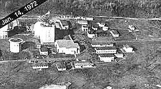
Caswell Air Force Station is a closed United States Air Force General Surveillance Radar station. It is located 4.3 miles (6.9 km) north of Limestone, Maine. It was closed in 1980.

<span class="mw-page-title-main">Kirksville Air Force Station</span> Former US Air Force radar station in Missouri

Kirksville Air Force Station is a closed United States Air Force General Surveillance Radar station. It is located 7.1 miles (11.4 km) north of Kirksville, Missouri. It was closed by the Air Force in 1968. Today the radar site is used by the Federal Aviation Administration (FAA) as a Joint Surveillance System (JSS) site.

<span class="mw-page-title-main">Custer Air Force Station</span> Radar station in Michigan, US 1952–1965

Custer Air Force Station is a closed United States Air Force General Surveillance Radar and Direction Center station. It is located 5.3 miles (8.5 km) west-northwest of Battle Creek, Michigan. It was closed in 1969.

Omaha Air Force Station is a closed United States Air Force General Surveillance Radar station. It is located 7.5 miles (12.1 km) north of Omaha, Nebraska. It was closed in 1968.

<span class="mw-page-title-main">Baudette Air Force Station</span> Closed US Air Force radar station near Baudette, Minnesota

Baudette Air Force Station is a closed United States Air Force General Surveillance Radar station. It is located 3.1 miles (5.0 km) south-southwest of Baudette, Minnesota. It was closed in 1979.

<span class="mw-page-title-main">Finland Air Force Station</span> Radar station in Minnesota, US 1950–1980

Finland Air Force Station is a closed United States Air Force General Surveillance Radar station. It is located 2.8 miles (4.5 km) north of Finland, Minnesota. It was closed in 1980.

<span class="mw-page-title-main">Grand Rapids Air Force Station</span> Closed US military installation

Grand Rapids Air Force Station is a closed United States Air Force General Surveillance Radar station. It is located 0.7 miles (1.1 km) east-northeast of Grand Rapids, Minnesota. It was closed in 1963.

Wadena Air Force Station is a closed United States Air Force General Surveillance Radar station. It is located 7 miles (11 km) north-northeast of Wadena, Minnesota. It was closed in 1970.

<span class="mw-page-title-main">Gettysburg Air Force Station</span> Radar station in South Dakota, US 1956–1965

Gettysburg Air Force Station is a closed United States Air Force General Surveillance Radar station. It is located 2.6 miles (4.2 km) north of Gettysburg, South Dakota. It was closed in 1968.

<span class="mw-page-title-main">Opheim Air Force Station</span> Closed United States Air Force General Surveillance Radar station

Opheim Air Force Station is a closed United States Air Force General Surveillance Radar station. It is located 3.3 miles (5.3 km) west of Opheim, Montana. It was closed in 1979.

Cambria Air Force Station is a closed United States Air Force General Surveillance Radar station. It is 3 miles (4.8 km) south-southeast of Cambria, California. It was closed in 1980.

North Bend Air Force Station is a closed United States Air Force General Surveillance Radar station. It is located 3.9 miles (6.3 km) north-northeast of Hauser, Oregon. It was closed in 1980.

<span class="mw-page-title-main">Blaine Air Force Station</span> Closed United States Air Force General Surveillance Radar station

Blaine Air Force Station is a closed United States Air Force General Surveillance Radar station. It is located 5.5 miles (8.9 km) south of Blaine, Washington. It was closed in 1979.

Houma Air Force Station is a closed United States Air Force General Surveillance Radar station. It is located 3.5 miles (5.6 km) southeast Houma, Louisiana. It was closed in 1970.

References

Notes

Explanatory notes
  1. Approved 24 August 1953.
Citations
  1. 1 2 Cornett & Johnson, p. 159

Bibliography

PD-icon.svg This article incorporates public domain material from the Air Force Historical Research Agency

Further reading