Related Research Articles
Dillingham Airfield is a public and military use airport located two nautical miles (4 km) west of the central business district of Mokulēʻia, in Honolulu County on the North Shore of Oʻahu in the U.S. state of Hawaii. It is operated by the Hawaii Department of Transportation under a 25-year lease from the United States Army. The airport is primarily used for gliding and sky diving operations, and also houses Civil Air Patrol (CAP) glider aircraft. Military operations consist largely of night operations for night vision device training and orientation flights for the United States Air Force Auxiliary (CAP). This airport is included in the Federal Aviation Administration (FAA) National Plan of Integrated Airport Systems for 2017–2021, in which it is categorized as a basic general aviation facility.

South Alabama Regional Airport at Bill Benton Field, formerly known as Andalusia-Opp Airport, is a public use airport in Covington County, Alabama, United States. It is located four nautical miles east of the central business district of Andalusia and about 9 miles (14 km) west of Opp. The airport is governed by the South Alabama Regional Airport Authority, with members appointed by the Andalusia City Council, the Opp Council, and the Covington County Commission.

Monroe County Airport is a county-owned public-use airport located three nautical miles (6 km) south of the central business district of Monroeville, in Monroe County, Alabama, United States. According to the FAA's National Plan of Integrated Airport Systems for 2009–2013, it is categorized as a general aviation facility.

Huntsville Executive Airport, also known as Tom Sharp Jr. Field and formerly Madison County Executive Airport, is a public-use airport in Madison County, Alabama, United States. It is owned by the Executive Flight Center and located eight nautical miles (14.80 km) northeast of the central business district of Huntsville. According to the FAA's National Plan of Integrated Airport Systems for 2009–2013, it is categorized as a general aviation facility.

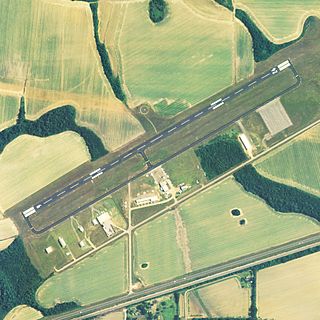
Wetumpka Municipal Airport is a city-owned, public-use airport located six nautical miles west of the central business district of Wetumpka, a city in Elmore County, Alabama, United States. It is included in the FAA's National Plan of Integrated Airport Systems for 2011–2015, which categorized it as a general aviation facility. During World War II the airport, known then as Elmore Auxiliary Field, served as an auxiliary field for Gunter Army Airfield training operations. In 2013 the airport was listed in the Alabama Register of Landmarks and Heritage.
St. Elmo Airport is a public-use airport located two nautical miles west of the central business district of St. Elmo, in Mobile County, Alabama, United States. It is included in the FAA's National Plan of Integrated Airport Systems for 2011–2015, which categorized it as a general aviation facility.
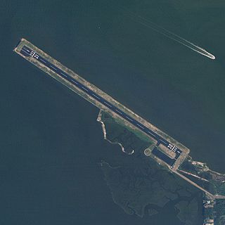
Jeremiah Denton Airport, formerly Dauphin Island Airport, is a county-owned public-use airport in Mobile County, Alabama, United States. It is just northwest of the central business district of Dauphin Island, a town located on a barrier island. The airport is on Mobile Bay, west of the Aloe Bay Channel.

Isbell Field is a city-owned public-use airport located two nautical miles north of the central business district of Fort Payne, a city in DeKalb County, Alabama, United States. According to the FAA's National Plan of Integrated Airport Systems for 2009–2013, it is categorized as a general aviation facility.

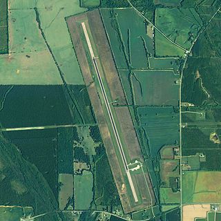
Geneva Municipal Airport is a city-owned public-use airport located two nautical miles north of the central business district of Geneva, a city in Geneva County, Alabama, United States. According to the FAA's National Plan of Integrated Airport Systems for 2009–2013, it is categorized as a general aviation facility.

Grove Hill Municipal Airport was a city-owned public-use airport located two nautical miles southeast of the central business district of Grove Hill, a city in Clarke County, Alabama, United States. According to the FAA's National Plan of Integrated Airport Systems for 2009–2013, it was categorized as a general aviation facility. The airport has been permanently closed.
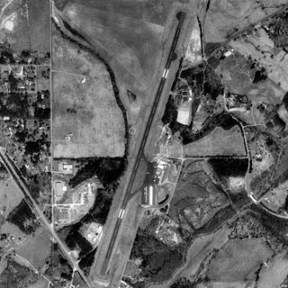
Guntersville Municipal Airport, also known as Joe Starnes Field, is a city-owned public-use airport located three nautical miles northeast of the central business district of Guntersville, a city in Marshall County, Alabama, United States. According to the FAA's National Plan of Integrated Airport Systems for 2009–2013, it is categorized as a general aviation facility.

Lanett Municipal Airport is a city-owned public-use airport located three nautical miles southwest of the central business district of Lanett, a city in Chambers County, Alabama, United States. According to the FAA's National Plan of Integrated Airport Systems for 2009–2013, it is categorized as a general aviation facility.
Vaiden Field Airport is a public-use airport located eight nautical miles southwest of the central business district of Marion, in the community of Vaiden, Perry County, Alabama, United States. It is owned by the Perry County Airport and Industrial Authority.
Robbins Field is a public use airport located five nautical miles northeast of the central business district of Oneonta, a city in Blount County, Alabama, United States. It is owned by the City of Oneonta and Blount County. According to the FAA's National Plan of Integrated Airport Systems for 2009–2013, it is categorized as a general aviation facility.

Scottsboro Municipal Airport, also known as Word Field, is a city-owned public-use airport located two nautical miles (3.7 km) northeast of the central business district of Scottsboro, a city in Jackson County, Alabama, United States. According to the FAA's National Plan of Integrated Airport Systems for 2009–2013, it is categorized as a general aviation facility.
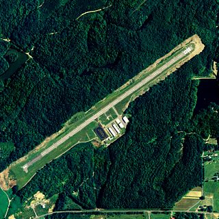
McMinn County Airport is a county-owned, public-use airport located three nautical miles (6 km) southeast of the central business district of Athens, a city in McMinn County, Tennessee, United States.

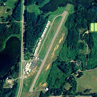
Moontown Airport is a privately owned public-use airport located seven nautical miles east of the central business district of Huntsville, a city in Madison County, Alabama, United States. It is 16 miles (26 km) east of Huntsville International Airport (HSV).
Roy Wilcox Airport is a public use airport in Washington County, Alabama, United States. The airport is owned by the town of Chatom and located three nautical miles (6 km) east of its central business district.
Hazel Green Airport is a privately owned airport, located four nautical miles west of the central business district of Hazel Green, a community in Madison County, Alabama, United States.
Stevenson Airport is a city-owned public-use airport located two nautical miles southwest of the central business district of Stevenson, a city in Jackson County, Alabama, United States.
References
- 1 2 3 4 FAA Airport Form 5010 for 25A PDF . Federal Aviation Administration. Effective 3 June 2010.
- ↑ "Abandoned & Little-Known Airfields: Northeastern Alabama".