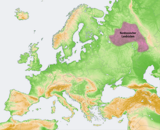
Geography
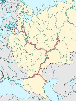
Before modern times most transport was by river. Therefore, much of its history and geography depends on the river system. From the site of Saint Petersburg one route runs south to the Black Sea and a shorter one goes to the headwaters of the Volga. The east–west routes are the Volga, the Sukhona route across the center, a northerly route parallel to the Arctic coast and the Arctic. The Northern Dvina drains the center and flows northeast into the White Sea. In the east the Pechora River flows northwest-north to the Arctic and the Kama River flows southwest to the Volga bend at Kazan.
Trade route from the Varangians to the Greeks: (this was the main axis of Kievan Rus'). From the site of Saint Petersburg (founded in 1703) east up the Neva River to Lake Ladoga, south up the Volkhov River past Staraya Ladoga to Novgorod (founded 860 or before), south across Lake Ilmen and south up the Lovat River. From the Lovat portage to the headwaters of the Western Dvina, portage to the upper Dnieper River and south to Kiev and the Black Sea. From portages around the Lovat one could go west down the Western Dvina to Riga or east to the upper Volga River.
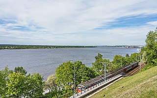
Volga–Baltic Waterway: Gulf of Finland, Neva River to Lake Ladoga, then northeast up the Svir River to Lake Onega, southeast up the Vytegra River, portage, down the Kovzha River to Lake Beloye and southeast down the Sheksna River to Rybinsk at the northernmost point of the Volga River. Today the entire route is canalized and the lower Sheksna is part of the Rybinsk Reservoir. The Northern Dvina Canal branches northeast to the Sukhona River (next section).
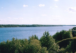
The Sukhona route and Veliky Ustyug: This route crosses the center along the Sukhona and Vychegda Rivers which join near Veliky Ustyug and links Novgorod to the Kama River and Kazan. From Veliky Ustyug one can go west up the Sukhona, east up the Vychegda, northwest down the Northern Dvina to the White Sea, or south up the Yug River and down the Unzha River to the Volga and Kazan. From the upper Sheksna south of Lake Beloye, portage to the ? river and downstream to Lake Kubenskoye. (This is now the Northern Dvina Canal. Vologda is just south of lake Kubenskoye.) From Lake Kubenskoye east northeast down the Sukhona River about 400 km to Veliky Ustyug where the Yug River comes in from the south. The river now gains the name of Northern Dvina and flows about 60 km northeast to the modern town of Kotlas where the Vychegda River comes in from the east. From Kotlas east at least 400 km up the Vychegda to its headwaters west of the Urals. From here portage north to the Pechora or south to the Kama, both of which lead to passes over the Urals.
Northern East–West route: This was the main axis of Novgorod's expansion. It skirts the southeast side of the White Sea and then crosses to the Pechora. Lake Onega, east up the Vodla River, portage to the Onega River basin, east across this, portage, down the Northern Dvina to Kholmogory near the White Sea, east up the Pinega River, portage to the Kuloy and north to the Mezen Bay of the White Sea. East up the Pyoza River, portage, down the Tsilma River to the west-flowing part of the Pechora.
Pechora River and Ural passes: 1. From the northern east–west route up the west-flowing part of the Pechora River, up the Usa River, over the easy Kamen portage of the Urals and down the short Sob River to the lower Ob River. 2. From the middle Pechora, up the Shchugor River, over either of two Ural passes and down the Northern Sosva to the Ob. 3. From the upper Pechora, over the Urals and down the Pelym River. 4. From the headwaters of the Vychegda to branches of the upper Kama River, across the middle Urals and down branches of the Tavda River to Tobolsk on the Ob.
North–South routes: 1. From Kazan northeast up the Kama River, portage to the Pechora or Vyshegda. 2. From Kazan up the Volga past Nizhny Novgorod to the point where the river turns from east to south, north up the Unzha River, portage, down the Yug River to Veliky Ustyug. 3. From the middle Vychegda, north up the Vym River, portage, east down the Ukhta River, north up the Izhma River to the Pechora. 4. From Moscow one route was northwest up the Moskva River to Volokolamsk and down the Lama River and Shosha River to the Volga. This was replaced by the current Moscow Canal further east.
The Kama is a 1,805-kilometre (1,122 mi) long river in Russia. It has a drainage basin of 507,000 square kilometres (196,000 sq mi). It is the longest left tributary of the Volga and the largest one in discharge. At their confluence, in fact, the Kama is even larger than the Volga.

The Northern Dvina is a river in northern Russia flowing through Vologda Oblast and Arkhangelsk Oblast into the Dvina Bay of the White Sea. Along with the Pechora River to the east, it drains most of Northwest Russia into the Arctic Ocean. It should not be confused with the Western Dvina.

Vologda Oblast is a federal subject of Russia. Its administrative center is Vologda. The oblast has a population of 1,202,444. The largest city is Cherepovets, the home of the Severstal metallurgical plant, the largest industrial enterprise in the oblast.

Arkhangelsk Oblast is a federal subject of Russia. It includes the Arctic archipelagos of Franz Josef Land and Novaya Zemlya, as well as the Solovetsky Islands in the White Sea. Arkhangelsk Oblast also has administrative jurisdiction over the Nenets Autonomous Okrug (NAO). Including the NAO, Arkhangelsk Oblast has an area of 587,400 square kilometres (226,800 sq mi), it's the largest of first-level administrative divisions in Europe. Its population was 1,227,626 as of the 2010 Census.

The Pechora is the sixth-longest river in Europe. Flowing from Northwest Russia and into the Arctic Ocean, it lies mostly in the Komi Republic but the northernmost part crosses the Nenets Autonomous Okrug.
The Vychegda is a river in the European part of Russia, a tributary of the Northern Dvina. Its length is about 1,100 kilometres (680 mi). Its source is approximately 310 kilometres (190 mi) west of the northern Ural Mountains. It flows roughly in a western direction, through the Komi Republic and Arkhangelsk Oblast. The largest city along the Vychegda is Syktyvkar, the capital of the Komi Republic. The Viled, the Yarenga, and the Vym are among its main tributaries. The Vychegda flows into the Northern Dvina in Kotlas.

The Yug is a river in Kichmengsko-Gorodetsky, Nikolsky, and Velikoustyugsky Districts of Vologda Oblast and in Podosinovsky District of Kirov Oblast in Russia. It is 574-kilometer (357 mi) long, and the area of its basin is 35,600 square kilometers (13,700 sq mi). The Yug joins the Sukhona near the town of Veliky Ustyug, forming the Northern Dvina, one of the biggest rivers of European Russia.
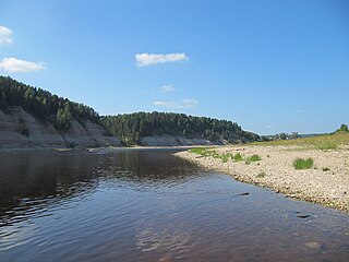
The Sukhona is a river in the European part of Russia, a tributary of the Northern Dvina. The course of the Sukhona lies in Ust-Kubinsky, Sokolsky, Mezhdurechensky, Totemsky, Tarnogsky, Nyuksensky, and Velikoustyugsky Districts of Vologda Oblast in Russia. It is 558 kilometres (347 mi) long, and the area of its basin 50,300 square kilometres (19,400 sq mi). The Sukhona joins the Yug near the town of Veliky Ustyug, forming the Northern Dvina, one of the biggest rivers of European Russia.

The Mezen is a river in Udorsky District of the Komi Republic and in Leshukonsky and Mezensky Districts of Arkhangelsk Oblast in Russia. Its mouth is located in the Mezen Bay of the White Sea. Mezen is one of the biggest rivers of European Russia. It is 857 kilometres (533 mi) long, and the area of its basin 78,000 square kilometres (30,000 sq mi). The principal tributaries of the Mezen are the Bolshaya Loptyuga (left), the Pyssa (left), the Mezenskaya Pizhma (right), the Sula (right), the Kyma (right), the Vashka (left), the Pyoza (right), and the Kimzha (left).

The trade route from the Varangians to the Greeks was a medieval trade route that connected Scandinavia, Kievan Rus' and the Eastern Roman Empire. The route allowed merchants along its length to establish a direct prosperous trade with the Empire, and prompted some of them to settle in the territories of present-day Belarus, Russia and Ukraine. The majority of the route comprised a long-distance waterway, including the Baltic Sea, several rivers flowing into the Baltic Sea, and rivers of the Dnieper river system, with portages on the drainage divides. An alternative route was along the Dniester river with stops on the western shore of Black Sea. These more specific sub-routes are sometimes referred to as the Dnieper trade route and Dniester trade route, respectively.

Veliky Ustyug is a town in Vologda Oblast, Russia, located in the northeast of the oblast at the confluence of the Sukhona and Yug Rivers. As of the 2010 Census, its population was 31,665.

The Volga–Baltic Waterway (Волгобалт), formerly known as the Mariinsk Canal System, is a series of canals and rivers in Russia which link the Volga with the Baltic Sea via the Neva. Like the Volga–Don Canal, it connects the biggest lake on Earth, the Caspian Sea, to the World Ocean. Its overall length between Cherepovets and Lake Onega is 368 kilometres (229 mi).
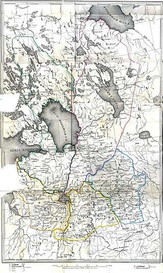
The administrative division of Novgorod Republic is not definitely known; the country was divided into several tysyachas and volosts. The city of Novgorod with its vicinity, as well as a few other towns were not part of any of those. Pskov achieved an autonomy from Novgorod in the 13th century; its independence was confirmed by the Treaty of Bolotovo in 1348. After the fall of the republic, Novgorod Land, as part of Muscovy, consisted of 5 pyatinas that were further divided into uyezds and pogosts. This division was replaced only in the beginning of 18th century when Peter I introduced guberniyas.

Nikolsky District is an administrative and municipal district (raion), one of the twenty-six in Vologda Oblast, Russia. It is located in the southeast of the oblast and borders with Kichmengsko-Gorodetsky District in the north, Vokhomsky District of Kostroma Oblast in the east, Pavinsky, Pyshchugsky, Mezhevskoy, and Kologrivsky Districts of Kostroma Oblast in the south, Babushkinsky District in the southwest, and with Nyuksensky District in the west. The area of the district is 7,476 square kilometers (2,886 sq mi). Its administrative center is the town of Nikolsk. Population: 22,414 (2010 Census); 26,461 ; 31,437 (1989 Census). The population of Nikolsk accounts for 38.0% of the district's total population.

Nyuksensky District is an administrative and municipal district (raion), one of the twenty-six in Vologda Oblast, Russia. It is located in the northeast of the oblast and borders with Ustyansky District of Arkhangelsk Oblast in the north, Velikoustyugsky District in the east, Kichmengsko-Gorodetsky District in the southeast, Babushkinsky District in the south, Totemsky District in the southwest, and with Tarnogsky District in the west. The area of the district is 5,167.42 square kilometers (1,995.15 sq mi). Its administrative center is the rural locality of Nyuksenitsa. District's population: 9,777 (2010 Census); 11,714 ; 13,287 (1989 Census). The population of Nyuksenitsa accounts for 43.7% of the district's total population.

Velikoustyugsky District is an administrative and municipal district (raion), one of the twenty-six in Vologda Oblast, Russia. It is located in the northeast of the oblast and borders with Kotlassky District of Arkhangelsk Oblast in the north, Luzsky District of Kirov Oblast in the east, Podosinovsky District of Kirov Oblast in the southeast, Kichmengsko-Gorodetsky District in the south, Nyuksensky District in the west, and with Ustyansky District of Arkhangelsk Oblast in the northwest. The area of the district is 7,700 square kilometers (3,000 sq mi). Its administrative center is the town of Veliky Ustyug. Population: 18,087 (2010 Census); 22,210 ; 26,146 (1989 Census).
The Northern Ridge, Northern Uvaly, Severnyye Uvaly, is the chain of hills in the northern part of the East European Plain in Russia. The Northern Ridge divides the river basins of the Northern Dvina River (north) and the Volga River (south). The chain is located roughly in the west–east direction, between the source of the Kostroma River and the sources of the Vychegda River and the Kama River. The Northern Ridge is approximately 200 km long. Roughly, the chain is limited from the north by the valleys of the Sukhona and the Vychegda, and from the south by the course of the Volga in the west and by the course of the Kama in the east.
The Unified Deep Water System of European Russia or UDWS is a system of inland waterways in Russia linking the White Sea, the Baltic Sea, the Volga River, Moscow, the Caspian Sea and—via the Sea of Azov—the Black Sea. In 2010, UDWS carried 70 million tons of cargo and 12 million passengers, making up two-thirds of overall inland waterway traffic volume in Russia. There are 60 common-use ports and quays in the UDWS, including three international ports, so Moscow is sometimes called "the port of the five seas".
