Old Red Sandstone

Last updated
Old Red Sandstone
Stratigraphic range: Late Silurian  earliest Carboniferous 419–358  Ma
Folded Old Red Sandstone at St Annes Head - geograph.org.uk - 629204.jpg
Folded Old Red Sandstone rock formation at St Ann's Head in Pembrokeshire, Wales
Type Supergroup
Sub-unitsSee text
ThicknessMore than 4 km (2.5 mi) (Shetland)
Lithology
Primary Sandstone
Other Conglomerate, shale, mudstone, siltstone, limestone
Location
Region North Atlantic
CountryCanada, Greenland, Ireland, Norway, United Kingdom
Extent700 km (430 mi) [1]
Hutton's angular unconformity at Siccar Point where 370-million-year-old Devonian Old Red Sandstone overlies 435-million-year-old Silurian greywacke. Siccar point SE cliff.jpg
Hutton's angular unconformity at Siccar Point where 370-million-year-old Devonian Old Red Sandstone overlies 435-million-year-old Silurian greywacke.

Old Red Sandstone, abbreviated ORS, is an assemblage of rocks in the North Atlantic region largely of Devonian age. It extends in the east across Great Britain, Ireland and Norway, and in the west along the eastern seaboard of North America. It also extends northwards into Greenland and Svalbard. [3] These areas were a part of the paleocontinent of Euramerica (Laurussia). In Britain it is a lithostratigraphic unit (a sequence of rock strata) to which stratigraphers accord supergroup status [4] and which is of considerable importance to early paleontology. The presence of Old in the name is to distinguish the sequence from the younger New Red Sandstone which also occurs widely throughout Britain.

Contents

Sedimentology

Bedding plane of Old Red Sandstone with quartz and chert pebbles, central England; scale bar is 10 mm OldRedSandstoneBeddingPlane.jpg
Bedding plane of Old Red Sandstone with quartz and chert pebbles, central England; scale bar is 10 mm

The Old Red Sandstone describes a group of sedimentary rocks deposited in a variety of environments in the late Silurian, through the Devonian and into the earliest part of the Carboniferous. The body of rock, or facies, is dominated by terrigenous deposits and conglomerates at its base, and progresses to a combination of dunes, and sediments that may have been laid down in lakes, river, estuaries, and possibly other coastal environments. The Old Red Sandstone was long thought to have been deposited mostly in freshwater, but more recent studies have discovered marine fossils (such as brachiopods) [5] in some locations, its vertebrate fauna also occurs in typically marine environments, [6] and an isotopic study also found significant marine influence in mineralised tissues of its vertebrates. [7] Thus, at least some strata appear to have been deposited on the coast, probably in marginal marine environments.

The familiar red colour of these rocks arises from the presence of iron oxide, but not all the Old Red Sandstone is red or sandstone the sequence also includes conglomerates, mudstones, siltstones and thin limestones and colours can range from grey and green through to red and purple. These deposits are closely associated with the erosion of the Caledonian Mountain chain which was thrown up by the collision of the former continents of Avalonia, Baltica and Laurentia to form the Old Red Sandstone Continent- an event known as the Caledonian Orogeny.

Many fossils are found within the rocks, including early fishes, arthropods and plants. As is typical with terrestrial red beds, the vast majority of the rock is not fossil-bearing; however there are isolated, localized beds within the rock that do contain fossils. Rocks of this age were also laid down in South West England (hence the name 'Devonian'; from Devon) though these are of true marine origin and are not included within the Old Red Sandstone. [1]

Stratigraphy

Since the Old Red Sandstone consists predominantly of rocks of terrestrial origin, it does not generally contain marine fossils which would otherwise prove useful in correlating one occurrence of the rock with another, both between and within individual sedimentary basins. Accordingly, local stage names were devised and these remain in use to some extent today though there is an increasing use of international stage names. Thus in the Anglo-Welsh Basin, there are frequent references to the Downtonian , Dittonian , Breconian and Farlovian stages in the literature. The existence of a number of distinct sedimentary basins throughout Britain has been established. [1]

Orcadian Basin

The Orcadian Basin extends over a wide area of North East Scotland and the neighbouring seas. It encompasses the Moray Firth and adjoining land areas, Caithness, Orkney and parts of Shetland. South of the Moray Firth, two distinct sub-basins are recognized at Turriff and at Rhynie. The sequence is more than 4 kilometres (13,000 ft) thick in parts of Shetland. The main basin is considered to be an intramontane basin resulting from crustal rifting associated with post-Caledonian extension, possibly accompanied by strike-slip faulting along the Great Glen Fault system. [8]

Argyll

There are a scatter of exposures of the Old Red Sandstone around Oban and the Isle of Kerrera on the West Highland coast, this unit is sometimes referred to as the Kerrera Sandstone Formation. The unit is up to 128m thick in its type area and consists of green and red sandstones and conglomerates, typically containing large (10–30 cm or 4–12 in across) elliptical well rounded clasts, accompanied by siltstones, mudstones and limestones. [9] On Kerrera a conglomerate of andesite boulders rests unconformably on Dalradian black, pyritic slates (Easdale Slate) of the Easdale Subgroup. On Oban there is merely an erosional contact incorporating debris of the slate in a basal conglomerate. The ORS around Oban are considered latest Silurian (Pridoli) to earliest Devonian in age. They are interpreted as alluvial fans which filled a depositional basin from the east and northeast. [10] Small outliers occur near Taynuilt and either side of Loch Avich. [11] The deposits are especially obvious on Kerrera where they form the bedrock across half of the island. [12] These are conformably overlain by peperite and the basaltic and andesitic Lorne plateau lavas. The ORS on Kerrera and isolated localities around Oban are known for their fossils, particularly fish. [13]

Old Red Sandstone at Gardenstown, Aberdeenshire Gardenstown Old Red Sandstone - geograph.org.uk - 178600.jpg
Old Red Sandstone at Gardenstown, Aberdeenshire

Midland Valley of Scotland

The Midland Valley graben defined by the Highland Boundary Fault in the north and the Southern Uplands Fault in the south harbours not only a considerable amount of Old Red Sandstone sedimentary rocks but also igneous rocks of this age associated with extensive volcanism. There is a continuous outcrop along the Highland Boundary Fault from Stonehaven on the North Sea coast to Helensburgh and beyond to Arran. A more disconnected series of outcrops occur along the line of the Southern Uplands Fault from Edinburgh to Girvan. Old Red Sandstone often occurs in conjunction with conglomerate formations, one such noteworthy cliffside exposure being the Fowlsheugh Nature Reserve, Kincardineshire.

Scottish borders

A series of outcrops occur from East Lothian southwards through Berwickshire. Hutton's famous unconformity at Siccar Point occurs within this basin - see History of study below.

Anglo-Welsh Basin

This relatively large basin extends across much of South Wales from southern Pembrokeshire in the west through Carmarthenshire into Powys and Monmouthshire and through the southern Welsh Marches, notably into Herefordshire, Worcestershire and Gloucestershire. Outliers in Somerset and north Devon complete the extent of this basin.

With the exception of south Pembrokeshire, all parts of the basin are represented by a range of lithologies assigned to the Lower Devonian and to the Upper Devonian, the contact between the two being unconformable and representing the complete omission of any Middle Devonian sequence. The lowermost formations are of upper Silurian age, these being the Downton Castle Sandstone Formation and the overlying Raglan Mudstone Formation except in Pembrokeshire where a more complex series of formations is recognized. In the east of the basin, the top of the Raglan Mudstone is marked by a well-developed calcrete, the Bishop's Frome Limestone. [14] The lowermost Devonian formation is the St Maughans Formation, itself overlain by the Brownstones Formation though with an intervening Senni Formation over much of the area. The Upper Devonian sequence is rather thinner and comprises a series of formations which are more laterally restricted. In the Brecon Beacons, the Plateau Beds Formation is unconformably overlain by the Grey Grits Formation though further east these divisions are replaced by the Quartz Conglomerate Group which is itself subdivided into a variety of different formations.

Lower Old Red Sandstone at Yesnaby, Orkney, cross-bedded aeolian sandstone Yensaby castle 1.JPG
Lower Old Red Sandstone at Yesnaby, Orkney, cross-bedded aeolian sandstone

Pembrokeshire

The sequence in Pembrokeshire differs from that of the main part of the basin and falls into two parts. [15]

In North Pembrokeshire to the north of the Ritec Fault, both the middle and upper ORS are missing with only the lower ORS present; this is divided into an earlier Milford Haven Group comprising in ascending order, the Red Cliff, Sandy Haven and Gelliswick Bay formations and a later Cosheston Group with, again in ascending order, its constituent Llanstadwell, Burton Cliff, Mill Bay, Lawrenny Cliff and New Shipping formations. These respectively equate with the Temeside, Raglan Mudstone and St Maughans formations of the central and eastern part of the basin.

In south Pembrokeshire to the south of the Ritec Fault, the lower ORS is represented by, in ascending order, the Freshwater East, Moors Cliff and Freshwater West formations. These are unconformably overlain by the Ridgeway Conglomerate Formation. The middle ORS is missing whilst the Upper ORS is represented by the Gupton and West Angle formations.

The Freshwater East Formation, and corresponding Red Cliff Formation of north Pembrokeshire, are both late Silurian in age. [16]

Anglesey

A small and separate basin exists here where both alluvial and lacustrine deposits are recorded. Both the middle and upper ORS are missing but the lower ORS is represented, in ascending order, by the Bodafon, Traeth Bach, Porth y Mor and Traeth Lligwy formations. Calcretes are also recorded representing carbonate-rich soils developed between periods of sediment deposition. The present day outcrop occupies a narrow zone from Dulas Bay on Anglesey's northeast coast, southwards to the town of Llangefni. [1] [17]

History of study

In 1787 James Hutton noted what is now known as Hutton's Unconformity at Inchbonny, Jedburgh, and in early 1788 he set off with John Playfair to the Berwickshire coast and found more examples of this sequence in the valleys of the Tower and Pease Burns near Cockburnspath. [18] They then took a boat trip from Dunglass Burn east along the coast with the geologist Sir James Hall of Dunglass and at Siccar Point found what Hutton called "a beautiful picture of this junction washed bare by the sea", [19] where 345-million-year-old Old Red Sandstone overlies 425-million-year-old Silurian greywacke. [2] [20]

In the early 19th century, the paleontology of the formation was studied intensively by Hugh Miller, Henry Thomas De la Beche, Roderick Murchison, and Adam Sedgwick—Sedgwick's interpretation was the one that placed it in the Devonian: he coined the name of that period. The term 'Old Red Sandstone' was originally used in 1821 by Scottish naturalist and mineralogist Robert Jameson to refer to the red rocks which underlay the 'Mountain Limestone' i.e. the Carboniferous Limestone. They were thought at that time to be the British version of Germany's Rotliegendes, which is in fact of Permian age. [1] Many of the science of stratigraphy's early debates were about the Old Red Sandstone.

In older geological works predating theories of plate tectonics, the United States' Catskill Delta formation is sometimes referred to as part of the Old Red Sandstone. In the modern day it is recognized that the two are not stratigraphically continuous but are very similar due to being formed at approximately the same time by the same processes.

Use as a building stone

St. Helen's Chapel at Siccar Point has walls faced in Old Red Sandstone, with greywacke used on the inner face and surrounding drystane dykes Siccar Point, St. Helen's chapel.jpg
St. Helen's Chapel at Siccar Point has walls faced in Old Red Sandstone, with greywacke used on the inner face and surrounding drystane dykes

The Old Red Sandstone has been widely used as a building stone across those regions where it outcrops. Notable examples of its use can be found in the area surrounding Stirling, Stonehaven, Perth and Tayside. The inhabitants of Caithness at the northeastern tip of Scotland also used the stone to a considerable extent. Old Red Sandstone has also frequently been used in buildings in Herefordshire, Monmouthshire and the former Brecknockshire (now south Powys) of south Wales.

Notable buildings

St Magnus Cathedral in Kirkwall, Orkney, constructed of locally quarried sandstone St Magnus Cathedral Kirkwall.jpg
St Magnus Cathedral in Kirkwall, Orkney, constructed of locally quarried sandstone

Canada

England

Scotland

Wales

See also

Related Research Articles

<span class="mw-page-title-main">Unconformity</span> Rock surface indicating a gap in the geological record

An unconformity is a buried erosional or non-depositional surface separating two rock masses or strata of different ages, indicating that sediment deposition was not continuous. In general, the older layer was exposed to erosion for an interval of time before deposition of the younger layer, but the term is used to describe any break in the sedimentary geologic record. The significance of angular unconformity was shown by James Hutton, who found examples of Hutton's Unconformity at Jedburgh in 1787 and at Siccar Point in Berwickshire in 1788, both in Scotland.

The geology of Shropshire is very diverse with a large number of periods being represented at outcrop. The bedrock consists principally of sedimentary rocks of Palaeozoic and Mesozoic age, surrounding restricted areas of Precambrian metasedimentary and metavolcanic rocks. The county hosts in its Quaternary deposits and landforms, a significant record of recent glaciation. The exploitation of the Coal Measures and other Carboniferous age strata in the Ironbridge area made it one of the birthplaces of the Industrial Revolution. There is also a large amount of mineral wealth in the county, including lead and baryte. Quarrying is still active, with limestone for cement manufacture and concrete aggregate, sandstone, greywacke and dolerite for road aggregate, and sand and gravel for aggregate and drainage filters. Groundwater is an equally important economic resource.

<span class="mw-page-title-main">Highland Boundary Fault</span> Geological fault zone crossing Scotland

The Highland Boundary Fault is a major fault zone that traverses Scotland from Arran and Helensburgh on the west coast to Stonehaven in the east. It separates two different geological terranes which give rise to two distinct physiographic terrains: the Highlands and the Lowlands, and in most places it is recognisable as a change in topography. Where rivers cross the fault, they often pass through gorges, and the associated waterfalls can be a barrier to salmon migration.

<span class="mw-page-title-main">Geology of South Wales</span> Overview of geology in South Wales

South Wales is an area with many features of outstanding interest to geologists, who have for long used the area for University field trips.

<span class="mw-page-title-main">Geology of Wales</span> Overview of the geology of Wales

The geology of Wales is complex and varied; its study has been of considerable historical significance in the development of geology as a science. All geological periods from the Cryogenian to the Jurassic are represented at outcrop, whilst younger sedimentary rocks occur beneath the seas immediately off the Welsh coast. The effects of two mountain-building episodes have left their mark in the faulting and folding of much of the Palaeozoic rock sequence. Superficial deposits and landforms created during the present Quaternary period by water and ice are also plentiful and contribute to a remarkably diverse landscape of mountains, hills and coastal plains.

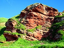
The Orcadian Basin is a sedimentary basin of Devonian age that formed mainly as a result of extensional tectonics in northeastern Scotland after the end of the Caledonian orogeny. During part of its history, the basin was filled by a lake now known as Lake Orcadie. In that lacustrine environment, a sequence of finely bedded sedimentary rocks was deposited, containing well-preserved fish fossils, with alternating layers of mudstone and coarse siltstone to very fine sandstone. These flagstones split easily along the bedding and have been used as building material for thousands of years. The deposits of the Orcadian Basin form part of the Old Red Sandstone (ORS). The lithostratigraphic terms lower, middle and upper ORS, however, do not necessarily match exactly with sediments of lower, middle and upper Devonian age, as the base of the ORS is now known to be in the Silurian and the top in the Carboniferous.

Hutton's Unconformity is a name given to various notable geological sites in Scotland identified by the 18th-century Scottish geologist James Hutton as places where the junction between two types of rock formations can be seen. This geological phenomenon marks the location where rock formations created at different times and by different processes adjoin. For Hutton, such an unconformity provided evidence for his Plutonist theories of uniformitarianism and the age of Earth.

<span class="mw-page-title-main">Geology of Orkney</span>

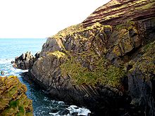
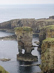
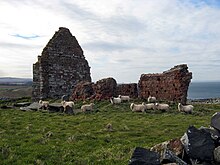
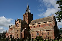
The geology of the Orkney islands in northern Scotland is dominated by the Devonian Old Red Sandstone (ORS). In the southwestern part of Mainland, this sequence can be seen to rest unconformably on a Moinian type metamorphic basement.

The Bishop's Frome Limestone is a rock unit within the Raglan Mudstone Formation of the Old Red Sandstone occurring in the border region between England and South Wales. This limestone is a calcrete, that is to say it originated as a soil during a break in deposition rather than being an original marine deposit. It is perhaps the most significant of all of the calcretes which occur within the uppermost Silurian and lower Devonian sequence of rocks which constitute the Old Red Sandstone of the Anglo-Welsh Basin. It defines the boundary within the basin between the Silurian and the Devonian periods. The rock was formerly known as the Psammosteus Limestone after a characteristic fossil fish recorded from it; Psammosteus anglicus. The fossil remains were subsequently shown to have been wrongly identified and belong in fact to Traquairaspis symondsi. Its modern name derives from the Herefordshire village of Bishop's Frome. Its thickness is variable ranging from 2m up to 8m.

The geology of Monmouthshire in southeast Wales largely consists of a thick series of sedimentary rocks of different types originating in the Silurian, Devonian, Carboniferous, Triassic and Jurassic periods.

<span class="mw-page-title-main">Milford Haven Group</span> Geological formation in Great Britain

The Milford Haven Group is a late Silurian to early Devonian lithostratigraphic group in west Wales. The name is derived from the estuary and town of Milford Haven in south Pembrokeshire. The Group comprises calcareous marls with occasional sandstones along with conglomerates and breccias.

The geology of Morocco formed beginning up to two billion years ago, in the Paleoproterozoic and potentially even earlier. It was affected by the Pan-African orogeny, although the later Hercynian orogeny produced fewer changes and left the Maseta Domain, a large area of remnant Paleozoic massifs. During the Paleozoic, extensive sedimentary deposits preserved marine fossils. Throughout the Mesozoic, the rifting apart of Pangaea to form the Atlantic Ocean created basins and fault blocks, which were blanketed in terrestrial and marine sediments—particularly as a major marine transgression flooded much of the region. In the Cenozoic, a microcontinent covered in sedimentary rocks from the Triassic and Cretaceous collided with northern Morocco, forming the Rif region. Morocco has extensive phosphate and salt reserves, as well as resources such as lead, zinc, copper and silver.

<span class="mw-page-title-main">Geology of Afghanistan</span>

The geology of Afghanistan includes nearly one billion year old rocks from the Precambrian. The region experienced widespread marine transgressions and deposition during the Paleozoic and Mesozoic, that continued into the Cenozoic with the uplift of the Hindu Kush mountains.

The geology of Loch Lomond and The Trossachs National Park in the southwestern part of the Scottish Highlands consists largely of Neoproterozoic and Palaeozoic bedrock faulted and folded and subjected to low grade metamorphism during the Caledonian orogeny. These older rocks, assigned to the Dalradian Supergroup, lie to the northwest of the northeast – southwest aligned Highland Boundary Fault which defines the southern edge of the Highlands. A part of this mountainous park extends south of this major geological divide into an area characterised by younger Devonian rocks which are assigned to the Old Red Sandstone.

The geology of Exmoor National Park in south-west England contributes significantly to the character of Exmoor, a landscape which was designated as a national park in 1954. The bedrock of the area consists almost wholly of a suite of sedimentary rocks deposited during the Devonian, a period named for the English county of Devon in which the western half of the park sits. The eastern part lies within Somerset and it is within this part of the park that limited outcrops of Triassic and Jurassic age rocks are to be found.

This article describes the geology of the Brecon Beacons National Park in mid/south Wales. The area gained national park status in 1957 with the designated area of 1,344 km2 (519 sq mi) including mountain massifs to both the east and west of the Brecon Beacons proper. The geology of the national park consists of a thick succession of sedimentary rocks laid down from the late Ordovician through the Silurian and Devonian to the late Carboniferous period. The rock sequence most closely associated with the park is the Old Red Sandstone from which most of its mountains are formed. The older parts of the succession, in the northwest, were folded and faulted during the Caledonian orogeny. Further faulting and folding, particularly in the south of the park is associated with the Variscan orogeny.

The geology of the Gower Peninsula in South Wales is central to the area's character and to its appeal to visitors. The peninsula is formed almost entirely from a faulted and folded sequence of Carboniferous rocks though both the earlier Old Red Sandstone and later New Red Sandstone are also present. Gower lay on the southern margin of the last ice sheet and has been a focus of interest for researchers and students in that respect too. Cave development and the use of some for early human occupation is a further significant aspect of the peninsula's scientific and cultural interest.

<span class="mw-page-title-main">Hornelen Basin</span> Sedimentary basin in Vestland, Norway

The Hornelen Basin is a sedimentary basin in Vestland, Norway, containing an estimated 25 km stratigraphic thickness of coarse clastic sedimentary rocks of Devonian age. It forms part of a group of basins of similar age along the west coast of Norway between Sognefjord and Nordfjord, related to movement on the Nordfjord-Sogn Detachment. It formed as a result of extensional tectonics as part of the post-orogenic collapse of crust that was thickened during the Caledonian Orogeny towards the end of the Silurian period. It is named for the mountain Hornelen on the northern margin of the basin.

The geology of the Yorkshire Dales National Park in northern England largely consists of a sequence of sedimentary rocks of Ordovician to Permian age. The core area of the Yorkshire Dales is formed from a layer-cake of limestones, sandstones and mudstones laid down during the Carboniferous period. It is noted for its karst landscape which includes extensive areas of limestone pavement and large numbers of caves including Britain's longest cave network.

The geology of Pembrokeshire in Wales inevitably includes the geology of the Pembrokeshire Coast National Park which extends around the larger part of the county's coastline and where the majority of rock outcrops are to be seen. Pembrokeshire's bedrock geology is largely formed from a sequence of sedimentary and igneous rocks originating during the late Precambrian and the Palaeozoic era, namely the Ediacaran, Cambrian, Ordovician, Silurian, Devonian and Carboniferous periods, i.e. between 635 and 299 Ma. The older rocks in the north of the county display patterns of faulting and folding associated with the Caledonian Orogeny. On the other hand, the late Palaeozoic rocks to the south owe their fold patterns and deformation to the later Variscan Orogeny.

References

  1. 1 2 3 4 5 Barclay, W.J. (2005). The Old Red Sandstone of Great Britain. City: Joint Nature Conservation Committee (JNCC). ISBN   978-1-86107-543-7.
  2. 1 2 Cliff Ford (2 September 2003). "Siccar Point". Field Excursion Preview. University of Edinburgh School of GeoSciences. Retrieved 2008-10-20.
  3. Friend, P.F. and Williams, B.P.J. (eds) 2000 New Perspectives on the Old Red Sandstone. Geological Society, London, Special publications 180 p1,35
  4. http://www.bgs.ac.uk/Lexicon/lexicon.cfm?pub=ORS entry in BGS on-line rock lexicon
  5. Goujet, D; Emig, C. C. (1985). "Des Lingula fossiles, indicateurs de modifications de l'environnement dans un gisement du Dévonien inférieur du Spitsberg". Des Lingula fossiles, indicateurs de modifications de l'environnement dans un gisement du Dévonien inférieur du Spitsberg. 301 (13): 945–948. ISSN   0764-4450.
  6. Janvier, Philippe (1 January 2007). "Living Primitive Fishes and Fishes From Deep Time". Fish Physiology. 26. Academic Press: 1–51. doi:10.1016/s1546-5098(07)26001-7. ISBN   978-0-12-373671-0.
  7. Goedert, Jean; Lécuyer, Christophe; Amiot, Romain; Arnaud-Godet, Florent; Wang, Xu; Cui, Linlin; Cuny, Gilles; Douay, Guillaume; Fourel, François; Panczer, Gérard; Simon, Laurent; Steyer, J.-Sébastien; Zhu, Min (June 2018). "Euryhaline ecology of early tetrapods revealed by stable isotopes". Nature. 558 (7708): 68–72. Bibcode:2018Natur.558...68G. doi:10.1038/s41586-018-0159-2. ISSN   1476-4687. PMID   29849142.
  8. Seranne, M. (1992). "Devonian extensional tectonics versus Carboniferous inversion in the northern Orcadian basin". Journal of the Geological Society. 149 (1): 27–37. Bibcode:1992JGSoc.149...27S. CiteSeerX   10.1.1.464.5569 . doi:10.1144/gsjgs.149.1.0027. S2CID   128640763 . Retrieved 2010-02-25.
  9. "Kerrera Sandstone Formation". BGS Lexicon of Named Rock Units. British Geological Survey. Retrieved 31 October 2018.
  10. British Geological Survey 1:50,000 scale geological map sheet 45W (Scotland) Connel 1991
  11. British Geological Survey 1:50,000 scale geological map sheet 37W (Scotland) Furnace 2008
  12. British Geological Survey 1:50,000 scale geological map sheet 44E (Scotland) Lismore 1992
  13. Trewin, N. H.; Gurr, P. R.; Jones, R. B.; Gavin, P. (November 2012). "The biota, depositional environment and age of the Old Red Sandstone of the island of Kerrera, Scotland". Scottish Journal of Geology. 48 (2): 77–90. Bibcode:2012ScJG...48...77T. doi:10.1144/sjg2012-452. ISSN   0036-9276. S2CID   140575299.
  14. "BGS Lexicon of Named Rock Units - Result Details". webapps.bgs.ac.uk.
  15. Barclay, W. J. (2005) in The Old Red Sandstone of Great Britain (W. J. Barclay, M. A. E. Browne, A. A. McMillan, E. A. Pickett, P. Stone and P. R. Wilby) Geological Conservation Review series, No 31 JNCC, Peterborough pp. 212213
  16. Howells, M. F. 2007 British Regional Geology: Wales (Keyworth, Nottingham. British Geological Survey) pp. 100101
  17. British Geological Survey 1:50K special map sheet Anglesey
  18. Keith Montgomery (2003). "Siccar Point and Teaching the History of Geology" (PDF). University of Wisconsin. Retrieved 2008-03-26.
  19. "Hutton's Journeys to Prove his Theory". Archived from the original on 2011-07-26. Retrieved 2018-12-14.
  20. Rance, Hugh (1999). "Hutton's unconformities" (PDF). Historical Geology: The Present is the Key to the Past. QCC Press. Archived from the original (PDF) on 2008-12-03. Retrieved 2008-10-20.
  21. 1 2 3 http://www.museumwales.ac.uk/media/4/9/5/2/Newsletter_5.pdf%5B%5D
  22. BBC. "The Cathedrals of Britain" . Retrieved 4 March 2010.