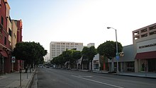
Fairfax Avenue is a street in the north central area of the city of Los Angeles, California, United States. It runs from La Cienega Boulevard in Culver City at its southern end to Hollywood Boulevard in Hollywood on its northern end. From La Cienega Boulevard to Sunset Boulevard, it separates the Westside from the central part of the city along with Venice Boulevard, La Cienega Boulevard, Hauser Boulevard, San Vicente Boulevard, South Cochran Avenue, Wilshire Boulevard, 6th Street, Cochran Avenue, 4th Street, La Brea Avenue, Fountain Avenue and Sunset Boulevard.

Palms is a community in the Westside region of Los Angeles, California, founded in 1886 and the oldest neighborhood annexed to the city, in 1915. The 1886 tract was marketed as an agricultural and vacation community. Today it is a primarily residential area, with many apartment buildings, ribbons of commercial zoning and a single-family residential area in its northwest corner. As of the 2000 census the population of Palms was 42,545.
The Los Angeles Westside is an urban region in western Los Angeles County, California, United States. It has no official definition, but sources like LA Weekly and the Mapping L.A. survey of the Los Angeles Times place the region on the western side of the Los Angeles Basin south of the Santa Monica Mountains.
West Los Angeles is an area within the city of Los Angeles, California, United States. The residential and commercial neighborhood is divided by the Interstate 405 freeway, and each side is sometimes treated as a distinct neighborhood, mapped differently by different sources. Each lies within the larger Westside region of Los Angeles County.

La Cienega Boulevard is a major north–south arterial road in the Los Angeles metropolitan area that runs from El Segundo Boulevard in Hawthorne to the Sunset Strip in West Hollywood to the north. It was named for Rancho Las Cienegas, literally "The Ranch Of The Swamps," an area of marshland south of Rancho La Brea.
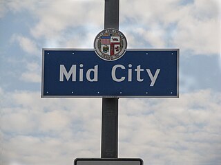
Mid City is a neighborhood in Central Los Angeles, California.

Santa Monica Boulevard is a major west–east thoroughfare in Los Angeles County, California, United States. It runs from Ocean Avenue in Santa Monica near the Pacific Ocean to Sunset Boulevard at Sunset Junction in Los Angeles. It passes through Beverly Hills and West Hollywood. A portion of it is designated as California State Route 2, while the full avenue was Historic Route 66.

South Robertson is an area on the Westside of Los Angeles that is served by the South Robertson neighborhood council. It contains the following city neighborhoods: Beverlywood, Castle Heights, Cheviot Hills, Crestview, La Cienega Heights and Reynier Village. The area is notable as a center for the Jewish community.

San Vicente Boulevard is a major northwest-southeast thoroughfare located in the western portion of the metropolitan area of Los Angeles, CA.

Olympic Boulevard is a major arterial road in Los Angeles, California. It stretches from Ocean Avenue on the western end of Santa Monica to East Los Angeles—farther than Wilshire Boulevard and most other streets.
Pico Boulevard is a major Los Angeles street that runs from the Pacific Ocean at Appian Way in Santa Monica to Central Avenue in Downtown Los Angeles, California, United States. It is named after Pío Pico, the last Mexican governor of Alta California.

Beverly Boulevard is one of the main east–west thoroughfares in Los Angeles, in the U.S. state of California. It begins off Santa Monica Boulevard in Beverly Hills and ends on the Lucas Avenue overpass near downtown Los Angeles to become 1st Street. A separate Beverly Boulevard begins off 3rd Street and Pomona Boulevard in East Los Angeles, runs through Montebello and Pico Rivera, and becomes Turnbull Canyon Road in Whittier near Rose Hills Memorial Park.

Venice Boulevard is a major east–west thoroughfare in Los Angeles, running from the ocean in the Venice district, past the I-10 intersection, into downtown Los Angeles. It was originally known as West 16th Street under the Los Angeles numbered street system.

Doheny Drive is a north–south thoroughfare mostly through Beverly Hills and West Hollywood, in Los Angeles County, California.

Mid-City West is an area in the western part of Central Los Angeles that is served by the Mid City West Neighborhood Council. It contains the neighborhoods of Beverly–Fairfax, Beverly Grove, Burton Way, Carthay Circle, Melrose, Miracle Mile and Park La Brea.

Beverly Drive is a major north–south roadway in Beverly Hills and Los Angeles.
Crestview is a neighborhood in the Westside of the city of Los Angeles, California.
Pico/Rimpau is an area of Mid-City, Los Angeles, at the junction of Pico Boulevard, Rimpau Street, San Vicente Boulevard, Venice Boulevard, Vineyard Avenue and West Boulevard. This area is the location of several key former and current transportation hubs and retail shopping centers for the Los Angeles area.

The Expo Bike Path is a 12-mile-long (19 km) rail with trail bicycle path and pedestrian route in Los Angeles County, California that travels roughly parallel to the Los Angeles Metro Rail's E Line between La Cienega/Jefferson and 17th Street/SMC stations. The Expo Bike Path is one of two major bicycle routes in Los Angeles that share dedicated rights-of-way with public transport, the other being the G Line Bikeway in the San Fernando Valley.