Westside (Los Angeles County)

Last updated
Los Angeles Westside
Region
Location map Western Los Angeles.png
Red pog.svg
Los Angeles Westside
Location within West Los Angeles
Coordinates: 34°02′30″N118°25′31″W / 34.04153°N 118.425392°W / 34.04153; -118.425392
Country United States
State California
County Los Angeles
Cities Los Angeles
Beverly Hills
Culver City
Santa Monica
Malibu
Unincorporated areas Marina del Rey
Ladera Heights

The Los Angeles Westside is an urban region in western Los Angeles County, California, United States. It has no official definition, but sources like LA Weekly and the Mapping L.A. survey of the Los Angeles Times place the region on the western side of the Los Angeles Basin south of the Santa Monica Mountains.

Contents

Geography

LA Weekly

According to the LA Weekly , there are different perspectives on where the Westside ends and the Eastside begins. [1] Generally, the Westside is the area south of the Santa Monica Mountains and Sepulveda Pass, and west of either:

Mapping L.A. boundaries

Los Angeles Times readers submitted more than 300 maps, with borders ranging from Lincoln to La Brea and beyond. The most common east/west dividing lines were: Downtown, La Cienega Boulevard (the most common street cited), and the 405 freeway (the most common answer).

The Times analyzed the results and no one definition approached a majority. Ultimately, the Los Angeles Times Mapping Project settled on a definition comprising 101.28 square miles (262 km2), encompassing not only districts in the city of Los Angeles but also two unincorporated neighborhoods, plus the cities of Beverly Hills, Culver City, and Santa Monica, but excluding all of the city of West Hollywood – even areas west of La Cienega Boulevard. [2]

Neighborhoods and districts

The Westside.
Map by the Los Angeles Times. Map of Westside area, Los Angeles County.png
The Westside.
Map by the Los Angeles Times.

According to the Mapping L.A. survey of the Los Angeles Times the Westside includes all of the below neighborhoods that are part of the city of Los Angeles:

Other cities

The Westside as seen by aircraft departing Los Angeles International Airport Westsidelosangeles.jpg
The Westside as seen by aircraft departing Los Angeles International Airport

Unincorporated areas

Population

In the 2000 census, the Westside (as defined by the Los Angeles Times Mapping Project) had a population of 529,427. In 2000, non-Hispanic whites made up 63% of the population. [2] The areas within the city of Los Angeles that Los Angeles Almanac recognized as part of the Westside had a population of 413,351. [3]

Education

Fifty-three percent of West Los Angeles residents aged 25 and older had earned a 4-year degree by 2000, according to Census Bureau figures quoted by the Los Angeles Times. They included 89,620 people with master's degrees or higher and 117,695 with bachelor's degrees. In addition, 95,187 people in that age range had some college experience. There were 46,823 with high school diplomas but 40,451 who had dropped out before graduating. [2] As of 2019, the median income of the neighborhood was about $96,300.

The Westside is home to the University of California, Los Angeles (UCLA), a public research university in the Westwood neighborhood. It is the second-oldest of the ten campuses of the University of California system. [4] UCLA is considered a flagship campus of the University of California system, along with UC Berkeley. [5] [6] [7] [8] It offers undergraduate and graduate degree programs in a wide range of disciplines. [9] With an approximate enrollment of 28,000 undergraduate and 12,000 graduate students, UCLA is the university with the largest enrollment in the state of California [10] and the most popular university in the United States by number of applicants. [11]

Other post-secondary schools in the Westside are as follows:

Los angeles from getty panorama.jpg
The view from the Getty Center, centered on the Westside as the 405 goes through the Sepulveda Pass in the Santa Monica Mountains and down through the city

See also

Other regions of Los Angeles County

Related Research Articles

<span class="mw-page-title-main">Westwood, Los Angeles</span> Neighborhood of Los Angeles in California, United States

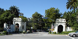
Westwood is a commercial and residential neighborhood in the northern central portion of the Westside region of Los Angeles, California. It is the home of the University of California, Los Angeles (UCLA). Bordering the campus on the south is Westwood Village, a major regional district for shopping, dining, movie theaters, and other entertainment.

<span class="mw-page-title-main">Bel Air, Los Angeles</span> Neighborhood of Los Angeles, California

Bel Air is a residential neighborhood on the Los Angeles Westside, in the foothills of the Santa Monica Mountains in the U.S. state of California. Founded in 1923, it is the home of the Hannah Carter Japanese Garden and the American Jewish University.

<span class="mw-page-title-main">Century City</span> Neighborhood of Los Angeles in California, United States

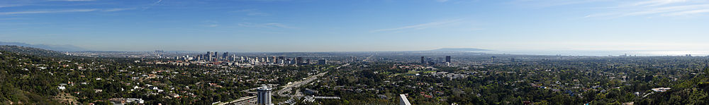
Century City is a 176-acre neighborhood and business district in Los Angeles, California, United States. Located on the Westside to the south of Santa Monica Boulevard around 10 miles (16 km) west of Downtown Los Angeles, Century City is one of the most prominent employment centers in the Los Angeles metropolitan area, and its skyscrapers form a distinctive skyline on the city's westside.

<span class="mw-page-title-main">Palms, Los Angeles</span> Neighborhood of Los Angeles, California,

Palms is a community in the Westside region of Los Angeles, California, founded in 1886 and the oldest neighborhood annexed to the city, in 1915. The 1886 tract was marketed as an agricultural and vacation community. Today it is a primarily residential area, with many apartment buildings, ribbons of commercial zoning and a single-family residential area in its northwest corner. As of the 2000 census the population of Palms was 42,545.

<span class="mw-page-title-main">California State Route 2</span> State highway in California, United States

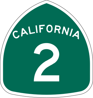
State Route 2 (SR 2) is a state highway in the U.S. state of California. It connects the Los Angeles Basin with the San Gabriel Mountains and the Victor Valley in the Mojave Desert. The highway's southwestern end is at the intersection of Centinela Avenue at the Santa Monica-Los Angeles border and its northeastern end is at SR 138 east of Wrightwood. The SR 2 is divided into four segments, and it briefly runs concurrently with U.S. Route 101 (US 101) and Interstate 210 (I-210). The southwestern section of SR 2 runs along a segment of the east–west Santa Monica Boulevard, an old routing of US 66, to US 101 in East Hollywood; the second section runs along segments of both the north–south Alvarado Street and Glendale Boulevard in Echo Park; the third section to I-210 in Glendale is known as the north–south Glendale Freeway; and the northeastern portion from I-210 in La Cañada Flintridge to SR 138 is designated as the Angeles Crest Highway.

West Los Angeles is an area within the city of Los Angeles, California, United States. The residential and commercial neighborhood is divided by the Interstate 405 freeway, and each side is sometimes treated as a distinct neighborhood, mapped differently by different sources. Each lies within the larger Westside region of Los Angeles County.

<span class="mw-page-title-main">Sawtelle, Los Angeles</span> Unincorporated community in California, United States

Sawtelle is a neighborhood in West Los Angeles, on the Westside of Los Angeles, California. The short-lived City of Sawtelle grew around the Pacific Branch of the National Home for Disabled Volunteer Soldiers, later the Sawtelle Veterans Home, and was incorporated as a city in 1899. Developed by the Pacific Land Company, and named for its manager W. E. Sawtelle, the City of Sawtelle was independent for fewer than 30 years before it was annexed by the City of Los Angeles.

<span class="mw-page-title-main">Rancho Park, Los Angeles</span> Neighborhood of Los Angeles in California, United States

Rancho Park is a residential neighborhood in the Westside of the city of Los Angeles, California with mostly single family homes and tree lined streets. The community is nestled between West Los Angeles and Cheviot Hills. This enclave draws young professionals and families and is home to residents working in a variety of professional occupations. History proves the neighborhood was once a part of Westwood until Olympic Blvd. was placed dividing the area North and South. The Southern section, now known as Rancho Park, felt cut off from its North side lobbying for its own identity in the 1930s.

<span class="mw-page-title-main">La Cienega Boulevard</span> Highway in California

La Cienega Boulevard is a major north–south arterial road in the Los Angeles metropolitan area that runs from El Segundo Boulevard in Hawthorne to the Sunset Strip in West Hollywood to the north. It was named for Rancho Las Cienegas, literally "The Ranch Of The Swamps," an area of marshland south of Rancho La Brea.

<span class="mw-page-title-main">East Hollywood, Los Angeles</span> Neighborhood of Los Angeles in California, United States

East Hollywood is a densely populated neighborhood of 78,000+ residents that is part of the Hollywood area of the central region of Los Angeles, California. It is notable for being the site of Los Angeles City College, Barnsdall Park, and a hospital district. There are seven public and five private schools, a Los Angeles Public Library branch, and three hospitals. Almost two-thirds of the people living there were born outside the United States, and 90% were renters. In 2000, the neighborhood had high percentages of never-married people and single parents.

<span class="mw-page-title-main">Wilshire Boulevard</span> Major thoroughfare in the metropolitan Los Angeles area, United States

Wilshire Boulevard (['wɪɫ.ʃɚ]) is a prominent 15.83 mi (25.48 km) boulevard in the Los Angeles area of Southern California, extending from Ocean Avenue in the city of Santa Monica east to Grand Avenue in the Financial District of downtown Los Angeles. One of the principal east–west arterial roads of Los Angeles, it is also one of the major city streets through the city of Beverly Hills. Wilshire Boulevard runs roughly parallel to Santa Monica Boulevard from Santa Monica to the west boundary of Beverly Hills. From the east boundary, it runs a block south of Sixth Street to its terminus.

<span class="mw-page-title-main">Mid City, Los Angeles</span> Neighborhood of Los Angeles in California, United States of America

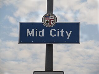
Mid City is a neighborhood in Central Los Angeles, California.

<span class="mw-page-title-main">Santa Monica Boulevard</span> East-west thoroughfare in Los Angeles, California, United States

Santa Monica Boulevard is a major west–east thoroughfare in Los Angeles County, California, United States. It runs from Ocean Avenue in Santa Monica near the Pacific Ocean to Sunset Boulevard at Sunset Junction in Los Angeles. It passes through Beverly Hills and West Hollywood. A portion of it is designated as California State Route 2, while the full avenue was Historic Route 66.

<span class="mw-page-title-main">South Robertson, Los Angeles</span> Neighborhood of Los Angeles in California, United States

South Robertson is an area on the Westside of Los Angeles that is served by the South Robertson neighborhood council. It contains the following city neighborhoods: Beverlywood, Castle Heights, Cheviot Hills, Crestview, La Cienega Heights and Reynier Village. The area is notable as a center for the Jewish community.

<span class="mw-page-title-main">Beverly Glen Boulevard</span> Road in Los Angeles, California

Beverly Glen Boulevard is one of five major routes that connect the Westside of Los Angeles to the San Fernando Valley (the other four are the San Diego Freeway, Sepulveda Boulevard, Laurel Canyon Boulevard, and Coldwater Canyon Avenue.

<span class="mw-page-title-main">Westwood Boulevard</span> Major street in Los Angeles, California

Westwood Boulevard is a street in Los Angeles that runs through the heart of Westwood Village and further south in West Los Angeles.

<span class="mw-page-title-main">University Park, Los Angeles</span> Neighborhood of Los Angeles in California, United States

University Park is a 1.17 square miles (3.0 km2) neighborhood in the South Los Angeles region of Los Angeles, California. It is the home of the University of Southern California (USC), Mount St. Mary's College and Hebrew Union College. Additionally, the neighborhood is the home of the historic Shrine Auditorium.

<span class="mw-page-title-main">Northeast Los Angeles</span> District in Los Angeles, California, United States

Northeast Los Angeles is a 17.18 sq mi (44.5 km2) region of Los Angeles County, comprising seven neighborhoods within Los Angeles. The area is home to Occidental College located in Eagle Rock.

<span class="mw-page-title-main">D Line Extension</span> Rapid transit construction project in Los Angeles, California

The D Line Subway Extension Project, formerly known as the Westside Subway Extension, the Subway to the Sea, and the Purple Line Extension, is a construction project in Los Angeles County, California, extending the rapid transit D Line of the Los Angeles Metro Rail system from its current terminus at Wilshire/Western in Koreatown, Los Angeles, to the Westside region. The project is being supervised by the Los Angeles County Metropolitan Transportation Authority (Metro). The subway has been given high priority by Metro in its long-range plans, and funding for the project was included in two county sales tax measures, Measure R and Measure M.

References

  1. "Eastside vs. Westside: 5 Ways of Looking At It". LA Weekly. April 30, 2013.
  2. 1 2 3 4 Mapping L.A.: Regions. The Westside. Los Angeles Times, Mapping L.A.
  3. "Population," Los Angeles Almanac
  4. "Fall 2008 Admissions Table" (PDF). Retrieved 2012-10-14.
  5. Frammolino, Ralph; Gladstone, Mark; Weinstein, Henry (1996-03-21). "UCLA Eased Entry Rules for the Rich, Well-Connected". Los Angeles Times. Retrieved 2011-05-27. The controversy over private admissions preferences strikes at the heart of the dilemma over how to allocate limited slots for undergraduates. At Berkeley and UCLA, the flagship campuses, the competition is particularly acute, and admissions officers must turn away thousands of qualified applicants each year.
  6. Gordon, Larry (2011-05-09). "University of California weighs varying tuitions at its 10 campuses". L.A. Times. Retrieved 2011-05-17. In contrast, UC has UC Berkeley and UCLA, both often considered flagships, and several other campuses with high national rankings, he and other analysts said
  7. Song, Jason (2007-12-11). "THE NATION; Higher-earning families to get a break at Harvard; Tuition will be slashed to 10% of income for those making $180,000 a year or less, making it cheaper than UCLA". Los Angeles Times. Retrieved 2011-05-20. That means any student that comes from such a family will pay less to attend Harvard than most flagship public universities, including UCLA
  8. "How To Get Into the Nations Most Celebrated Colleges". Los Angeles Magazine. 2005. Retrieved 2011-05-25. The Ivy League Schools and their ilk (Stanford) and the flagship UC campuses dominate their lists...and a few other less competitive UC Campuses (San Diego, Santa Barbara, Irvine) as fall-backs.
  9. Vazquez, Ricardo (2013-01-18). "UCLA sets new undergraduate applications record". UCLA Newsroom. Retrieved 2018-09-24.
  10. "UCLA admits more than 15,000 students for Fall 2012 freshman class". Daily Bruin.
  11. Bartlett, Lauren (2007-01-24). "UCLA Remains the Country's Most Popular University with More Than 50,000 High School Seniors Applying for Fall / UCLA Newsroom". Newsroom.ucla.edu. Retrieved 2012-10-14.

34°02′30″N118°25′31″W / 34.04153°N 118.425392°W / 34.04153; -118.425392