Reynier Village, Los Angeles

Last updated
Reynier Village, Los Angeles
Reynier Village Sign.jpg
"Welcome to Reynier Village" sign located at the intersection of Cadillac & Shenandoah.
Location map Western Los Angeles.png
Red pog.svg
Reynier Village, Los Angeles
Location within Western Los Angeles
Coordinates: 34°02′24″N118°23′05″W / 34.0400406°N 118.3847449°W / 34.0400406; -118.3847449
Country Flag of the United States.svg United States
State Flag of California.svg  California
County Flag of Los Angeles County, California.svg Los Angeles
Time zone Pacific
Zip Code
90034
Area code 310

Reynier Village is a neighborhood on the Westside of Los Angeles, California. The Reynier Village neighborhood was known as Reynier Park in the 1920s and 1930s although the actual city park was not established until the late 1970s. For many years, real estate agents had called the area "Beverlywood adjacent" or "south Robertson" (the name of the neighborhood council, which encompasses several neighborhoods including Reynier Village). [1]

Contents

Geography

Reynier Village is a triangular-shaped neighborhood bordered on the north by Cadillac Avenue; on the west by Robertson Boulevard; and on the southeast by Kramerwood Place, the 10 Freeway, and Garth Avenue. [2] [1] The Reynier Park operated by the City of Los Angeles Parks and Recreation Department is bounded by Reynier Avenue, Olin, Shenandoah Street, and Hargis. [3] Councilman Zev Yaroslavsky advocated for the creation of the park in 1978. [3]

Reynier Village is south of La Cienega Heights and southwest of Faircrest Heights.

The Los Angeles Times' Mapping L.A. project places Reynier Village is in the larger neighborhood of Mid-City. [4] However, according to the Reynier Village neighborhood association, the village is in Zone 5 of the South Robertson neighborhood. [1] [5]

History

Reynier Park (2023) Los Angeles neighborhood photos 2023-16.jpg
Reynier Park (2023)

According to locals, the subdivision was named after a family whose home stood on what it now the city-maintained Reynier Park at 2803 Reynier Avenue. [1] [6]

The residential subdivision was developed about 1921 by a real estate company. [1] The Reynier Park Improvement Association was affiliated with five other neighborhood groups in 1927. [7] In 1929 the association was vocally opposed to an increase in Pacific Electric streetcar fares, especially on the neighboring Venice Short Line. [8] In 1930 the group requested public fire alarm boxes for "for that section from National boulevard to Pico boulevard and extending from Venice boulevard to the hills west of Robertson bouleyard in the district of Raynier Park". [9] In 1931 the group was advocating for the channelization of Ballona Creek. [10] In 1934 the newly constructed Benedict Canyon creek storm drain alleviated previously common street flooding "kept the area in Palms and Reynier Park near the Alexander Hamilton high school comparatively dry" and thus Culver City buses were rerouted to Robertson instead of Washington during the rains. [11]

Rocha House

A well-preserved 1 1/2 -story adobe in the heart of this small West Los Angeles neighborhood speaks to its early days as part of the Rancho Rincon de los Bueyes (which means "corner of the oxen"). Built in 1865 by Antonio Jose Rocha II, the privately occupied residence at 2400 Shenandoah St. in 1963 became Los Angeles' 13th historic-cultural monument. [1]

Rocha House, the 13th Los Angeles Historic-Cultural Monument, is located in the village. [12]

Services

Shenandoah Street School is located in Reynier Village. [12] The neighborhood is served by the Robertson branch of the Los Angeles Public Library.

Reynier Park makes an appearance in Paul Beatty's 2003 Los Angeles novel The White-Boy Shuffle . [13]

Notes and references

  1. 1 2 3 4 5 6 Groves, Martha (February 26, 2006). "Spanish style still defines central pocket". Los Angeles Times . Retrieved September 15, 2020.
  2. "Reynier Village Neighborhood Association Map" . Retrieved 3 July 2018.
  3. 1 2 "Way Cleared for West L.A. Park Site". The Los Angeles Times. 1978-07-23. p. 583. Retrieved 2023-11-04.
  4. Location of Reynier Village on Mapping L.A., Los Angeles Times
  5. Reynier Village Neighborhood Association
  6. "REYNIER PARK". City of Los Angeles Department of Recreation and Parks. Retrieved 2020-09-16.
  7. "Form United Western L.A. Association". Evening Vanguard. 1927-09-29. p. 1. Retrieved 2023-11-04.
  8. "Street Car Fares Asked by Chamber". Evening Vanguard. 1929-04-18. p. 10. Retrieved 2023-11-04.
  9. "Fire Protection Asked". Los Angeles Evening Express. 1930-04-17. p. 15. Retrieved 2023-11-04.
  10. "Move to obtain federal aid for flood control". Evening Vanguard. 1931-11-14. p. 1. Retrieved 2023-11-04.
  11. "Storm drains". Evening Vanguard. 1934-01-04. p. 1. Retrieved 2023-11-04.
  12. 1 2 Kitazawa, Yosuke (September 10, 2012). "Reynier Village". KCET . Retrieved September 15, 2020.
  13. Beatty, Paul (2014-12-23). The White Boy Shuffle. Picador. p. 39. ISBN   978-1-4668-8782-4.

Related Research Articles

<span class="mw-page-title-main">Fairfax Avenue</span> Street in the city of Los Angeles, California

Fairfax Avenue is a street in the north central area of the city of Los Angeles, California, United States. It runs from La Cienega Boulevard in Culver City at its southern end to Hollywood Boulevard in Hollywood on its northern end. From La Cienega Boulevard to Sunset Boulevard, it separates the Westside from the central part of the city along with Venice Boulevard, La Cienega Boulevard, Hauser Boulevard, San Vicente Boulevard, South Cochran Avenue, Wilshire Boulevard, 6th Street, Cochran Avenue, 4th Street, La Brea Avenue, Fountain Avenue and Sunset Boulevard.

<span class="mw-page-title-main">Hancock Park, Los Angeles</span> Neighborhood of Los Angeles in California, United States

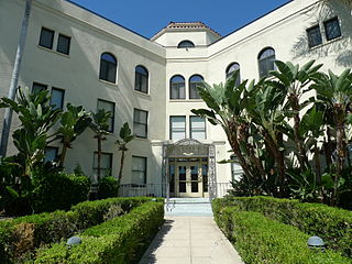
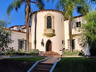
Hancock Park is a neighborhood in the Wilshire area of Los Angeles, California. Developed in the 1920s, the neighborhood features architecturally distinctive residences, many of which were constructed in the early 20th century. Hancock Park is covered by a Historic Preservation Overlay Zone (HPOZ).

<span class="mw-page-title-main">Eagle Rock, Los Angeles</span> Neighborhood of Los Angeles in California, United States of America

<span class="mw-page-title-main">Los Feliz, Los Angeles</span> Neighborhood of Los Angeles in California, United States

Los Feliz is a hillside neighborhood in the greater Hollywood area of Los Angeles, California, abutting Hollywood and encompassing part of the Santa Monica Mountains. The neighborhood is named after the Feliz family of Californios who had owned the area since 1795, when José Vicente Feliz was granted Rancho Los Feliz.

<span class="mw-page-title-main">Palms, Los Angeles</span> Neighborhood of Los Angeles, California,

Palms is a community in the Westside region of Los Angeles, California, founded in 1886 and the oldest neighborhood annexed to the city, in 1915. The 1886 tract was marketed as an agricultural and vacation community. Today it is a primarily residential area, with many apartment buildings, ribbons of commercial zoning and a single-family residential area in its northwest corner. As of the 2000 census the population of Palms was 42,545.

Beverlywood is a neighborhood in the Westside of the city of Los Angeles, California.

West Los Angeles is an area within the city of Los Angeles, California, United States. The residential and commercial neighborhood is divided by the Interstate 405 freeway, and each side is sometimes treated as a distinct neighborhood, mapped differently by different sources. Each lies within the larger Westside region of Los Angeles County.

<span class="mw-page-title-main">West Adams, Los Angeles</span> Neighborhood of Los Angeles in California, United States

West Adams is a historic neighborhood in the South Los Angeles region of Los Angeles, California. The area is known for its large number of historic buildings, structures and notable houses and mansions.

<span class="mw-page-title-main">Baldwin Hills, Los Angeles</span> Neighborhood of Los Angeles in California, United States

Baldwin Hills is a neighborhood within the South Los Angeles region of Los Angeles, California. It is often referred to as the Black Beverly Hills.

<span class="mw-page-title-main">Larchmont, Los Angeles</span> Neighborhood of Los Angeles in California, United States

Larchmont is a half-square-mile neighborhood in the central region of the City of Los Angeles, California. It has three schools and one small park. It has been the site of early and recent motion picture shoots.

<span class="mw-page-title-main">Jefferson Park, Los Angeles</span> Neighborhood of Los Angeles in California, United States

Jefferson Park is a neighborhood in the South region of the City of Los Angeles, California. There are five Historic-Cultural Monuments in the neighborhood. In 1987, the Jefferson branch library was added to the National Register of Historic Places.

<span class="mw-page-title-main">Wilshire Boulevard</span> Major thoroughfare in the metropolitan Los Angeles area, United States

Wilshire Boulevard (['wɪɫ.ʃɚ]) is a prominent 15.83 mi (25.48 km) boulevard in the Los Angeles area of Southern California, extending from Ocean Avenue in the city of Santa Monica east to Grand Avenue in the Financial District of downtown Los Angeles. One of the principal east–west arterial roads of Los Angeles, it is also one of the major city streets through the city of Beverly Hills. Wilshire Boulevard runs roughly parallel to Santa Monica Boulevard from Santa Monica to the west boundary of Beverly Hills. From the east boundary, it runs a block south of Sixth Street to its terminus.

Mid-Wilshire is a neighborhood in the central region of Los Angeles, California. It is known for the Los Angeles County Museum of Art, the Petersen Automotive Museum, and the Miracle Mile shopping district.

<span class="mw-page-title-main">Faircrest Heights, Los Angeles</span> Neighborhood of Los Angeles

Faircrest Heights is a neighborhood in Mid-City, Los Angeles, California.

<span class="mw-page-title-main">Mid City, Los Angeles</span> Neighborhood of Los Angeles in California, United States of America

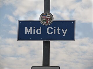
Mid City is a neighborhood in Central Los Angeles, California.

<span class="mw-page-title-main">Arlington Heights, Los Angeles</span> Neighborhood of Los Angeles in California, United States

Arlington Heights is a neighborhood in Central Los Angeles, California.

<span class="mw-page-title-main">South Robertson, Los Angeles</span> Neighborhood of Los Angeles in California, United States

South Robertson is an area on the Westside of Los Angeles that is served by the South Robertson neighborhood council. It contains the following city neighborhoods: Beverlywood, Castle Heights, Cheviot Hills, Crestview, La Cienega Heights and Reynier Village. The area is notable as a center for the Jewish community.

<span class="mw-page-title-main">Mid-City West, Los Angeles</span> Los Angeles neighborhood in Central LA

Mid-City West is an area in the western part of Central Los Angeles that is served by the Mid City West Neighborhood Council. It contains the neighborhoods of Beverly–Fairfax, Beverly Grove, Burton Way, Carthay Circle, Melrose, Miracle Mile and Park La Brea.

<span class="mw-page-title-main">La Cienega Heights, Los Angeles</span> Neighborhood in California, U.S.

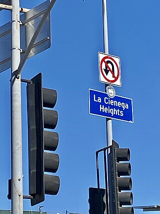
La Cienega Heights is a neighborhood in the Westside of the city of Los Angeles, California.