Streetcar suburb

Last updated

A streetcar suburb is a residential community whose growth and development was strongly shaped by the use of streetcar lines as a primary means of transportation. Such suburbs developed in the United States in the years before the automobile, when the introduction of the electric trolley or streetcar allowed the nation’s burgeoning middle class to move beyond the central city’s borders. [1] Early suburbs were served by horsecars, but by the late 19th century cable cars and electric streetcars, or trams, were used, allowing residences to be built farther away from the urban core of a city. Streetcar suburbs, usually called additions or extensions at the time, were the forerunner of today's suburbs in the United States and Canada. San Francisco's Western Addition is one of the best examples of streetcar suburbs before westward and southward expansion occurred.[ citation needed ]

Contents

Although most closely associated with the electric streetcar, the term can be used for any suburb originally built with streetcar-based transit in mind, thus some streetcar suburbs date from the early 19th century. As such, the term is general and one development called a streetcar suburb may vary greatly from others. However, some concepts are generally present in streetcar suburbs, such as straight (often gridiron) street plans and relatively narrow lots.

Similar terms

Railroad suburbs

Advertisement for a subdivision in Cincinnati, Ohio, touting the short walk to nearby rail stations Largewalnut071203.jpg
Advertisement for a subdivision in Cincinnati, Ohio, touting the short walk to nearby rail stations

By 1830, many New York City area commuters were going to work in Manhattan from what are now the boroughs of Brooklyn and Queens, which were not part of New York City at that time. They commuted by ferries. In 1852, architect Alexander Jackson Davis designed Llewellyn Park in New Jersey, a planned suburb served by both ferry[ citation needed ] and steam railroad. In the 1840s and 1850s, new railroad lines fostered the development of such New York City suburbs as Yonkers, White Plains, and New Rochelle. The steam locomotive in the mid 19th century provided the wealthy with the means to live in bucolic surroundings, to socialize in country clubs [2] and still commute to work downtown. These suburbs were what historian Kenneth T. Jackson called the "railroad suburbs" [3] and historian Robert Fishman called a "bourgeois utopia". [4]

Outside of Philadelphia, suburbs like Radnor, Bryn Mawr, and Villanova developed along the Philadelphia Main Line. As early as 1850, 83 commuter stations had been built within a 15-mile radius of Boston. [5] Chicago saw huge developments, with 11 separate lines serving over 100 communities by 1873. A famous community served was Riverside, Illinois, arguably one of the first planned communities in the United States, designed in 1869 by Frederick Law Olmsted. [6]

Horsecar and cable car suburbs

However, the suburbs closest to the city were based on horsecars and eventually cable cars. First introduced to America around 1830, the horse-drawn omnibus was revolutionary because it was the first mass transit system, offering regularly scheduled stops along a fixed route, allowing passengers to travel three miles sitting down in the time it would take them to walk two miles. Later more efficient horse-drawn streetcars allowed cities to expand to areas even more distant. By 1860, they operated in most major American and Canadian cities, including New York, Baltimore, Philadelphia, Chicago, Cincinnati, Saint Louis, Montreal, and Boston. [7]

Horsecar suburbs emanated from the city center towards the more distant railroad suburbs. For the first time, transportation began to separate social and economic classes in cities, as the working and middle class continued to live in areas closer to the city center, while the rich could afford to live farther out. [8]

History

Development

The introduction of the electrical streetcar in Richmond, Virginia, in 1887 by Frank J. Sprague marked the start of a new era of transportation-influenced suburbanization through the birth of the "streetcar suburb". The early trolley allowed people to effortlessly travel in 10 minutes what they could walk in 30, and was rapidly introduced in cities like Boston and Los Angeles, and eventually to all larger American and Canadian cities. There were 5,783 miles of streetcar track serving American cities in 1890; this grew to 22,000 by 1902 and 34,404 by 1907. [9]

By 1890, electric streetcar lines were replacing horse-drawn ones in cities of all sizes, allowing the lines to be extended and fostering a tremendous amount of suburban development. They were often extended out to formerly rural communities, which experienced an initial surge of development, and then new residential corridors were created along the newly built lines leading to what had sometimes been separate communities. [10] On side streets, the houses closest to the original streetcar line are often as much as ten to twenty years older than houses built farther down the street, reflecting the initial surge and slow completion of a development.

Because streetcar operators offered low fares and free transfers, commuting was finally affordable to nearly everyone. Combined with the relatively cheap cost of land farther from the city, streetcar suburbs were able to attract a broad mix of people from all socioeconomic classes, although they were most popular by far with the middle class. [11]

The houses in a streetcar suburb were generally narrow in width compared to later homes, and Arts and Crafts movement styles like the California Bungalow and American Foursquare were most popular. These houses were typically purchased by catalog and many of the materials arrived by railcar, with some local touches added as the house was assembled. The earliest streetcar suburbs sometimes had more ornate styles, including late Victorian and Stick. The houses of streetcar suburbs, whatever the style, tended to have prominent front porches, while driveways and built-in garages were rare, reflecting the pedestrian-focused nature of the streets when the houses were initially built. Setbacks between houses were not nearly as small as in older neighborhoods (where they were sometimes nonexistent), but houses were still typically built on lots no wider than 30 to 40 feet.

Shops such as groceries, bakeries, and drug stores were usually built near the intersection of streetcar lines, or directly along more heavily traveled routes (otherwise, routes would simply be lined with houses similar to those found in the surrounding neighborhoods). These shops would sometimes be multi-story buildings, with apartments on the upper floors. These provided convenient shopping for household supplies for the surrounding neighborhoods, which could potentially be visited on one's way to or from work. While there were stores near houses, they were not quite as close as in older parts of cities, and they were usually confined to specific streets, representing the beginning of a complete separation between residential and commercial areas in cities. [12]

Unlike railroad suburbs, which tended to form in pockets around stations along the interurban line, streetcar suburbs formed continuous corridors stretching outwards from city cores. The streetcar lines themselves were either built on roads that conformed to the grid, or on former turnpikes radiating in all directions from the city, sometimes giving such cities a roughly star-like appearance on maps. Along the lines, developers built rectangular "additions" with homes, usually on small lots, within a five- to ten-minute walk of the streetcar. These were essentially built on the grid plan of the older central cities, and typically spread out in between streetcar lines throughout a city.

Decline

Streetcar use continued to increase until 1923 when patronage reached 15.7 billion, but it declined in every year after that as automobile use increased amongst the middle and upper classes. By the 1930s, the once-profitable streetcar companies were diversifying by adding motorized buses and trackless trolleys to their fleets. [13] By the 1940s, streetcar ridership had dropped dramatically, and few subdivisions were being built with streetcars or mass transit in general in mind. By the 1950s, nearly all streetcar lines had stopped running, and were instead served by buses. Compared to the streetcars, which were the primary method of transport at their peak and ran very frequent service, the replacement buses tended to be much less frequent and reliable.

In the second half of the 20th century, streetcar suburbs in many American cities suffered serious deterioration. The home ownership boom facilitated by the Federal Housing Administration excluded neighborhoods which received negative reviews from FHA and bank officials in the underwriting process. FHA standards at the time discouraged many design features common in streetcar suburbs; small lots, narrow streets, semi-detached housing, lack of off-street parking, and mixing single-family houses with apartment or commercial buildings were all viewed negatively in FHA reports. This meant that streetcar suburbs were very frequently redlined. Without streetcar services, and lacking adequate space and infrastructure for residents to keep private automobiles, these neighborhoods were considered obsolete and were a frequent target of Urban renewal programs. The West End in Cincinnati, Bronzeville, Chicago, and West Philadelphia were all typical streetcar suburbs which were partially or completely demolished as part of postwar urban renewal programs.

Modern streetcar suburbs

Toronto Transit Co. car No. 2438 (Queen-Woodbine), Connaught Ave. looking south from Queen Street.jpg
A Toronto streetcar on Queen Street East in 1923 serving streetcar suburbs such as Riverdale and The Beaches.
Queen Street Bridge.jpg
A Toronto streetcar in 2007 serving the exact same areas.

Now somewhat urban in appearance, former streetcar suburbs are readily recognizable by the neighborhood structure along and near the route. Every few blocks, or along the entire route in well-preserved neighborhoods, there are small commercial structures, storefronts usually flush with the sidewalk; these were small stores—often groceries—operated by "mom and pop" operators who lived in quarters behind or above the establishment. Off-street parking, if it exists at all, is in the rear of the building.

Because stores were originally built along streetcar lines, a person could exit the transport near home, do some light shopping for dinner items, and continue by walking to his or her residence. These buildings also provided shopping for a non-employed spouse. Very few small groceries remain (outside of dense cities), though the space is often now used for non-foodstuff retail, capable of drawing clients from outside of the immediate neighborhood.

Modern streetcar suburbs are usually served by buses which run roughly the original streetcar routes, and may offer highly reasonable mass transit commute times to downtowns and other business areas, especially compared to later automobile suburbs. Toronto, Ontario, Canada is an example of a city in which most streetcar suburbs are still served by streetcars.

House prices in streetcar suburbs vary by neighborhood and city. Lots left empty in these areas during initial development, or where the initial houses have burned or been torn down, are usually too narrow for modern residential zoning regulations, meaning that it is difficult to infill housing in well-preserved streetcar suburbs. Occasionally two lots are combined into one for a wide enough lot, or many houses are torn down for a new use as needed. However, in some cases where historic zoning applies, infill housing is encouraged or required to match neighboring housing standards. [14]

Features

In a greater sense, the streetcar suburbs of the early 20th century worked well for a variety of reasons.

Examples of streetcar suburbs in North America

Atlanta

Austin

Baltimore

Boston

Cleveland

Columbus

Dallas

Detroit

Edmonton

Houston

Indianapolis

Jacksonville

Knoxville

Los Angeles

Miami

Miami's Coral Gables neighborhoods were built in the 1920s as the earliest suburbs of Downtown Miami by early Miami developers. Coral Gables was connected to Downtown, by a series of streetcars down Coral Way. Today, Coral Gables homes are some of the most expensive single-family homes in Miami, as the vast majority of them have been preserved since the 1920s. Within Coral Gables, Miracle Mile has urbanized over the decades, becoming a dense, urban neighborhood with numerous high rise apartment and office towers.

Milwaukee

Montreal

Most of Montreal's streetcar suburbs feature a mix of attached red-brick or greystone duplexes, triplexes, fourplexes and multiplexes with exterior staircases instead of narrow-lot single-family homes. These areas usually feature a vibrant main street, usually the one where the trams traversed, that contains most of the shops, businesses and services, while smaller dépanneurs (Convenience stores) line the intersections of the smaller residential streets.

Newark

Many communities in Essex County, New Jersey were served by the Public Service Railway lines that fed into the Newark City Subway and the Newark Public Service Terminal including Irvington, Maplewood, Montclair, Bloomfield, Glen Ridge and The Oranges. Some of these routes remain today as NJ Transit Bus routes including the 21, 25, 27, 29 and 39.

Omaha

Soon after the city's founding in 1856, many different companies provided horse-drawn cars, streetcars and eventually busing throughout the city. Streetcar service stopped on March 4, 1955. Some of the communities served exclusively as streetcar suburbs included:

Ottawa

Philadelphia

Phoenix

Piedmont

Pittsburgh

1920s tract houses in Mt Lebanon, on narrow lots backing onto the streetcar line Shady Dr East brick houses Lebo jeh.jpg
1920s tract houses in Mt Lebanon, on narrow lots backing onto the streetcar line

Portland, Oregon

Richmond, Virginia

St. Louis

Salt Lake City

San Jose

Seattle

Toronto

Washington, D.C.

During the late-1800s, streetcars spurred development in numerous villages in Washington County, D.C., including Brightwood, Mount Pleasant, Tenleytown, Chevy Chase, LeDroit Park, Uniontown, and Brookland. All lost streetcar service by the mid-1960s. [32] [33]

From the late 1880s to the end of the streetcar era, transit lines spread out of Washington and into the surrounding areas of Montgomery and Prince George's counties in Maryland, heading out to Rockville, Forest Glen, Kensington, Takoma Park, and Berwyn Heights. In particular, the streetcar helped shape the development of the Gateway Arts District from Mount Rainier through Hyattsville and Riverdale Park and beyond through College Park to Laurel. [34]

Australasia

Kelburn, New Zealand is served by the Wellington Cable Car, and Karori transport once linked to it.

The inner suburbs of many Australian cities were planned around tram lines. Melbourne's existing extensive tram network includes some examples of existing tram suburbs where tram was the dominant form of early transportation and still a major form of transport, including Carlton, Fitzroy, St Kilda, Albert Park, South Melbourne and Brunswick.

Old World

In the Old World, many residential neighborhoods were developed in the early days of industrial urbanization before electric streetcars/trams were invented. However, in much of Europe tram systems eventually came to play a much larger role in public transportation than in most of the New World. Here, therefore, the term "streetcar suburb" is not needed as distinct concept as most neighborhoods in many European cities are tram-oriented, especially in those countries which still had a lower rate of private automobile ownership in the 20th century, such as in the former Soviet Union.

An example is the city of Prague, the capital of the Czech Republic. Prague has built many new suburban roads since the fall of communism and also has an extensive metro and bus system, but because its central core is a UNESCO World Heritage Site, the city authorities limit new road construction in historic areas. Instead the tram system is the backbone of the transportation system, with many pre-communist and communist-era neighborhoods featuring brick and plaster walk-up apartment buildings lining roads that are served by several tram routes which run into the centre of the city. This is broadly similar to many mid-sized European cities.

As housing was scarce in much of the Eastern bloc, new construction mostly occurred in the Plattenbau/Panelák style and new neighborhoods were planned from the outset with a tram connection to enable easy commuting. Examples include the planned developments of Berlin Marzahn, Halle-Neustadt or Dresden-Gorbitz. In the west, streetcars had lost much of their importance so similar neighborhoods were built along much more car-dependent lines or - in the case of Nürnberg Langwasser - with a new subway that was built from Langwasser inwards to link the new neighborhoods to jobs and shopping in downtown Nuremberg.

See also

Related Research Articles

<span class="mw-page-title-main">Suburb</span> Human settlement within a metropolitan area

A suburb is an area within a metropolitan area which has a higher or lower population density and sometimes less detached housing. In many metropolitan areas suburbs rise in population during the day and are where most jobs are located; being major commercial and job hubs, many suburbs also exist as separate residential communities within commuting distance of a larger city. Suburbs can have their own political or legal jurisdiction, especially in the United States, but this is not always the case, especially in the United Kingdom, where most suburbs are located within the administrative boundaries of cities. In most English-speaking countries, suburban areas are defined in contrast to central city or inner city areas, but in Australian English and South African English, suburb has become largely synonymous with what is called a "neighborhood" in the U.S., but it is used in contrast with inner city areas.

<span class="mw-page-title-main">Twin City Rapid Transit Company</span>

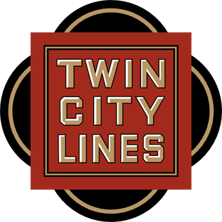
The Twin City Rapid Transit Company (TCRT), also known as Twin City Lines (TCL), was a transportation company that operated streetcars and buses in the Minneapolis-St. Paul metropolitan area in the U.S. state of Minnesota. Other types of transportation were tested including taxicabs and steamboats, along with the operation of some destination sites such as amusement parks. It existed under the TCRT name from a merger in the 1890s until it was purchased in 1962. At its height in the early 20th century, the company operated an intercity streetcar system that was believed to be one of the best in the United States. It is a predecessor of the current Metro Transit bus and light rail system that operates in the metro area.

<span class="mw-page-title-main">Toronto Transportation Commission</span> Former public transit operator in Toronto, Canada

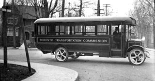
Toronto Transportation Commission (TTC) was the public transit operator in Toronto, Ontario, Canada, beginning in 1921. It operated buses, streetcars and the island ferries. The system was renamed the Toronto Transit Commission (TTC) in 1954.

<span class="mw-page-title-main">San Diego Electric Railway</span> Mass transit system (1892–1949)

The San Diego Electric Railway (SDERy) was a mass transit system in Southern California, United States, using 600 volt DC streetcars and buses.

Kirkwood is a national historic designated neighborhood on the east side of Atlanta, Georgia, United States. It is a historic streetcar suburb situated entirely in DeKalb County, bordered by the neighborhoods of Lake Claire, East Lake, Edgewood, and Oakhurst. Kirkwood is bound on the north by DeKalb Avenue, on the south by Memorial Drive and Interstate 20, on the west by Montgomery Street, and on the east by 1st Ave. A large part of the neighborhood is listed on the National Register of Historic Places as Kirkwood Historic District.

Various terms are used for passenger railway lines and equipment; the usage of these terms differs substantially between areas:

<span class="mw-page-title-main">West Philadelphia</span> Neighborhood of Philadelphia, Pennsylvania

West Philadelphia, nicknamed West Philly, is a section of the city of Philadelphia. Although there are no officially defined boundaries, it is generally considered to reach from the western shore of the Schuylkill River, to City Avenue to the northwest, Cobbs Creek to the southwest, and the SEPTA Media/Wawa Line to the south. An alternate definition includes all city land west of the Schuylkill; this would also include Southwest Philadelphia and its neighborhoods. The eastern side of West Philadelphia is also known as University City.

<span class="mw-page-title-main">Boston-area streetcar lines</span>

As with many large cities, a large number of Boston-area streetcar lines once existed, and many continued operating into the 1950s. However, only a few now remain, namely the four branches of the Green Line and the Ashmont–Mattapan High-Speed Line, with only one running regular service on an undivided street.

<span class="mw-page-title-main">Streetcars in Washington, D.C.</span> Streetcars that existed in Washington until 1962

Streetcars in Washington, D.C. transported people across the city and region from 1862 until 1962.

<span class="mw-page-title-main">Transportation in Richmond, Virginia</span>

Transportation in Richmond, Virginia and its immediate surroundings include land, sea and air modes. This article includes the independent city and portions of the contiguous counties of Henrico and Chesterfield. While almost all of Henrico County would be considered part of the Richmond area, southern and eastern portions of Chesterfield adjoin the three smaller independent cities of Petersburg, Hopewell, and Colonial Heights, collectively commonly called the Tri-Cities area. A largely rural section of southwestern Chesterfield may be considered not a portion of either suburban area.

<span class="mw-page-title-main">Pittsburgh Light Rail</span> Light rail system in Pittsburgh, Pennsylvania

The Pittsburgh Light Rail is a 26.2-mile (42.2 km) light rail system in Pittsburgh, Pennsylvania, and surrounding suburbs. It operates as a deep-level subway in Downtown Pittsburgh, but runs mostly at-grade in the suburbs south of the city. The system is largely linear in a north-south direction, with one terminus near Pittsburgh's central business district and two termini in the South Hills. The system is owned and operated by Pittsburgh Regional Transit. The T is one of the surviving first-generation streetcar systems in North America, with the oldest portions of the network dating back to 1903 and the Pittsburgh Railways. It is also one of only three light rail systems in the United States that continues to use the broad 5 ft 2+12 in Pennsylvania Trolley Gauge on its lines instead of the 4 ft 8+12 instandard gauge. In 2022, the system had a ridership of 2,429,500.

<span class="mw-page-title-main">Streetcars in Washington, D.C., and Maryland</span>

Streetcars and interurbans operated in the Maryland suburbs of Washington, D.C., between 1890 and 1962.

<span class="mw-page-title-main">Streetcars in North America</span> History of street cars

Streetcars or trolley(car)s were once the chief mode of public transit in hundreds of North American cities and towns. Most of the original urban streetcar systems were either dismantled in the mid-20th century or converted to other modes of operation, such as light rail. Today, only Toronto still operates a streetcar network essentially unchanged in layout and mode of operation.

<span class="mw-page-title-main">Park Heights, Baltimore</span> Neighborhood of Baltimore in Maryland, United States

Park Heights is an area of Baltimore City, Maryland, that lies approximately 5 miles northwest of downtown Baltimore and within two miles of the Baltimore County line. A 1,500-acre community, Park Heights comprises 12 smaller neighborhoods that together contain approximately 30,000 residents. It is bounded on the south by Druid Park Drive, on the west by Wabash Avenue, on the east by Greenspring Avenue, and on the north by Northern Parkway. Interstate-83 is less than a half mile to the east. Two major roadways—Park Heights Avenue and Reisterstown Road—run north-south through Park Heights, serving as the neighborhood's "Main Streets" as well as commuter corridors. Limited commercial uses—primarily retail—are scattered along these roads; there is also some industrial activity on the neighborhood's western edge.

<span class="mw-page-title-main">Transportation in metropolitan Detroit</span>

Transportation in metropolitan Detroit comprises an expansive system of roadways, multiple public transit systems, a major international airport, freight railroads, and ports. Located on the Detroit River along the Great Lakes Waterway, Detroit is a significant city in international trade, with two land crossings to Canada. Three primary Interstate highways serve the region.

<span class="mw-page-title-main">Streetcars in Atlanta</span> Aspect of the history of Atlanta, Georgia, USA

Streetcars originally operated in Atlanta downtown and into the surrounding areas from 1871 until the final line's closure in 1949.

Network 2011 was a plan for transit expansion created in 1985 by the Toronto Transit Commission. It was centred on three proposed subway lines: the Downtown Relief Line, Eglinton West Line, and the Sheppard Line. Only a portion of the Sheppard Line was built. The Eglinton West and Downtown Relief Lines were cancelled; they were superseded by the Eglinton Crosstown light rail line and the Ontario Line respectively.

The West Side is a large area defining many neighborhoods in the city of Manchester, New Hampshire, in the United States. It consists of all parts of the city that lie west of the Merrimack River and includes the neighborhoods of Northwest Manchester, Rimmon Heights, Notre Dame, Piscataquog, Wolfe Park, and Mast Road. It lies just to the east of the community of Pinardville in the neighboring town of Goffstown.

South River City is a community located in Austin, Texas. Also frequently called Travis Heights, the neighborhood is located south of the city's urban core, just below Lake Lady Bird in South Austin. The area encompasses a portion of ZIP code 78704.

<span class="mw-page-title-main">Public transit in Columbus, Ohio</span> Overview of public transportation in Columbus, Ohio

Public transit has taken numerous forms in Columbus, the largest city and capital of Ohio. Transit has variously used passenger trains, horsecars, streetcars, interurbans, trolley coaches, and buses. Current service is through the Central Ohio Transit Authority's bus system, numerous intercity bus companies, and through bikeshare, rideshare, and electric scooter services.

References

  1. Caves, R. W. (2004). Encyclopedia of the City. Routledge. p. 635. ISBN   9780415252256.
  2. Jackson, Kenneth T. (1985), Crabgrass Frontier: The Suburbanization of the United States , New York: Oxford University Press, ISBN   0-19-504983-7 , p. 97-99
  3. Jackson, Kenneth T. (1985), Crabgrass Frontier: The Suburbanization of the United States , New York: Oxford University Press, ISBN   0-19-504983-7 , Chapter 5: "The Main Lite Elite Suburbs and Commuter Railroads", p. 87-102
  4. Fishman, Robert (1985). Bourgeois Utopias. Basic Books. p.  155. ISBN   0-465-00748-1.
  5. Schuyler, David (1988). The New Urban Landscape. Johns Hopkins University Press. p. 152. ISBN   0-8018-3748-0.
  6. Keating, Anne D. (1988). Building Chicago. Ohio State University Press. p.  14. ISBN   0-8142-0455-4.
  7. Clay McShane and Joel A. Tarr (1998). The Centrality of the Horse in the Nineteenth Century City. SR Books. p. 111.
  8. Fishman, Robert (1985). Bourgeois Utopias. Basic Books. p.  138. ISBN   0-465-00748-1.
  9. Konvitz, Josef W. (1987). "Patterns in the Development of Urban Infrastructure". American Urbanism. Greenwood Press: 204.
  10. Jackson, Kenneth T. (1985), Crabgrass Frontier: The Suburbanization of the United States , New York: Oxford University Press, ISBN   0-19-504983-7 , p.119
  11. Jackson, Kenneth T. (1985), Crabgrass Frontier: The Suburbanization of the United States , New York: Oxford University Press, ISBN   0-19-504983-7 , p.118–120
  12. "Why Streetcar Suburbs Worked Well". Archived from the original on 2007-10-08. Retrieved 2006-07-07.
  13. Foster, Marc S. (1981). From Streetcar to Superhighway. Philadelphia: Temple University Press. pp. 49, 52. ISBN   0-87722-210-X.
  14. "Heart of Knoxville Infill Housing Design Guidelines" (PDF). Knoxville - Knox County Metropolitan Planning Commission. Retrieved 15 September 2011.
  15. "History of Brighton-Allston". www.bahistory.org. Retrieved 19 April 2018.
  16. Ueda, Reed (1984). "The High School and Social Mobility in a Streetcar Suburb: Somerville, Massachusetts, 1870-1910". Journal of Interdisciplinary History. The MIT Press. 14 (4): 751–771. doi:10.2307/203464. JSTOR   203464.
  17. "Neighborhood Essay–Indianapolis: A Discover Our Shared Heritage Travel Itinerary". U.S. Department of the Interior . Retrieved June 10, 2016.
  18. "Preserve America Neighborhood: Irvington neighborhood, Indianapolis, Indiana". Preserve America . Retrieved June 10, 2016.
  19. "Riverside Drive Historic District". The Cultural Landscape Foundation . Retrieved March 21, 2021.
  20. "Lost Jacksonville: Streetcars".
  21. Kevin David Kane and Thomas L. Bell (1985). "Suburbs for a Labor Elite". Geographical Review. American Geographical Society. 75 (3): 319–334. Bibcode:1985GeoRv..75..319K. doi:10.2307/214488. JSTOR   214488.
  22. Fishman, Robert (1989). "Bourgeois Utopias". Basic Books. p. 160. ISBN   978-0-465-00747-9.
  23. Rodin, Judith (2007). The University & Urban Revival . University of Pennsylvania. p.  26. ISBN   978-0-8122-4022-1. streetcar suburb West Philadelphia.
  24. "History of the Neighborhood". www.fqstory.org. Retrieved 19 April 2018.
  25. Hildebrand, George H. (1982). Borax Pioneer: Francis Marion Smith . San Diego: Howell-North Books. ISBN   9780831071486. Smythe, Dallas Walker. (1937). An Economic History of Local and Interurban Transportation in the East Bay Cities with Particular Reference to the Properties Developed by F. M. Smith. Berkeley: University of California.
  26. "Mister Rogers' Neighborhood . Parents & Teachers . The Neighborhood Trolley – PBS Kids". pbskids.org. Retrieved 19 April 2018.
  27. Minor, Kristen (August 16, 2018), National Register of Historic Places Registration Form: Laurelhurst Historic District (PDF), archived (PDF) from the original on April 26, 2019, retrieved May 12, 2022.
  28. "The Five Circles of Hanchett Park". Walking San Jose's Rose Garden Area. Retrieved 19 April 2018.
  29. Stripling, Sherry (March 21, 2002). "Columbia City: Strolling past some Seattle history". The Seattle Times . Retrieved August 22, 2016.
  30. Wilma, David (August 20, 2001). "Seattle Neighborhoods: Ravenna - Roosevelt -- Thumbnail History". HistoryLink . Retrieved August 22, 2016.
  31. "Route 502 and 503 - The Kingston Road Streetcars - Transit Toronto - Content". transittoronto.ca. Retrieved 19 April 2018.
  32. Prince, T.E. (1979). "IV" (PDF). Washington, D.C.'s Streetcar Suburbs: A Comparative Analysis of Brookland and Brightwood, 1870-1900 (M.A.). University of Maryland. Retrieved 2015-12-01.
  33. Sheir, Rebecca (2012-08-17). "Visiting Washington's Original "Streetcar Suburbs"". Metro Connection. Washington, D.C.: WAMU . Retrieved 2015-12-02.
  34. Theis, Michael (2013-02-07). "Ride the Rhode Island Ave Streetcar from DC to College Park". Hyattsville Patch. Patch Media . Retrieved 2015-12-02.