Piedmont is a small city located in Alameda County, California, United States, enclaved by the city of Oakland. Its residential population was 11,270 at the 2020 census.[7] The name comes from the region of Piedmont in Italy, and it means 'foothill'. Piedmont was incorporated in 1907, and was developed significantly in the 1920s and 1930s.
The original neighborhood of Piedmont was larger than the current municipality of Piedmont, with the Mountain View Cemetery considered full part of the Piedmont neighborhood.
Residents initially sought incorporation in 1907. Two elections were held among the citizens of Piedmont in 1907, both of which narrowly upheld the decision for Piedmont to become a separate city, rather than become a neighborhood within the city of Oakland.
Like surrounding Oakland,[8] Piedmont has a history of racial segregation, but it also has a separate history of racial exclusion.[9][10][11] In 1924, the city's first African-American homeowners, Sidney and Irene Dearing, got around the city's restrictive housing covenants by purchasing a home using a white family member as a proxy. They could not count on the city of Piedmont to protect them from violent threats against their lives—the chief of police at the time, Burton Becker, was an active member of the Ku Klux Klan.[12] While the Dearings initially refused to leave, bombs were left around their property. They sold it to the city for $25,000 after a mob surrounded their home and demanded that they leave.[13]
A photograph of the front page of the Oakland Tribune describing bomb threats against the first black homeowners in Piedmont, California
Before 1968, restrictive housing covenants and redlining were used to exclude non-whites in the city for many years.[14] The American sociologist and historian James W. Loewen identified Piedmont as a "probable" sundown town, meaning that non-whites were not welcome after dusk and could face violence and intimidation. While surrounding Oakland is one of the most ethnically and culturally diverse cities in the United States,[10] Piedmont has a less racially diverse population than Oakland. Attempts to ethnically and culturally diversify the city and allow for higher density and affordable housing are typically met with resistance from the city's residents.[15]
In early 2021, the city council indicated that it intended "to move forward with public acknowledgement and an apology for the abhorrent treatment Sidney Dearing and his family received in 1924."[16]
According to the city's Web page, "In the Roaring Twenties, Piedmont was known as the 'City of Millionaires' because there were more millionaires per square mile than in any city in the United States."[17] Many of these millionaires built mansions that still stand, notably on Sea View Avenue and Sotelo Avenue/Glen Alpine Road in 'Alta' Piedmont. Piedmont became a charter city under the laws of the state of California on December 18, 1922. On February 27, 1923, voters adopted the charter, which can only be changed by another vote of the people.
Piedmont celebrated the year 2007 as its Centennial Anniversary since incorporation. The Centennial Committee hosted celebratory events along a trail that ran through downtown Piedmont and denoted historical landmarks in the city. The Committee also created a float for the city's Fourth of July parade.[18]
The historical exhibit "A Deluxe Autonomy: Piedmont’s First 100 Years" was on display in the Oakland Public Library from January 5 to March 31, 2007.[19]
In August 2017, the mayor of Piedmont, Jeffrey Wieler,[20] resigned after it was revealed he had made disparaging Facebook posts about Black Lives Matter and transgender people.[21]
Geography
El Cerrito Avenue, one of Piedmont's tree-lined streets
It is located near the Hayward Fault, a geological fault line that runs through the East Bay region.
According to the United States Census Bureau, the city has a total area of 1.7 square miles (4.4km2), all land.
Borders
Piedmont is surrounded on all sides by the city of Oakland. Specifically, Piedmont's northwestern border is adjacent to Oakland's Piedmont Ave commercial district. Piedmont borders Oakland's historic Grand Lake District (Lakeshore and Grand Avenue commercial districts) to the southwest, the quaint and rustic Montclair District to the northeast, and the Crocker Highlands and Glenview Districts to the south.
Major streets
Piedmont's major streets include Oakland Avenue, which runs east-west through Piedmont's small city center; Highland Avenue, which divides Piedmont into upper and lower sections; Moraga Avenue, which runs along the city's northern border; and Grand Avenue, which runs near Piedmont's western border and further distinguishes 'Lower' Piedmont (west of Highland Ave) from 'Baja' Piedmont (west of Grand Ave). Lots in upper Piedmont are, on average, larger than lots in lower Piedmont. A nearby shopping district on Piedmont Avenue is located in Oakland, not Piedmont. A small shopping hamlet had been located on Highland Avenue near the Exedra at Piedmont Park for many years, but in the last few decades has dwindled in number to a small, local grocer-deli (Mulberry's Market), a service station and three banks. No major highways run within Piedmont's borders, but entrances to CA Highway 13 and CA I-580 are quite near.
Housing
Piedmont is almost entirely zoned for single-family dwelling residential use. Piedmont has minimal commerce compared with statistically similar cities and relies primarily on property taxes and fees for public revenues to support public services. The city also has relatively few multi-family or second (in-law) units. The city has a very small number of businesses in its commercial district on Highland Avenue and a very small number of businesses on Grand Avenue near Piedmont's western border with Oakland.
Emergency services
Piedmont provides its own fire, police, parks, and recreational services but does not have its own public library nor federal post office; these services are shared with Oakland. Special, incremental property tax assessments on Piedmont real estate for schools and some public services are not shared with Oakland.
The 2010 United States Census[24] reported that Piedmont had a population of 10,667. The population density was 6,358.5 inhabitants per square mile (2,455.0/km2). The racial makeup of Piedmont was 7,917 (74.2%) White, 144 (1.3%) African American, 6 (0.1%) Native American, 1,939 (18.2%) Asian, 13 (0.1%) Pacific Islander, 94 (0.9%) from other races, and 554 (5.2%) from two or more races. Hispanic or Latino of any race were 421 persons (3.9%). The Census reported that 10,664 people (100% of the population) lived in households, three (0%) lived in non-institutionalized group quarters, and none (0%) was institutionalized.
There were 3,801 households, out of which 1,606 (42.3%) had children under the age of 18 living in them, 2,738 (72.0%) were opposite-sex married couples living together, 260 (6.8%) had a female head of household with no spouse present, 119 (3.1%) had a male head of household with no spouse present. There were 67 (1.8%) unmarried opposite-sex partnerships, and 38 (1.0%) same-sex married couples or partnerships. 578 households (15.2%) consisted of an individual householder, and 344 (9.1%) were senior (age 65+) individual householders. There were 3,117 families (82.0% of all households); the average family size was 3.11.
The age distribution of Piedmont's population is diverse with 3,017 people (28.3%) under the age of 18, 451 people (4.2%) aged 18 to 24, 1,638 people (15.4%) aged 25 to 44, 3,922 people (36.8%) aged 45 to 64, and 1,639 people (15.4%) who were 65 years of age or older. The median age was 46.2 years. For every 100 females, there were 94.7 males. For every 100 females age 18 and over, there were 89.8 males.
There were 3,924 housing units, with an average household size of 2.81. Piedmont's average housing-unit density is 2,339.1 units per square mile (903.1/km2), of which 3,801 were occupied. Piedmont had 3,358 (88.3%) owner-occupied housing units, and 443 (11.7%) renter-occupied housing units. The homeowner vacancy rate was 0.5%; the rental vacancy rate was 3.7%. 9,393 people (88.1% of the population) lived in owner-occupied housing units and 1,271 people (11.9%) lived in rental housing units.
2000
As of the census[25] of 2000, there were 10,952 people, 3,804 households, and 3,104 families residing in the city. The population density was 6,488.7 inhabitants per square mile (2,505.3/km2). There were 3,859 housing units at an average density of 2,286.3 per square mile (882.7/km2).
There were 3,804 households, 47.3% containing children under the age of 18, 70.9% were married couples living together, 8.5% had a female householder with no spouse present, and 18.4% were other family configurations. 14.5% of all households consisted of individuals, and 7.8% were households consisting of senior (age 65+ years) individuals. The average household size was 2.88, and the average family size was 3.18.
According to the 2000 U.S. Census, the age distribution of Piedmont's population was spread, with 30.3% of residents under the age of 18, 3.8% aged 18 to 24 years, 18.5% aged 25 to 44 years, 34.0% aged 45 to 64 years, and 13.5% aged 65+ years. The median age was 44 years. For every 100 females, there were 92.7 males. For every 100 females age 18 and over, there were 87.8 males.
The median income for a household in the city was $134,270, and the median income for a family was $149,857. Males had a median income of $100,000 versus $58,553 for females. The per capita income for the city was $70,539. About 1.0% of families and 2.0% of the population were below the poverty line, including 2.6% of those under age 18 and 1.6% of those aged 65 or over.
Arts and culture
Piedmont Park, Oakland, California
Piedmont has a City Hall, a Community Hall, a Veterans' Memorial Building, a Recreation Center, Aquatics Center, and Center for the Arts. Public parks include Piedmont Park, Dracena Park, Crocker Park, Hampton Park, Linda Ave Tot Lot and Dog Run, Kennelly Skate Park, and Blair Park. Playfields include Coaches Playfield, Linda Playfield, and Piedmont Sports Field (at Hampton Park).
Regular town events include the July 4 Parade, Movies in the Park, Harvest Festival, Haunted House, Thanksgiving Turkey Trot, and Christmas Tree Lighting. Piedmont High School's annual Bird Calling Contest was previously featured on The Tonight Show Starring Johnny Carson and the Late Show with David Letterman.
Active charities and community groups include the Piedmont Education Foundation, the Piedmont Historical Society, the Piedmont Center for the Arts, the Piedmont Beautification Foundation, the Daughters of the American Revolution (Piedmont Chapter), the Piedmont League of Women Voters, Dress Best for Less, the Piedmont Highlanders Drums & Pipes, the Piedmont Civic Association, the Piedmont Community Church, the Piedmont East Bay Children's Choir, the Piedmont-Montclair Rotary Club, the Piedmont Boy Scouts, the Piedmont Baseball Foundation, the Piedmont Basketball Foundation, and the Piedmont Soccer Club. The Children's Support League holds annual Heart of the Home tours of Oakland and Piedmont homes.
Elementary and secondary students (PK-12) residing in Piedmont, children of City of Piedmont employees, and children of Piedmont Unified School District employees are eligible to attend schools within the Piedmont Unified School District. The district, coinciding with the municipal boundaries, includes three elementary schools (Havens, Beach, and Wildwood), one middle school (Piedmont Middle School), and two high schools—one larger (Piedmont High School), and one smaller, alternative high school, Millennium High School. A very high percentage[quantify] of Piedmont High School graduates are accepted to 4-year undergraduate programs. Many graduates continue their post-secondary education at very prestigious and competitive public and private colleges and universities.[28]
The Piedmont Unified School District currently ranks #68 of 756 districts in the state of California according to one statistical analysis of California public education.[29]
Piedmont voters have approved several local bond measures earmarked for maintaining and/or improving PUSD's educational facilities. For instance, Witter Field, PUSD's sports complex, was rebuilt between 1996 and 1999. The city-owned field adjacent to Beach Elementary School was resurfaced with natural cork-based artificial turf in early 2015. The PUSD-owned artificial turf field at Havens Elementary School (Becker Playfield) was placed in 2010.
Most recently, with the passage of Measure E in 2006, voters authorized the Piedmont Unified School District to issue up to $56 million in bonds to improve Piedmont public school buildings to reduce dangers from earthquakes, eliminate major collapse risks, and to meet or exceed all current state and federal seismic safety standards.
In addition to the public bond measures approved for PUSD facility upgrades and modernization, Piedmont voters have quadrennially approved, since 1980, a supplemental parcel tax (collected annually) which accounts for a very significant portion of PUSD's basic operational budget. In 2005, two measures were approved by voters, one of which renewed the basic school district parcel tax, paying for 21% of the district's budget, and another which added an incremental amount, short-term, to compensate for reduced funding from mainly state, and some federal, sources. Piedmont's most recent school support tax, Measure A, was again approved by 88% of Piedmont voters in 2012. Due to further reductions in state education budgets during the Great Recession (2008-2011), state diversions from local school property tax allocations since 2004, and shifting of state financial responsibilities onto local school districts, Piedmont's local school parcel tax now represents 30% of PUSD's annual operating budget.
The Piedmont Educational Foundation awards a number of grants for academic innovation in Piedmont schools each year, and provides a source of operational funding for the PUSD through its Endowment Fund[32] which reached $6 million in 2015.
Media
The city is served by two local weekly newspapers: the Piedmont Post and the Piedmonter, a neighborhood newspaper organized under the Contra Costa Times news organization.
Transportation
AC Transit provides Piedmont with bus service. Bus routes 12 and 33 connect Piedmont to Oakland's BART stations. In addition to Route 33 serving BART stations, the route serves Upper Piedmont going to Estates Drive on weekdays. AC Transit also provides a Transbay bus. Route P, to the Transbay Terminal in Downtown San Francisco during peak commute hours.
Author Jack London wrote Call of the Wild while living on Blair Avenue in a house that exists today; since this predated incorporation, technically he was never a citizen of Piedmont. John F. Kennedy's Secretary of Defense Robert S. McNamara grew up in Piedmont, where his family lived on Annerley Road.[33]Clint Eastwood resided in Piedmont and attended Piedmont schools. Country Joe McDonald resided in Piedmont in the 1970s. Actors Dean Butler (Little House on the Prairie) also grew up in Piedmont. Notable tennis player and coach Brad Gilbert grew up in Piedmont. Professional male tennis player Mackenzie "Mackie" McDonald grew up in Piedmont and attended Piedmont HS. Charles R. Schwab, founder of the discount stock brokerage firm bearing his name, and his family also lived in Piedmont in the early 1980s, as did Dean Witter, founder of Dean Witter Reynolds brokerage, in the 1940s.
Other residents have included: F. Wayne Valley, philanthropist, construction magnate, owner of the Oakland Raiders and founding member of the AFL; Frank C. Havens, for whom Havens Elementary School is named; and James Gamble, president of the Western Union Telegraph Company, who, in 1877, founded the Piedmont Land Company, introducing the name adopted by the city upon incorporation.
Actors, entertainment, and film professionals
Mark Andrews, Academy Award- and Golden Globe-winning film director
Albany is a city on the east shore of San Francisco Bay in northwestern Alameda County, California. The population was 20,271 at the 2020 census.
Peoria is a city in Maricopa and Yavapai counties in the U.S. state of Arizona. Most of the city is located in Maricopa County, while a portion of it in the north is in Yavapai County. It is a major suburb of Phoenix. As of the 2020 census, the population of Peoria was 190,985, up from 154,065 in 2010. It is the sixth-largest city in Arizona in land area and the ninth-largest in population. It was named after Peoria, Illinois. The word peoria is a corruption of the Miami-Illinois word for "prairie fire". It is the spring training home of the San Diego Padres and Seattle Mariners, who share the Peoria Sports Complex.
Ashland is a census-designated place (CDP) and unincorporated community in Alameda County, California, United States. The population was 23,823 at the 2020 census. Ashland is located between the city of San Leandro to the north, the unincorporated community of Cherryland to the south, the unincorporated community of Castro Valley to the east, and the unincorporated community of San Lorenzo to the southwest.
Dublin is a suburban city of the East Bay in California, United States. It is located within the Amador Valley of Alameda County's Tri-Valley region. It is located along the north side of Interstate 580 at the intersection with Interstate 680, roughly 35 miles (56 km) east of downtown San Francisco, 23 miles (37 km) east of downtown Oakland, and 31 miles (50 km) north of downtown San Jose.
Emeryville is a city located in northwest Alameda County, California, in the United States. It lies in a corridor between the cities of Berkeley and Oakland, with a border on the shore of San Francisco Bay. The resident population was 12,905 as of 2020. Its proximity to San Francisco, the Bay Bridge, the University of California, Berkeley, and Silicon Valley has been a catalyst for recent economic growth.
Kensington is an unincorporated community and census designated place located in the Berkeley Hills, in the East Bay, part of the San Francisco Bay Area, in Contra Costa County, California. In the 20th century it was considered part of Berkeley, although it is across the county line. House numbers follow the pattern used in Berkeley, and Kensington shares two zip codes with the Berkeley Hills area.
Orinda is a city in Contra Costa County, California, United States. The city's population as of the 2020 census is estimated at 19,514 residents.
Cudahy is a city located in southeastern Los Angeles County, California, United States. In area, Cudahy is the second smallest city in Los Angeles County after Hawaiian Gardens but with one of the highest population densities of any incorporated city in the United States. It is part of the Gateway Cities region and had a population of 23,805 as of the 2010 U.S. Census.
South Gate is the 19th largest city in Los Angeles County, California, United States, with 7.4 square miles (19 km2). South Gate is located 7 miles (11 km) southeast of Downtown Los Angeles. It is part of the Gateway Cities region of southeastern Los Angeles County.
Buena Park is a city in northern Orange County, California, United States. As of the 2020 census its population was 84,034. It is the location of several tourist attractions, including Knott's Berry Farm. It is about 12 miles (20 km) northwest of downtown Santa Ana, the county seat, and is within the Los Angeles metropolitan area.
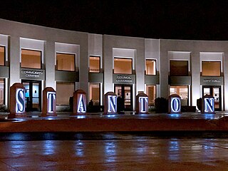
Stanton is a city in northern Orange County, California, United States, within the Los Angeles metropolitan area. The population was 37,962 at the 2020 United States Census. The city was incorporated in 1956 and operates under the council–manager form of government, providing a full range of municipal services. Stanton is bounded by Cypress on the west, Anaheim on the north, and east, and Garden Grove on the east and south.
Belmont is a city in San Mateo County in the U.S. state of California. It is in the San Francisco Bay Area, on the San Francisco Peninsula about halfway between San Francisco and San Jose. Known for its wooded hills, views of the San Francisco Bay and stretches of open space, Belmont is a quiet residential community in the midst of the culturally and technologically rich Bay Area. It was originally part of Rancho de las Pulgas, for which one of its main roads, the Alameda de las Pulgas, is named. The city was incorporated in 1926. Its population was 28,335 at the 2020 census.
Cotati is an incorporated city in Sonoma County, California, United States, located approximately 45 mi (70 km) north of San Francisco in the 101 corridor between Rohnert Park and Petaluma. Cotati's population as of the 2020 Census was 7,584, making it the smallest incorporated community in Sonoma County.
Rohnert Park is a city in Sonoma County, California, United States, located approximately 50 miles (80 km) north of San Francisco. The population at the 2020 United States Census was 44,390. It is an early planned city and is the sister city of Hashimoto in Japan. Sonoma State University, part of the California State University system, is located nearby.
Auburn Hills is a city in Oakland County in the U.S. state of Michigan. A northern suburb of Detroit, Auburn Hills is located about 26 miles (42 km) north of downtown Detroit. As of the 2020 census, the city had a population of 24,360.
Berkley is a city in Oakland County in the U.S. state of Michigan. A northern suburb of Detroit on the Woodward Corridor, Berkley is located roughly 14 miles (22.5 km) northwest of downtown Detroit. As of the 2020 census, the city had a population of 15,194.
Oak Park is a city in Oakland County in the U.S. state of Michigan. An inner-ring suburb of Detroit, Oak Park borders Detroit to the north, roughly 14 miles (22.5 km) northwest of downtown Detroit. As of the 2020 census, the city had a population of 29,560.
Madison Heights is a city in Oakland County in the U.S. state of Michigan. An inner-ring suburb of Detroit, Madison Heights is located roughly 12 miles (19.3 km) north of downtown Detroit. As of the 2020 census, the city had a population of 28,468.
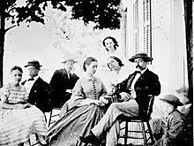
The history of Piedmont, California, covers the history of the area in California's San Francisco Bay Area that is now known as Piedmont, up to and beyond the legal establishment of a city.
Lakewood is a city in Los Angeles County, California, United States. The population was 82,496 at the 2020 census. It is bordered by Long Beach on the west, northwest and south, Bellflower on the north, Cerritos on the northeast, Cypress on the east, and Hawaiian Gardens on the southeast. Major thoroughfares include Lakewood, Bellflower, and Del Amo Boulevards and Carson and South Streets. The San Gabriel River Freeway (I-605) runs through the city's eastern regions.
This page is based on this Wikipedia article Text is available under the CC BY-SA 4.0 license; additional terms may apply. Images, videos and audio are available under their respective licenses.