Gilroy | |
---|---|
City of Gilroy | |
Nickname: "Garlic Capital of the World" | |
Coordinates: 37°0′43″N121°34′48″W / 37.01194°N 121.58000°W | |
Country | United States |
State | California |
County | Santa Clara |
CSA | San Jose-San Francisco-Oakland |
Metro | San Jose-Sunnyvale-Santa Clara |
Incorporated | March 12, 1870 [1] |
Named for | John Gilroy |
Government | |
• Mayor | Marie Blankley [2] |
• City Administrator | Jimmy Forbis [3] |
Area | |
• City | 16.52 sq mi (42.78 km2) |
• Land | 16.51 sq mi (42.75 km2) |
• Water | 0.01 sq mi (0.03 km2) 0.06% |
• Metro | 2,695 sq mi (6,979 km2) |
Elevation | 200 ft (61 m) |
Population | |
• City | 59,520 |
• Estimate (2021) [7] | 58,101 |
• Density | 3,576.18/sq mi (1,380.75/km2) |
• Metro | 1,836,911 |
• Metro density | 680/sq mi (260/km2) |
Demonym | Gilroyan |
Time zone | UTC−8 (Pacific Time Zone) |
• Summer (DST) | UTC−7 (PDT) |
ZIP codes | 95020, 95021 |
Area code | 408/669 |
FIPS code | 06-29504 |
GNIS feature IDs | 277523, 2410591 |
Website | www |
Gilroy is a city in Northern California's Santa Clara County, south of Morgan Hill and north of San Benito County. Gilroy is the southernmost city in the San Francisco Bay Area, with a population of 59,520 as of the 2020 Census.
Gilroy's origins lie in the village of San Ysidro that grew in the early 19th century out of Rancho San Ysidro, granted to Californio ranchero Ygnacio Ortega in 1809. [8] Following Ygnacio's death in 1833, his daughter Clara Ortega de Gilroy and son-in-law John Gilroy inherited the largest portion of the rancho and began developing the settlement. [8] When the town was incorporated in 1868, it was renamed in honor of John Gilroy, a Scotsman who had emigrated to California in 1814, naturalized as a Mexican citizen, adopted the Spanish language, and converted to Catholicism, taking the name of Juan Bautista Gilroy. [8]
Gilroy is known for its garlic crop and the annual Gilroy Garlic Festival, featuring various foods containing garlic. These led to the city being nicknamed the Garlic Capital of the World. It is also known for boutique wine production, as part of the Santa Clara Valley AVA, mostly consisting of family vineyards around the base of the Santa Cruz Mountains to the west. [9]
Spanish explorers led by Juan Bautista de Anza first passed through the Santa Clara Valley area in 1776, and in 1797 Mission San Juan Bautista was established near the Pajaro River. In 1809, Ygnacio Ortega was granted the 13,066-acre (5,288 ha) Spanish land concession Rancho San Ysidro. The village of San Ysidro grew nearby, at the foot of Pacheco Pass which linked the El Camino Real and the Santa Clara Valley with the San Joaquin Valley. California's main exports at this time were hides and tallow, of which thousands of barrels were produced and shipped to the rest of New Spain. Trade and diplomatic intercourse with foreigners was strictly forbidden by the royal government but was quietly carried on by Californians desperate for luxury goods.
During the War of 1812, the armed merchantman Isaac Todd [10] was sent by the North West Company to seize Fort Astoria, an American trading post at the mouth of the Columbia River. The ship, with a Royal Navy escort, departed from Portsmouth, England, made its way around Cape Horn and proceeded up the Pacific coast of the Americas, stopping at Spanish ports for supplies along the way. In January 1814, having fallen behind its escort, the Isaac Todd arrived at Monterey, California, the Spanish colonial capital of Alta California. During the visit, ordinary seaman John Gilroy (a Scotsman who had changed his name from John Cameron when he went to sea to avoid recognition) either (depending on the historical source) jumped ship [11] or was left ashore to recover from scurvy. [12]
John Gilroy (1794–1869), also known as Juan Bautista Gilroy, [13] spent the next few years moving around among the missions, pueblos and ranchos, plying his trade as a cooper (barrel maker). At first, by his own account in an 1856 letter to Thomas O. Larkin, Gilroy was one of only two English-speakers resident in Alta California. [14] Eventually, he found his way to Rancho San Ysidro, converted to Roman Catholicism and became the first naturalized English-speaking settler in Alta California. In 1821, the same year Mexico won its independence from Spain, Gilroy married a daughter of his employer, ranchero Ygnacio Ortega. Upon Ygnacio's death in 1833, the rancho was divided among his three children—including Gilroy's wife Maria Clara. In 1867, under U.S. property law, the Rancho San Ysidro (Gilroy) was patented to John Gilroy.
The settlement now known as "Old Gilroy" grew up around Gilroy's rancho complex and, after the end of the Mexican–American War in 1848, Gilroy served as alcalde of the village. [15] It served as a stagecoach station of the Butterfield Overland Mail and other stage lines in the late 19th century.
Following the U.S. Conquest of California and the discovery of gold in the Sierra Nevada in 1848, the trickle of immigrants from the eastern states and abroad became a flood. As many of the earlier Mexican and Californio landowners sold off their land, lost it to squatters, or were dispossessed through title hearings, the area around San Ysidro became known as Pleasant Valley. On March 12, 1870, it was officially incorporated by the state legislature as the town of Gilroy (John Gilroy had died in 1869). [16] By then the town center had been relocated west of the El Camino Real (Old Gilroy is today a sparsely populated agricultural area).
Cattle ranching and timber from the nearby Santa Cruz Mountains were important to the economy for some time but, as in the rest of the valley, agriculture was the town's greatest source of income. During the 1920s, Kiyoshi “Jimmy” Hirasaki began growing garlic commercially in the Gilroy area. [17] Referred to as the "Garlic King", Hirasaki continued to farm garlic into the 1950s. [18] [17] In 1979, the Gilroy Garlic Festival was launched. Farming remains significant, but in the 1970s the city began evolving into a bedroom community for Silicon Valley to the north.
There are a number of extant historical buildings dating from the mid-19th century. Built in 1857, the Christian Church at 160 Fifth Street is the oldest wood-framed church in continuous use in Santa Clara County. Blacksmith George Eustice's house at 213 Fifth Street was constructed in 1869; Eustice was an American Civil War veteran who fought at Gettysburg. [19] Samuel Moore was a long-time Gilroy postmaster, whose home was built in the 1870s at 7151 Church Street. [20]
Nearby in the foothills of the Diablo Range to the northeast is the historic resort site Gilroy Yamato Hot Springs, first developed in the 1870s (and now closed to the public). [21] In 1905, the Old City Hall was built in downtown Gilroy; in 1975, it was designated on the list of National Register of Historic Places. [22]
On July 28, 2019, a mass shooting occurred at the 2019 Gilroy Garlic Festival. Three people were killed by the gunman and at least 12 others were injured. The suspect, Santino William Legan, committed suicide after being shot by police. [23] [24]
Gilroy is approximately 16 miles (26 km) south of San Jose, California (Bailey Avenue (37.206770, -121.729150) to Monterey/Day Road (37.038210, -121.584480)) on U.S. Route 101 and 19 miles (31 km) inland from the Pacific Coast. Despite its apparent close proximity to San Jose, it is important to note that Gilroy City Hall lies at a distance of 33.3 miles (53.6 km) from San Jose City Hall. Lying in a southern extension of the Santa Clara Valley at an elevation of about 200 feet (61 m) above MSL, it is bounded by the Santa Cruz Mountains to the west and the Diablo Range to the east. According to the United States Census Bureau, the city has a total area of 16.2 square miles (42 km2), of which 16.1 square miles (42 km2) is land and 0.06% is water.
Primary contributors to environmental noise include U.S. Route 101, El Camino Real, Leavesley Road and other major arterials. The number of people exposed to sound levels above 60 CNEL is approximately 4,000. [25]
Due to the moderating influence of the Pacific Ocean, Gilroy experiences a warm Mediterranean climate (Köppen Csb, bordering on Csa). Temperatures range from an average midsummer maximum of 90.1 °F (32.3 °C) to an average midwinter low of 33.6 °F (0.9 °C). Average annual precipitation is 18.9 inches (480 mm), and the summer months are typically dry. Snowfall is rare; occurring approximately once every 20 years, it is light and short-lived. Summer months are characterized by coastal fog which arrives from the ocean around 10 p.m. and dissipates the next morning by 10 a.m. During summer afternoons, the maritime influence lowers and, as a result, Gilroy is much more prone to heat waves than nearby geographical areas to its north and west. Winter months have many sunny and partly cloudy days, with frequent breaks between rainstorms. The local terrain is not conducive to tornadoes, severe windstorms, or thunderstorms. The local climate supports chaparral and grassland biomes, with stands of live oak at higher elevations.
Average temperatures in December, the coldest month, are a maximum of 60.4 °F (15.8 °C) and a minimum of 37.0 °F (2.8 °C). Average temperatures in August, the hottest month, are a maximum of 87.2 °F (30.7 °C) and a minimum of 54.4 °F (12.4 °C). There are an average of 7.7 days with highs of 100 °F (38 °C) or higher and an average of 16.1 days with lows of 32 °F (0 °C) or lower. The record high temperature of 115 °F (46 °C) occurred on July 15, 1972. The record low temperature of 17 °F (−8 °C) occurred on December 22–24, 1990. [26]
There are an average of 55.0 days with measurable precipitation. The wettest year was 1983 with 37.76 inches (959 mm) and the driest year was 1977 and 2007, both with 11.17 inches (284 mm). The most rainfall in one month was 14.64 inches (372 mm) in January 1914. [26]
Climate data for Gilroy, California (1991–2020 averages, extremes 1957–present) | |||||||||||||
---|---|---|---|---|---|---|---|---|---|---|---|---|---|
Month | Jan | Feb | Mar | Apr | May | Jun | Jul | Aug | Sep | Oct | Nov | Dec | Year |
Record high °F (°C) | 80 (27) | 86 (30) | 90 (32) | 100 (38) | 106 (41) | 112 (44) | 115 (46) | 112 (44) | 113 (45) | 107 (42) | 94 (34) | 80 (27) | 115 (46) |
Mean maximum °F (°C) | 71.2 (21.8) | 76.4 (24.7) | 81.9 (27.7) | 89.0 (31.7) | 94.1 (34.5) | 100.1 (37.8) | 101.6 (38.7) | 102.1 (38.9) | 101.0 (38.3) | 95.3 (35.2) | 82.9 (28.3) | 70.5 (21.4) | 105.6 (40.9) |
Mean daily maximum °F (°C) | 60.7 (15.9) | 64.0 (17.8) | 68.1 (20.1) | 71.9 (22.2) | 77.3 (25.2) | 82.8 (28.2) | 87.2 (30.7) | 87.2 (30.7) | 84.9 (29.4) | 78.8 (26.0) | 68.3 (20.2) | 60.4 (15.8) | 74.3 (23.5) |
Daily mean °F (°C) | 49.4 (9.7) | 52.2 (11.2) | 55.3 (12.9) | 58.2 (14.6) | 63.1 (17.3) | 67.2 (19.6) | 70.6 (21.4) | 70.8 (21.6) | 68.7 (20.4) | 63.4 (17.4) | 55.0 (12.8) | 48.7 (9.3) | 60.2 (15.7) |
Mean daily minimum °F (°C) | 38.1 (3.4) | 40.4 (4.7) | 42.6 (5.9) | 44.5 (6.9) | 49.0 (9.4) | 51.6 (10.9) | 54.0 (12.2) | 54.4 (12.4) | 52.5 (11.4) | 47.9 (8.8) | 41.6 (5.3) | 37.0 (2.8) | 46.1 (7.8) |
Mean minimum °F (°C) | 28.4 (−2.0) | 32.4 (0.2) | 35.0 (1.7) | 37.6 (3.1) | 42.8 (6.0) | 45.7 (7.6) | 50.0 (10.0) | 49.7 (9.8) | 46.0 (7.8) | 40.3 (4.6) | 32.7 (0.4) | 28.2 (−2.1) | 26.0 (−3.3) |
Record low °F (°C) | 18 (−8) | 23 (−5) | 23 (−5) | 27 (−3) | 31 (−1) | 36 (2) | 41 (5) | 37 (3) | 30 (−1) | 29 (−2) | 23 (−5) | 17 (−8) | 17 (−8) |
Average precipitation inches (mm) | 4.55 (116) | 4.27 (108) | 2.59 (66) | 1.30 (33) | 0.56 (14) | 0.15 (3.8) | 0.00 (0.00) | 0.03 (0.76) | 0.04 (1.0) | 0.85 (22) | 1.74 (44) | 3.69 (94) | 19.77 (502) |
Average precipitation days (≥ 0.01 in) | 9.8 | 9.8 | 7.8 | 5.1 | 2.5 | 0.6 | 0.3 | 0.3 | 0.6 | 2.8 | 6.1 | 9.3 | 55.0 |
Source: NOAA [26] [27] |
Census | Pop. | Note | %± |
---|---|---|---|
1870 | 1,625 | — | |
1880 | 1,621 | −0.2% | |
1890 | 1,694 | 4.5% | |
1900 | 1,820 | 7.4% | |
1910 | 2,437 | 33.9% | |
1920 | 2,862 | 17.4% | |
1930 | 3,502 | 22.4% | |
1940 | 3,615 | 3.2% | |
1950 | 4,951 | 37.0% | |
1960 | 7,348 | 48.4% | |
1970 | 12,684 | 72.6% | |
1980 | 21,641 | 70.6% | |
1990 | 31,487 | 45.5% | |
2000 | 41,464 | 31.7% | |
2010 | 48,821 | 17.7% | |
2020 | 59,520 | 21.9% | |
U.S. Decennial Census [28] |
As of the United States 2000 Census, [29] there were 41,464 people, 11,869 households, and 9,590 families residing in the city. The population density was 2,615.2 inhabitants per square mile (1,009.7/km2). There were 12,152 housing units at an average density of 766.5 per square mile (295.9/km2). The racial makeup of the city was 58.9% White, 1.8% African American, 1.6% Native American, 4.4% Asian, 0.3% Pacific Islander, 27.7% from other races, and 5.4% from two or more races. 53.8% of the population were Hispanic or Latino of any race.
There were 11,869 households, out of which 47.7% had children under the age of 18 living with them, 60.8% were married couples living together, 14.2% had a female householder with no husband present, and 19.2% were non-families. 14.3% of all households were made up of individuals, and 5.9% had someone living alone who was 65 years of age or older. The average household size was 3.46 and the average family size was 3.74.
In the city, the population was spread out, with 32.6% under the age of 18, 10.0% from 18 to 24, 32.7% from 25 to 44, 18.0% from 45 to 64, and 6.8% who were 65 years of age or older. The median age was 30 years. For every 100 females, there were 99.3 males. For every 100 females age 18 and over, there were 98.6 males.
The median income for a household in the city was $66,401, and the median income for a family was $80,371. Males had a median income of $45,759 versus $34,710 for females. The per capita income for the city was $22,071. About 7.3% of families and 10.4% of the population were below the poverty line, including 12.8% of those under 18 and 6.5% of those 65 and older.
The 2010 United States Census [30] reported that Gilroy had a population of 48,821. The population density was 3,021.7 inhabitants per square mile (1,166.7/km2). The racial makeup of Gilroy was 28,674 (58.7%) White, 942 (1.9%) African American, 831 (1.7%) Native American, 3,448 (7.1%) Asian, 111 (0.2%) Pacific Islander, 12,322 (25.2%) from other races, and 2,493 (5.1%) from two or more races. Hispanic or Latino of any race were 28,214 persons (57.8%).
The Census reported that 48,015 people (98.3% of the population) lived in households, 642 (1.3%) lived in non-institutionalized group quarters, and 164 (0.3%) were institutionalized.
There were 14,175 households, out of which 7,111 (50.2%) had children under the age of 18 living in them, 8,160 (57.6%) were opposite-sex married couples living together, 2,212 (15.6%) had a female householder with no husband present, 964 (6.8%) had a male householder with no wife present. There were 996 (7.0%) unmarried opposite-sex partnerships, and 102 (0.7%) same-sex married couples or partnerships. 2,136 households (15.1%) were made up of individuals, and 908 (6.4%) had someone living alone who was 65 years of age or older. The average household size was 3.39. There were 11,336 families (80.0% of all households); the average family size was 3.69.
The population was spread out, with 14,983 people (30.7%) under the age of 18, 4,514 people (9.2%) aged 18 to 24, 14,104 people (28.9%) aged 25 to 44, 11,122 people (22.8%) aged 45 to 64, and 4,098 people (8.4%) who were 65 years of age or older. The median age was 32.4 years. For every 100 females, there were 98.5 males. For every 100 females age 18 and over, there were 97.1 males.
There were 14,854 housing units at an average density of 919.4 per square mile (355.0/km2), of which 8,624 (60.8%) were owner-occupied, and 5,551 (39.2%) were occupied by renters. The homeowner vacancy rate was 1.7%; the rental vacancy rate was 4.6%. 27,798 people (56.9% of the population) lived in owner-occupied housing units and 20,217 people (41.4%) lived in rental housing units.
According to the 2020 United States Census, [31] Gilroy is growing with a population standing at 59,520 and 17,023 households. This represents about 3% of Santa Clara County's population. The city's demographic breakdown stands at 58.3% Hispanic or Latino, 26.7% Caucasian, 9.9% Asian, 1.8% African American, 0.5% Native American and 19.8% from two or more races. [32] The median household income was $116,206 and per capita income was $41,393. The average cost of a home was $778,300. [33]
The top five employers in Gilroy are: Gilroy Unified School District, Christopher Ranch LLC, Saint Louise Regional Hospital, Wal-Mart, and Olam International. [34]
Gilroy also has over 20 wineries and tasting rooms located along the Santa Clara Valley Wine Trail.
The most notable park in the city is Christmas Hill Park, which was the former site of the Gilroy Garlic Festival and consists of a playground, bike trails, and sports fields. [37]
Another notable park in the area is Gilroy Sports Park. It is located in the southern portion of the city and currently consists of a playground, sports fields, and bike trails.
In the California State Legislature, Gilroy is in the 17th Senate District , represented by Democrat John Laird, and in the 30th Assembly District , represented by Democrat Dawn Addis. [38]
In the United States House of Representatives, Gilroy is split between California's 19th congressional district, represented by Jimmy Panetta ( D – Carmel Valley ) and California's 18th congressional district, represented by Zoe Lofgren ( D – San Jose ).
Gilroy Unified School District operates seven elementary schools, three middle schools, and three high schools located in the city. [39] Gilroy is also home to a college, Gavilan College.
Private schools in Gilroy are primarily run by religious groups. There are currently two private religious schools:
Gilroy's local newspaper is the Gilroy Dispatch , a weekly newspaper founded in 1868 by John N. Hall and Thomas Losey. CMAP TV, a community accessible television channel, operates channels 17 through 20 on Spectrum and on the internet. [43] Radio stations within Gilroy include KBAY (94.5 FM), which is based in Gilroy with its studio in San Jose, KAZA (1290 AM), and KFAT. The lattermost radio station, founded by Laura Ellen Hopper, [44] ran from c. 1975 to January 16, 1983, until it became KBAY. KFAT was succeeded by KPIG, [44] which broadcasts in the Freedom, California, region.
Small general-aviation aircraft are served by the uncontrolled San Martin Airport (E16), located at San Martin, about six miles north of Gilroy. Commercial flights are served by San Jose International Airport, about 36 mi (58 km) away in San Jose.
Gilroy is served by two major highways:
Gilroy station is a planned stop for the California High-Speed Rail. Two different locations were being considered:
In 2019, the Authority Board of Directors identified the downtown station location as their choice.
The Santa Clara County Library District operates the Gilroy Library located at 350 West Sixth Street. Its activities include poetry contests, summer reading programs, [49] and public speaking. [50]
Gilroy is twinned with: [51] [52]
San Jose, officially the City of San José, is the largest city in Northern California by both population and area. With a 2022 population of 971,233, it is the most populous city in both the Bay Area and the San Jose–San Francisco–Oakland Combined Statistical Area—which in 2022 had a population of 7.5 million and 9.0 million respectively—the third-most populous city in California after Los Angeles and San Diego, and the 12th-most populous in the United States. Located in the center of the Santa Clara Valley on the southern shore of San Francisco Bay, San Jose covers an area of 179.97 sq mi (466.1 km2). San Jose is the county seat of Santa Clara County and the main component of the San Jose–Sunnyvale–Santa Clara Metropolitan Statistical Area, with an estimated population of around two million residents in 2018.
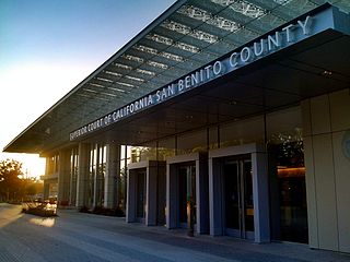
San Benito County, officially the County of San Benito, is a county located in the Coast Range Mountains of the U.S. state of California. As of the 2020 census, the population was 64,209. The county seat is Hollister.
Santa Cruz County, officially the County of Santa Cruz, is a county on the Pacific coast of the U.S. state of California. As of the 2020 census, the population was 270,861. The county seat is Santa Cruz. Santa Cruz County comprises the Santa Cruz–Watsonville, CA Metropolitan Statistical Area, which is also included in the San Jose–San Francisco–Oakland, CA Combined Statistical Area. The county is on the California Central Coast, south of the San Francisco Bay Area region. The county forms the northern coast of the Monterey Bay, with Monterey County forming the southern coast.
San Dimas is a city in the San Gabriel Valley of Los Angeles County, California, United States. At the 2020 census, its population was 34,924. It historically took its name from San Dimas Canyon in the San Gabriel Mountains above the northern section of present-day San Dimas.
Aromas is an unincorporated community and census-designated place (CDP) in Monterey County and San Benito County, California, United States. The population was 2,708 at the 2020 census.
Castroville is an unincorporated town and census-designated place (CDP) in Monterey County, California, United States. At the time of the 2020 census the population was 7,515, up from 6,481 in 2010. Castroville is known for its artichoke crop and for the annual Castroville Artichoke Festival, leading to its nickname as the "Artichoke Center of the World".
Salinas is a city in the U.S. state of California and the county seat of Monterey County. With a population of 163,542 in the 2020 Census, Salinas is the most populous city in Monterey County. Salinas is an urban area located along the eastern limits of the Monterey Bay Area, lying just south of the San Francisco Bay Area and 10 miles (16 km) southeast of the mouth of the Salinas River. The city is located at the mouth of the Salinas Valley, about eight miles (13 km) from the Pacific Ocean, and it has a climate more influenced by the ocean than the interior.
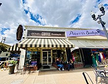
Hollister is a city in and the county seat of San Benito County, located in the Central Coast region of California, United States. With a 2020 United States census population of 41,678, Hollister is one of the largest cities in the Monterey Bay Area and a member of the Association of Monterey Bay Area Governments. The city is an agricultural town known primarily for its local Blenheim apricots, olive oil, vineyards, pomegranates, and chocolate.
Cupertino is a city in Santa Clara County, California, United States, directly west of San Jose on the western edge of the Santa Clara Valley with portions extending into the foothills of the Santa Cruz Mountains. The population was 60,381 as of the 2020 census. The city is widely known for being the home of Apple Inc., headquartered within the city at Apple Park.
Morgan Hill is a city in Santa Clara County, California, at the southern tip of Silicon Valley in the San Francisco Bay Area. Morgan Hill is an affluent residential community, the seat of several high-tech companies, and a dining, entertainment, and recreational destination, owing to its luxury hospitality, wineries, and nature parks.
San Martin or San Martín is a village and census-designated place (CDP) in Santa Clara County, California, in the southern Santa Clara Valley. Located to the south of Morgan Hill and north of Gilroy, San Martin is characterized by ranches, wineries, and orchards, as well as large estates in the foothills of the Santa Cruz Mountains.
Watsonville is a city in Santa Cruz County, California, in the Monterey Bay Area of the Central Coast of California. The population was 52,590 at the 2020 census. Predominantly Latino and Democratic, Watsonville is a self-designated sanctuary city.
Robert Thomas Livermore, also known as Don Roberto Livermore, was an English-born Californian ranchero. He emigrated to Alta California in 1822, eventually becoming a Mexican citizen and a prominent landowner in the Bay Area. The city of Livermore, California is named for him.
California's 18th congressional district is a congressional district located in the U.S. state of California. The district is currently represented by Democrat Zoe Lofgren. Since the 2022 election, the district is landlocked and includes all of San Benito County and parts of Santa Clara and Monterey counties, including Salinas, Hollister, Watsonville, Gilroy, Soledad, and downtown and eastern San Jose.
Ygnacio Ramón de Jesus del Valle was a Californio ranchero and politician. He owned much of the Santa Clarita Valley and served briefly as Mayor of Los Angeles and as a California State Assemblyman.
Gilroy station is a Caltrain station located in Gilroy, California, United States. It is the southernmost terminus of the Caltrain system, and is only served during weekday rush hours in the peak direction, with trains going toward San Francisco in the morning and returning southbound in the evening. The station building was constructed by the Southern Pacific Railroad in 1918 and restored in 1998. Future plans call for extended Amtrak Capitol Corridor service, as well as California High-Speed Rail trains, to also stop at Gilroy. The station was named to the National Register of Historic Places in 2019 as Gilroy Southern Pacific Railroad Depot.
Santa Clara County, California, is one of California's original counties, with prior habitation dating from prehistory to the Alta California period.
Milpitas is a city in Santa Clara County, California, in Silicon Valley. As of the 2020 census, the city population was 80,273. The city's origins lie in Rancho Milpitas, granted to Californio ranchero José María Alviso in 1835. Milpitas incorporated in 1954 and has become home to numerous high tech companies, as part of Silicon Valley.
Rancho San Ysidro was a 13,066-acre (52.88 km2) Spanish land grant in present-day Santa Clara County, California, given in 1809 by Governor José Joaquín de Arrillaga to Ygnacio Ortega. Today's city of Gilroy is on former Rancho Ysidro lands, as is nearby Old Gilroy.
Santa Clara County, officially the County of Santa Clara, is the sixth-most populous county in the U.S. state of California, with a population of 1,936,259 as of the 2020 census. Santa Clara County and neighboring San Benito County form the San Jose–Sunnyvale–Santa Clara metropolitan statistical area, which is part of the larger San Jose–San Francisco–Oakland combined statistical area. Santa Clara is the most populous county in the San Francisco Bay Area and in Northern California.
Gilroy currently has four sister cities: Monticelli d'Ongina, Italy; Saint Clar, France; Takko-Machi, Japan; and Tecate, Baja California.