
West Sparta is a town in Livingston County, New York, United States. The population was 1,255 at the 2010 census. The name is derived from the neighboring town of Sparta.
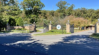
East Hills is a village in Nassau County, New York, United States, on the North Shore of Long Island. It is considered part of the Greater Roslyn area, which is anchored by the Village of Roslyn. As of the United States 2010 Census, the population of the village was 6,955.

Richmondtown is a neighborhood in the Mid-Island section of Staten Island, New York City. It is bounded by Arthur Kill Road on the northwest, Richmond Road on the north, Amboy Road on the east and southeast, and the United Hebrew and Ocean View cemeteries on the southwest.

New Utrecht was a town in western Long Island, New York encompassing all or part of the present-day Bath Beach, Bay Ridge, Bensonhurst, Borough Park, Dyker Heights and Fort Hamilton neighborhoods of Brooklyn, New York City. New Utrecht was established in 1652 by Dutch settlers in the Dutch colony of New Netherland, the last of the original six towns to be founded in Kings County. New Utrecht ceased to exist in 1894 when it was annexed by the City of Brooklyn, and became part of the City of Greater New York when Brooklyn joined as a borough in 1898.
Prince's Bay is the name of a neighborhood located on the South Shore of New York City's borough of Staten Island. Prince's Bay is bordered to the north by Huguenot, to the south by the Raritan Bay, and to the west by Pleasant Plains. The neighborhood is represented in the New York State Senate by Andrew Lanza, in the New York State Assembly by Michael Reilly, and in the New York City Council by Joe Borelli.

Rosebank is a neighborhood in the northeastern part of Staten Island, one of the five boroughs of New York City. It is bordered by Clifton to the north, Arrochar to the south, and the Upper New York Bay to the east.
Westerleigh is a residential neighborhood in the northwestern part of Staten Island in New York City.
Willowbrook is a neighborhood in Staten Island, one of the five boroughs of New York City. It is located in the region of the island usually referred to as Mid-Island, immediately to the south of Port Richmond, to the west of Meiers Corners and Westerleigh, to the north of New Springville, and to the east of Bulls Head.
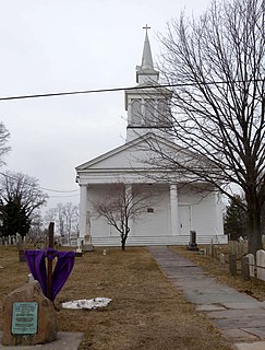
Woodrow is a neighborhood located on the South Shore of Staten Island, New York, United States. The neighborhood is represented in the New York State Senate by Andrew Lanza, in the New York State Assembly by Michael Reilly, and in the New York City Council by Joe Borelli.
Vanderbilt Avenue is the name of three thoroughfares in the New York City boroughs of Brooklyn, Manhattan, and Staten Island. They were named after Cornelius Vanderbilt (1794–1877), the builder of Grand Central Terminal in Midtown Manhattan.

Macondray Lane is a small pedestrian lane on the southeastern side of Russian Hill in San Francisco, California. It forms a wooded enclave that was added to the National Register of Historic Places in 1988 as the Russian Hill–Macondray Lane District.

Five Corners is a neighborhood located at the intersection of Summit Avenue, Newark Avenue, and Hoboken Avenue in Jersey City, New Jersey, United States, and is situated in the northeastern portion of the larger Journal Square district. The name of the intersection is used for the neighborhood radiating from the crossing, which is adjacent to the Hilltop, just south of Bergen Arches and The Divided Highway.
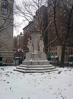
Verdi Square is a small triangle on Upper West Side of Manhattan, New York City. It is between 72nd Street on the south, 73rd Street on the north, Broadway on the west, and Amsterdam Avenue on the east. On the south the square fronts West 72nd Street; across the street to the south lies Sherman Square. On the north side, the park faces the Apple Bank for Savings' central building at 2112 Broadway, designed by York and Sawyer.

Church Street is a short, but heavily travelled, north-south street in Lower Manhattan in New York City. Its southern end is at Trinity Place, of which it is a continuation, and its northern end is at Canal Street.
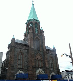
The Village is a neighborhood in the western section of Historic Downtown in Jersey City. It is bordered by Hamilton Park and Harsimus Cove to the east and the Turnpike Extension to the west, on the other side of which Jones Park and Mary Benson Park are located. Newark Avenue is the major street across the Village from Grove Street at the east to Bergen Hill at the west. The neighborhood for many years was considered the city's "Little Italy" neighborhood. Brunswick Street, between 1st and 10th Streets was once full of merchants and nicknamed "Bushel Avenue". St. Anthony of Padua Roman Catholic Church at 457 Monmouth St. received its historic designation on March 22, 2004.

Van Vorst Park is a neighborhood in the Historic Downtown of Jersey City, Hudson County, New Jersey, United States, centered on a park sharing the same name. The neighborhood is located west of Paulus Hook and Marin Boulevard, north of Grand Street, east of the Turnpike Extension, and south of The Village and Christopher Columbus Drive. Much of it is included in the Van Vorst Park Historical District.
Bergen-Lafayette is a section of Jersey City, New Jersey.
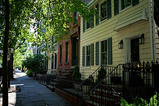
Wallabout is a neighborhood in the New York City borough of Brooklyn that dates back to the 17th century. It is one of the oldest areas of Brooklyn, in the area that was once Wallabout Bay but has largely been filled in and is now the Brooklyn Navy Yard.

Clayton is a neighborhood located in the city and county Denver, Colorado. Often confused with Park Hill, Cole, or the City Park neighborhoods, Clayton is a distinct neighborhood as defined by the city of Denver. The neighborhood is named for the historical former George W. Clayton Trust and College located on the northwest corner of Martin Luther King Blvd. and Colorado Blvd. This college has been listed on the National Register of Historic Places.


