
Calvary Cemetery is a Roman Catholic cemetery that the Archdiocese of Los Angeles runs in the community of East Los Angeles. It is also called "New Calvary Cemetery" because it succeeded the original Calvary Cemetery, over which Cathedral High School was built.

The Kingsway is a residential neighbourhood in Toronto, Ontario, Canada. It is bounded by Bloor Street to the south, Dundas Street to the north, the Mimico Creek to the west and the Humber River to the east. The neighbourhood was officially known as Kingsway Park, which later became replaced by its nickname, The Kingsway. For planning purposes, the neighbourhood is known by the City of Toronto as "Kingsway South" to differentiate it from a more recent extension of The Kingsway north of Dundas Street. "Kingsway South" is not used by residents, due to confusion with the South Kingsway, a street located east of the Humber River and extending south from Bloor Street.

Ashburton is a suburb of Melbourne, Victoria, Australia, 12 km (7.5 mi) southeast of Melbourne's Central Business District, located within the City of Boroondara local government area. Ashburton recorded a population of 7,952 at the 2021 census.

Werribee is a suburb in Melbourne, Victoria, Australia, 32 km (20 mi) south-west of Melbourne's Central Business District, located within the City of Wyndham local government area. Werribee recorded a population of 50,027 at the 2021 census.

Roncesvalles is a neighbourhood in the city of Toronto, Ontario, Canada, centred on Roncesvalles Avenue, a north–south street leading from the intersection of King and Queen Streets to the south, north to Dundas Street West, a distance of roughly 1.5 kilometres. It is located east of High Park, north of Lake Ontario, in the Parkdale–High Park provincial and federal ridings and the municipal Ward 14. Its informal boundaries are High Park to the west, Bloor Street West to the north, Lake Ontario/Queen Street West to the south and Lansdowne Avenue/rail corridor to the east. Originally known as "Howard Park", most of this area was formerly within the boundaries of Parkdale and Brockton villages and was annexed into Toronto in the 1880s.

Yorkville is a neighbourhood and former village in Toronto, Ontario, Canada. It is roughly bounded by Bloor Street to the south, Davenport Road to the north, Yonge Street to the east and Avenue Road to the west, and it is part of The Annex neighbourhood. Established as a separate community in 1830, it was annexed into Toronto in 1883. Yorkville comprises residential areas, office space, and retail shopping.

Strokestown, also known as Bellanamullia and Bellanamully, is a small town in County Roscommon, Ireland. It is one of the 27 designated Heritage Towns in Ireland. Located in the part of the country marketed for tourism purposes as Ireland's Hidden Heartlands, it is 140 km (87 mi) from Dublin and 120 km (75 mi) from Galway. Strokestown is one of Ireland's few planned towns, showing evidence of deliberate planning, such as formally aligned streets and prominent public buildings.
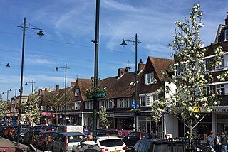
Whitton is an area in the London Borough of Richmond upon Thames, England. Historically, the boundaries of Whitton were the north-western part of Twickenham manor, bounded internally by the sections of the River Crane and the Duke of Northumberland's River.

Woodside is a residential and commercial neighborhood in the western portion of the borough of Queens in New York City. It is bordered on the south by Maspeth, on the north by Astoria, on the west by Sunnyside, and on the east by Elmhurst, Jackson Heights, and East Elmhurst. Some areas are widely residential and very quiet, while other parts, especially the ones around Roosevelt Avenue, are busier.

Queens Botanical Garden is a botanical garden located at 43-50 Main Street in Flushing, Queens, New York City. The 39-acre (16 ha) site features rose, bee, herb, wedding, and perennial gardens; an arboretum; an art gallery; and a LEED-certified Visitor & Administration Building. Queens Botanical Garden is located on property owned by the City of New York, and is funded from several public and private sources. It is operated by Queens Botanical Garden Society, Inc.
Irish Hill is a neighborhood east of downtown Louisville, Kentucky USA. It is bounded by Baxter Avenue to the west, Lexington Road to the north, the middle fork of Beargrass Creek and I-64 to the east. Cave Hill Cemetery is located directly south of Irish Hill. It is in the inner Highlands area of Louisville.

Tang Hall is a suburban district of the city of York in North Yorkshire, England. The name is derived from the Anglo Saxon Tang, which means the meeting place of two becks, and a Hall that stood on Fourth Avenue until the 1970s. The Hall was latterly used as the Tang Hall pub until it was demolished and replaced by a purpose-built pub which in turn was demolished in 2007.
Gladstone Park is a suburb in Melbourne, Victoria, Australia, 15 km (9.3 mi) north-west of Melbourne's Central Business District, located within the City of Hume local government area. Gladstone Park recorded a population of 8,213 at the 2021 census.

Kew Gardens Hills is a neighborhood in the middle of the New York City borough of Queens. The borders are Flushing Meadows-Corona Park to the west, the Long Island Expressway to the north, Union Turnpike to the south, and Parsons Boulevard to the east.
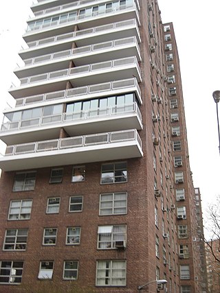
Morningside Gardens is a private housing cooperative operated by Morningside Heights Housing Corporation (MHHC) in Morningside Heights, Manhattan, New York City. It is composed of a parking garage and six apartment buildings of 21 stories each, for a total of about 980 apartments. MHHC rents space to the Children's Learning Center preschool and the Morningside Retirement and Health Service. The complex has many amenities for its cooperators including a playground, a fitness center, storage units, indoor play spaces for children and young adults, bike rooms, and a workshop including ceramics and woodworking.
Baden is a neighborhood of St. Louis, Missouri.

Berczy Village is a residential neighbourhood in Markham, Ontario, Canada. It is bounded to the north by Major Mackenzie Drive, to the east by McCowan Road, to the south by 16th Avenue, and to the west by Kennedy Road. This area is north of Unionville. The community is named after William Berczy, Markham's founder. The name can be found on limestone plaques throughout the community's many arterial road entrances.
Shandon is an area of Edinburgh within North Merchiston approximately three miles west of the centre of Edinburgh. It is bounded by Slateford Road to the north, Harrison Road to the east, the Union Canal to the south and the Glasgow-Edinburgh Shotts Line and Suburban rail lines to the west.

Ferry Point Park is a 413.8-acre (167.5 ha) park in the Bronx, New York City. The park site is a peninsula projecting into the East River roughly opposite the College Point and Malba neighborhoods of Queens. The park is located on the eastern shore of Westchester Creek, adjacent to the neighborhood of Throggs Neck. The park is operated by the New York City Department of Parks and Recreation. The Hutchinson River Expressway crosses the park to the Bronx-Whitestone Bridge, splitting it into east and west sides.

The Presbyterian Burying Ground, also known as the Old Presbyterian Burying Ground, was a historic cemetery which existed between 1802 and 1909 in the Georgetown neighborhood of Washington, D.C., in the United States. It was one of the most prominent cemeteries in the city until the 1860s. Burials there tapered significantly after Oak Hill Cemetery was founded nearby in 1848. The Presbyterian Burying Ground closed to new burials in 1887, and about 500 to 700 bodies were disinterred after 1891 when an attempt was made to demolish the cemetery and use the land for housing. The remaining graves fell into extensive disrepair. After a decade of effort, the District of Columbia purchased the cemetery in 1909 and built Volta Park there, leaving nearly 2,000 bodies buried at the site. Occasional human remains and tombstones have been discovered at the park since its construction. A number of figures important in the early history of Georgetown and Washington, D.C., military figures, politicians, merchants, and others were buried at Presbyterian Burying Ground.
