Second Avenue (Manhattan)

Last updated

Template:Attached KML/Second Avenue (Manhattan)
KML is from Wikidata
Second Avenue
Second Avenue at 26th Street, looking north.jpg
Second Avenue (Manhattan)
Owner City of New York
Maintained by NYCDOT
Length6.4 mi (10.3 km) [1]
Location Manhattan, New York City
South end Houston  / Chrystie Streets in Lower East Side
Major
junctions
NY-25.svg NY 25 (Queensboro Bridge) in East Midtown
RFK Bridge in East Harlem
North endHarlem River Drive Shield free.svg Harlem River Drive  / 128th Street in East Harlem
East First Avenue
West Third Avenue
Construction
Commissioned March 1811

Second Avenue is located on the East Side of the New York City borough of Manhattan extending from Houston Street at its south end to the Harlem River Drive at 128th Street at its north end. A one-way street, vehicular traffic on Second Avenue runs southbound (downtown) only, except for a one-block segment of the avenue in Harlem. South of Houston Street, the roadway continues as Chrystie Street south to Canal Street.

Contents

A bicycle lane runs in the leftmost lane of Second Avenue from 125th to Houston Streets. The section from 55th to 34th Streets closes a gap in the Manhattan Waterfront Greenway.

Second Avenue passes through a number of Manhattan neighborhoods including (from south to north) the Lower East Side, the East Village, Stuyvesant Square, Kips Bay, Tudor City, Turtle Bay, East Midtown, Lenox Hill, Yorkville and Spanish Harlem. [2] [3]

History

Second Avenue facing north from 42nd Street in 1861 Second Avenue Manhattan 1861.jpg
Second Avenue facing north from 42nd Street in 1861

Downtown Second Avenue in the Lower East Side was the home to many Yiddish theatre productions during the early part of the 20th century, and Second Avenue came to be known as the "Yiddish Theater District", "Yiddish Broadway", or the "Jewish Rialto". Although the theaters are gone, many traces of Jewish immigrant culture remain, such as kosher delicatessens and bakeries, and the famous Second Avenue Deli (which closed in 2006, later reopening on East 33rd Street and Third Avenue).

The Second Avenue Elevated train line ran above Second Avenue the full length of the avenue north of 23rd Street, and stood from 1880 until service was ended on June 13, 1942. South of Second Avenue, it ran on First Avenue and then Allen and Division Street. [4] The elevated trains were noisy and often dirty (in the 19th century they were pulled by soot-spewing steam locomotives). This depressed land values along Second Avenue during the late 19th and early 20th centuries. Partially because of the presence of the El, most buildings constructed during this era were working class tenements. The line was finally torn down in 1942 because it was deteriorated and obsolete, and the cost of World War II made upkeep impossible. [5] Second Avenue maintains its modest architectural character today, despite running through a number of high income areas.

Second Avenue has carried one-way traffic since June 4, 1951, before which it carried traffic in both the northbound and southbound directions. [6]

A protected bike lane on the left, or east, side of the avenue between 59th and 68th streets was completed in 2019. This, along with previous bike lane projects, gave the avenue a continuous bike lane from 125th to 43rd Street. [7] [8] In March 2024, the NYCDOT announced plans to widen the bike lane on Second Avenue from 59th to Houston Street, as well as relocate the bus lane away from the curb. [9] [10]

2015 gas explosion

On March 26, 2015, a gas explosion and resulting fire in the East Village destroyed three buildings at 119, 121 and 123 Second Avenue, between East 7th Street and St. Mark's Place. At least twenty-two people were injured, four critically, and two people were initially listed as missing. [11] Later, two men were found dead in the debris of the explosion and were confirmed to be the ones listed as missing. [12] [13] There had previously been an illegal tap installed into the gas line feeding 121 Second Avenue. [14] In the days before the explosion, work was ongoing in the building for the installation of a new 4-inch gas line to service the apartments in 121, and some of the tenants had smelled gas an hour before the explosion. [14]

Eleven other buildings were evacuated as a result of the explosion, and Con Ed turned off the gas to the area. A few residents were allowed to return to some of the vacated buildings several days later. [14]

Transportation

Bus service

The M15 local serves the entirety of Second Avenue. The M15 Select Bus Service, the Select Bus Service equivalent of the local M15 bus, provides bus rapid transit service along Second Avenue southbound. Additionally, the M34A Select Bus Service runs along Second Avenue between East 34th Street and East 23rd Street en route to Waterside Plaza. [15]

Subway

The Q train serves Second Avenue from 96th Street to 72nd Street before turning onto 63rd Street with a stop at Lexington Avenue, which has an exit at Third Avenue. A Second Avenue Subway line has been planned since 1919, [16] with provisions to construct it as early as 1929. [17]

Two short sections of the line have been completed over the years, serving other subway services (the Grand Street station is served by the B and D trains), and others simply sitting vacant underground (such as the unused upper level at the Second Avenue station on the F and <F> trains). Portions have been leased from time to time by New York Telephone to house equipment serving the company's principal north-south communication lines which run under the Avenue. [18] Isolated 1970s-era segments of the line, built without any infrastructure, exist between Pell and Canal Streets, and between 99th–105th and 110th–120th Streets. [19] Construction on Phase 1, which will eventually extend from 125th Street to the Financial District via the T service, began on April 12, 2007. Phase 1 connects the BMT 63rd Street Line with the new line north to stations at 72nd, 86th, and 96th Streets, serving the Q train. Phase 1 opened on January 1, 2017. [20] Phase 2, which would extend the line to East Harlem at 125th Street and Lexington Avenue, is expected to be completed between 2027 and 2029. [21] When the whole Second Avenue subway line is completed, it is projected to serve about 560,000 daily riders. [22]

Bike lane

There is a bicycle lane along the avenue south of 125th St. [23] [24]

Related Research Articles

The Second Avenue Subway is a New York City Subway line that runs under Second Avenue on the East Side of Manhattan. The first phase of this new line, with three new stations on Manhattan's Upper East Side, opened on January 1, 2017. The full Second Avenue Line, if it will be funded, will be built in three more phases to eventually connect Harlem–125th Street in Harlem to Hanover Square in Lower Manhattan. The proposed full line would be 8.5 miles (13.7 km) and 16 stations long, serve a projected 560,000 daily riders, and cost more than $17 billion.

<span class="mw-page-title-main">125th Street station (IRT Lexington Avenue Line)</span> New York City Subway station in Manhattan

The 125th Street station is an express station with four tracks and two island platforms. It is the northernmost Manhattan station on the IRT Lexington Avenue Line of the New York City Subway. Located at Lexington Avenue and East 125th Street in East Harlem, it is served by the 4 and 6 trains at all times, the 5 train at all times except late nights, and the <6> train during weekdays in peak direction. This station was constructed as part of the Dual Contracts by the Interborough Rapid Transit Company and opened in 1918.

<span class="mw-page-title-main">125th Street (Manhattan)</span> West-east street in Manhattan, New York

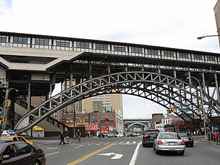
125th Street, co-named Martin Luther King Jr. Boulevard, is a two-way street that runs east–west in the New York City borough of Manhattan, from First Avenue on the east to Marginal Street, a service road for the Henry Hudson Parkway along the Hudson River in the west. It is often considered to be the "Main Street" of Harlem.

<span class="mw-page-title-main">M23 (New York City bus)</span> Bus route in Manhattan, New York

The 23rd Street Crosstown is a surface transit line on 23rd Street in Manhattan, New York City. It currently hosts the M23 SBS bus route of the Metropolitan Transportation Authority (MTA)'s Regional Bus Operations. The M23 runs between Chelsea Piers, along the West Side Highway near 22nd Street, via 23rd Street, to Avenue C and 20th Street in Stuyvesant Town–Peter Cooper Village.

<span class="mw-page-title-main">Third Avenue</span> North-south avenue in Manhattan and the Bronx, New York

Third Avenue is a north-south thoroughfare on the East Side of the New York City borough of Manhattan, as well as in the center portion of the Bronx. Its southern end is at Astor Place and St. Mark's Place. It transitions into Cooper Square, and further south, the Bowery, Chatham Square, and Park Row. The Manhattan side ends at East 128th Street. Third Avenue is two-way from Cooper Square to 24th Street, but carries only northbound (uptown) traffic while in Manhattan above 24th Street; in the Bronx, it is again two-way. However, the Third Avenue Bridge carries vehicular traffic in the opposite direction, allowing only southbound vehicular traffic, rendering the avenue essentially non-continuous to motor vehicles between the boroughs.

<span class="mw-page-title-main">First Avenue (Manhattan)</span> North-south avenue in Manhattan, New York

First Avenue is a north-south thoroughfare on the East Side of the New York City borough of Manhattan, running from Houston Street northbound to 127th Street. At 125th Street, most traffic continues onto the Willis Avenue Bridge over the Harlem River, which continues into the Bronx. South of Houston Street, the roadway continues as Allen Street south to Division Street. Traffic on First Avenue runs northbound (uptown) only.

<span class="mw-page-title-main">IRT Second Avenue Line</span> Former New York City rapid transit line

The IRT Second Avenue Line, also known as the Second Avenue Elevated or Second Avenue El, was an elevated railway in Manhattan, New York City, United States, from 1878 to 1942. It was operated by the Interborough Rapid Transit Company until 1940, when the city took over the IRT. Service north of the 57th Street station ended on June 11, 1940; the rest of the line closed on June 13, 1942.

<span class="mw-page-title-main">Chatham Square</span> Square in Manhattan, New York

Chatham Square is a major intersection in Chinatown, Manhattan, New York City. The square lies at the confluence of eight streets: the Bowery, Doyers Street, East Broadway, St. James Place, Mott Street, Oliver Street, Worth Street and Park Row. The small park in the center of the square is known as Kimlau Square and Lin Ze Xu Square.

<span class="mw-page-title-main">M15 (New York City bus)</span> Bus route in Manhattan, New York

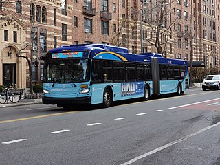
The First and Second Avenues Line, also known as the Second Avenue Line, is a bus line in Manhattan, New York City, running mostly along Second Avenue from Lower Manhattan to East Harlem. Originally a streetcar line along Second Avenue, it is now the M15 bus route, the busiest bus route in the city and United States, carrying 16.4 million riders annually. MTA Regional Bus Operations, under the New York City Bus and Select Bus Service brands, operates the local out of the Tuskegee Airmen Bus Depot and the SBS from the Mother Clara Hale Bus Depot. Service is operated exclusively with articulated buses.

<span class="mw-page-title-main">M60 (New York City bus)</span> Bus route in Manhattan and Queens, New York

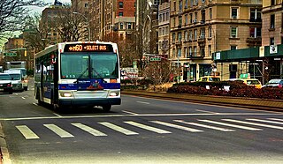
The M60 Select Bus Service is a bus route in New York City. It is part of MTA Regional Bus Operations, operated by the Manhattan and Bronx Surface Transit Operating Authority (MaBSTOA) under the New York City Transit brand. The M60 provides service between the Upper West Side of Manhattan and LaGuardia Airport in East Elmhurst, Queens, traveling between boroughs via the RFK-Triborough Bridge. It is the only direct public transit option between Manhattan and LaGuardia Airport.

2nd Avenue or Second Avenue may refer to:

<span class="mw-page-title-main">Allen Street</span> Street in Manhattan, New York

Allen Street is a street in the New York City borough of Manhattan which runs north-south through the Lower Manhattan neighborhood of Chinatown and the Lower East Side. It is continued north of Houston Street as First Avenue. South of Division Street, it is known as Pike Street to its southern terminus at South Street. The northbound and southbound roadways are separated by a meridian mall, which has two bike lanes located outside the meridian mall; each bike lane is unidirectional. The street's namesake was Master Commandant William Henry Allen, the youngest person to command a Navy ship in the War of 1812. He was killed in action at the age of 28. His exploits included the capture of the British ship HMS Macedonian.

<span class="mw-page-title-main">Select Bus Service</span> Bus service in New York City

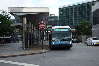
Select Bus Service is a brand used by the Metropolitan Transportation Authority (MTA)'s Regional Bus Operations for limited-stop bus routes with some bus rapid transit features in New York City. The first SBS route was implemented in 2008 to improve speed and reliability on long, busy corridors.

<span class="mw-page-title-main">Metropolitan Hospital Center</span> NYC public hospital

Metropolitan Hospital Center is a hospital in East Harlem, New York City. It has been affiliated with New York Medical College since it was founded in 1875, representing the oldest partnership between a hospital and a private medical school in the United States.

<span class="mw-page-title-main">96th Street station (Second Avenue Subway)</span> New York City Subway station in Manhattan

The 96th Street station is a station on the IND Second Avenue Line of the New York City Subway. Located at the intersection of Second Avenue and 96th Street on the border of the Upper East Side/Yorkville and East Harlem neighborhoods in Manhattan, it is the northern terminus for the Q train at all times. It is also served by limited southbound rush hour N trains and one northbound morning rush hour R train. The station is the terminus for the first phase of the Second Avenue Line.

<span class="mw-page-title-main">Bx15 and M125 buses</span> Bus routes in Manhattan and the Bronx, New York

The Bx15 and M125 bus routes constitute the Third Avenue/125th Street Line, a public transit line in New York City. The Bx15 runs between Fordham Plaza and the Hub in the Bronx, running primarily along Third Avenue. The M125 runs between the Hub in the Bronx and Manhattanville in Manhattan, running along Willis Avenue in the South Bronx and along 125th Street in Harlem, Manhattan.

<span class="mw-page-title-main">106th Street station (Second Avenue Subway)</span> New York City Subway station in Manhattan, New York

106th Street is a planned station along the IND Second Avenue Line of the New York City Subway. It would be located at the intersection of Second Avenue and 106th Street in East Harlem, Manhattan, United States. Proposed since 1968, the station is expected to be built as part of Phase 2 of the Second Avenue Subway. When opened, it will initially be served by the Q train, with the T train providing service when Phase 3 of the line is built.

<span class="mw-page-title-main">116th Street station (Second Avenue Subway)</span> New York City Subway station in Manhattan, New York

116th Street is a planned station along the IND Second Avenue Line of the New York City Subway. It would be located at the intersection of Second Avenue and 116th Street in East Harlem, Manhattan. Proposed since 1968, the station is expected to be built as part of Phase 2 of the Second Avenue Subway. When opened, it will initially be served by the Q train, with the T train providing service when Phase 3 of the line is built.

<span class="mw-page-title-main">Unbuilt plans for the Second Avenue Subway</span> History of a New York City Subway line

The Second Avenue Subway, a New York City Subway line that runs under Second Avenue on the East Side of Manhattan, has been proposed since 1920; the first phase of the line did not open until 2017. Up until the 1960s, many distinct plans for the Second Avenue subway line were never carried out, though small segments were built in the 1970s. The complex reasons for these delays are why the line is sometimes called "the line that time forgot".

<span class="mw-page-title-main">Construction of the Second Avenue Subway</span> History of a New York City Subway line

The Second Avenue Subway, a New York City Subway line that runs under Second Avenue on the East Side of Manhattan, has been proposed since 1920. The first phase of the line, consisting of three stations on the Upper East Side, started construction in 2007 and opened in 2017, ninety-seven years after the route was first proposed. Up until the 1960s, many distinct plans for the Second Avenue subway line were never carried out, though small segments were built in the 1970s as part of the Program for Action. The complex reasons for these delays are why the line is sometimes called "the line that time forgot".

References

  1. Google (September 1, 2015). "Second Avenue (Manhattan)" (Map). Google Maps . Google. Retrieved September 1, 2015.
  2. "The Study Area includes many distinctive urban elements in a densely developed area: the East River waterfront, well known residential enclaves such as Tudor City, Turtle Bay, Beekman Place, and Sutton Place with historic buildings and features, Stuyvesant Square, the United Nations, and other older residential neighborhoods intermixed with more recent apartment towers and superblock housing developments, as well as two massive power plant complexes, several superblocks of hospital facilities, and neighborhood parks."
  3. Yorkville, Manhattan: Senior Pedestrian Crashes 2001-2006
  4. "Second Avenue 'El' Coming to a Stop", The Christian Science Monitor , June 13, 1942. Accessed October 12, 2008.
  5. "Second Avenue Subway: Route 132-C". www.nycsubway.org. Retrieved June 5, 2014.
  6. Ingraham, Joseph (June 5, 1951). "Autos Speeded 15% on 1st And 2nd Aves". The New York Times. Retrieved August 28, 2012.
  7. Nieves, Alicia (August 16, 2019). "Cyclists celebrate 2nd Avenue bike lane". PIX11. Retrieved March 5, 2024.
  8. "New York City opens bike lane on dangerous section of 2nd Avenue". ABC7 New York. August 16, 2019. Retrieved March 5, 2024.
  9. Lane, Charles (March 5, 2024). "Manhattan's 2nd Avenue would get 24/7 bus lane, wider bike lane under proposed redesign". Gothamist. Retrieved March 5, 2024.
  10. Simko-Bednarski, Evan (March 5, 2024). "NYC DOT plans revamp of Second Ave. bus and bike lanes". New York Daily News. Retrieved March 5, 2024.
  11. Flegenheimer, Matt and Surico, John "Two Men Remain Missing as Remnants of Explosion Are Scoured in Manhattan" The New York Times (March 28, 2015)
  12. Barr, Meghan. "Official: 2 found dead in rubble believed to be missing men", Yahoo! News (March 30, 2015)
  13. Dolan, Jim (April 3, 2015). "Crews Reach Basement In Manhattan Building Explosion Clean-up". WABC-TV. Retrieved April 4, 2015.
  14. 1 2 3 Sandoval, Edgar and Smith, Greg B. "City probing whether East Village building owner illegally tapped into gas main as family mourns Nicholas Figueroa" New York Daily News (March 31, 2015)
  15. "Manhattan Bus Map" (PDF). Metropolitan Transportation Authority. July 2019. Retrieved December 1, 2020.
  16. Staff. "Second Avenue 'El' Coming to a Stop", The Christian Science Monitor , June 13, 1942. Accessed October 12, 2008.
  17. "100 Miles of Subway in New City Project; 52 of them in Queens". The New York Times . September 16, 1929. p. 1. Retrieved August 12, 2023.
  18. "Second Avenue Subway: Route 132-C". www.nycsubway.org. Retrieved June 5, 2014.
  19. "The Line That Time Forgot – Second Avenue Subway". Nymag.com. April 5, 2004. Retrieved April 10, 2014.
  20. Slotnik, Daniel E.; Wolfe, Jonathan; Fitzsimmons, Emma G.; Palmer, Emily; Remnick, Noah (January 1, 2017). "Opening of Second Avenue Subway: Updates". The New York Times. ISSN   0362-4331 . Retrieved January 1, 2017.
  21. "New York City 2nd Ave Subway Phase 2 Profile" (PDF). FTA. December 27, 2016. Archived from the original (PDF) on January 5, 2017. Retrieved January 4, 2017.
  22. Smith, Stephen J. (October 2, 2013). "The Next 20 Years for New York's MTA – Next City". Nextcity.org. Retrieved June 5, 2014.
  23. "Manhattan Bike Map: Manhattan Bike Paths, Bike Lanes & Greenways". NYC Bike Maps. Retrieved June 5, 2014.
  24. Miller, Stephen (September 17, 2013). "DOT Proposes Filling the Gap in Second Avenue Protected Bike Lane | Streetsblog New York City". Streetsblog.org. Retrieved June 5, 2014.