Park Avenue Viaduct

Last updated

Park Avenue Viaduct
GCT PAV 2.jpg
A portion of the viaduct crosses 42nd Street at Grand Central Terminal.
Park Avenue Viaduct
Location Park Avenue between East 40th and 46th Streets
Manhattan, New York
Coordinates 40°45′07″N73°58′40″W / 40.75194°N 73.97778°W / 40.75194; -73.97778
Built1919 (western roadway and south leg)
1928 (eastern roadway)
ArchitectWarren & Wetmore; Reed & Stem
Architectural style Beaux-Arts
NRHP reference No. 83001726
NYSRHP No.06101.006478
NYCL No.1127
Significant dates
Added to NRHPAugust 11, 1983 [1]
Designated NYSRHPJuly 6, 1983 [2]
Designated NYCLSeptember 23, 1980 [3]

The Park Avenue Viaduct, also known as the Pershing Square Viaduct, is a roadway in Manhattan, New York City. It carries vehicular traffic on Park Avenue from 40th to 46th Streets. The viaduct is composed of two sections: a steel viaduct with two roadways from 40th to 42nd Streets, as well as a pair of roadways between 42nd and 46th Streets. The section from 40th to 42nd Streets was designated a New York City landmark in 1980 and was listed on the National Register of Historic Places in 1983. The street-level service roads of Park Avenue, which flank the viaduct between 40th and 42nd Streets, are called Pershing Square. The section of the viaduct between 42nd and 46th Streets travels around Grand Central Terminal and the MetLife Building, then through the Helmsley Building; all three buildings lie across the north–south axis of the avenue.

Contents

The viaduct was first proposed by New York Central Railroad president William J. Wilgus in 1900 as part of the construction of Grand Central Terminal. Construction on the viaduct's western leg began in 1917, after the terminal had opened, and was completed in 1919. The western leg initially carried two-way traffic, so the eastern leg was completed for northbound traffic in 1928, and the western leg was reconfigured to carry southbound traffic only. An information booth was established in 1939 beneath the viaduct, and the city renovated the viaduct in the early 1990s.

Description

The viaduct is used by automobile traffic between 40th Street to the south and 46th Street to the north. It is composed of two sections: the steel viaduct between 40th and 42nd Streets, and the pair of roadways between 42nd and 46th Streets. Immediately to the south of 40th Street is the portal of the Park Avenue Tunnel, which carries northbound traffic from 33rd Street directly onto the viaduct. [4] The posted weight limit for the viaduct is 15 short tons (13 long tons; 14 t), and commercial traffic is prohibited. [5] Pedestrian and bicycle traffic is generally also prohibited, [6] [7] except during "Summer Streets", when Park Avenue is closed to vehicular traffic on selected summer weekends. [7] [8]

Route

Southern section

Plaque on the viaduct Park Avenue Viaduct plaque 1919 jeh.jpg
Plaque on the viaduct

From the south, traffic from Park Avenue, 40th Street, or the Park Avenue Tunnel enters the steel viaduct. The viaduct rises to a T-intersection just north of 42nd Street, over the street-level entrance to Grand Central Terminal below. [4] [9] This segment of the viaduct is 600 feet (180 m) long and consists of a granite approach ramp with stone balustrades, as well as three steel arches, which are separated by granite piers with foliate friezes. [9] [10] The central arch has been infilled to create a restaurant space. [9] [11] The arches were included because of "aesthetic considerations", but are actually cantilever beams, because true arches would have required excessively large abutments. [12] [13] The girders over each pier are each 136 feet (41 m) long by 12 feet (3.7 m) deep, weighing 73 short tons (65 long tons; 66 t) each. They were made in New Jersey and shipped from Delaware to New York, then pulled by 52 horses from the East River. [14]

The deck of the viaduct, above the steel arches, contains railings with plain and foliate panels, as well as lampposts atop each granite pier. [9] [10] [12] The deck is 60 feet (18 m) wide. [15] The arches of the Pershing Square Viaduct are based on the Pont Alexandre III in Paris, [16] and contain plaques with the words "Pershing Square" at their centers. [11]

Northern section

At the T-intersection north of 42nd Street, the viaduct splits into two legs. [4] A statue of Cornelius Vanderbilt, longtime owner of New York Central, is at the T-intersection. [17] [18] The legs of the viaduct surround the terminal building and the MetLife Building to the north before passing through a pair of portals under the Helmsley Building between 45th and 46th Streets. Northbound traffic uses the eastern leg, which runs above a private road called Depew Place, while southbound traffic uses the western leg, which runs above the eastern sidewalk of Vanderbilt Avenue. Both roadways pass above 45th Street without intersection. [4] The roadways then take sharp S-curves into the Helmsley Building, where they descend into triple-story arches that exit onto 46th Street. [19]

The western leg is 35 feet (11 m) wide; the eastern leg is 33 feet (10 m) wide between 42nd and 44th Streets, widening to 53 feet (16 m) north of 44th Street. The roadway above 42nd Street, which connects the two legs, is 40 feet (12 m) wide. [20] The portion of the viaduct immediately surrounding the terminal's building has a masonry balustrade with an additional metal guardrail. [4] There is a cast-iron eagle atop the balustrade where the western leg curves onto the connecting roadway above 42nd Street. [21] [22] A sidewalk, accessible from the Grand Hyatt hotel, runs along the section of the viaduct that is parallel to 42nd Street. [17]

Pershing Square

The viaduct crosses over Pershing Square Park Avenue Viaduct Pershing Square from west.jpg
The viaduct crosses over Pershing Square

The street-level service roads of Park Avenue between 40th and 42nd Streets are called Pershing Square. The service roads between 41st and 42nd Streets are open only to bicycles and pedestrians. [23] The square is named after General John J. Pershing. Consequently, the southern portion of the viaduct between 40th and 42nd Streets is also known as the Pershing Square Viaduct. [24]

History

The New York Central Railroad built the Grand Central Depot in 1869 as the southern terminus of the Park Avenue main line. [25] The depot was located along the axis of Fourth Avenue (later Park Avenue), splitting the avenue into two parts: a section south of 42nd Street and another north of 45th Street. [26] The southern section of Park Avenue was a quiet road running through the upscale enclave of Murray Hill, [27] while the northern section contained an open cut (later covered over), which carried the Park Avenue main line. [25] Further, the northern end of the Park Avenue Tunnel rose to ground level between 40th and 42nd Streets, splitting 41st Street into two sections at Park Avenue. [20] [28] Depew Place ran along the eastern side of the depot, while Vanderbilt Avenue ran along the western side. [29]

Early plans

Grand Central Terminal as seen from the southern end of the viaduct At New York, USA 2017 019.jpg
Grand Central Terminal as seen from the southern end of the viaduct

The Park Avenue Viaduct was first proposed by New York Central president William J. Wilgus in 1900, when he suggested replacing Grand Central Depot with Grand Central Terminal. [30] During a design competition for the terminal in 1903, Reed and Stem proposed vehicular viaducts around the terminal building. New York Central ultimately selected Reed and Stem, as well as Warren and Wetmore, to construct Grand Central Terminal. [31] [32] [33] The two architectural firms had a tense relationship. Over Wilgus's objections, Warren and Wetmore modified Reed and Stem's plan, eliminating a proposed 12-story tower and vehicular viaducts. [34] The elevated viaducts were restored, as were several of Reed and Stem's other design elements, as part of an agreement between the two firms in 1909. [33] [35] The railroad also bought Depew Place, over which the eastern leg of the viaduct would run. [20] [29] Two years later, the New York City Board of Estimate approved New York Central's plans for a viaduct carrying Park Avenue over 42nd Street. [36]

The present plans for the Park Avenue Viaduct were devised in 1912 by Warren and Wetmore. [37] The terminal's construction already provided for roadways to either side of the terminal building, in preparation for the viaduct's eventual completion. [15] The terminal was opened in 1913, [38] but the viaduct could not be built yet because the Interborough Rapid Transit Company, one of the operators of the city's subway system, had not even decided whether to build the Grand Central–42nd Street station under the viaduct's site. [39] The IRT ultimately decided to build the station diagonally under 42nd Street, connecting its new Lexington Avenue Line to the north with the existing subway under Park Avenue to the south, and by mid-1917, subway construction had progressed to the extent that work on the viaduct could commence. [40] Bidding for the viaduct's construction was opened in August 1917. At that time, Fifth Avenue and Madison Avenue (which ran parallel to Park Avenue) were heavily congested, and the viaduct was expected to alleviate some of that traffic. [41]

Construction

GCT Hyatt.jpg
Taxi stand on the viaduct, outside the Grand Hyatt hotel
Park Av high west jeh.JPG
The western leg of the viaduct during "Summer Streets", temporarily closed to cars

Construction on the viaduct began in November 1917. [42] [43] However, further progress was hindered due to the difficulty in securing ornamental steel during World War I. [26] Work resumed in July 1918 when an order for the necessary steel was placed, and builders began erecting the masonry foundation and wall. [15] The viaduct opened on April 16, 1919; the project had cost $768,032, including related infrastructure projects, such as the opening of 41st Street and the relocation of both of the Park Avenue Tunnel's portals. [26] [44] When it opened, only automobiles and taxicabs used the Park Avenue Viaduct. [18] The original viaduct took two-way traffic from Park Avenue at 40th Street and carried it around the west side of Grand Central Terminal, terminating at the T-intersection of 45th Street and Vanderbilt Avenue. [lower-alpha 1] An elevated service driveway ran to the east of the terminal, above Depew Place; it was used by baggage and mail vans, and provided parking space and an entrance to the Commodore Hotel. [10] [26] [45] The driveway served the Grand Central post office at 450 Lexington Avenue, as well as a since-demolished baggage building north of the terminal. [46]

Shortly after the viaduct's opening, the area at the bottom of the viaduct was renamed Pershing Square in 1919 to honor World War I General John J. Pershing. [47] The lot immediately to the east had been occupied by Grand Union Hotel, which was condemned via eminent domain in 1914 and subsequently demolished. [35] [48] That space was proposed for use as an open plaza [49] with a three-story memorial called "Victory Hall". [50] In July 1920, a realty consortium headed by investor Henry Mandel bought the site. [51] [52] Mandel gave the Bowery Savings Bank the eastern portion of the site, which would be developed into an office building at 110 East 42nd Street, [53] completed in 1923. [54] [55] The western portion of the site became the Pershing Square Building, also completed in 1923. [56] The "Pershing Square" name subsequently applied to the service roads of the Park Avenue Viaduct between 40th and 42nd Streets. [10]

Expansion

The exit of the eastern leg of the viaduct through the Helmsley Building back to ground level Portal to Park Avenue.jpg
The exit of the eastern leg of the viaduct through the Helmsley Building back to ground level

Soon after the viaduct's opening, traffic at 45th Street and Vanderbilt Avenue started to accumulate, causing gridlock at that intersection, since thirteen lanes of traffic converged there. [45] [57] By 1920, business associations were advocating for the eastern leg of the viaduct to be opened to public use. [58] [59] The city started negotiating with New York Central to open the eastern leg of the viaduct, although the railroad was holding out unless it was granted property on Park Avenue. [60] The city proposed building a ramp from the viaduct that would descend to ground level at 46th Street, while keeping Park Avenue open to traffic between 45th and 46th Streets; however, New York Central's proposal would altogether close off that block of Park Avenue. [45] The Manhattan borough president, Julius Miller, proposed giving New York Central the right to erect a building over Park Avenue, in exchange for the railroad giving Depew Place back to the city so that the eastern leg of the viaduct could be built. [61] By November 1922, Miller and the New York Central reached an agreement to submit a proposal for the viaduct to city authorities, [62] and the Board of Estimate approved the proposal in January 1923. [45]

New York Central had made a revised agreement by the city by 1924, which gave the railroad the right to erect a building over Park Avenue. [29] [57] [63] As part of the project, the section of Park Avenue between 45th and 46th Streets would be closed, the eastern leg of the viaduct would be completed, and traffic would be carried around both sides of the terminal and through the New York Central Building before being deposited at Park Avenue and 46th Street. The plans also called for a roadway running above 45th Street's southern sidewalk, connecting the two directions of traffic, as well as the extension of Vanderbilt Avenue north to 47th Street and the widening of Park Avenue. [29] [63] [64] Initial plans called for the viaduct to run across 46th Street so that viaduct traffic did not interfere with traffic on 45th and 46th Streets. [65] This was later changed to allow the viaduct's roadways to descend to street level between 45th and 46th Streets. The roadways were placed on S-curves supported by stanchions that did not touch the New York Central Building's frame. [66]

In April 1924, the revised plan was sent to the Board of Estimate, which approved the project. [65] Work could start upon the approval of Charles L. Craig, the city controller. [67] However, Craig initially refused to certify the plan, stating that the city had paid much more for Depew Place than the land was worth. [68] After more than a year of re-negotiations, Craig finally certified the plan in December 1925. [67] The next year, work on the New York Central Building's foundations commenced, [61] and the block of Park Avenue between 45th and 46th Streets was closed. The eastern leg along Depew Place was opened in February 1928, and northbound traffic was diverted there. [69] Construction was complete by September of that year, with the completion of the western leg, which had been extended to Park Avenue and 46th Street with an overpass over 45th Street. [45] In November 1928, the Vanderbilt statue was installed at the T-intersection above 42nd Street. [70]

Later history

The entrance to the Pershing Square Cafe, which extends to 41st Street under the viaduct Pershing Square Cafe.jpg
The entrance to the Pershing Square Cafe, which extends to 41st Street under the viaduct

The space under the viaduct between 41st and 42nd Streets was originally used as a trolley barn. [71] In 1938, the city announced that it would build a tourist information center within that space in advance of the 1939 New York World's Fair. [72] The city subsequently built a steel and glass-brick structure under the center arch of the viaduct. [9] [11] [73] The structure, located at 90 East 42nd Street, [74] opened in December 1939 and was initially used to provide tourist information. [75] [76] During World War II, the space was used by United Service Organizations, and after the war, became an outpost of the New York Convention and Visitors Bureau. [77] By 1960, leaks from the viaduct had damaged the information center. That year, a reconstruction project for the viaduct was announced, which involved repairing trusses as well as installing drainage and a nonskid deck. [78]

The former tourist-information center had become an unemployment office by the 1980s. [9] [11] The viaduct had also become dilapidated, with potholes, leaks, and rusted steel supports, [79] so the city government undertook the first major renovations in the viaduct's history. [80] The southbound roadway was closed in July 1984, [79] reopening that November. [80] The northbound roadway was then closed from May 1985 [81] to September 1985. [80] The viaduct's original lamps were removed in a 1986 repaving project. [73] [82] An $8 million restoration of the viaduct was announced three years later. [12] As part of the renovation, the Grand Central Partnership would turn the space between 41st and 42nd Streets into a restaurant. [83] Seven of the original lamps were also restored in 1992. [73] [82]

In 1995, the city and the Grand Central Partnership unveiled plans to restore the space under the viaduct at a cost of $2 million, then lease it as a restaurant. [84] The restaurant space would be located in the former site of the World's Fair information center. [73] [84] The Pershing Square Cafe signed a lease at the space in 1997. [85] The owner of the renovated space, Michael O'Keeffe, placed so much attention to the renovation of the space that the project's costs increased to $5 million, and the cafe's opening date was pushed back by several months. [86]

Critical reception and landmark designations

When the Park Avenue Viaduct opened, it was praised as a solution to the traffic congestion around Grand Central Terminal. In 1922, the New-York Tribune called it one of several works of "engineering magic". [87] Christopher Gray, architecture critic at The New York Times , wrote that "the completion of the viaduct suddenly changed Park Avenue from an inconvenient local street to the most modern highway in New York." [12] The building's design in relation to Grand Central Terminal was also lauded. Architecture magazine said that the design "has produced a beautiful and satisfying work of truly monumental character." [14]

The Park Avenue Viaduct was designated a New York City landmark in 1980. [88] [3] In its report, the New York City Landmarks Preservation Commission wrote that the viaduct "is an integral part of the complex circulation system of Grand Central Terminal". [11] The viaduct was listed on the National Register of Historic Places in 1983, technically as a "boundary increase" to the Grand Central Terminal's listing, but carrying a separate reference number. [1] Both designations apply only to the section of the viaduct between 40th and 42nd Streets. [3] [89]

See also

Related Research Articles

<span class="mw-page-title-main">42nd Street (Manhattan)</span> West-east street in Manhattan, New York

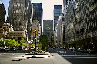
42nd Street is a major crosstown street in the New York City borough of Manhattan, spanning the entire breadth of Midtown Manhattan, from Turtle Bay at the East River, to Hell's Kitchen at the Hudson River on the West Side. The street hosts some of New York's best known landmarks, including the headquarters of the United Nations, the Chrysler Building, Grand Central Terminal, the New York Public Library Main Branch, Times Square, and the Port Authority Bus Terminal.

<span class="mw-page-title-main">Grand Central Terminal</span> Railway terminal in Manhattan, New York

Grand Central Terminal, is a commuter rail terminal located at 42nd Street and Park Avenue in Midtown Manhattan, New York City. Grand Central is the southern terminus of the Metro-North Railroad's Harlem, Hudson and New Haven Lines, serving the northern parts of the New York metropolitan area. It also contains a connection to the Long Island Rail Road through the Grand Central Madison station, a 16-acre (65,000 m2) rail terminal underneath the Metro-North station, built from 2007 to 2023. The terminal also connects to the New York City Subway at Grand Central–42nd Street station. The terminal is the third-busiest train station in North America, after New York Penn Station and Toronto Union Station.

<span class="mw-page-title-main">MetLife Building</span> Office skyscraper in Manhattan, New York

The MetLife Building is a skyscraper at Park Avenue and 45th Street, north of Grand Central Terminal, in the Midtown Manhattan neighborhood of New York City. Designed in the International style by Richard Roth, Walter Gropius, and Pietro Belluschi and completed in 1962, the MetLife Building is 808 feet (246 m) tall with 59 stories. It was advertised as the world's largest commercial office space by square footage at its opening, with 2.4 million square feet (220,000 m2) of usable office space. As of November 2022, the MetLife Building remains one of the 100 tallest buildings in the United States.

<span class="mw-page-title-main">Park Avenue</span> North–south avenue in Manhattan and the Bronx, New York

Park Avenue is a boulevard in New York City that carries north and southbound traffic in the boroughs of Manhattan and the Bronx. For most of the road's length in Manhattan, it runs parallel to Madison Avenue to the west and Lexington Avenue to the east. Park Avenue's entire length was formerly called Fourth Avenue; the title still applies to the section between Cooper Square and 14th Street. The avenue is called Union Square East between 14th and 17th Streets, and Park Avenue South between 17th and 32nd Streets.

<span class="mw-page-title-main">Grand Central–42nd Street station</span> New York City Subway station complex in Manhattan

The Grand Central–42nd Street station is a major station complex of the New York City Subway. Located in Midtown Manhattan at 42nd Street between Madison and Lexington Avenues, it serves trains on the IRT Lexington Avenue Line, the IRT Flushing Line and the 42nd Street Shuttle. The complex is served by the 4, 6, and 7 trains at all times; the 5 and 42nd Street Shuttle (S) trains at all times except late nights; the <6> train during weekdays in the peak direction; and the <7> train during rush hours and early evenings in the peak direction.

<span class="mw-page-title-main">Park Avenue Tunnel (roadway)</span> Tunnel in Manhattan, New York

The Park Avenue Tunnel, also called the Murray Hill Tunnel, is a 1,600-foot-long (488 m) tunnel that passes under seven blocks of Park Avenue in Murray Hill, in the New York City borough of Manhattan. Traffic used to travel northbound from 33rd Street toward the Park Avenue Viaduct. The tunnel is under the jurisdiction of the New York City Department of Transportation. It is designed to carry one lane of northbound car traffic from East 33rd Street to East 40th Street. From 40th Street north, traffic must follow the Park Avenue Viaduct around Grand Central Terminal to 46th Street. The vertical clearance is 8 ft 11 in (2.72 m).

<span class="mw-page-title-main">Chanin Building</span> Office skyscraper in Manhattan, New York

The Chanin Building, also known as 122 East 42nd Street, is a 56-story office skyscraper in Midtown Manhattan in New York City. It is on the southwest corner of 42nd Street and Lexington Avenue, near Grand Central Terminal to the north and adjacent to 110 East 42nd Street to the west. The building is named for Irwin S. Chanin, its developer.

<span class="mw-page-title-main">FDR Drive</span> Highway in New York

Franklin D. Roosevelt East River Drive, commonly called FDR Drive for short, is a controlled-access parkway on the east side of the New York City borough of Manhattan. It starts near South and Broad Streets, just north of the Battery Park Underpass, and runs north along the East River to the 125th Street / Robert F. Kennedy Bridge / Willis Avenue Bridge interchange, where it becomes Harlem River Drive. All of FDR Drive is designated New York State Route 907L (NY 907L), an unsigned reference route.

The Macombs Dam Bridge is a swing bridge across the Harlem River in New York City, connecting the boroughs of Manhattan and the Bronx. The bridge is operated and maintained by the New York City Department of Transportation (NYCDOT).

<span class="mw-page-title-main">West Side Elevated Highway</span> Former highway in Manhattan, New York

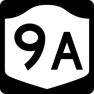
The West Side Elevated Highway was an elevated section of New York State Route 9A running along the Hudson River in the New York City borough of Manhattan to the tip of the island. It was an elevated highway, one of the first urban freeways in the world, and served as a prototype for urban freeways elsewhere, including Boston's Central Artery.

<span class="mw-page-title-main">Helmsley Building</span> Office skyscraper in Manhattan, New York

The Helmsley Building is a 35-story skyscraper at 230 Park Avenue between East 45th and 46th Streets, just north of Grand Central Terminal, in the Midtown Manhattan neighborhood of New York City. It was built in 1929 as the New York Central Building and was designed by Warren & Wetmore in the Beaux-Arts style. It was the tallest structure in the "Terminal City" complex around Grand Central prior to the completion of what is now the MetLife Building.

<span class="mw-page-title-main">42nd Street–Bryant Park/Fifth Avenue station</span> New York City Subway station complex in Manhattan

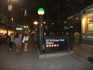
The 42nd Street–Bryant Park/Fifth Avenue station is an underground New York City Subway station complex, consisting of stations on the IRT Flushing Line and IND Sixth Avenue Line. Located at 42nd Street between Fifth Avenue and Sixth Avenue in Manhattan, it is served by the 7, D and F trains at all times, the B and M trains on weekdays, and the ⟨7⟩ and ⟨F⟩ trains during rush hours in the peak direction. A free passageway from the IND platforms to the Times Square–42nd Street/Port Authority Bus Terminal station, served by the 1, ​2, ​3​, 7, <7>​​, ​A​, ​C​, ​E​, N, ​Q, ​R, ​W​, and S trains is open during the day from 6 a.m. to 12 a.m.

<span class="mw-page-title-main">Park Avenue main line</span> Railroad line in New York City

The Park Avenue main line, which consists of the Park Avenue Tunnel and the Park Avenue Viaduct, is a railroad line in the New York City borough of Manhattan, running entirely along Park Avenue. The line carries four tracks of the Metro-North Railroad as a tunnel from Grand Central Terminal at 42nd Street to a portal at 97th Street, where it rises to a viaduct north of 99th Street and continues over the Harlem River into the Bronx over the Park Avenue Bridge. During rush hours, Metro-North uses three of the four tracks in the peak direction.

<span class="mw-page-title-main">Pershing Square Building</span> Office skyscraper in Manhattan, New York

The Pershing Square Building, also known as 125 Park Avenue or 100 East 42nd Street, is a 25-story office building in Midtown Manhattan in New York City. It is located on the eastern side of Park Avenue between 41st and 42nd streets, across from Grand Central Terminal to the north and adjacent to 110 East 42nd Street to the east.

<span class="mw-page-title-main">Grand Central Palace</span> Former exhibition hall in New York City

The Grand Central Palace was an exhibition hall in Midtown Manhattan, New York City. The name refers to two structures, both located on Lexington Avenue near Grand Central Terminal.

<span class="mw-page-title-main">Pershing Square, Manhattan</span> Plaza in Manhattan, New York

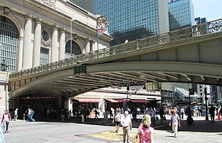
Pershing Square is a public plaza in Manhattan, New York City, located where Park Avenue and 42nd Street intersect in front of Grand Central Terminal. The main roadway of Park Avenue crosses over 42nd Street on the Park Avenue Viaduct, also known as the Pershing Square Viaduct. Two service roads, one northbound and one southbound, connect 42nd Street with the main roadway of Park Avenue, at 40th Street.

<span class="mw-page-title-main">Graybar Building</span> Office skyscraper in Manhattan, New York

The Graybar Building, also known as 420 Lexington Avenue, is a 30-story office building in Midtown Manhattan, New York City. Designed by Sloan & Robertson in the Art Deco style, the Graybar Building is at 420–430 Lexington Avenue between 43rd and 44th Streets, adjacent to Grand Central Terminal.

<span class="mw-page-title-main">Socony–Mobil Building</span> Office skyscraper in Manhattan, New York

The Socony–Mobil Building, also known as 150 East 42nd Street, is a 45-story, 572-foot-tall (174 m) skyscraper in the Murray Hill and East Midtown neighborhoods of Manhattan in New York City. It occupies the block bounded by 41st Street, 42nd Street, Lexington Avenue, and Third Avenue.

<span class="mw-page-title-main">History of Grand Central Terminal</span> History of a New York City commuter rail station

Grand Central Terminal is a major commuter rail terminal in Midtown Manhattan, New York City, serving the Metro-North Railroad's Harlem, Hudson and New Haven Lines. It is the most recent of three functionally similar buildings on the same site. The current structure was built by and named for the New York Central & Hudson River Railroad, though it also served the New York, New Haven and Hartford Railroad. Passenger service has continued under the successors of the New York Central and New Haven railroads.

<span class="mw-page-title-main">Terminal City (Manhattan)</span> Commercial development in Manhattan, New York City

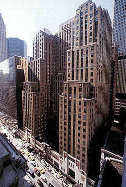
Terminal City, also known as the Grand Central Zone, is an early 20th century commercial and office development in Midtown Manhattan, New York City. The space was developed atop the former Grand Central Station railyard, after the New York Central Railroad decided to rebuild the station into Grand Central Terminal, and reshape the railyard into a below-ground train shed, allowing roads and skyscrapers to be built atop it.

References

Informational notes

  1. Vanderbilt Avenue continued as a private roadway north of 45th Street; it was opened to the public when the viaduct was extended in 1928. [45]

Citations

  1. 1 2 "National Register Information System". National Register of Historic Places . National Park Service. April 15, 2008.
  2. "Cultural Resource Information System (CRIS)". New York State Office of Parks, Recreation and Historic Preservation. November 7, 2014. Retrieved July 20, 2023.
  3. 1 2 3 Landmarks Preservation Commission 1980 , p. 1.
  4. 1 2 3 4 5 Google (June 7, 2020). "Park Avenue Viaduct" (Map). Google Maps . Google. Retrieved June 7, 2020.
  5. "New York City Bridge Report" (PDF). New York City Department of Transportation. 2017. p. 250. Archived (PDF) from the original on December 2, 2018. Retrieved March 16, 2018.
  6. "NYC DOT – Bicycle Maps" (PDF). nyc.gov . New York City Department of Transportation. 2019. Archived (PDF) from the original on May 14, 2019. Retrieved May 14, 2019.
  7. 1 2 Walsh, Kevin (August 26, 2010). "Car-Free Saturday Part 6: Park Avenue Viaduct". Forgotten New York. Archived from the original on June 8, 2020. Retrieved June 8, 2020.
  8. Metro (August 5, 2016). "Summer Streets guide: Traffic closures, schedule, activities". Metro US. Archived from the original on June 8, 2020. Retrieved June 8, 2020.
  9. 1 2 3 4 5 6 National Park Service 1983 , p. 4.
  10. 1 2 3 4 Landmarks Preservation Commission 1980 , p. 5.
  11. 1 2 3 4 5 Landmarks Preservation Commission 1980 , p. 6.
  12. 1 2 3 4 Gray, Christopher (October 29, 1989). "Streetscapes: The Grand Central Viaduct; An $8 Million Revival for a Midtown Masterpiece". The New York Times. ISSN   0362-4331. Archived from the original on July 15, 2020. Retrieved June 6, 2020.
  13. Architecture 1919 , p. 41.
  14. 1 2 Architecture 1919 , p. 44.
  15. 1 2 3 "New Park Avenue Viaduct; Work Started Last Week to Be Completed by Next Spring". The New York Times. July 21, 1918. ISSN   0362-4331. Archived from the original on June 7, 2020. Retrieved June 7, 2020.
  16. Robins & New York Transit Museum 2013 , p. 83.
  17. 1 2 Durante, Dianne L. (2007). Outdoor Monuments of Manhattan: A Historical Guide. NYU Press. ISBN   9780814719862. Archived from the original on April 22, 2020. Retrieved December 19, 2018.
  18. 1 2 Morrison, D.D.; Diehl, L.B. (2019). Grand Central Terminal and Penn Station: Statuary and Sculptures. Images of Rail. Arcadia Publishing Incorporated. pp. 20–21. ISBN   978-1-4396-6741-5. Archived from the original on May 6, 2022. Retrieved June 7, 2020.
  19. Landmarks Preservation Commission 1987 , p. 19.
  20. 1 2 3 "Park Avenue Viaduct to End Traffic Snarl". The Sun. May 26, 1918. p. 52. Archived from the original on May 6, 2022. Retrieved June 7, 2020 via newspapers.com Open Access logo PLoS transparent.svg .
  21. Ferguson, Colleen (August 8, 2018). "Secrets of Grand Central Terminal: missing decorations, hidden staircases and a tiny acorn". The Journal News. Archived from the original on December 20, 2018. Retrieved December 19, 2018.
  22. Walsh, Kevin (May 22, 2018). "Grand Central Eagle". Forgotten New York. Archived from the original on June 8, 2020. Retrieved June 8, 2020.
  23. Warerkar, Tanay (February 16, 2018). "Busy block near Grand Central Terminal will transform into a pedestrian plaza". Curbed NY. Archived from the original on December 6, 2018. Retrieved December 5, 2018.
  24. Landmarks Preservation Commission 1980 , p. 1.
  25. 1 2 Fitch, James Marston; Waite, Diana S. (1974). Grand Central Terminal and Rockefeller Center: A Historic-critical Estimate of Their Significance. Albany, New York: The Division. p. 3.
  26. 1 2 3 4 "Park Ave. Viaduct Opens Wednesday". The Sun. April 13, 1919. p. 17. Archived from the original on May 6, 2022. Retrieved June 7, 2020 via newspapers.com Open Access logo PLoS transparent.svg .
  27. Gray, Christopher (July 21, 2011). "Putting the Park in Park Avenue". The New York Times. ISSN   0362-4331. Archived from the original on April 27, 2022. Retrieved June 7, 2020.
  28. "Want 41st Street Opened; Eliminate Tunnel Obstructions at Park Avenue as Relief to Traffic Congestion". The New York Times. March 5, 1911. ISSN   0362-4331. Archived from the original on June 7, 2020. Retrieved June 7, 2020.
  29. 1 2 3 4 "Central Tells Plans for New Skyscraper" . New York Herald-Tribune. September 18, 1927. p. C1. Archived from the original on March 29, 2020. Retrieved June 11, 2020 via ProQuest.
  30. Schlichting 2001 , pp. 60–62.
  31. Robins & New York Transit Museum 2013 , p. 53.
  32. Schlichting 2001 , pp. 118–120.
  33. 1 2 "Grand Central Terminal Interior" (PDF). Landmarks Preservation Commission. September 23, 1980. p. 5. Archived (PDF) from the original on December 8, 2017. Retrieved December 25, 2018.
  34. Schlichting 2001 , p. 123.
  35. 1 2 Landmarks Preservation Commission 1980 , p. 4.
  36. "Elevated Roadway Around a New Station; Central's Plan to Carry Park Avenue Over Forty-second Street Approved". The New York Times. June 16, 1911. ISSN   0362-4331. Archived from the original on June 7, 2020. Retrieved June 7, 2020.
  37. National Park Service 1983 , p. 7.
  38. "Modern Terminal Supplies Patrons with Home Comforts". The New York Times. February 2, 1913. ISSN   0362-4331. Archived (PDF) from the original on April 24, 2022. Retrieved February 2, 2018.
  39. "Park Avenue Viaduct Scheme". The Sun. April 4, 1913. p. 7. Archived from the original on May 6, 2022. Retrieved June 7, 2020 via newspapers.com Open Access logo PLoS transparent.svg .
  40. "Park Avenue Viaduct.; Bids for Improvement to be Opened Tomorrow". The New York Times. July 29, 1917. ISSN   0362-4331. Archived from the original on June 7, 2020. Retrieved June 7, 2020.
  41. "Bids Opened for the New Park Avenue Viaduct Over Forty-second Street; an Ornamental Structure Landing on Upper Level of Grand Central Terminal Planned to Relieve Traffic on Fifth and Madison Avenues-- Estimated to Cost About $700,000". The New York Times. August 5, 1917. ISSN   0362-4331. Archived from the original on June 7, 2020. Retrieved June 7, 2020.
  42. "New Forty-second Street Viaduct; Work Started on Structure to Connect Park Avenue with Grand Central Terminal". The New York Times. November 4, 1917. ISSN   0362-4331. Archived from the original on June 6, 2020. Retrieved June 6, 2020.
  43. "Start Park Avenue Viaduct". The Sun. November 2, 1917. p. 9. Archived from the original on May 6, 2022. Retrieved June 7, 2020 via newspapers.com Open Access logo PLoS transparent.svg .
  44. "Link Up Park Av. To Ease Congestion; Civic Bodies Celebrate Opening of Viaduct at 42d Street and Ramp at 33d Street". The New York Times. April 17, 1919. ISSN   0362-4331. Archived from the original on August 18, 2020. Retrieved June 6, 2020.
  45. 1 2 3 4 5 6 "New Viaduct Thoroughfare Relieves Park Avenue Traffic Congestion; Result of Many Years' Work" (PDF). The New York Times. September 2, 1928. p. 123. ISSN   0362-4331. Archived from the original on April 24, 2022. Retrieved December 7, 2018.
  46. Schlichting 2001 , pp. 62–63.
  47. "Name Street For Pershing; Space in Front of Grand Central Becomes Pershing Square". The New York Times. December 3, 1918. ISSN   0362-4331. Archived from the original on October 20, 2019. Retrieved October 20, 2019.
  48. "The Passing of Old Hotels" (PDF). The Real Estate Record: Real Estate Record and Builders' Guide. Vol. 93, no. 2407. May 5, 1914. p. 818. Archived (PDF) from the original on October 20, 2019. Retrieved May 11, 2020 via columbia.edu.
  49. "Plan To Create New Public Square On East Forty-second Street". The New York Times. February 9, 1919. ISSN   0362-4331. Archived from the original on October 20, 2019. Retrieved October 20, 2019.
  50. "Plans for Victory Hall; Board of Estimate to Consider Proposed Pershing Square Building". The New York Times. June 13, 1919. ISSN   0362-4331. Archived from the original on October 20, 2019. Retrieved October 20, 2019.
  51. "Bids $2,900,000 for Grand Union Site; Henry Mandel Offers Upset City Price for Valuable Pershing Square Plot". The New York Times. July 21, 1920. ISSN   0362-4331. Archived from the original on October 20, 2019. Retrieved October 20, 2019.
  52. "Builders Buy Grand Union Site" (PDF). The Real Estate Record: Real Estate Record and Builders' Guide. Vol. 106, no. 6. August 7, 1920. p. 787. Archived (PDF) from the original on October 20, 2019. Retrieved May 11, 2020 via columbia.edu.
  53. "Pershing Square Building" (PDF). New York City Landmarks Preservation Commission. November 25, 2016. p. 7. Archived (PDF) from the original on February 8, 2017. Retrieved June 7, 2020.
  54. "Move $202,000,000 In Crowded Streets; Train of Armored Cars, Machine Guns Bristling, Transfers the Bowery Bank's Wealth". The New York Times. June 24, 1923. ISSN   0362-4331. Archived from the original on October 28, 2019. Retrieved October 28, 2019.
  55. "Bowery Savings Opens New Home". Brooklyn Daily Eagle. June 22, 1923. p. 22. Archived from the original on May 6, 2022. Retrieved October 28, 2019 via Brooklyn Public Library; newspapers.com Open Access logo PLoS transparent.svg .
  56. Seward, Anne (June 22, 1924). "Banking, One Flight up, New City Business Feature". The New York Times. ISSN   0362-4331. Archived from the original on October 27, 2019. Retrieved October 27, 2019.
  57. 1 2 Landmarks Preservation Commission 1987 , p. 6.
  58. "City Likely to Gain Use of Depew Place; Negotiations With New York Central for Roadway East of Terminal". The New York Times. September 15, 1922. ISSN   0362-4331. Archived from the original on June 7, 2020. Retrieved June 7, 2020.
  59. "Ask New Roadway at Grand Central". New York Evening World. August 30, 1920. p. 3. Archived from the original on May 6, 2022. Retrieved June 7, 2020 via newspapers.com Open Access logo PLoS transparent.svg .
  60. "Viaduct East of Grand Central Planned by City". New-York Tribune. August 1, 1922. p. 8. Archived from the original on April 24, 2022. Retrieved June 7, 2020 via newspapers.com Open Access logo PLoS transparent.svg .
  61. 1 2 "N.Y. Central Starts 35-story Building; Wants Bids on 40,000 Tons of Steel for Structure to Span Park Avenue". The New York Times. December 9, 1926. ISSN   0362-4331. Archived from the original on June 7, 2020. Retrieved June 7, 2020.
  62. "Traffic Plan Ready for Grand Central". New York Herald. November 5, 1922. p. 8. Archived from the original on May 6, 2022. Retrieved June 7, 2020 via newspapers.com Open Access logo PLoS transparent.svg .
  63. 1 2 "Traffic Jam Relief". New York Daily News. April 14, 1924. p. 36. Archived from the original on May 6, 2022. Retrieved June 7, 2020 via newspapers.com Open Access logo PLoS transparent.svg .
  64. "Park Av. Traffic to Flow Through 35-story Building; With Second Ramp on East Side of Grand Central Congestion Will Be Greatly Eased". The New York Times. September 18, 1927. ISSN   0362-4331. Archived from the original on June 7, 2020. Retrieved June 7, 2020.
  65. 1 2 "City Soon to Start Depew Place Work" (PDF). The New York Times. April 13, 1924. ISSN   0362-4331. Archived from the original on May 6, 2022. Retrieved May 18, 2021.
  66. Landmarks Preservation Commission 1987 , p. 7.
  67. 1 2 "Park Av. Roadway Plan Goes Through; Craig Certifies Contract for Great Improvement Around Grand Central Terminal". The New York Times. December 29, 1925. ISSN   0362-4331. Archived from the original on June 8, 2020. Retrieved June 6, 2020.
  68. "Craig Turns Down Mayor's Contract with N.Y. Central". Brooklyn Times-Union. October 12, 1924. p. 5. Archived from the original on May 6, 2022. Retrieved June 2, 2020 via newspapers.com Open Access logo PLoS transparent.svg .
  69. "Depew Place Open to Public Traffic; Miller Draws Aside Cord Which Permits First Cars to Use Grand Central Viaduct". The New York Times. February 5, 1928. ISSN   0362-4331. Archived from the original on June 7, 2020. Retrieved June 7, 2020.
  70. "Grand Central Gets Vanderbilt Statue; Huge Figure From Freight Station to Face Automobile Viaduct From Park Avenue". The New York Times. November 29, 1928. ISSN   0362-4331. Archived from the original on June 7, 2020. Retrieved June 7, 2020.
  71. Martin, Douglas (November 16, 1995). "Plan for Pershing Square Would Yield New Park". The New York Times. ISSN   0362-4331. Archived from the original on June 7, 2020. Retrieved June 7, 2020.
  72. "Information Aid for World's Fair". New York Daily News. December 19, 1938. p. 279. Archived from the original on May 6, 2022. Retrieved June 7, 2020 via newspapers.com Open Access logo PLoS transparent.svg .
  73. 1 2 3 4 Stern, Robert A. M.; Fishman, David; Tilove, Jacob (2006). New York 2000: Architecture and Urbanism Between the Bicentennial and the Millennium . New York: Monacelli Press. p. 485. ISBN   978-1-58093-177-9. OCLC   70267065. OL   22741487M.
  74. "90 East 42nd Street". NYC.gov. New York City Department of Information Technology and Telecommunications. Archived from the original on September 1, 2021. Retrieved March 20, 2020.
  75. Federal Writers' Project (1939). New York City Guide. New York: Random House. p. 222. ISBN   978-1-60354-055-1. (Reprinted by Scholarly Press, 1976; often referred to as WPA Guide to New York City.)
  76. "1,200 an Hour Jam City's New Information Booth to Play Quiz". New York Daily News. December 19, 1939. p. 277. Archived from the original on May 6, 2022. Retrieved June 7, 2020 via newspapers.com Open Access logo PLoS transparent.svg .
  77. Slatin, Peter (August 22, 1993). "Al Fresco Dining Facing Grand Central?". The New York Times. ISSN   0362-4331. Archived from the original on June 7, 2020. Retrieved June 7, 2020.
  78. "Viaduct to Be Closed; Repairs Will Be Made on Park Avenue Segment". The New York Times. January 24, 1960. ISSN   0362-4331. Archived from the original on June 7, 2020. Retrieved June 7, 2020.
  79. 1 2 Rimer, Sara (July 19, 1984). "Park Avenue Viaduct: New Battle in Traffic Wars". The New York Times. ISSN   0362-4331. Archived from the original on June 7, 2020. Retrieved June 7, 2020.
  80. 1 2 3 "The City; Park Ave. Viaduct To Reopen Today". The New York Times. September 9, 1985. ISSN   0362-4331. Archived from the original on June 7, 2020. Retrieved June 7, 2020.
  81. "Northbound Park Ave. Shut at Grand Central for Repairs". The New York Times. May 1, 1985. ISSN   0362-4331. Archived from the original on June 7, 2020. Retrieved June 7, 2020.
  82. 1 2 Louie, Elaine (October 8, 1992). "Currents; 1919 Lights Return to A Viaduct". The New York Times. ISSN   0362-4331. Archived from the original on April 9, 2019. Retrieved June 6, 2020.
  83. Shepard, Joan (November 29, 1989). "42d Street plan may get a nibble". New York Daily News. p. 661. Archived from the original on May 6, 2022. Retrieved June 7, 2020 via newspapers.com Open Access logo PLoS transparent.svg .
  84. 1 2 Martin, Douglas (November 16, 1995). "Plan for Pershing Square Would Yield New Park". The New York Times. ISSN   0362-4331. Archived from the original on June 7, 2020. Retrieved June 6, 2020.
  85. Rothstein, Mervyn (May 14, 1997). "Restaurant to Fill Niche Under Park Ave. Viaduct". The New York Times. ISSN   0362-4331. Archived from the original on June 7, 2020. Retrieved June 6, 2020.
  86. Varner, Bill (August 15, 1999). "Cafe to call attention to Pershing Square". The Journal-News. p. 3. Archived from the original on May 6, 2022. Retrieved June 4, 2020 via newspapers.com Open Access logo PLoS transparent.svg .
  87. Sparkes, Boyden (August 6, 1922). "Making New York Safe for Pedestrians". New-York Tribune. p. 50. Retrieved June 7, 2020 via newspapers.com Open Access logo PLoS transparent.svg .
  88. New York City Landmarks Preservation Commission; Dolkart, Andrew S.; Postal, Matthew A. (2009). Postal, Matthew A. (ed.). Guide to New York City Landmarks (4th ed.). New York: John Wiley & Sons. p. 101. ISBN   978-0-470-28963-1.
  89. National Park Service 1983 , p. 11.

Sources