Ninth Avenue (Manhattan)

Last updated
Template:Attached KML/Ninth Avenue (Manhattan)
KML is from Wikidata
Ninth Avenue
Columbus Avenue (59th–110th Streets)
Morningside Drive (north of 110th Street)
9th-food.jpg
The avenue in Hell's Kitchen
Ninth Avenue (Manhattan)
Owner City of New York
Maintained by NYCDOT
Length5.7 mi (9.2 km) [1]
Location Manhattan, New York City
South end Greenwich Street
North endBroadway above West 220th Street in Inwood, Manhattan
East Eighth Avenue (below 59th Street)
Central Park West (59th–110th Streets)
West Tenth Avenue (below 59th Street)
Amsterdam Avenue (above 59th Street)
Construction
Commissioned March 1811

Ninth Avenue, known as Columbus Avenue between West 59th and 110th Streets, is a thoroughfare on the West Side of Manhattan in New York City, United States. Traffic runs downtown (southbound) from the Upper West Side to Chelsea. Two short sections of Ninth Avenue also exist in the Inwood neighborhood, carrying two-way traffic.

Contents

Description

Ninth Avenue originates just south of West 14th Street at Gansevoort Street in the West Village, and extends uptown for 48 blocks until its intersection with West 59th Street, where it becomes Columbus Avenue – named after Christopher Columbus. It continues without interruption through the Upper West Side to West 110th Street, where its name changes again, to Morningside Drive, and runs north through Morningside Heights to West 122nd Street.

A one-block stretch of Ninth Avenue between 15th and 16th Streets is also signed as "Oreo Way". [2] The first Oreo cookies were manufactured in 1912 at the former Nabisco headquarters on that block. [2]

The portion of the avenue between 14th and 31st Streets was remodeled in 2008 with a bicycle lane between the eastern curb and the parking lane, followed by another portion between 77th and 96th Streets in 2011. [3]

Above the Lincoln Square neighborhood—where the ABC television network houses its corporate headquarters in a group of rehabilitated and modern buildings—Columbus Avenue passes through the Central Park West Historic District, stretching from 67th/68th Streets to 89th Street. There, the avenue presents a unified streetscape of 5- to 7-story tenement buildings of brick and brownstone with discreet Romanesque and Italianate details, employing cast terracotta details and panels and courses of angle-laid brickwork. Many ornate tin cornices remain. The buildings are separated in mid-block by the narrowest of access alleys, giving glimpses of Ailanthus foliage in the side-street yards. The repeated designs of three or four commercial speculative builders, using the same features and detailing, add to the avenue's architectural unity. There are several generously scaled pre-World War I apartment buildings and the former Endicott Hotel, as well as a small commercial block from the office of McKim, Mead, and White at 72nd Street.

Between 77th and 81st Streets, Columbus Avenue borders the American Museum of Natural History and Theodore Roosevelt Park. [4]

Ninth Avenue reappears in the Inwood neighborhood as a short two-way street in two segments interrupted by the New York City Subway's 207th Street Yard. It runs from West 201st Street to West 208th Street, dead-ending at Inwood North Cove Park at the Harlem River, [1] then picks up again at West 215th Street, and terminates at Broadway between West 220th Street and the Broadway Bridge, at the location where West 221st Street would normally be. [1] The addresses along this upper stretch from 201st Street to Broadway are continuous with the lower portion of Ninth Avenue.

History

The Ninth Avenue Elevated was a passenger train that ran above Ninth Avenue, beginning in the nineteenth century. The lease for the line was assumed by the Interborough Rapid Transit Company (IRT) on April 1, 1903. [5] The line ran until it was closed and dismantled in 1940, following the purchase of the IRT by the City of New York, as it was made redundant by the city's Eighth Avenue subway line.

Ninth Avenue and Columbus Avenue were converted to carry one-way traffic southbound in two stages. South of its intersection with Broadway, the avenue was converted on November 6, 1948. [6] [7] The remaining stretch, to 110th Street, was converted on December 6, 1951. [8]

In 2007, Ninth Avenue became the first major north-south avenue in Manhattan with a protected bike lane. [9] The bike lane initially extended only from 23rd to 16th Street. [9] [10] A protected bike lane on Columbus Avenue was built between 96th and 77th Street in 2010–2011; the bike lane led to increases in vehicular speeds, since drivers were no longer stuck behind bicyclists. [11] After a $231 million project that replaced some of the water pipes under Ninth Avenue, the segment between 59th and 50th Street was narrowed to three travel lanes in March 2023, and a painted sidewalk and protected bike lane were added. [12] [13]

The Ninth Avenue International Food Festival street fair is held every year in May. [14]

Transportation

Ninth Avenue (Columbus Avenue) is served primarily by the M7 between 66th Street and 106th Street while the M11 between Cathedral Parkway and 14th Street. The M12, M79 SBS, M34A SBS, and M14D+ Select Bus runs on short portions of the street.

The 1 (2 during late nights) have a station on Columbus Avenue on the IRT Broadway - Seventh Avenue Line at 66th Street and Broadway

Points of interest

See also

Related Research Articles

<span class="mw-page-title-main">Broadway (Manhattan)</span> Avenue in New York

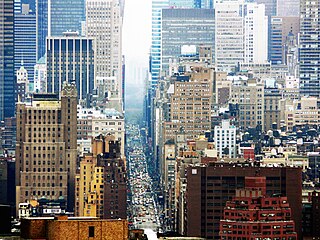
Broadway is a road in the U.S. state of New York. Broadway runs from State Street at Bowling Green for 13 mi (20.9 km) through the borough of Manhattan and 2 mi (3.2 km) through the Bronx, exiting north from New York City to run an additional 18 mi (29.0 km) through the Westchester County municipalities of Yonkers, Hastings-On-Hudson, Dobbs Ferry, Irvington, and Tarrytown, and terminating north of Sleepy Hollow.

<span class="mw-page-title-main">Upper West Side</span> Neighborhood of Manhattan in New York City

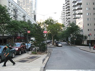
The Upper West Side (UWS) is a neighborhood in the borough of Manhattan in New York City. It is bounded by Central Park on the east, the Hudson River on the west, West 59th Street to the south, and West 110th Street to the north. The Upper West Side is adjacent to the neighborhoods of Hell's Kitchen to the south, Columbus Circle to the southeast, and Morningside Heights to the north.

<span class="mw-page-title-main">Sixth Avenue</span> North/south avenue in Manhattan, New York City, also known as Avenue of the Americas

Sixth Avenue – also known as Avenue of the Americas, although this name is seldom used by New Yorkers – is a major thoroughfare in New York City's borough of Manhattan, on which traffic runs northbound, or "uptown". It is commercial for much of its length.

<span class="mw-page-title-main">IRT Ninth Avenue Line</span> Former New York City rapid transit line

The IRT Ninth Avenue Line, often called the Ninth Avenue Elevated or Ninth Avenue El, was the first elevated railway in New York City. It opened in July 1868 as the West Side and Yonkers Patent Railway, as an experimental single-track cable-powered elevated railway from Battery Place, at the south end of Manhattan Island, northward up Greenwich Street to Cortlandt Street. By 1879 the line was extended to the Harlem River at 155th Street. It was electrified and taken over by the Interborough Rapid Transit Company in 1903.

59th Street station may refer to:

<span class="mw-page-title-main">Seventh Avenue (Manhattan)</span> North-south avenue in Manhattan, New York

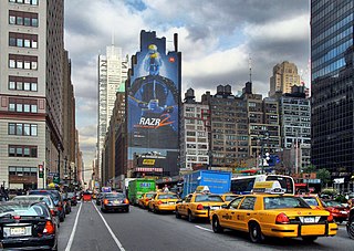
Seventh Avenue–co-named Fashion Avenue in the Garment District and known as Adam Clayton Powell Jr. Boulevard north of Central Park–is a thoroughfare on the West Side of the borough of Manhattan in New York City. It is southbound below the park and a two-way street north of it.

<span class="mw-page-title-main">Eighth Avenue (Manhattan)</span> North-south avenue in Manhattan, New York

Eighth Avenue is a major north–south avenue on the west side of Manhattan in New York City, carrying northbound traffic below 59th Street. It is one of the original avenues of the Commissioners' Plan of 1811 to run the length of Manhattan, though today the name changes twice: At 59th Street/Columbus Circle, it becomes Central Park West, where it forms the western boundary of Central Park, and north of 110th Street/Frederick Douglass Circle, it is known as Frederick Douglass Boulevard before merging onto Harlem River Drive north of 155th Street.

<span class="mw-page-title-main">First Avenue (Manhattan)</span> North-south avenue in Manhattan, New York

First Avenue is a north-south thoroughfare on the East Side of the New York City borough of Manhattan, running from Houston Street northbound to 127th Street. At 125th Street, most traffic continues onto the Willis Avenue Bridge over the Harlem River, which continues into the Bronx. South of Houston Street, the roadway continues as Allen Street south to Division Street. Traffic on First Avenue runs northbound (uptown) only.

<span class="mw-page-title-main">Tenth Avenue (Manhattan)</span> North-south avenue in Manhattan, New York

Tenth Avenue, known as Amsterdam Avenue between 59th Street and 193rd Street, is a north-south thoroughfare on the West Side of Manhattan in New York City. It carries uptown (northbound) traffic as far as West 110th Street, after which it continues as a two-way street.

<span class="mw-page-title-main">Eleventh Avenue (Manhattan)</span> North-south avenue in Manhattan, New York

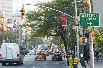
Eleventh Avenue is a north–south thoroughfare on the far West Side of the borough of Manhattan in New York City, located near the Hudson River. Eleventh Avenue originates in the Meatpacking District in the Greenwich Village and West Village neighborhoods at Gansevoort Street, where Eleventh Avenue, Tenth Avenue, and West Street intersect. It is considered part of the West Side Highway between 22nd and Gansevoort Streets.

<span class="mw-page-title-main">59th Street–Columbus Circle station</span> New York City Subway station complex in Manhattan

The 59th Street–Columbus Circle station is a New York City Subway station complex shared by the IRT Broadway–Seventh Avenue Line and the IND Eighth Avenue Line. It is located at Columbus Circle in Manhattan, where 59th Street, Broadway and Eighth Avenue intersect, and serves Central Park, the Upper West Side, Hell's Kitchen, and Midtown Manhattan. The station is served by the 1, A, and D trains at all times; the C train at all times except late nights; the B train during weekdays until 11:00 p.m.; and the 2 train during late nights.

<span class="mw-page-title-main">Lexington Avenue/59th Street station</span> New York City Subway station complex in Manhattan

The Lexington Avenue/59th Street station is a New York City Subway station complex shared by the IRT Lexington Avenue Line and the BMT Broadway Line. It is located at Lexington Avenue between 59th and 60th Streets, on the border of Midtown and the Upper East Side of Manhattan. The station complex is the fourteenth-busiest in the system, with over 21 million passengers in 2016.

<span class="mw-page-title-main">59th Street (Manhattan)</span> West-east street in Manhattan, New York

59th Street is a crosstown street in the New York City borough of Manhattan, running from York Avenue and Sutton Place on the East Side of Manhattan to the West Side Highway on the West Side. The three-block portion between Columbus Circle and Grand Army Plaza is known as Central Park South, since it forms the southern border of Central Park. There is a gap in the street between Ninth Avenue/Columbus Avenue and Columbus Circle, where the Deutsche Bank Center is located. While Central Park South is a bidirectional street, most of 59th Street carries one-way traffic.

<span class="mw-page-title-main">66th Street (Manhattan)</span> West-east street in Manhattan, New York

66th Street is a crosstown street in the New York City borough of Manhattan with portions on the Upper East Side and Upper West Side connected across Central Park via the 66th Street transverse. West 66th Street is notable for hosting the Lincoln Center for the Performing Arts between Broadway and Columbus Avenue.

<span class="mw-page-title-main">M10 and M20 buses</span> Bus routes in Manhattan, New York

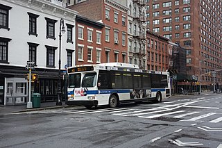
The Eighth Avenue Line is a public transit line in Manhattan, New York City, running mostly along Eighth Avenue from Lower Manhattan to Harlem. Originally a streetcar line, it is now the M10 bus route and the M20 bus route, operated by the New York City Transit Authority. The M10 bus now only runs north of 57th Street, and the M20 runs south of 66th Street. The whole line was a single route, the M10, until 2000 when the M20 was created.

<span class="mw-page-title-main">M11 (New York City bus)</span> Bus route in Manhattan, New York

The Ninth and Tenth Avenues Line or Ninth Avenue Line is a surface transit line in the New York City borough of Manhattan, running mostly along Ninth Avenue and Amsterdam Avenue from Lower Manhattan to Manhattanville. Originally a streetcar line operated by the Manhattan and Bronx Surface Transit Operating Authority, it is now the M11 bus route operated by the New York City Transit Authority.

<span class="mw-page-title-main">M7 (New York City bus)</span> Bus route in Manhattan, New York

The Columbus Avenue Line is a public transit line in Manhattan, New York City, running mostly along Columbus Avenue, 116th Street, and Lenox Avenue from Lower Manhattan to Harlem. Originally a streetcar line, it is now the M7 bus route, operated by the New York City Transit Authority, a division of the Metropolitan Transportation Authority.

<span class="mw-page-title-main">Fourth Avenue (Brooklyn)</span> Avenue in Brooklyn, New York

Fourth Avenue is a major thoroughfare in the New York City borough of Brooklyn. It stretches for 6 miles (9.7 km) south from Times Plaza, which is the triangle intersection created by Atlantic and Flatbush Avenues in Downtown Brooklyn, to Shore Road and the Belt Parkway in Bay Ridge.

References

Notes

  1. 1 2 3 Google (December 1, 2015). "Ninth Avenue / Columbus Avenue" (Map). Google Maps . Google. Retrieved December 1, 2015.
  2. 1 2 Hinkley, David (2012-05-20). "Celebrating the life of 'Mr. Oreo'". New York Daily News . Retrieved 2012-06-02.
  3. Olea, Rebecca. "Columbus Ave. bike path gets two thumbs up" Crain's New York Business (October 12, 2011)
  4. "Theodore Roosevelt Park". www.nycgovparks.org. Retrieved May 11, 2016.
  5. Feinman, Mark S. "Continuing the Story of the 9th Avenue El" . Retrieved 2009-08-04. On April 1, 1903, the entire Manhattan Elevated system was leased to the IRT Company for 999 years. Subway system construction was planned to connect with the Els at various points. By June 25, 1903, the last steam-powered elevated train was operated in passenger service on the 9th Ave El.
  6. Ingraham, Joseph (7 November 1948). "Traffic Speeded on 9th, 10th Aves. By One-way Plan". The New York Times . Retrieved 28 August 2012.
  7. "Ninth and Tenth Avenues Are One Way Permanently". The New York Times. 14 May 1949. Retrieved 28 August 2012.
  8. "Two More Avenues One-way Thursday". The New York Times. 4 December 1951. Retrieved 28 August 2012.
  9. 1 2 Neuman, William (September 23, 2007). "A Busy City Street Makes Room for Bikes". The New York Times. Retrieved July 19, 2023.
  10. Hogarty, Dave (September 23, 2007). "Cars To Protect Cyclists on 9th Ave". Gothamist. Retrieved July 19, 2023.
  11. Stromberg, Joseph (September 8, 2014). "Bike lanes have actually sped up car traffic in New York City". Vox. Retrieved July 19, 2023.
  12. "'Super Sidewalks' Hit Midtown: Check Out the New Ninth Avenue". NBC New York. March 21, 2023. Retrieved July 19, 2023.
  13. "NYC traffic: City cuts ribbon on improvements along 9th Avenue corridor in Hell's Kitchen, Manhattan". abc7ny.com. March 21, 2023. Retrieved July 19, 2023.
  14. Ninth Avenue International Food Festival