Los Feliz is a hillside neighborhood in the greater Hollywood area of Los Angeles, California, abutting Hollywood and encompassing part of the Santa Monica Mountains. The neighborhood is named after the Feliz family of Californios who had owned the area since 1795, when José Vicente Féliz was granted Rancho Los Feliz.

Mount Washington is a historic neighborhood in the San Rafael Hills of Northeast Los Angeles, California. Founded in 1909, it includes the Southwest Museum, the world headquarters of the Self-Realization Fellowship, and Eldred Street, one of the three steepest streets in the United States.

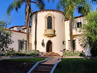
West Hills is a suburban/residential community in the western San Fernando Valley region of the City of Los Angeles, California. The percentage of residents aged 35 and older is among the highest in Los Angeles County.

Pico-Union is a neighborhood in Central Los Angeles, California. The name "Pico-Union" refers to the neighborhood that surrounds the intersection of Pico Boulevard and Union Avenue. Located immediately west of Downtown Los Angeles, it is home to over 40,000 residents.

West Adams is a historic neighborhood in the South Los Angeles region of Los Angeles, California. The area is known for its large number of historic buildings, structures and notable houses and mansions. It contains several Historic Preservation Overlay Zones as well as designated historic districts.

Harvard Heights is a neighborhood in Central Los Angeles, California. It lies within a municipally designated historic preservation overlay zone designed to protect its architecturally significant single-family residences, including the only remaining Greene and Greene house in Los Angeles.

Hastings Ranch is a neighborhood of Pasadena, California which lies in northeast Pasadena. It is principally accessed by Sierra Madre Boulevard, Michillinda Avenue, Hastings Ranch Blvd., and Riviera Drive. Hastings Ranch is also identified by large shopping areas at its southernmost end and by a shopping center at the corner of Sierra Madre and Michillinda. Hastings Ranch is divided by Sierra Madre Blvd, north of the blvd is Upper Hastings Ranch and south is Lower Hastings Ranch. To the north of the Ranch is the San Gabriel Mountains and Mount Wilson.

El Sereno is a Los Angeles neighborhood in the Eastside Los Angeles region of Los Angeles County, California.

Arlington Heights is a neighborhood in Central Los Angeles, California.

Montecito Heights is a neighborhood in the Northeast Los Angeles region of Los Angeles, California. The population in 2000 was estimated at 16,768.

The neighborhoods of Albany, New York are listed below.

Annandale is a former community in Los Angeles County, California that is now a neighborhood in Los Angeles, California and Pasadena, California. The Pasadena portion is bordered by Colorado Boulevard to the north, San Rafael Avenue to the east, and the Pasadena-Los Angeles border to the south and west. The Los Angeles portion is approximately bordered by Meridian Street, Figueroa Street, Colorado Blvd and the Pasadena-Los Angeles border. The main roads through the neighborhood are Figueroa Street, Avenue 64 and La Loma Road.
Bellefontaine is a neighborhood in Pasadena, California, immediately south of Downtown. The neighborhood is bordered by Del Mar Boulevard to the north, Columbia Street to the south, Orange Grove Boulevard to the west, and Fair Oaks Avenue to the east. The main roads through the neighborhood are California Boulevard and Pasadena Avenue.

Bungalow Heaven is a neighborhood in Pasadena, California named for the more than 800 small craftsman homes built there from 1900 to 1930, most of which still stand. Much of the area became a landmark district in 1989 and annual historic home tours have been conducted in Bungalow Heaven every year since then.
Linda Vista is a neighborhood in Pasadena, California. It is one of Pasadena's wealthiest neighborhoods, and its largest by area. It is bordered by Oak Grove Drive to the north, Colorado Boulevard to the south, the Pasadena-Glendale border to the west, and Linda Vista Avenue to the east.
Madison Heights is a neighborhood in Pasadena, California. It is bordered by California Boulevard to the north; Lake Avenue, Arden Road, Oak Knoll Avenue, Oak Knoll Circle, and El Molino Avenue to the east; Allendale, Los Robles Avenue, and South Pasadena to the south, and Marengo Avenue to the west.

Normandie Heights is a neighborhood in Pasadena, California. It is bordered by Woodbury Road to the north, Washington Boulevard to the south, Los Robles Avenue to the west, and Lake Avenue to the east. While the exterior of many older homes in Southern California have been coated with stucco, Normandie is distinguished by a high concentration of Craftsman homes with well-maintained wooden exteriors. Accordingly, the City of Pasadena has designated more than 50 homes in the neighborhood as architectural landmarks, many on Rio Grande Street, between Los Robles Avenue and El Molino Avenue, which was the site of the first residences in the neighborhood.

Exposition Park is a neighborhood in the south region of Los Angeles, California. It is home to Exposition Park, which includes the Los Angeles Memorial Coliseum, BMO Stadium, Exposition Rose Garden and three museums: the California African American Museum, the California Science Center and the Natural History Museum of Los Angeles County. It is also home to a Science Center Academy.
There are several neighborhoods in the city of Pasadena, California
