Eagle Rock is a neighborhood of Northeast Los Angeles, abutting the San Rafael Hills in Los Angeles County, California. The community is named after Eagle Rock, a large boulder whose shadow resembles an eagle. Eagle Rock was once part of the Rancho San Rafael under Spanish and Mexican governorship. In 1911, Eagle Rock was incorporated as a city, and in 1923 it was annexed by Los Angeles.

Route 110, consisting of State Route 110 (SR 110) and Interstate 110 (I-110), is a state and auxiliary Interstate Highway in the Los Angeles metropolitan area of the US state of California. The entire route connects San Pedro and the Port of Los Angeles with Downtown Los Angeles and Pasadena. The southern segment from San Pedro to I-10 in downtown Los Angeles is signed as I-110, while the northern segment to Pasadena is signed as SR 110. The entire length of I-110, as well as SR 110 south of the Four Level Interchange with US Route 101 (US 101), is the Harbor Freeway, and SR 110 north from US 101 to Pasadena is the historic Arroyo Seco Parkway, the first freeway in the western United States.

Highland Park is a neighborhood in Los Angeles, California, located in the city's Northeast region. It was one of the first subdivisions of Los Angeles and is inhabited by a variety of ethnic and socioeconomic groups.

Colorado Boulevard is a major east–west street in Southern California. It runs from Griffith Park in Los Angeles east through Glendale, the Eagle Rock section of Los Angeles, Pasadena, and Arcadia, ending in Monrovia. The full route was once various state highways but is now locally maintained in favor of the parallel Ventura Freeway and Foothill Freeway (I-210).

Lake Avenue is a major north–south feeder road for the Pasadena and Altadena communities in Los Angeles County, California. The road was developed in the mid 19th century and takes its name from a lake which was located at its southernmost end known variously as Mission Lake, Kewen Lake, and Wilson Lake reflecting different owners of the land. The lake bed still exists as a municipal park in the City of San Marino just south of the Raymond Dike, but it holds no water. It has been surrounded by residences who are served by a crisscross set of roads that dip into the edges of impression and back out the other side. Lake Avenue is approximately 5.06 miles (8.14 km) in length.

University Hills is a neighborhood on the East Side of Los Angeles, California. It consists of the residential areas surrounding California State University, Los Angeles.

Figueroa Street is a major north-south street in Los Angeles County, California, spanning from the Los Angeles neighborhood of Wilmington north to Eagle Rock. A short, unconnected continuation of Figueroa Street runs just south of Marengo Drive in Glendale to Chevy Chase Drive in La Cañada Flintridge.

Olympic Boulevard is a major arterial road in Los Angeles, California. It stretches from Ocean Avenue on the western end of Santa Monica to East Los Angeles—farther than Wilshire Boulevard and most other streets.

San Fernando Road is a major street in the City of Los Angeles and Los Angeles County. Within the Burbank city limits it is signed as San Fernando Boulevard, and north of Newhall Pass it is signed as The Old Road. It was previously designated as Business Loop 5 in the 1970s.

Fair Oaks Avenue in Pasadena, California, is a major north–south road connecting the communities of Altadena, Pasadena, and South Pasadena, running 7.9 miles (12.7 km) in length. It starts at its southernmost end in South Pasadena at Huntington Drive. It travels due north to a terminus above Loma Alta Avenue in Altadena and the gates of Angelus County Park. Beyond this, the road becomes a private easement.

Cypress Park is a densely populated neighborhood of 10,000+ residents in Northeast Los Angeles, California. Surrounded by hills on three sides, it sits in the valley created by the Los Angeles River and the Arroyo Seco. It is the site of the Rio de Los Angeles State Park, the Los Angeles River Bike Path and other recreational facilities. It hosts one private and four public schools.
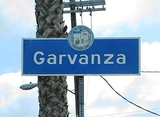
Garvanza is a neighborhood in northeast Los Angeles. Fourteen Los Angeles Historic-Cultural Monuments are located in the neighborhood.
Bellefontaine is a neighborhood in Pasadena, California, immediately south of Downtown. The neighborhood is bordered by Del Mar Boulevard to the north, Columbia Street to the south, Orange Grove Boulevard to the west, and Fair Oaks Avenue to the east. The main roads through the neighborhood are California Boulevard and Pasadena Avenue.

Bungalow Heaven is a neighborhood in Pasadena, California, named for the more than 800 small craftsman homes built there from 1900 to 1930, most of which still stand. Much of the area became a landmark district in 1989 and annual historic home tours have been conducted in Bungalow Heaven every year since then.

Lamanda Park is a neighborhood in Pasadena, California. It is bordered roughly by Foothill Boulevard to the north, Del Mar Boulevard to the south, the Eaton Wash to the east, and Allen Avenue to the west, with a panhandle extending south along the western bank of the Eaton Wash. Like Annandale, it was originally a small township that was gradually enveloped by Pasadena. It was annexed in 1920. Even today, many commercial enterprises and newspapers still identify the area as a separate community.
Linda Vista is a neighborhood in Pasadena, California. It is one of Pasadena's wealthiest neighborhoods, and its largest by area. It is bordered by Oak Grove Drive to the north, Colorado Boulevard to the south, the Pasadena-Glendale border to the west, and Linda Vista Avenue to the east.
Lower Arroyo is a neighborhood in Pasadena, California, centered on the Arroyo Seco south of Brookside Park. It is bordered by Holly Street to the north, Columbia Street to the south, San Rafael Avenue to the west, and Orange Grove Boulevard to the east.

Normandie Heights is a neighborhood in Pasadena, California. It is bordered by Woodbury Road to the north, Washington Boulevard to the south, Los Robles Avenue to the west, and Lake Avenue to the east. While the exterior of many older homes in Southern California have been coated with stucco, Normandie is distinguished by a high concentration of Craftsman homes with well-maintained wooden exteriors. Accordingly, the City of Pasadena has designated more than 50 homes in the neighborhood as architectural landmarks, many on Rio Grande Street, between Los Robles Avenue and El Molino Avenue, which was the site of the first residences in the neighborhood.
The Los Angeles Avenues refer to a series of 50 numbered streets in Los Angeles, California in the Northeast and Eastside regions. They are all designated with the word "Avenue" followed by a number such as "Avenue 64." The Avenues are located in the Los Angeles neighborhoods of Lincoln Heights, Cypress Park, Montecito Heights, Glassell Park, Highland Park, Mt. Washington and Eagle Rock. They are not related to 2nd through 13th Avenues west of Arlington Avenue in Jefferson Park and other neighborhoods in South Los Angeles.
There are several neighborhoods in the city of Pasadena, California


