Adelphi, Ohio

Last updated

Adelphi, Ohio
Adelphi, Ohio.JPG
OHMap-doton-Adelphi.png
Location of Adelphi, Ohio
Map of Ross County Ohio Highlighting Adelphi Village.png
Location of Adelphi in Ross County
Coordinates: 39°27′49″N82°44′50″W / 39.46361°N 82.74722°W / 39.46361; -82.74722
Country United States
State Ohio
County Ross
Area
[1]
  Total0.28 sq mi (0.71 km2)
  Land0.27 sq mi (0.71 km2)
  Water0.00 sq mi (0.00 km2)
Elevation
[2]
846 ft (258 m)
Population
 (2020)
  Total322
  Estimate 
(2023) [3]
316
  Density1,175.18/sq mi (453.95/km2)
Time zone UTC-5 (Eastern (EST))
  Summer (DST) UTC-4 (EDT)
ZIP code
43101
Area code 740
FIPS code 39-00450 [4]
GNIS feature ID2397915 [2]

Adelphi is a village in Ross County, Ohio, United States. The population was 322 at the 2020 census.

Contents

Adelphi was laid out in 1804 by two brothers, and named after the Greek word for "brothers". [5] Adelphi was incorporated as a village in 1838. [6]

Geography

According to the United States Census Bureau, the village has a total area of 0.27 square miles (0.70 km2), all land. [7]

Demographics

Historical population
CensusPop.Note
1820 132
1830 24787.1%
1840 2501.2%
1850 41264.8%
1860 378−8.3%
1870 41710.3%
1880 46912.5%
1890 4894.3%
1900 5165.5%
1910 407−21.1%
1920 329−19.2%
1930 41225.2%
1940 4140.5%
1950 392−5.3%
1960 44112.5%
1970 4553.2%
1980 4723.7%
1990 398−15.7%
2000 371−6.8%
2010 3802.4%
2020 322−15.3%
2023 (est.)316 [3] −1.9%
U.S. Decennial Census [8]

2010 census

As of the census [9] of 2010, there were 380 people, 154 households, and 100 families living in the village. The population density was 1,407.4 inhabitants per square mile (543.4/km2). There were 175 housing units at an average density of 648.1 per square mile (250.2/km2). The racial makeup of the village was 95.0% White, 1.6% African American, 0.3% Asian, and 3.2% from two or more races.

There were 154 households, of which 34.4% had children under the age of 18 living with them, 47.4% were married couples living together, 11.7% had a female householder with no husband present, 5.8% had a male householder with no wife present, and 35.1% were non-families. 29.2% of all households were made up of individuals, and 11.6% had someone living alone who was 65 years of age or older. The average household size was 2.47 and the average family size was 3.00.

The median age in the village was 39 years. 26.8% of residents were under the age of 18; 6.3% were between the ages of 18 and 24; 25.5% were from 25 to 44; 26.1% were from 45 to 64; and 15.3% were 65 years of age or older. The gender makeup of the village was 51.1% male and 48.9% female.

2000 census

As of the census [4] of 2000, there were 371 people, 156 households, and 111 families living in the village. The population density was 1,343.3 inhabitants per square mile (518.7/km2). There were 176 housing units at an average density of 637.3 per square mile (246.1/km2). The racial makeup of the village was 96.23% White, 2.96% African American, and 0.81% from two or more races. Hispanic or Latino of any race were 0.54% of the population.

There were 156 households, out of which 28.2% had children under the age of 18 living with them, 53.8% were married couples living together, 12.2% had a female householder with no husband present, and 28.8% were non-families. 26.3% of all households were made up of individuals, and 12.2% had someone living alone who was 65 years of age or older. The average household size was 2.38 and the average family size was 2.83.

In the village, the population was spread out, with 22.4% under the age of 18, 9.7% from 18 to 24, 28.8% from 25 to 44, 25.3% from 45 to 64, and 13.7% who were 65 years of age or older. The median age was 38 years. For every 100 females there were 101.6 males. For every 100 females age 18 and over, there were 97.3 males.

The median income for a household in the village was $33,125, and the median income for a family was $37,143. Males had a median income of $30,250 versus $24,375 for females. The per capita income for the village was $14,657. About 13.2% of families and 13.6% of the population were below the poverty line, including 18.4% of those under age 18 and 23.3% of those age 65 or over.

Notable people

Related Research Articles

<span class="mw-page-title-main">Fort Shawnee, Ohio</span> CDP in Ohio, United States

Fort Shawnee is census-designated place (CDP) in Allen County, Ohio, United States. The population was 6,263 at the 2020 census. It is included in the Lima, Ohio Metropolitan Statistical Area. Fort Shawnee is adjacent to the city of Lima and the village of Cridersville in Auglaize County. In 2012, village residents voted to disincorporate the village. According to the United States Census Bureau, the village had a total area of 7.25 square miles (18.78 km2), of which 7.21 square miles (18.67 km2) is land and 0.04 square miles (0.10 km2) is water.

<span class="mw-page-title-main">Hamersville, Ohio</span> Village in Ohio, United States

Hamersville is a village in Clark Township, Brown County, Ohio, United States. The population was 485 at the 2020 census.

<span class="mw-page-title-main">Yorkshire, Ohio</span> Village in Ohio, United States

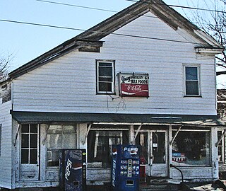
Yorkshire is a village in Darke County, Ohio, United States. The population was 95 at the 2020 census.

<span class="mw-page-title-main">Lockbourne, Ohio</span> Village in Ohio, United States

Lockbourne is a village in Franklin County and Pickaway County, Ohio, United States. The population was 236 at the 2020 census. Lockbourne is located near Rickenbacker International Airport, and had initially provided its original name of Lockbourne Air Force Base.

<span class="mw-page-title-main">Addyston, Ohio</span> Village in Ohio, United States

Addyston is a village in Miami Township, Hamilton County, Ohio, United States. Located along the Ohio River, it is a western suburb of the neighboring city of Cincinnati. The population was 927 at the 2020 census.

<span class="mw-page-title-main">Martinsburg, Ohio</span> Village in Ohio, United States

Martinsburg is a village in Knox County, Ohio, United States. The population was 222 at the 2020 census.

<span class="mw-page-title-main">Waite Hill, Ohio</span> Village in Ohio, United States

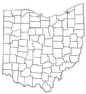
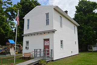
Waite Hill is a village in Lake County, Ohio, United States and a rural suburb of Cleveland. The population was 543 at the 2020 census.

<span class="mw-page-title-main">Hanover, Ohio</span> Village in Ohio, United States

Hanover is a village in Licking County, Ohio, United States. The population was 1,270 at the 2020 census. The village lies along Ohio State Route 16.

<span class="mw-page-title-main">Rochester, Ohio</span> Village in Ohio

Rochester is a village in Lorain County, Ohio, United States, along the West Branch of the Black River. The population was 159 at the 2020 census.

<span class="mw-page-title-main">South Solon, Ohio</span> Village in Ohio, United States

South Solon is a village in Madison County, Ohio, United States. The population was 329 at the 2020 census. Despite their similar names, South Solon is not adjacent to the city of Solon, Ohio, a suburb of Cleveland in Cuyahoga County. The two towns are approximately 170 miles (270 km) apart.

<span class="mw-page-title-main">Miltonsburg, Ohio</span> Village in Ohio, United States

Miltonsburg is a village in Monroe County, Ohio, United States. The population was 42 at the 2020 census. Miltonsburg was named after Milton Pierson, son of Ohio pioneer David Pierson. David Pierson named Clarington, Ohio after his daughter Clarinda.

<span class="mw-page-title-main">Adamsville, Ohio</span> Village in Ohio, United States

Adamsville is a village in Muskingum County, Ohio, United States. The population was 140 at the 2020 census. It is part of the Zanesville micropolitan area.

<span class="mw-page-title-main">Haviland, Ohio</span> Village in Ohio, United States

Haviland is a village in Paulding County, Ohio, United States. The population was 160 at the 2020 census.

<span class="mw-page-title-main">Port Jefferson, Ohio</span> Village in Ohio, United States

Port Jefferson is a village in Salem Township, Shelby County, Ohio, United States. The population was 308 at the 2020 census.

<span class="mw-page-title-main">Limaville, Ohio</span> Census-designated place in Ohio, United States

Limaville is a census-designated place (CDP) and former village in Stark County, Ohio, United States. The population was 151 at the 2020 census. It is part of the Canton–Massillon Metropolitan Statistical Area.

<span class="mw-page-title-main">Clinton, Ohio</span> Village in Ohio, United States

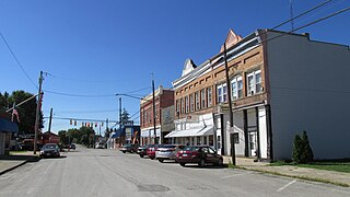
Clinton is a village in southwestern Summit County, Ohio, United States. The population was 1,197 at the 2020 Census. It is part of the Akron metropolitan area.

<span class="mw-page-title-main">Macksburg, Ohio</span> Village in Ohio, United States

Macksburg is a village in Washington County, Ohio, United States, along the West Fork of Duck Creek. The population was 120 at the 2020 census. The village is about 28 miles (45 km) south of Cambridge, Ohio.

<span class="mw-page-title-main">Congress, Ohio</span> Village in Ohio, United States

Congress is a village in Wayne County, Ohio, United States. The population was 132 at the 2020 census.

<span class="mw-page-title-main">New Holland, Ohio</span> Village in Ohio, United States

New Holland is a village in Fayette and Pickaway counties in Ohio, United States. The population was 804 at the 2020 census.

<span class="mw-page-title-main">Scott, Ohio</span> Village in Ohio, United States

Scott is a village in Paulding and Van Wert counties in the U.S. state of Ohio. The population was 242 at the 2020 census. The Van Wert County portion of Scott is part of the Van Wert Micropolitan Statistical Area.

References

  1. "ArcGIS REST Services Directory". United States Census Bureau. Retrieved September 20, 2022.
  2. 1 2 U.S. Geological Survey Geographic Names Information System: Adelphi, Ohio
  3. 1 2 "Annual Estimates of the Resident Population for Incorporated Places in Ohio: April 1, 2020 to July 1, 2023". United States Census Bureau. Retrieved May 16, 2024.
  4. 1 2 "U.S. Census website". United States Census Bureau . Retrieved January 31, 2008.
  5. Overman, William Daniel (1958). Ohio Town Names. Akron, OH: Atlantic Press. p. 1.
  6. Federal Writers' Project (1938). Chillicothe and Ross County. Works Progress Administration. p. 75.
  7. "US Gazetteer files 2010". United States Census Bureau. Archived from the original on January 25, 2012. Retrieved January 6, 2013.
  8. "Census of Population and Housing". Census.gov. Retrieved June 4, 2015.
  9. "U.S. Census website". United States Census Bureau . Retrieved January 6, 2013.