Clarksburg, Ohio

Last updated

Clarksburg, Ohio
ClarksburgOH2.JPG
Intersection of Main and High Streets in Clarksburg.
OHMap-doton-Clarksburg.png
Location of Clarksburg, Ohio
Map of Ross County Ohio Highlighting Clarksburg Village.png
Location of Clarksburg in Ross County
Coordinates: 39°30′21″N83°09′16″W / 39.50583°N 83.15444°W / 39.50583; -83.15444
Country United States
State Ohio
County Ross
Area
[1]
  Total0.16 sq mi (0.41 km2)
  Land0.16 sq mi (0.41 km2)
  Water0.00 sq mi (0.00 km2)
Elevation
[2]
771 ft (235 m)
Population
 (2020)
  Total409
  Density2,572.33/sq mi (996.21/km2)
Time zone UTC-5 (Eastern (EST))
  Summer (DST) UTC-4 (EDT)
ZIP code
43115
Area code 740
FIPS code 39-15336 [3]
GNIS feature ID2397632 [2]

Clarksburg is a village in Ross County, Ohio, United States. The population was 409 at the 2020 census. [4]

Contents

History

The first permanent settlement at Clarksburg was founded circa 1800. [5] Clarksburg was platted in 1817 by George Clark, and named for him. [6]

Geography

According to the United States Census Bureau, the village has a total area of 0.17 square miles (0.44 km2), all land. [7]

Demographics

Historical population
CensusPop.Note
1880 308
1890 37822.7%
1900 55145.8%
1910 5581.3%
1920 420−24.7%
1930 400−4.8%
1940 390−2.5%
1950 3910.3%
1960 43812.0%
1970 4574.3%
1980 4835.7%
1990 5238.3%
2000 516−1.3%
2010 455−11.8%
2020 409−10.1%
U.S. Decennial Census [8]

2010 census

As of the census [9] of 2010, there were 455 people, 166 households, and 117 families living in the village. The population density was 2,676.5 inhabitants per square mile (1,033.4/km2). There were 184 housing units at an average density of 1,082.4 per square mile (417.9/km2). The racial makeup of the village was 98.5% White, 0.2% African American, 0.4% from other races, and 0.9% from two or more races. Hispanic or Latino of any race were 1.8% of the population.

There were 166 households, of which 38.6% had children under the age of 18 living with them, 52.4% were married couples living together, 15.1% had a female householder with no husband present, 3.0% had a male householder with no wife present, and 29.5% were non-families. 22.9% of all households were made up of individuals, and 12% had someone living alone who was 65 years of age or older. The average household size was 2.74 and the average family size was 3.23.

The median age in the village was 34.8 years. 29% of residents were under the age of 18; 8% were between the ages of 18 and 24; 25.8% were from 25 to 44; 23% were from 45 to 64; and 14.3% were 65 years of age or older. The gender makeup of the village was 47.3% male and 52.7% female.

2000 census

As of the census [3] of 2000, there were 516 people, 178 households, and 131 families living in the village. The population density was 2,772.9 inhabitants per square mile (1,070.6/km2). There were 190 housing units at an average density of 1,021.0 per square mile (394.2/km2). The racial makeup of the village was 97.48% White, 1.55% African American, 0.19% Native American, 0.58% from other races, and 0.19% from two or more races.

There were 178 households, out of which 37.1% had children under the age of 18 living with them, 53.4% were married couples living together, 15.7% had a female householder with no husband present, and 26.4% were non-families. 20.8% of all households were made up of individuals, and 9.6% had someone living alone who was 65 years of age or older. The average household size was 2.80 and the average family size was 3.20.

In the village, the population was spread out, with 28.5% under the age of 18, 9.7% from 18 to 24, 28.1% from 25 to 44, 22.7% from 45 to 64, and 11.0% who were 65 years of age or older. The median age was 32 years. For every 100 females there were 100.8 males. For every 100 females age 18 and over, there were 95.2 males.

The median income for a household in the village was $32,159, and the median income for a family was $36,667. Males had a median income of $30,781 versus $17,500 for females. The per capita income for the village was $12,064. About 14.6% of families and 18.8% of the population were below the poverty line, including 26.4% of those under age 18 and 18.8% of those age 65 or over.

Related Research Articles

<span class="mw-page-title-main">Clarksburg, Missouri</span> City in Missouri, United States

Clarksburg is a city in Moniteau County, Missouri, United States. The population was 254 at the 2020 census, down from 334 in 2010. It is part of the Jefferson City metropolitan area.

<span class="mw-page-title-main">Fort Shawnee, Ohio</span> CDP in Ohio, United States

Fort Shawnee is census-designated place (CDP) in Allen County, Ohio, United States. The population was 6,263 at the 2020 census. It is included in the Lima, Ohio Metropolitan Statistical Area. Fort Shawnee is adjacent to the city of Lima and the village of Cridersville in Auglaize County. In 2012, village residents voted to disincorporate the village. According to the United States Census Bureau, the village had a total area of 7.25 square miles (18.78 km2), of which 7.21 square miles (18.67 km2) is land and 0.04 square miles (0.10 km2) is water.

<span class="mw-page-title-main">Hamersville, Ohio</span> Village in Ohio, United States

Hamersville is a village in Clark Township, Brown County, Ohio, United States. The population was 485 at the 2020 census.

<span class="mw-page-title-main">Gordon, Ohio</span> Village in Ohio, United States

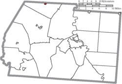
Gordon is a village in Darke County, Ohio, United States. The population was 245 at the 2020 census.

<span class="mw-page-title-main">Valleyview, Ohio</span> Village in Ohio, United States

Valleyview is a village in Franklin County, Ohio, United States. The population was 669 at the 2020 census.

<span class="mw-page-title-main">Lyons, Ohio</span> Village in Ohio, United States

Lyons is a village in Fulton County, Ohio, United States. The population was 602 at the 2020 census.

<span class="mw-page-title-main">Addyston, Ohio</span> Village in Ohio, United States

Addyston is a village in Miami Township, Hamilton County, Ohio, United States. Located along the Ohio River, it is a western suburb of the neighboring city of Cincinnati. The population was 927 at the 2020 census.

<span class="mw-page-title-main">Cleves, Ohio</span> City in Ohio, United States

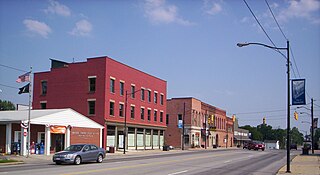
Cleves is a village in Miami Township, Hamilton County, Ohio, United States. Located along the Ohio River, it is a western suburb of Cincinnati. The population was 3,414 at the 2020 census.

<span class="mw-page-title-main">Evendale, Ohio</span> Village in Ohio, United States

Evendale is a village in Hamilton County, Ohio, United States, within the Cincinnati metropolitan area. The population was 2,669 at the 2020 census.

<span class="mw-page-title-main">Monroeville, Ohio</span> Village in Ohio, United States

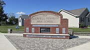
Monroeville is a village in Huron County, Ohio, United States. The population was 1,300 at the 2020 census.

<span class="mw-page-title-main">Hanover, Ohio</span> Village in Ohio, United States

Hanover is a village in Licking County, Ohio, United States. The population was 1,270 at the 2020 census. The village lies along Ohio State Route 16.

<span class="mw-page-title-main">Hartford, Ohio</span> Village in Ohio, United States

Hartford is a village in the township of the same name in Licking County, Ohio, United States. The population was 404 at the 2020 census.

<span class="mw-page-title-main">Hebron, Ohio</span> Village in Ohio, USA

Hebron is a village in Licking County, Ohio, United States. The population was 2,326 at the 2020 census.

<span class="mw-page-title-main">St. Louisville, Ohio</span> Village in Ohio, United States

St. Louisville or Saint Louisville is a village in Licking County, Ohio, United States, along the North Fork of the Licking River. The population was 352 at the 2020 census.

<span class="mw-page-title-main">Haviland, Ohio</span> Village in Ohio, United States

Haviland is a village in Paulding County, Ohio, United States. The population was 160 at the 2020 census.

<span class="mw-page-title-main">Limaville, Ohio</span> Census-designated place in Ohio, United States

Limaville is a census-designated place (CDP) and former village in Stark County, Ohio, United States. The population was 151 at the 2020 census. It is part of the Canton–Massillon Metropolitan Statistical Area.

<span class="mw-page-title-main">Clinton, Ohio</span> Village in Ohio, United States

Clinton is a village in southwestern Summit County, Ohio, United States. The population was 1,197 at the 2020 Census. It is part of the Akron metropolitan area.

<span class="mw-page-title-main">Bradner, Ohio</span> Village in Ohio, United States

Bradner is a village in Wood County, Ohio, United States. The population was 971 at the 2020 census.

<span class="mw-page-title-main">Anmoore, West Virginia</span> Town in West Virginia, United States

Anmoore is a town in Harrison County, West Virginia, United States. It is located at the intersection of WV 58 and Interstate 79. The population was 514 at the 2020 census.

<span class="mw-page-title-main">Wilson, Ohio</span> Village in Ohio, United States

Wilson is a village in Belmont and Monroe counties in the U.S. state of Ohio. The population was 129 at the 2020 census. It is part of the Wheeling metropolitan area.

References

  1. "ArcGIS REST Services Directory". United States Census Bureau. Retrieved September 20, 2022.
  2. 1 2 U.S. Geological Survey Geographic Names Information System: Clarksburg, Ohio
  3. 1 2 "U.S. Census website". United States Census Bureau . Retrieved January 31, 2008.
  4. "Clarksburg, Ohio". The United States Census Bureau. Retrieved April 12, 2022.
  5. Federal Writers' Project (1938). Chillicothe and Ross County. Works Progress Administration. p. 76.
  6. Overman, William Daniel (1958). Ohio Town Names. Akron, OH: Atlantic Press. p. 29.
  7. "US Gazetteer files 2010". United States Census Bureau. Archived from the original on January 25, 2012. Retrieved January 6, 2013.
  8. "Census of Population and Housing". Census.gov. Retrieved June 4, 2015.
  9. "U.S. Census website". United States Census Bureau . Retrieved January 6, 2013.