Alfordsville, Indiana

Last updated

Alfordsville, Indiana
Alfordsville-Church-Street-in.jpg
Alfordsville
Daviess County Indiana Incorporated and Unincorporated areas Alfordsville Highlighted 1800964.svg
Location of Alfordsville in Daviess County, Indiana.
Coordinates: 38°33′38″N86°56′54″W / 38.56056°N 86.94833°W / 38.56056; -86.94833
Country United States
State Indiana
County Daviess
Township Reeve
Area
[1]
  Total0.07 sq mi (0.17 km2)
  Land0.07 sq mi (0.17 km2)
  Water0.00 sq mi (0.00 km2)
Elevation
[2]
512 ft (156 m)
Population
 (2020)
  Total65
  Density984.85/sq mi (382.29/km2)
Time zone UTC-5 (EST)
  Summer (DST) UTC-5 (EST)
ZIP code
47553 [3]
Area code 812 and 930
FIPS code 18-00964
GNIS ID2397424 [2]

Alfordsville is a town in Reeve Township, Daviess County, Indiana, United States. The population was 101 at the 2010 census.

Contents

History

Alfordsville was laid out in 1845. [4] It was named for James Alford, a pioneer settler. [5]

A post office was established at Alfordsville in 1856, and it was discontinued in 1968. [6]

Geography

Alfordsville is situated in a hilly area in southeastern Daviess County, northwest of Jasper. County Road 650 connects the town with U.S. Route 231 to the east. The Glendale Fish and Wildlife Area, which includes Dogwood Lake, lies to the west of Alfordsville.

According to the 2010 census, Alfordsville has a total area of 0.07 square miles (0.18 km2), all land. [7]

Demographics

Historical population
CensusPop.Note
1880 119
1930 90
1940 10617.8%
1950 101−4.7%
1960 12119.8%
1970 105−13.2%
1980 13225.7%
1990 74−43.9%
2000 11251.4%
2010 101−9.8%
2020 65−35.6%
U.S. Decennial Census [8]

2010 census

As of the 2010 census, [9] there were 101 people, 37 households, and 29 families residing in the town. The population density was 1,442.9 inhabitants per square mile (557.1/km2). There were 42 housing units at an average density of 600.0 per square mile (231.7/km2). The racial makeup of the town was 99.0% White and 1.0% from two or more races.

There were 37 households, of which 27.0% had children under the age of 18 living with them, 70.3% were married couples living together, 5.4% had a female householder with no husband present, 2.7% had a male householder with no wife present, and 21.6% were non-families. 21.6% of all households were made up of individuals, and 8.1% had someone living alone who was 65 years of age or older. The average household size was 2.73 and the average family size was 3.17.

The median age in the town was 38.8 years. 24.8% of residents were under the age of 18; 8% were between the ages of 18 and 24; 23.7% were from 25 to 44; 29.6% were from 45 to 64; and 13.9% were 65 years of age or older. The gender makeup of the town was 52.5% male and 47.5% female.

2000 census

As of the 2000 census, [10] there were 112 people, 44 households, and 30 families residing in the town. The population density was 1,638.4 inhabitants per square mile (632.6/km2). There were 46 housing units at an average density of 672.9 per square mile (259.8/km2). The racial makeup of the town was 100.00% White.

There were 44 households, out of which 34.1% had children under the age of 18 living with them, 59.1% were married couples living together, 9.1% had a female householder with no husband present, and 31.8% were non-families. 31.8% of all households were made up of individuals, and 20.5% had someone living alone who was 65 years of age or older. The average household size was 2.55 and the average family size was 3.20.

In the town, the population was spread out, with 26.8% under the age of 18, 10.7% from 18 to 24, 21.4% from 25 to 44, 27.7% from 45 to 64, and 13.4% who were 65 years of age or older. The median age was 38 years. For every 100 females, there were 96.5 males. For every 100 females age 18 and over, there were 95.2 males.

The median income for a household in the town was $54,375, and the median income for a family was $55,000. Males had a median income of $37,500 versus $19,531 for females. The per capita income for the town was $21,111. There were 9.4% of families and 18.5% of the population living below the poverty line, including 25.6% of under eighteens and 50.0% of those over 64.

Related Research Articles

<span class="mw-page-title-main">Milltown, Indiana</span> Town in Indiana, United States

Milltown is a town in Whiskey Run Township in Crawford County, Indiana and in Blue River and Spencer townships in Harrison County. The population was 818 at the time of the 2010 census.

<span class="mw-page-title-main">Cannelburg, Indiana</span> Town in Indiana, United States

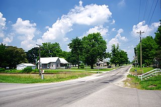
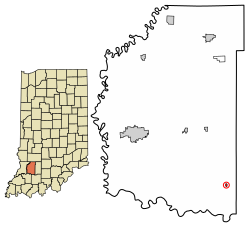
Cannelburg is a town in Barr Township, Daviess County, Indiana, United States. The population was 135 at the 2010 census.

<span class="mw-page-title-main">Elnora, Indiana</span> Town in Indiana, United States

Elnora is a town in Elmore Township, Daviess County, Indiana, United States. The population was 640 at the 2010 census.

<span class="mw-page-title-main">Montgomery, Indiana</span> Town in Indiana, United States

Montgomery is a town in Barr Township, Daviess County, Indiana, United States. The population was 343 at the 2010 census.

<span class="mw-page-title-main">Odon, Indiana</span> Town in Indiana, United States

Odon is a town in Madison Township, Daviess County, Indiana, United States. The population was 1,354 at the 2010 census.

<span class="mw-page-title-main">Plainville, Indiana</span> Town in Indiana, United States

Plainville is a town in Steele Township, Daviess County, Indiana, United States. The population was 476 at the 2010 census. The former high school mascot was the Plainville Midgets.

<span class="mw-page-title-main">Altona, Indiana</span> Town in Indiana, United States

Altona is a town in Keyser Township, DeKalb County, Indiana, United States. The population was 197 at the 2010 census.

<span class="mw-page-title-main">Bargersville, Indiana</span> Town in Indiana, United States

Bargersville is a town in White River and Union townships, Johnson County, Indiana, United States. The population was 9,560 at the 2020 census.

<span class="mw-page-title-main">Decker, Indiana</span> Town in Indiana, United States

Decker is a town in Johnson Township, Knox County, Indiana, United States. The population was 249 at the 2010 census. It was founded in 1869 by Isaac Decker. Decker is near the White River, and is well known for the watermelon and cantaloupe produced in the surrounding rural area.

<span class="mw-page-title-main">Sandborn, Indiana</span> Town in Indiana, United States

Sandborn is a town in Vigo Township, Knox County, Indiana, United States. The population was 359 at the 2020 census. It is the home of the annual Black Creek Festival.

<span class="mw-page-title-main">Wheatland, Indiana</span> Town in Indiana, United States

Wheatland is a town in Steen Township, Knox County, Indiana, United States. The population was 480 at the 2010 census.

<span class="mw-page-title-main">Kingsbury, Indiana</span> Town in Indiana, United States

Kingsbury is a town in Washington Township, LaPorte County, Indiana, just northwest of the intersection of U.S. Route 35 and U.S. Route 6. The town was founded in 1835 and incorporated on March 3, 1941. During 1940 - 1941, the Kingsbury Ordnance Plant (KOP) was built for use during World War II. The plant closed after the war but reopened during the Korean War, closing permanently in 1959. The population was 242 at the 2010 census. It is included in the Michigan City, Indiana-La Porte, Indiana Metropolitan Statistical Area. The town has its own fire department, KVFD, and a Greek revival style First Baptist church built in 1851 with its own graveyard and Winchell Cemetery.

<span class="mw-page-title-main">Crane, Indiana</span> Town in Indiana, United States

Crane is a town in Perry Township, Martin County, in the U.S. state of Indiana. The population was 166 at the 2020 census. The community is adjacent to the Naval Surface Warfare Center Crane Division.

<span class="mw-page-title-main">Bethany, Indiana</span> Town in Indiana, United States

Bethany is a town in Clay Township, Morgan County, in the U.S. state of Indiana. The population was 95 at the 2020 census.

<span class="mw-page-title-main">Paragon, Indiana</span> Town in Indiana, United States

Paragon is a town in Ray Township, Morgan County, in the U.S. state of Indiana. The population was 556 at the 2020 census, down from 659 in 2010.

<span class="mw-page-title-main">Marshall, Indiana</span> Town in Indiana, United States

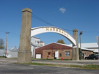
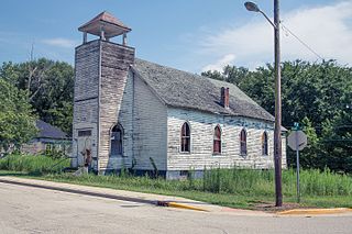
Marshall is a town in Washington Township, Parke County, Indiana, United States. As of the 2010 census, the population was 324.

<span class="mw-page-title-main">Mount Auburn, Indiana</span> Town in Indiana, United States

Mount Auburn is a town in Jackson Township, Wayne County, in the U.S. state of Indiana. The population was 117 at the 2010 census. The town is sandwiched between Dublin and Cambridge City.

<span class="mw-page-title-main">Uniondale, Indiana</span> Town in Indiana, United States

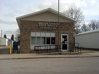
Uniondale is a town in Union and Rockcreek townships, Wells County, in the U.S. state of Indiana. The population was 310 at the 2010 census, down from 271 at the 2020 Census.

<span class="mw-page-title-main">McFall, Missouri</span> City in Missouri, United States

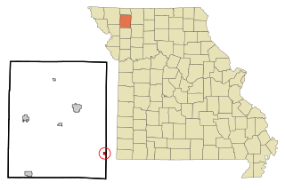
McFall is a rural village, incorporated and thus called a city in Missouri law, located in southeast Gentry County, Missouri, United States. It is also located within the Gentry County administrative subdivision of Miller Township. The population of McFall was 119 at the 2020 census. There is a post office at McFall, also a city hall and fire department, and a small apartment complex.

<span class="mw-page-title-main">Meridian Hills, Indiana</span> Town in Indiana, United States

Meridian Hills is a town in Washington Township, Marion County, Indiana, about 8 miles (13 km) north of downtown Indianapolis. It had a population of 1,774 at the 2020 census, up from 1,616 in 2010.

References

  1. "2020 U.S. Gazetteer Files". United States Census Bureau. Retrieved March 16, 2022.
  2. 1 2 U.S. Geological Survey Geographic Names Information System: Alfordsville, Indiana
  3. "Alfordsville IN ZIP Code". zipdatamaps.com. 2023. Retrieved December 7, 2023.
  4. History of Knox and Daviess County, Indiana: From the Earliest Time to the Present. Goodspeed. 1886. pp.  710.
  5. Bulletin of the United States Geological Survey. U.S. Government Printing Office. 1902. p.  21.
  6. "Daviess County". Jim Forte Postal History. Retrieved August 31, 2014.
  7. "G001 - Geographic Identifiers - 2010 Census Summary File 1". United States Census Bureau. Archived from the original on February 13, 2020. Retrieved July 13, 2015.
  8. "Census of Population and Housing". Census.gov. Retrieved June 4, 2015.
  9. "U.S. Census website". United States Census Bureau . Retrieved December 11, 2012.
  10. "U.S. Census website". United States Census Bureau . Retrieved January 31, 2008.