
DeKalb County is a county located in the northwest portion of the U.S. state of Missouri. As of the 2020 census, the population was 11,029. Its county seat is Maysville. The county was organized February 25, 1845 and named for General Johann de Kalb, Baron de Kalb, of the Revolutionary War.

Daviess County is a county located in the U.S. state of Missouri. As of the 2020 census, the population was 8,430. Its county seat is Gallatin. The county was organized December 29, 1836, from Ray County and named for Major Joseph Hamilton Daveiss, a soldier from Kentucky who was killed in 1811 at the Battle of Tippecanoe.

Daviess County ( "Davis"), is a county in Kentucky. As of the 2020 census, the population was 103,312. Its county seat is Owensboro. The county was formed from part of Ohio County on January 14, 1815.

Daviess County is a county in the U.S. state of Indiana. As of the 2010 United States Census, the population was 31,648. The county seat is Washington. About 15% of the county's population is Amish of Swiss origin, as of 2017.
Washington is a city in Daviess County, Indiana. The population was 11,509 at the time of the 2010 census. The city is the county seat of Daviess County. It is also the principal city of the Washington, Indiana Micropolitan Statistical Area, which comprises all of Daviess County and had an estimated 2017 population of 31,648.
Harlan is an unincorporated census-designated place (CDP) in Springfield Township, Allen County, in the U.S. state of Indiana. As of the 2010 census, Harlan had a population of 1,634.

Davis Township is one of eleven townships in Fountain County, Indiana, United States. As of the 2010 census, its population was 682 and it contained 286 housing units.

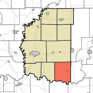
Barr Township is one of ten townships in Daviess County, Indiana. As of the 2010 census, its population was 4,811 and it contained 1,481 housing units.
Reeve Township is one of ten townships in Daviess County, Indiana. As of the 2010 census, its population was 631 and it contained 257 housing units.
Steele Township is one of ten townships in Daviess County, Indiana. As of the 2010 census, its population was 903 and it contained 399 housing units.

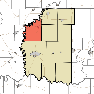
Van Buren Township is one of ten townships in Daviess County, Indiana. As of the 2010 census, its population was 2,552 and it contained 657 housing units. The population grew 30% since the 2000 census, when the population was 1,960.

Veale Township is one of ten townships in Daviess County, Indiana. As of the 2010 census, its population was 1,095 and it contained 449 housing units.

Washington Township is one of ten townships in Daviess County, Indiana. As of the 2010 census, its population was 15,534 and it contained 6,771 housing units.
Black Oak is a small unincorporated community in Barr Township, Daviess County, Indiana.

Cornettsville is an unincorporated community in Bogard Township, Daviess County, Indiana, United States.

Farlen is an unincorporated community in Madison Township, Daviess County, Indiana.

Glendale is an unincorporated community in Harrison Township, Daviess County, Indiana.
Hudsonville is an unincorporated community in Harrison Township, Daviess County, Indiana.

Raglesville is an unincorporated community and census-designated place (CDP) in Van Buren Township, Daviess County, Indiana, United States. As of the 2010 census it had a population of 141.

The Cincinnati metropolitan area is a metropolitan area centered on Cincinnati and including surrounding counties in the U.S. states of Ohio, Kentucky, and Indiana. The area is commonly known as Greater Cincinnati.


