Iowa County is a county located in the U.S. state of Iowa. As of the 2020 census, the population was 16,662. The county seat is Marengo.
Peppermill Village is an unincorporated community near Maryland Route 214 in Prince George's County, Maryland, United States. Per the 2020 census, the population was 5,264. FedExField, Metrorail's Blue Line, and Hampton Mall shopping center are all located nearby. Because it is not formally incorporated, it has no official boundaries, but the United States Census Bureau has defined a census-designated place (CDP) consisting of Peppermill Village and the adjacent community of Carmody Hills, for statistical purposes.
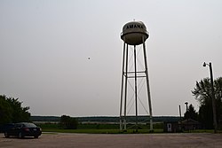
Homestead is an unincorporated community in Iowa County, Iowa, United States. It has the ZIP code 52236.
Lansdowne is a census-designated place and planned community located near Leesburg, Virginia, United States. The population as of the 2010 United States Census was 11,253. It is north of State Route 7 and south of the Potomac River. Before the Revolutionary War, the Lee family established Coton Manor here. A section of the Potomac Heritage Trail runs through Lansdowne. It is the home of Inova Loudoun Hospital, the Jack Kent Cooke Foundation, Lansdowne Resort, Prison Fellowship, and Lansdowne Woods of Virginia, a gated, age-restricted community.
Hopeland is a small unincorporated hamlet and census-designated place (CDP) in Lancaster County in the south of the U.S. state of Pennsylvania. The hamlet's ZIP code is 17533. As of the 2010 census the population was 738.
Lakeville is a hamlet and census-designated place (CDP) in the town of Livonia, Livingston County, New York, United States. Its population was 756 as of the 2010 census.
East Avon is a hamlet and census-designated place (CDP) in the town of Avon, Livingston County, New York, United States. The population was 608 at the 2010 census.

Lampeter is an unincorporated community and census-designated place (CDP) in West Lampeter Township, Lancaster County, Pennsylvania, United States. As of the 2010 census it had a population of 1,669. It is a suburb of Lancaster and has a ZIP code of 17537. The community was named after Lampeter, in Wales.
Middle Amana is an unincorporated community and census-designated place (CDP) in Iowa County, Iowa, United States. It is the largest of the seven villages of the Amana Colonies, all designated as a National Historic Landmark. As of the 2010 Census, the population of Middle Amana was 581.
South Amana is an unincorporated community and census-designated place (CDP) in northern Iowa County, Iowa, United States, and is part of the "seven villages" of the Amana Colonies. As of the 2010 census, it had a population of 159.

Iowa Highway 220 (Iowa 220) is a short state highway through the Amana Colonies in east-central Iowa. Along with U.S. Highway 6 (US 6) and US 151, it is part of the circuitous Amana Colonies Trail scenic byway. Iowa 220 begins at US 6 in South Amana and ends at US 151 in Amana.
New Bedford is an unincorporated community and census-designated place (CDP) in Lawrence County, Pennsylvania, United States. The population was 925 at the 2010 census.
Winter Harbor is a census-designated place (CDP) in the town of Winter Harbor in Hancock County, Maine, United States. The CDP population was 426 at the 2010 census, out of 516 people in the town as a whole.

Huntington is a census-designated place (CDP) comprising the main village in the town of Huntington in Hampshire County, Massachusetts, United States. The population of the CDP was 936 at the 2010 census, out of a total town population of 2,180. It is part of the Springfield, Massachusetts Metropolitan Statistical Area.
High Amana is an unincorporated community and census-designated place (CDP) in Iowa County, Iowa, United States, and is part of the "seven villages" of the Amana Colonies. As of the 2010 Census, the population of High Amana was 115.
West Amana is an unincorporated community and census-designated place in Iowa County, Iowa, United States, and is part of the "seven villages" of the Amana Colonies. As of the 2010 census, the population of West Amana was 135.
East Amana is an unincorporated community and census-designated place (CDP) in Iowa County, Iowa, United States, and is part of the "seven villages" of the Amana Colonies. As of the 2010 Census, the population of East Amana was 56.

Waldoboro is a census-designated place (CDP) comprising the central village in the town of Waldoboro in Lincoln County, Maine, United States. The population was 1,233 at the 2010 census, out of 5,075 people in the entire town of Waldoboro.

Wiscasset is a census-designated place (CDP) comprising the primary settlement in the town of Wiscasset in Lincoln County, Maine, United States. The population was 1,097 at the 2010 census, out of 3,732 people in the entire town. Wiscasset is the county seat of Lincoln County.
Spring Ridge is census-designated place (CDP) and suburban housing community in Frederick County, in the U.S. state of Maryland, just outside the city of Frederick. As of the 2020 census it had a population of 6,005. Before 2010, it was part of the Linganore-Bartonsville, Maryland census-designated place, which was split into three for the 2010 census.