
Interstate 12 (I-12) is an Interstate Highway located entirely within the U.S. state of Louisiana. It spans a total of 86.65 miles (139.45 km) in an east–west direction from I-10 in Baton Rouge to an interchange with both I-10 and I-59 in Slidell. Along the way, it passes through the city of Hammond, where it intersects I-55 and US Route 51 (US 51). It also serves the cities of Ponchatoula and Denham Springs, as well as the St. Tammany Parish cities of Covington and Mandeville. Skirting the northern shore of Lake Pontchartrain, I-12 serves as both a northern bypass of the New Orleans metropolitan area and an alternate route for I-10, which serves the city of New Orleans itself.
West Feliciana Parish is a civil parish located in the U.S. state of Louisiana. At the 2010 census, the population was 15,625, and 15,310 at the 2020 census. The parish seat is St. Francisville. The parish was established in 1824.

St. Helena Parish is a parish in the U.S. state of Louisiana. At the 2010 United States census, the population was 11,203, and 10,920 at the 2020 census. Its seat is Greensburg. The parish was created in 1810. St. Helena Parish is part of the Baton Rouge metropolitan area.

East Feliciana Parish is a parish located in the U.S. state of Louisiana. At the 2010 census, the population was 20,267, and 19,531 in 2020. The parish seat is Clinton.

East Baton Rouge Parish is the most populous parish in the U.S. state of Louisiana. At the 2010 U.S. census, its population was 440,171, and 456,781 at the 2020 census. The parish seat is Baton Rouge, Louisiana's state capital. East Baton Rouge Parish is located within the Greater Baton Rouge area.

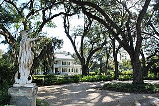
St. Francisville is a town in and the parish seat of, West Feliciana Parish, Louisiana, United States. The population was 1,765 at the 2010 U.S. census, and 1,589 at the 2020 population estimates program. It is part of the Baton Rouge metropolitan statistical area.

The Florida Parishes, on the east side of Mississippi River—an area also known as the Northshore or Northlake region—are eight parishes in the southeastern portion of the U.S. state of Louisiana; the Florida Parishes were part of West Florida in the 18th and early 19th centuries. Unlike most of the state, this region was not part of the 1803 Louisiana Purchase; it had been under British and then Spanish control since 1763.

William Henson Moore III is an American attorney and businessman who is a former member of the U.S. House of Representatives, having represented Louisiana's 6th congressional district, based about Baton Rouge, from 1975 to 1987. He was only the second Republican to have represented Louisiana in the House since Reconstruction, the first having been David C. Treen, then of Jefferson Parish.

Baton Rouge Community College is a public community college in Baton Rouge, Louisiana. Established on June 28, 1995, the college settled into a permanent location in 1998. The 60-acre (240,000 m2) campus consists of six main buildings: Governors Building, Louisiana Building, Cypress Building, Bienvenue Student Center, the Magnolia Library and Performing Arts Pavilion, and the Bonne Santé Wellness Center. The college's current enrollment is more than 7,000 students.

The Baton Rouge metropolitan statistical area, as defined by the United States Office of Management and Budget, or simply the Baton Rouge metropolitan area or Greater Baton Rouge, is a sprawling metropolitan statistical area surrounding the city of Baton Rouge. Its principal city Baton Rouge is unusual because it has no major incorporated satellite cities, a rarity for a metropolitan area of its size. Including the western edge of the Florida Parishes regions, it is known as "Plantation Country", the "Capital Region", and "The 225". At the 2010 U.S. census, the metropolitan area had a population of 802,484, up from 705,973 in 2000. At the 2020 census, its population increased to 870,569, up from 2020 estimates at 858,571.
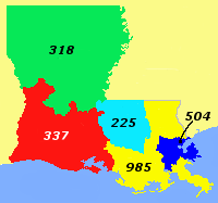
Area code 504 is a telephone area code that covers greater New Orleans, Louisiana. Besides New Orleans itself, it includes all of St. Bernard and Plaquemines parishes and most of Jefferson Parish.
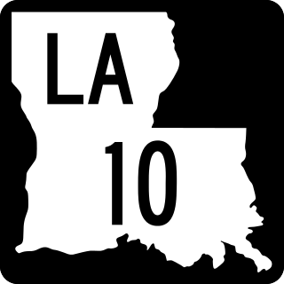
Louisiana Highway 10 (LA 10) is a state highway located in southern Louisiana. It runs 255.51 miles (411.20 km) in an east–west direction from U.S. Highway 171 (US 171) south of Leesville to the Mississippi state line east of Bogalusa.
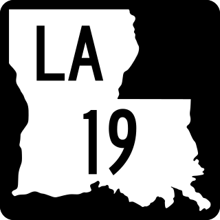
Louisiana Highway 19 (LA 19) is a state highway located in southeastern Louisiana. It runs 33.93 miles (54.61 km) in a north–south direction from U.S. Highway 61 (US 61) in Baton Rouge to the Mississippi state line north of Norwood.

Feliciana Parish, or New Feliciana, French: Paroisse de Félicianne, was a parish of the Territory of Orleans and the state of Louisiana, formed in 1810 from West Florida territory. Given an increase in population, it was divided in 1824 into East Feliciana Parish and West Feliciana Parish.
Baton Rouge offers a wide range of educational and cultural opportunities including being the home to three major universities and colleges and a variety of public and private schools.
Istrouma Area Council serves Scouts in both Louisiana and Mississippi, primarily in the Greater Baton Rouge Area and Florida Parishes. Specifically, the council includes Scouts from the following parishes: Ascension, East Baton Rouge, West Baton Rouge, East Feliciana, West Feliciana, Iberville, Pointe Coupee, St. Helena, St. James, St. Tammany, Washington, and Tangipahoa. Wilkinson County is the sole Mississippi county in the council.

Louisiana Highway 66 (LA 66) is a state highway located in southeastern Louisiana. It runs 19.62 miles (31.58 km) in a general east–west direction from the main entrance of the Louisiana State Penitentiary at Angola to a junction with U.S. Highway 61 (US 61) north of St. Francisville.

Louisiana Highway 68 (LA 68) is a state highway located in southeastern Louisiana. It runs 19.13 miles (30.79 km) in a north–south direction from U.S. Highway 61 (US 61) north of Port Hudson to LA 19 in Wilson.

The National Weather Service Weather Forecast Office New Orleans/Baton Rouge, Louisiana is a National Weather Service office located in Slidell, Louisiana.
