Ashley, Ohio

Last updated

Ashley, Ohio
500 East High Street - Ashley, Ohio.tif
Bartha House in Ashley, Ohio
OHMap-doton-Ashley.png
Location of Ashley, Ohio
Map of Delaware County Ohio Highlighting Ashley Village.png
Location of Ashley in Delaware County
USA Ohio location map.svg
Red pog.svg
Ashley
Usa edcp location map.svg
Red pog.svg
Ashley
North America laea location map.svg
Red pog.svg
Ashley
Coordinates: 40°24′35″N82°57′06″W / 40.40972°N 82.95167°W / 40.40972; -82.95167
Country United States
State Ohio
County Delaware
Township Oxford
Area
[1]
  Total0.66 sq mi (1.71 km2)
  Land0.66 sq mi (1.71 km2)
  Water0.00 sq mi (0.00 km2)
Elevation
[2]
978 ft (298 m)
Population
 (2020)
  Total1,198
  Estimate 
(2023) [3]
1,318
  Density1,817.91/sq mi (702.12/km2)
Time zone UTC-5 (Eastern (EST))
  Summer (DST) UTC-4 (EDT)
ZIP code
43003
Area code 740
FIPS code 39-02582 [4]
GNIS feature ID1086041 [2]

Ashley is a village in Delaware County, Ohio, United States. The population was 1,198 at the 2020 census.

Contents

Ashley students attend the Buckeye Valley Local School District.

History

Ashley was laid out in 1849. [5] The village takes its name from L. W. Ashley, one of the original owners of the village site. [6]

Geography

According to the United States Census Bureau, the village has a total area of 0.66 square miles (1.71 km2), all land. [7]

Demographics

Historical population
CensusPop.Note
1870 454
1880 4836.4%
1890 62830.0%
1900 70011.5%
1910 7060.9%
1920 78611.3%
1930 734−6.6%
1940 7623.8%
1950 7984.7%
1960 90713.7%
1970 1,03414.0%
1980 1,0572.2%
1990 1,0590.2%
2000 1,21614.8%
2010 1,3309.4%
2020 1,198−9.9%
2023 (est.)1,318 [3] 10.0%
U.S. Decennial Census [8]

2010 census

As of the census [9] of 2010, there were 1,330 people, 503 households, and 342 families living in the village. The population density was 2,015.2 inhabitants per square mile (778.1/km2). There were 542 housing units at an average density of 821.2 per square mile (317.1/km2). The racial makeup of the village was 97.2% White, 0.5% African American, 0.1% Native American, 0.2% Asian, 0.1% from other races, and 2.0% from two or more races. Hispanic or Latino of any race were 1.5% of the population.

There were 503 households, of which 36.8% had children under the age of 18 living with them, 47.7% were married couples living together, 14.9% had a female householder with no husband present, 5.4% had a male householder with no wife present, and 32.0% were non-families. 26.8% of all households were made up of individuals, and 11.1% had someone living alone who was 65 years of age or older. The average household size was 2.62 and the average family size was 3.12.

The median age in the village was 36.3 years. 27.1% of residents were under the age of 18; 7.5% were between the ages of 18 and 24; 26.3% were from 25 to 44; 25.4% were from 45 to 64; and 13.6% were 65 years of age or older. The gender makeup of the village was 47.1% male and 52.9% female.

2000 census

As of the census [4] of 2000, there were 1,216 people, 469 households, and 324 families living in the village. The population density was 2,241.4 inhabitants per square mile (865.4/km2). There were 500 housing units at an average density of 921.6 per square mile (355.8/km2). The racial makeup of the village was 96.96% White, 0.99% African American, 0.33% Native American, 0.08% Pacific Islander, 0.25% from other races, and 1.40% from two or more races. Hispanic or Latino of any race were 0.82% of the population.

There were 469 households, out of which 35.4% had children under the age of 18 living with them, 51.4% were married couples living together, 12.8% had a female householder with no husband present, and 30.9% were non-families. 27.3% of all households were made up of individuals, and 12.8% had someone living alone who was 65 years of age or older. The average household size was 2.57 and the average family size was 3.06.

In the village, the population was spread out, with 29.5% under the age of 18, 7.8% from 18 to 24, 31.3% from 25 to 44, 18.3% from 45 to 64, and 13.1% who were 65 years of age or older. The median age was 34 years. For every 100 females there were 90.9 males. For every 100 females age 18 and over, there were 85.1 males.

The median income for a household in the village was $38,239, and the median income for a family was $42,313. Males had a median income of $31,667 versus $25,000 for females. The per capita income for the village was $15,513. About 10.2% of families and 12.7% of the population were below the poverty line, including 13.8% of those under age 18 and 24.4% of those age 65 or over.

Public services

Emergency medical services for the Village of Ashley and its surrounding area are provided by the Delaware County EMS. [10]

Related Research Articles

<span class="mw-page-title-main">Aberdeen, Ohio</span> Village in Ohio, United States

Aberdeen is a village in Huntington Township, Brown County, Ohio, United States, along the Ohio River 50 miles (80 km) southeast of Cincinnati. The population was 1,515 at the 2020 census.

<span class="mw-page-title-main">Galena, Ohio</span> Village in Ohio, United States

Galena is a village in Delaware County, Ohio, United States. The population was 924 at the 2020 United States Census.

<span class="mw-page-title-main">Ostrander, Ohio</span> Village in Ohio, United States

Ostrander is a village in Delaware County, Ohio, United States. The population was 1,094 at the 2020 census.

<span class="mw-page-title-main">Shawnee Hills, Delaware County, Ohio</span> Village in Ohio, United States

Shawnee Hills is a village in Delaware County, Ohio, United States. The population was 835 at the 2020 census. It is a part of the Columbus, Ohio Metropolitan Statistical Area.

<span class="mw-page-title-main">Sunbury, Ohio</span> City in Ohio, United States

Sunbury is a city in Delaware County, Ohio, United States. The population was 6,614 at the 2020 census. Sunbury went from being a village to a city on October 22, 2021.

<span class="mw-page-title-main">Brice, Ohio</span> Village in Ohio, United States

Brice is a village in Franklin County, Ohio, United States, on the southeast side of the Columbus metropolitan area. The population was 93 at the 2020 census.

<span class="mw-page-title-main">Addyston, Ohio</span> Village in Ohio, United States

Addyston is a village in Miami Township, Hamilton County, Ohio, United States. Located along the Ohio River, it is a western suburb of the neighboring city of Cincinnati. The population was 927 at the 2020 census.

<span class="mw-page-title-main">Cleves, Ohio</span> City in Ohio, United States

Cleves is a village in Miami Township, Hamilton County, Ohio, United States. Located along the Ohio River, it is a western suburb of Cincinnati. The population was 3,414 at the 2020 census.

<span class="mw-page-title-main">Elmwood Place, Ohio</span> Village in Hamilton County, Ohio, United States

Elmwood Place is a village in Hamilton County, Ohio, United States. The population was 2,087 at the 2020 census. Except for a small portion which touches neighboring St. Bernard, Elmwood Place is nearly surrounded by the city of Cincinnati.

<span class="mw-page-title-main">Evendale, Ohio</span> Village in Ohio, United States

Evendale is a village in Hamilton County, Ohio, United States, within the Cincinnati metropolitan area. The population was 2,669 at the 2020 census.

<span class="mw-page-title-main">Woodlawn, Ohio</span> Village in Ohio, United States

Woodlawn is a village in Hamilton County, Ohio, United States. The population was 3,916 at the 2020 census.

<span class="mw-page-title-main">Hanover, Ohio</span> Village in Ohio, United States

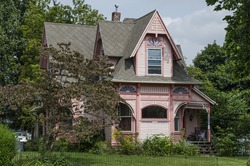
Hanover is a village in Licking County, Ohio, United States. The population was 1,270 at the 2020 census. The village lies along Ohio State Route 16.

<span class="mw-page-title-main">Hebron, Ohio</span> Village in Ohio, USA

Hebron is a village in Licking County, Ohio, United States. The population was 2,326 at the 2020 census.

<span class="mw-page-title-main">Whitehouse, Ohio</span> Village in Ohio, United States

Whitehouse is a village within the Toledo Metropolitan Area in Lucas County, Ohio, United States. The population was 4,990 at the 2020 census.

<span class="mw-page-title-main">Clarksburg, Ohio</span> Village in Ohio, United States

Clarksburg is a village in Ross County, Ohio, United States. The population was 409 at the 2020 census.

<span class="mw-page-title-main">Clinton, Ohio</span> Village in Ohio, United States

Clinton is a village in southwestern Summit County, Ohio, United States. The population was 1,197 at the 2020 Census. It is part of the Akron metropolitan area.

<span class="mw-page-title-main">Bolivar, Ohio</span> Village in Ohio, United States

Bolivar is a village in Tuscarawas County, Ohio, United States. The population was 1,000 at the 2020 census. Bolivar is also home to Fort Laurens, the only American Revolutionary War-era fort in what is now Ohio.

<span class="mw-page-title-main">Newcomerstown, Ohio</span> Village in Ohio, United States

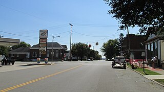
Newcomerstown is a village in Tuscarawas County, Ohio, United States, 85 miles (137 km) east-northeast of Columbus. The population was 3,702 at the 2020 census.

<span class="mw-page-title-main">Port Washington, Ohio</span> Village in Ohio, United States

Port Washington is a village in Tuscarawas County, Ohio, United States. The population was 548 at the 2020 census.

<span class="mw-page-title-main">Gratiot, Ohio</span> Village in Ohio, United States

Gratiot is a village in Licking and Muskingum counties in the U.S. state of Ohio. The population was 215 at the 2020 census.

References

  1. "ArcGIS REST Services Directory". United States Census Bureau. Retrieved September 20, 2022.
  2. 1 2 U.S. Geological Survey Geographic Names Information System: Ashley, Ohio
  3. 1 2 "Annual Estimates of the Resident Population for Incorporated Places in Ohio: April 1, 2020 to July 1, 2023". United States Census Bureau. Retrieved May 21, 2024.
  4. 1 2 "U.S. Census website". United States Census Bureau . Retrieved January 31, 2008.
  5. Overman, William Daniel (1958). Ohio Town Names. Akron, OH: Atlantic Press. p. 6.
  6. History of Delaware County and Ohio. O. L. Baskin & Company. 1880. pp.  539.
  7. "US Gazetteer files 2010". United States Census Bureau. Archived from the original on January 25, 2012. Retrieved January 6, 2013.
  8. "Census of Population and Housing". Census.gov. Retrieved June 4, 2015.
  9. "U.S. Census website". United States Census Bureau . Retrieved January 6, 2013.
  10. Delaware County EMS