
Clinton County is a county located in the U.S. state of Indiana. As of 2020, the population was 33,190. The county seat is Frankfort.

Vermillion County lies in the western part of the U.S. state of Indiana between the Illinois border and the Wabash River. As of the 2020 census, the population was 15,439. The county seat is Newport. It was officially established in 1824 and was the fiftieth Indiana county created. Vermillion County is included in the Terre Haute, Indiana, Metropolitan Statistical Area. The county contains seven incorporated towns with a total population of about 9,900. as well as several unincorporated communities; it is also divided into five townships which provide local services. An interstate highway, two U.S. routes, and five state roads cross the county, as does a major railroad line.

Clinton is a city in Clinton Township, Vermillion County, in the U.S. state of Indiana. The population was 4,893 at the 2010 census.
Manson is an unincorporated community in Perry Township, Clinton County, Indiana. The town is named for Mahlon Dickerson Manson, a general in the American Civil War and Lieutenant Governor of Indiana.

Madison Township is one of fourteen townships in Clinton County, Indiana. As of the 2010 census, its population was 2,079 and it contained 846 housing units. The township was named after President James Madison.

Michigan Township is one of fourteen townships in Clinton County, Indiana. As of the 2010 census, its population was 1,649 and it contained 675 housing units. The township was named for the Michigan Road, an early thoroughfare through the area.
Antioch is an unincorporated community in Jackson Township, Clinton County, Indiana.
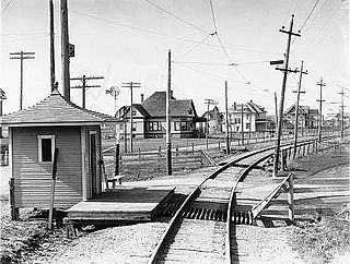
Boyleston is an unincorporated community in Michigan Township, Clinton County, Indiana.

Cambria is an unincorporated community in Owen Township, Clinton County, Indiana.
Cyclone is an unincorporated community in Jackson Township, Clinton County, Indiana.

Edna Mills is an unincorporated community in Ross Township, Clinton County, Indiana.
Fickle is an unincorporated community in Washington Township, Clinton County, Indiana.
Geetingsville is an unincorporated community on the border of Owen and Warren townships in Clinton County, Indiana.
Hamilton is an unincorporated community in Madison Township, Clinton County, Indiana. The town is named for Alexander Hamilton.
Hillisburg is an unincorporated community in Johnson Township, Clinton County, Indiana.
Jefferson is an unincorporated community in Washington Township, Clinton County, Indiana. The town is named for U.S. President Thomas Jefferson.

Kilmore is an unincorporated community in Union Township, Clinton County, Indiana. The town was laid out in 1854 by Abner C. Pence and for twenty years was known as Penceville, but after it became a station on the Vandalia Railroad in 1870 the company changed its name to Kilmore after the nearby creek.
Middlefork is an unincorporated community in Warren Township, Clinton County, Indiana. It is named for the Middle Fork of Wildcat Creek which runs along the north side of the town.
Moran is an unincorporated community in Owen Township, Clinton County, Indiana. Originally a station on the Vandalia Railroad, Moran was laid out by Noah L. Bunnell in October, 1873, and named for an official of the railroad. The official, who was from Sedalia, Illinois, also suggested the name of the nearby town of Sedalia, Indiana.
Pickard is an unincorporated community in Sugar Creek Township, Clinton County, Indiana. The community is named for Jacob Pickard who operated a sawmill at the site.

